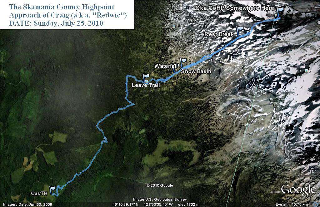
Skamania CoHP - SW Approach
A "Google Earth" portrayal of the southwest approach for the Skamania County Highpoint, starting from the Stagman Ridge Trail.
The county line is shown on this image. As you can see, I actually passed the county line (intentionally) to ~9000' elevation, and then made my way back down. I found three cairns on the ridge, which my GPS showed at ~8936', ~8970', and ~9000'.
Route taken, and GPS Track Log created, on July 25, 2010.
(Side-Note: It is misleading by how the waypoint writing came across on this image, but I encountered a small snow basin first, then a small waterfall. After passing by east of the waterfall, I continued up on a general NE traverse. Fortunately, nearly all of the terrain was still snow-covered, making most of the off-trail approach one big snow traverse rather than a loose rock/dirt approach.)


