Comments
No comments posted yet.
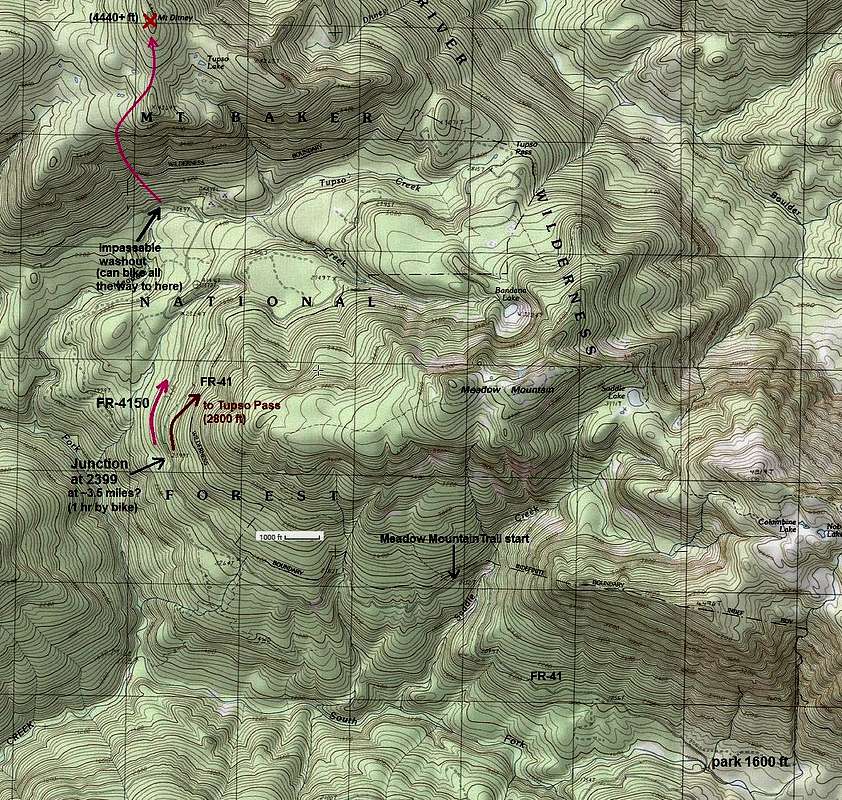
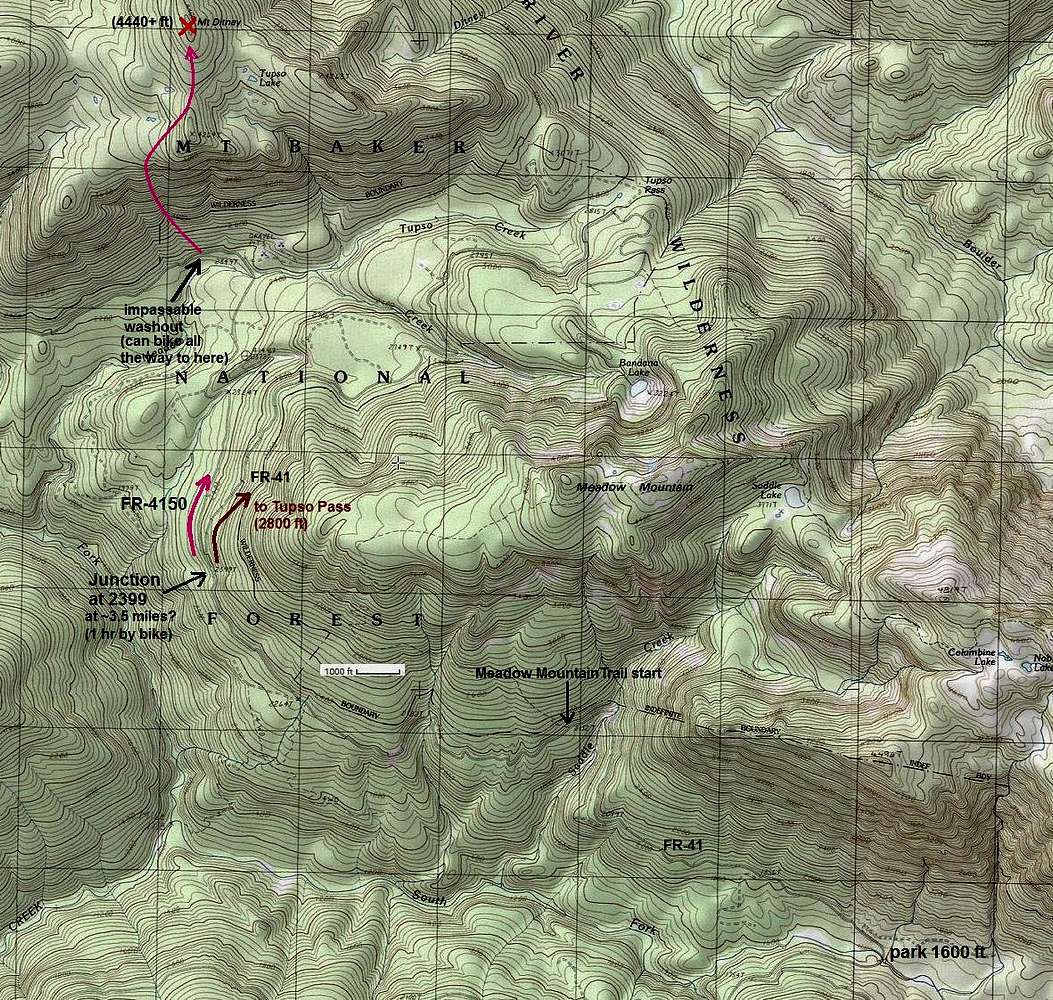
This is a topo map for the south slope route, which is probably the shortest route to the top (it took me 6.5 hours round trip from the Canyon Creek Bridge). The road system (FR-41 then FR-4150) can be biked (as of May 2018) all the way to a large road washout below the south face--maybe 2 hours to this point on a bike (it is approximately 5 miles). From the washout hike up and left through open woods, aiming for the stream cut. I crossed the stream at ~2900 ft between minor canyons below and above. There are probably other crossings, especially higher up. Then up steep woods and one minor cliff band with a convenient dirt ramp, then a dirty chute adjacent to a rock wall, before reaching the flat upper part of the mountain. Only one approximately 100-yard brushy section was encountered above the cliff after the stream crossing (small evergreens, salal, holly, and huckleberry). The flat upper area appeared to be mostly brush free, though it was covered with 2-6 feet of snow for me. This route is Class 2 with just steep woods and occasional rocky sections to navigate.

You are at the First Image | You are at the Last Image |

