
Viewing: 1-3 of 3

Koen - Oct 19, 2007 7:04 am - Voted 10/10
NiceWhat kind of software do you use to make these?

Vid Pogachnik - Oct 22, 2007 11:35 am - Hasn't voted
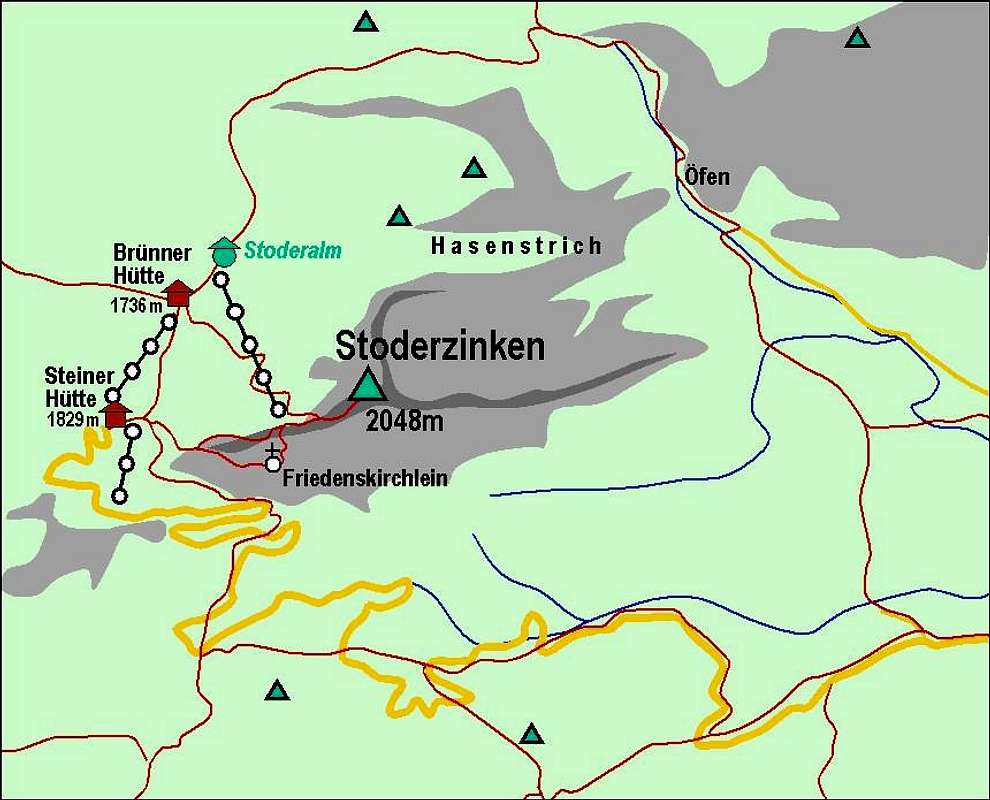
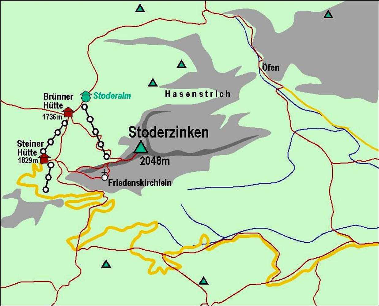
Re: NiceIt's simply Powerpoint. I cut a part of the screen with a real map (in this case Austrian Map CD), copy-paste it into Powerpoint and there draw paths, summits etc. over it. Then I take again the screen shot from Powerpoint and copy-paste it into Photoshop, only to save the picture in .jpg format. For pictures like this one, I don't need more than 30 minutes.
Cheers!
Koen - Oct 22, 2007 6:11 pm - Voted 10/10
Re: NiceVid, thank you for this info, it might help me to make some maps. And keep on jumping!
Viewing: 1-3 of 3


Comments
Post a Comment