
-
 5686 Hits
-
 79.04% Score
-
 10 Votes
|
|
Route |
|---|---|
|
|
34.46900°N / 119.65879°W |
|
|
Spring, Summer, Fall, Winter |
|
|
Add Heading here

Not to be mistaken with Tangerine Falls Summit Trail, Tangerine Falls Trail is a different trail leading to the base of Tangerine Falls. Although both of these trails begin from the same trailhead, after about half a mile they separate, never to meet again.
 Rock Art along the trail?
Route description:
 One of many swimming holes along the trail.
Start your hike at the same trailhead as West Fork Of Cold Springs Canyon Trail and Tangerine Falls Summit Trail. After a quarter of a mile you will see a wooden bench and a rusty old sign marking the point where you need to cross the creek. From here on you won’t be crossing any more major creeks until you arrive at the main gorge where Tangerine Falls is located. About half a mile up the trail you will come to a fork in the trail. Take the right fork that passes by a boulder and a broken pipe. After a short distance you will come to another fork in the trail. The left fork takes you to the summit of Tangerine Falls and follows along a hillside to the west of the main gorge. The right fork passes by an exposed water pipe and takes you into a steep and narrow gorge. The right fork is the one you need to be on. Soon after climbing over the pipe you will cross the creek and the start of the trail into the gorge. This trail is not very long, but it requires being in good shape. There are a number of places where you will be kickstepping into a steep hillside where the trail has been washed out by flood waters. There are also short sections of rocks and boulders to scramble. Due to heavy vegetation, the waterfall is not visible until the last minute, but when you get there, the view is impressive, especially after a hard rain
How to get there
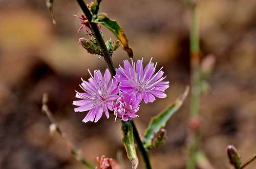
 Wild Flower along the trail
From the intersection of 101 and Hot Springs Road in Santa Barbara, California, drive 2.2 miles to it's intersection with East Mountain Drive.
Turn left onto East Mountain Drive and drive 1.1 miles to where it crosses Cold Springs Creek. About two hundred yards before the creek you will see a wide turnout on the right side of the road. Park here and walk up the road to the trailhead.
Note: There are two trailheads. The one on the right bypasses the creek crossings and ends up at the Montecito Overlook. The left trailhead follows the bottom of the canyon along the creek. The left trail is the one you should take for Tangerine Falls.
| Benchmark | Tangerine Falls Summit Trail coordinates | elevation | Distance from trailhead |
 Trailhead Trailhead | N 34.45522--------W 119.65331 | 741 ft | 0 |
 Rusty old sign Rusty old sign | N 34.45900-------- W 119.65414 | 940 ft | .25 mile |
 Take the right fork here Take the right fork here | N 34.46492--------W119.65852 | 1250 ft | .5 miles |
 Unusual trail direction Unusual trail direction | will give coordinates at a later date | 1250 ft | .65 |
 watterfall watterfall | N 34.4690--------W119.65879 | 1650 ft | just over 1.5 miles |
Camping and Red Tape
There are no permit requirements to hike the Tangerine Falls Trail. Looking west from Earth Watch
Camping
Unfortunately, there are no campgrounds close and convenient to Earth Watch.
There is, however, one very large and well developed campground at Cachuma Lake, and a few less developed ones along Paradise Road off Highway 154. There are also a few campgrounds along Highway 101 at El Capitan State Park and Refugio State Park.
El Capitan Beach Camping
Refugio State Beach Camping
Cachuma Lake