Toggle navigation
Mountains
Routes
Images
Trip Reports
Forum
What's New
People
Areas & Ranges
Articles
Trailheads
Canyons
Huts & Campgrounds
Albums
Logistical Centers
Fact Sheets
Lists
Custom Objects
Gear
Plans & Partners
WELCOME TO SUMMITPOST
SIGN IN
REGISTER
The approximate line of my...
The approximate line of my...
View High-Resolution Image
The approximate line of my...
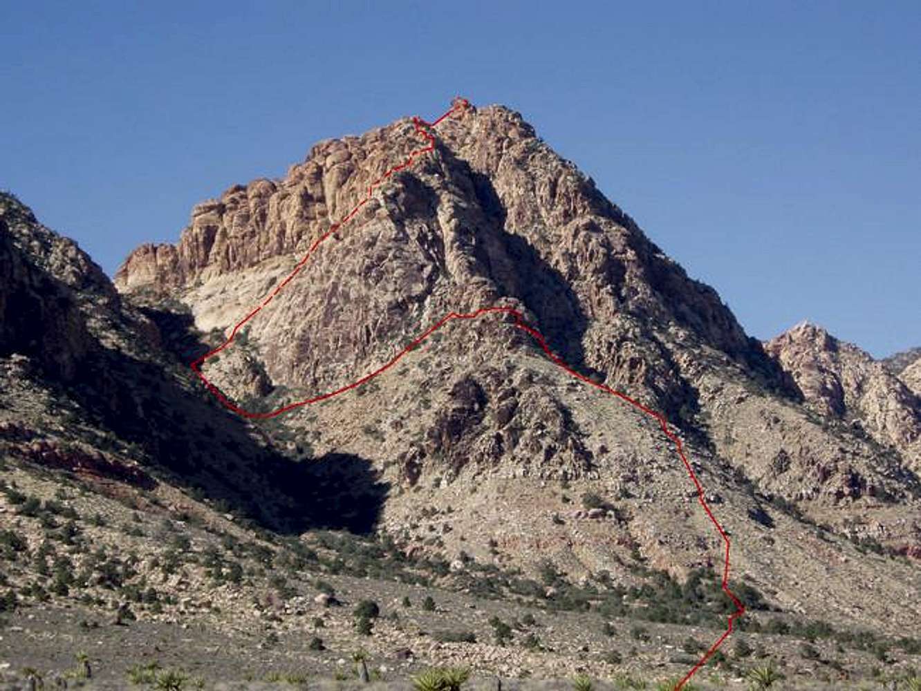
The approximate line of my route up the south ridge of the east face (indirect variation). A pretty sweet route, actually, if you overlook the brush in the wash.
« PREV
NEXT »
cp0915
on
Nov 30, 2005 1:02 pm
Comments & voting
Other parents
Lat/Lon:
36.00860°N / 115.4687°W
Image ID:
138858
869 Hits
74.92
% Score
5
Votes
Log in to vote
Comments
No comments posted yet.
to post!
Don't have an account?
cp0915's Image Gallery
« PREV
Viewing
#246 of 388
GALLERY
NEXT »
×
You need to login in order to vote!
User Name
Password
Remember me
Forgot your password?
Log me out when I close my browser.
Keep me logged in all the time.
sign in as a user
Don't have an account?
Register now for FREE
Rating available
Suggested routes for you
People who climb the same things as you
Comments Available
Create Albums
Register Here


