Toggle navigation
Mountains
Routes
Images
Trip Reports
Forum
What's New
People
Areas & Ranges
Articles
Trailheads
Canyons
Huts & Campgrounds
Albums
Logistical Centers
Fact Sheets
Lists
Custom Objects
Gear
Plans & Partners
WELCOME TO SUMMITPOST
SIGN IN
REGISTER
The end of Langental
View High-Resolution Image
The end of Langental
The end of Langental with Sasshonger to the left, Sas da Ciampac to the right and Monte Pelmo right above Forca da Ciampac in the middle. June 16th 2012
« PREV
NEXT »
Gangolf Haub
on
Oct 29, 2017 6:03 am
Comments & voting
Other parents
Lat/Lon:
46.58805°N / 11.83249°E
Image ID:
1009614
711 Hits
77.48
% Score
8
Votes
Log in to vote
Comments
Post a Comment
Viewing: 1-1 of 1
rdmc
-
Oct 30, 2017 5:25 pm - Voted 10/10
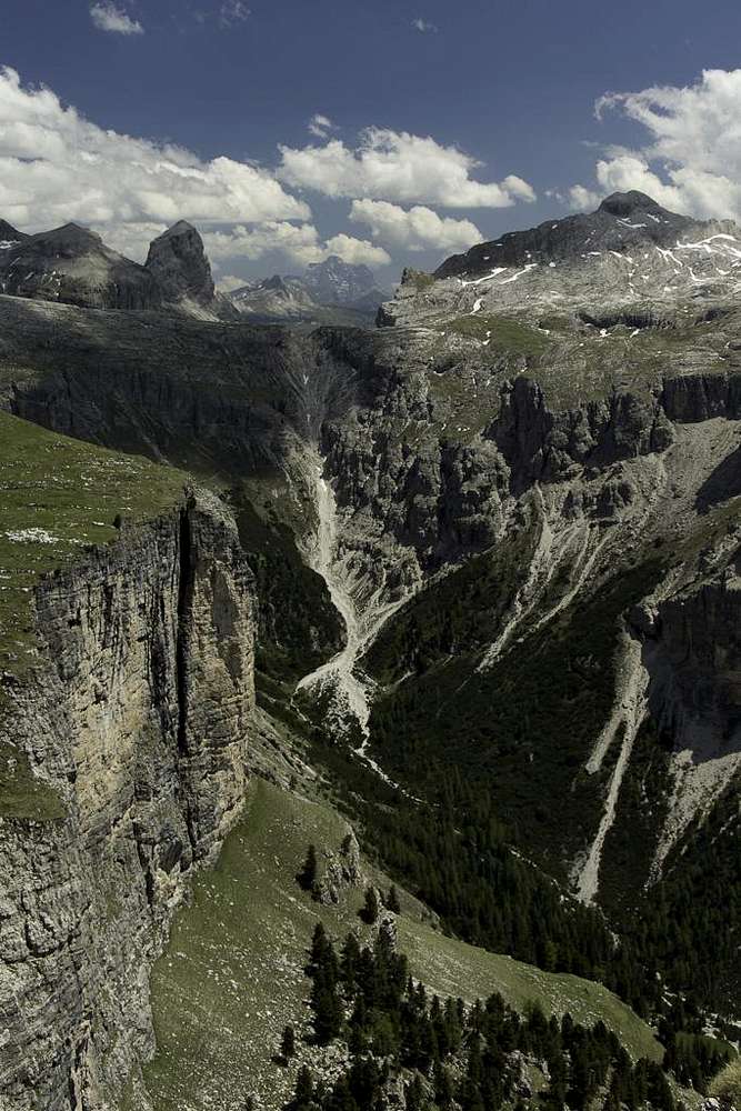
WOW!
This photo shows such depth. Beautiful!
:0)
Viewing: 1-1 of 1
to post!
Don't have an account?
Crespeina and Gherdenacia Round Trip
(Route)
You are at
the First
Image
Viewing
#1 of 1
GALLERY
You are at
the Last
Image
Gangolf Haub's Image Gallery
« PREV
Viewing
#1465 of 13940
GALLERY
NEXT »
Crespeina and Gherdenacia Round Trip
(Route)
Loading....
×
You need to login in order to vote!
User Name
Password
Remember me
Forgot your password?
Log me out when I close my browser.
Keep me logged in all the time.
sign in as a user
Don't have an account?
Register now for FREE
Rating available
Suggested routes for you
People who climb the same things as you
Comments Available
Create Albums
Register Here
Comments
Post a Comment