

Dennis Poulin - Jan 29, 2006 2:42 pm - Hasn't voted
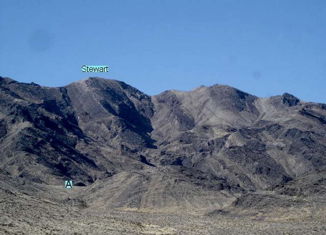
Re: Confusion?The register and the BM Stewart are on the peak I have labeled. It is definitely higher than the one to the right by a couple hundred feet. I have both the DPS Guide and Andy Zdon's book. I also entered the waypoint information in my GPS before I hiked the peak to make sure I got to the correct spot. I think we all hiked to the same correct Highpoint. My GPS tracking shows I visited the correct area also.
My careful examination of this pic shows that the black rocks on the right side of the peak I labeled are correctly positioned with the buff colored rocks at the actual summit. I just hiked this peak last Wednesday and my memory is fresh.

cp0915 - Jan 30, 2006 10:59 am - Voted 10/10
Re: Confusion?Having been up there myself, I'd have to say that Dennis is correct. The point marked on this photo is most certainly higher than the point to the right. Nice photo, by the way - quite helpful for those not familiar with the peak.
Dennis Poulin - Jan 30, 2006 7:06 pm - Hasn't voted
Re: Confusion?I'm not attacking you, just reporting what I saw and did. I've been confused many times looking for summits and have even climbed a few highpoints that turned out to be non-summits. Usually, it has meant just a longer hike and a little more elevation gain to get to the real summit.
My GPS has helped me verify that I am at the true summits and has kept me from going too far astray in search of those elsusive summits. Most importantly, it has helped me find the car when I'm done. That's real important in the forests of the Northwest.
Stewart Point summit is easily found and really indisputable because you hike over the other contenders on the way up the ridge. It is the highest point on the ridge.
The problem here is the label in the pic. Since I printed your SP page prior to my trip and had it with me on my hike, I was surprised to find the summit was one more hill past where you had it labeled. I wanted it to be where you had it because I was tired.
No harm done here. Since this is your SP page, I will pull the label off my pic if you want me to.

Day Hiker - Feb 1, 2006 4:10 am - Hasn't voted
Re: Confusion?See this picture for an explanation.


Comments
Post a Comment