Toggle navigation
Mountains
Routes
Images
Trip Reports
Forum
What's New
People
Areas & Ranges
Articles
Trailheads
Canyons
Huts & Campgrounds
Albums
Logistical Centers
Fact Sheets
Lists
Custom Objects
Gear
Plans & Partners
WELCOME TO SUMMITPOST
SIGN IN
REGISTER
Manly Beacon
Additional Parents
Image
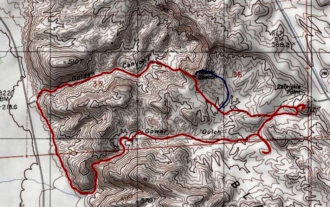
Topo map of the hike from the...
View High-Resolution Image
Topo map of the hike from the...
Topo map of the hike from the Golden Canyon trail head, up Gower Gulch to Zabriskie point and back via Golden Canyon (red). The Manly Beacon deviation with the ascent up the southern-most ridge is shown in blue.
« PREV
NEXT »
blmcclain
on
Mar 24, 2004 3:48 am
Comments & voting
Other parents
Lat/Lon:
36.42000°N / 116.83°W
Image ID:
46951
2219 Hits
73.06
% Score
3
Votes
Log in to vote
Comments
No comments posted yet.
to post!
Don't have an account?
Manly Beacon
(Mountain/Rock)
« PREV
Viewing
#48 of 63
GALLERY
NEXT »
blmcclain's Image Gallery
« PREV
Viewing
#69 of 98
GALLERY
NEXT »
×
You need to login in order to vote!
User Name
Password
Remember me
Forgot your password?
Log me out when I close my browser.
Keep me logged in all the time.
sign in as a user
Don't have an account?
Register now for FREE
Rating available
Suggested routes for you
People who climb the same things as you
Comments Available
Create Albums
Register Here


