Toggle navigation
Mountains
Routes
Images
Trip Reports
Forum
What's New
People
Areas & Ranges
Articles
Trailheads
Canyons
Huts & Campgrounds
Albums
Logistical Centers
Fact Sheets
Lists
Custom Objects
Gear
Plans & Partners
WELCOME TO SUMMITPOST
SIGN IN
REGISTER
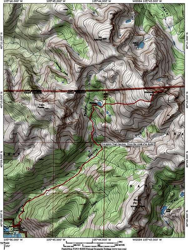
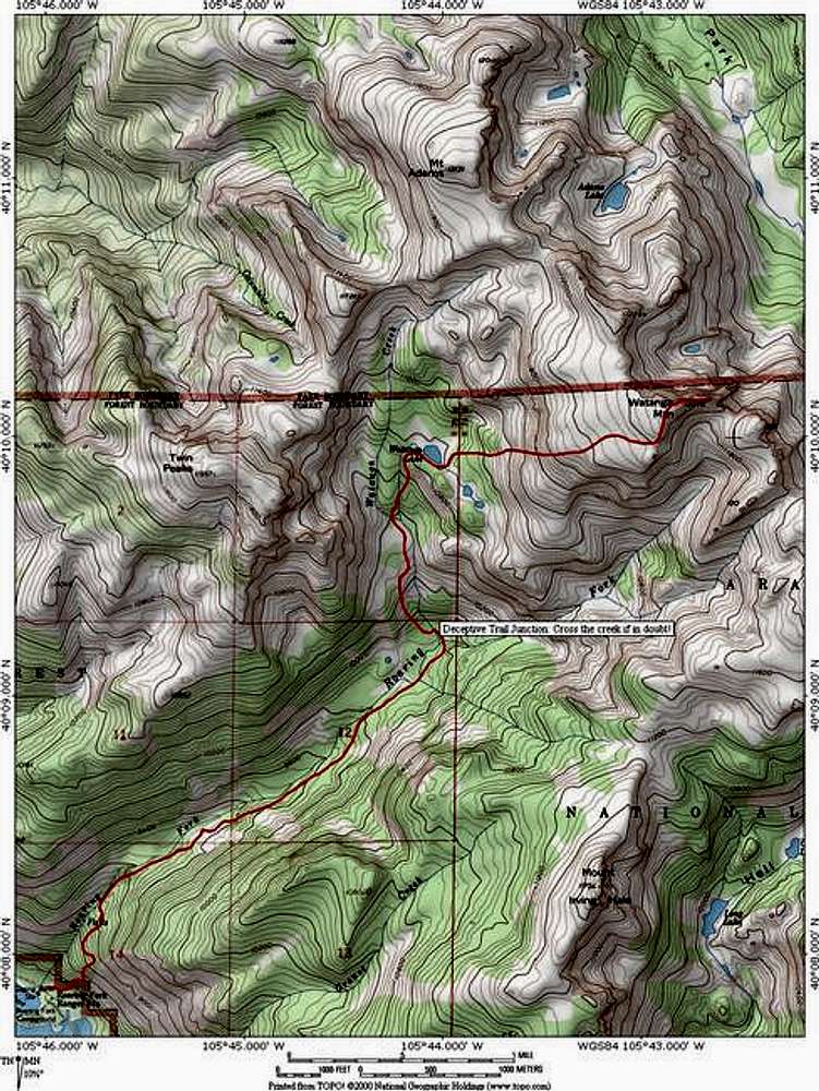
Topographic map of the...
View High-Resolution Image
Topographic map of the...
Topographic map of the
Roaring Fork Route
on
Watanga Mountain
. This route covers 10.5 miles roundtrip and ascends 3,900 ft. It uses the same trailhead as
Hiamovi Mountain
and offers acess to
Mount Adams
and
Twin Peaks
.
« PREV
NEXT »
JonBradford
on
Jan 3, 2006 12:02 am
Comments & voting
Other parents
Lat/Lon:
40.16860°N / 105.7133°W
Image ID:
143515
2580 Hits
75.81
% Score
6
Votes
Log in to vote
Comments
No comments posted yet.
to post!
Don't have an account?
Watanga Mountain
(Mountain/Rock)
You are at
the First
Image
Viewing
#1 of 1
GALLERY
You are at
the Last
Image
JonBradford's Image Gallery
« PREV
Viewing
#491 of 1444
GALLERY
NEXT »
Watanga Mountain
(Mountain/Rock)
Loading....
×
You need to login in order to vote!
User Name
Password
Remember me
Forgot your password?
Log me out when I close my browser.
Keep me logged in all the time.
sign in as a user
Don't have an account?
Register now for FREE
Rating available
Suggested routes for you
People who climb the same things as you
Comments Available
Create Albums
Register Here


