Toggle navigation
Mountains
Routes
Images
Trip Reports
Forum
What's New
People
Areas & Ranges
Articles
Trailheads
Canyons
Huts & Campgrounds
Albums
Logistical Centers
Fact Sheets
Lists
Custom Objects
Gear
Plans & Partners
WELCOME TO SUMMITPOST
SIGN IN
REGISTER
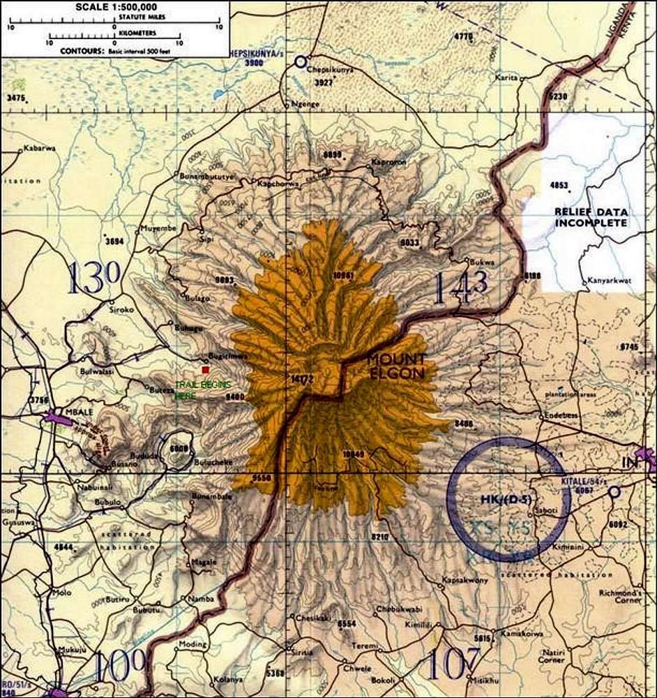
TPC Map L-5D. TPC...
View High-Resolution Image
TPC Map L-5D. TPC...
TPC Map L-5D. TPC (Tactical Pilotage Maps) maps are made by the United States Goverment and are on sale through government agencies or
Omnimap.com
. I have marked the beginning of the Budadiri Route with a red square.
« PREV
NEXT »
Scott
on
Apr 14, 2005 6:24 pm
Comments & voting
Other parents
Lat/Lon:
1.13000°N / 34.55000°E
Image ID:
100468
9985 Hits
72.37
% Score
4
Votes
Log in to vote
Comments
No comments posted yet.
to post!
Don't have an account?
Mount Elgon
(Mountain/Rock)
You are at
the First
Image
Viewing
#1 of 1
GALLERY
You are at
the Last
Image
Scott's Image Gallery
« PREV
Viewing
#3785 of 8098
GALLERY
NEXT »
Mount Elgon
(Mountain/Rock)
Loading....
Sasa River route
(Route)
Loading....
×
You need to login in order to vote!
User Name
Password
Remember me
Forgot your password?
Log me out when I close my browser.
Keep me logged in all the time.
sign in as a user
Don't have an account?
Register now for FREE
Rating available
Suggested routes for you
People who climb the same things as you
Comments Available
Create Albums
Register Here


