Toggle navigation
Mountains
Routes
Images
Trip Reports
Forum
What's New
People
Areas & Ranges
Articles
Trailheads
Canyons
Huts & Campgrounds
Albums
Logistical Centers
Fact Sheets
Lists
Custom Objects
Gear
Plans & Partners
WELCOME TO SUMMITPOST
SIGN IN
REGISTER
Mount Cardigan
Additional Parents
Image
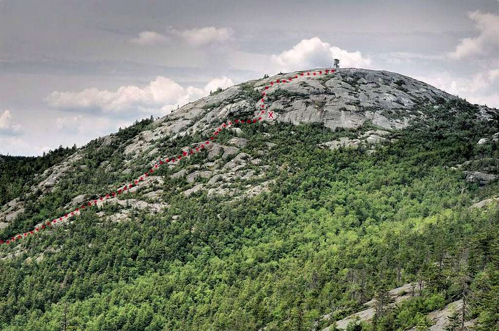
Upper Holt Trail
View High-Resolution Image
Upper Holt Trail
The line of the upper Holt Trail on the east face of Mount Cardigan, with the red x marking the steepest section. The ledges to the right of it are much closer to vertical.
« PREV
NEXT »
sunfish
on
Jul 5, 2007 2:32 pm
Comments & voting
Other parents
Lat/Lon:
43.64940°N / 71.91322°W
Image Type(s):
Hiking
Image ID:
308193
6818 Hits
83.1
% Score
16
Votes
Log in to vote
Comments
No comments posted yet.
to post!
Don't have an account?
Mount Cardigan
(Mountain/Rock)
« PREV
Viewing
#16 of 63
GALLERY
NEXT »
sunfish's Image Gallery
« PREV
Viewing
#62 of 93
GALLERY
NEXT »
Holt Trail
(Route)
Loading....
×
You need to login in order to vote!
User Name
Password
Remember me
Forgot your password?
Log me out when I close my browser.
Keep me logged in all the time.
sign in as a user
Don't have an account?
Register now for FREE
Rating available
Suggested routes for you
People who climb the same things as you
Comments Available
Create Albums
Register Here