Toggle navigation
Mountains
Routes
Images
Trip Reports
Forum
What's New
People
Areas & Ranges
Articles
Trailheads
Canyons
Huts & Campgrounds
Albums
Logistical Centers
Fact Sheets
Lists
Custom Objects
Gear
Plans & Partners
WELCOME TO SUMMITPOST
SIGN IN
REGISTER
Vetter Mountain
Additional Parents
Image
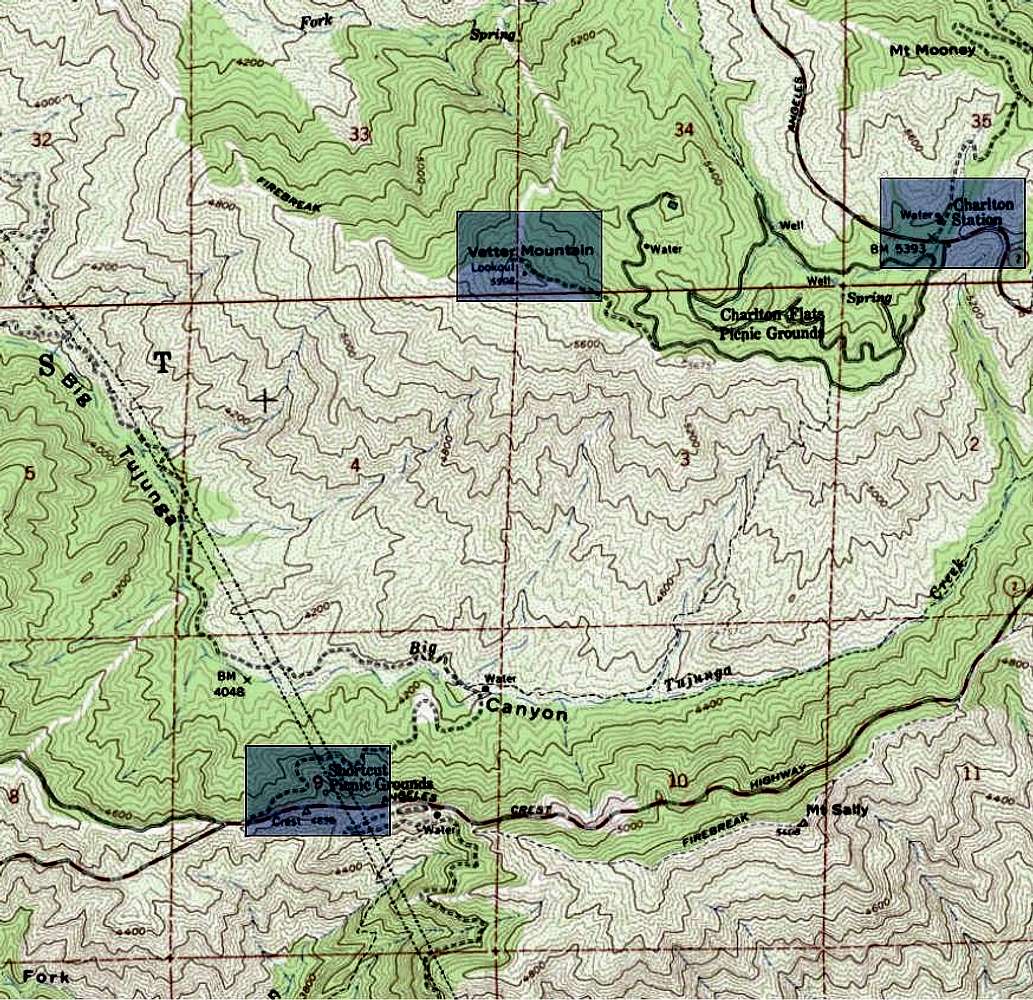
Vetter Topo
View High-Resolution Image
Vetter Topo
Map showing the approaches to Vetter Mountain. The Silver Moccasin Trail begins along CA2 and joins the approach from Charlton Flats on the ridge (see blue highlights).
« PREV
NEXT »
CookieMonster
on
Jul 14, 2007 3:25 am
Comments & voting
Other parents
Lat/Lon:
34.29000°N / 118.02°W
Image Type(s):
Topo/Diagram
Image ID:
311827
2479 Hits
71.06
% Score
1
Votes
Log in to vote
Comments
No comments posted yet.
to post!
Don't have an account?
Vetter Mountain
(Mountain/Rock)
« PREV
Viewing
#26 of 26
GALLERY
You are at
the Last
Image
CookieMonster's Image Gallery
« PREV
Viewing
#41 of 50
GALLERY
NEXT »
×
You need to login in order to vote!
User Name
Password
Remember me
Forgot your password?
Log me out when I close my browser.
Keep me logged in all the time.
sign in as a user
Don't have an account?
Register now for FREE
Rating available
Suggested routes for you
People who climb the same things as you
Comments Available
Create Albums
Register Here


