-
 6502 Hits
-
 81.18% Score
-
 13 Votes
|
|
Route |
|---|---|
|
|
46.39260°N / 13.86540°E |
|
|
Via Ferrata |
|
|
Summer, Fall |
|
|
Most of a day |
|
|
A medium hard ferrata |
|
|
Approach
We start the tour in Kot valley, where we can park freely (2024) on the altitude of some 950 m. From Mojstrana in Sava valley till the last parking place we have 1 h 45 min of walk (7 km).
Route Description
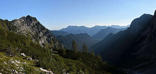
Till below the rocks of Spodnja Vrbanova špica
From the parking place at Lengarjev rovt (alpine meadow) we continue by the flat valley. The marked path soon crosses a dry creek bed (gravel field) and enters the forest on the SE side of the valley. At first it ascends only gently, but when right below us we already feel the valley-end, the path turns left and ascends steeply with many turns. That's how we overcome a rocky step, after the path again starts traversing the slopes. Not gaining much more altitude, we reach through forrest a good, but weak water source, 1340 m. Good 1 h till there.
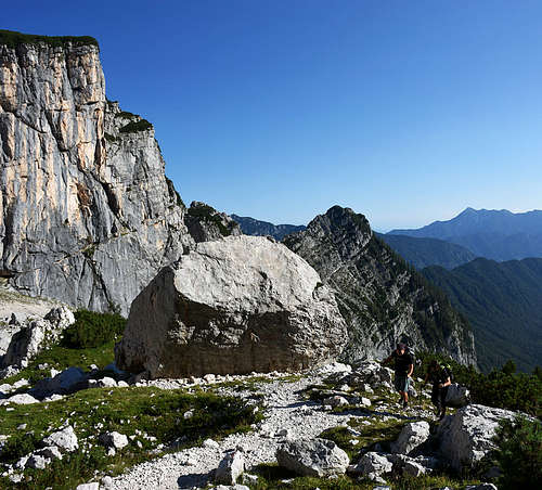
Then we continue traversing the slopes of Rjavina (in early summer there might be snow fields), allways towards the right. Now we are already above the forests so nothing obscurs the magnificent view on the Rjavina north wall. On the other side of the valley, Spodnja Vrbanova špica catches our views, and in the lower part of its ridge also Požgana Mlinarica. Below Spodnja Vrbanova špica, near the middle of the velley, there's the Debeli kamen (Fat Boulder), a distinct orientation point. We reach it over more or less steep slopes.

Above the boulder, there's another similar slope, already quite above the dwarf-pines area. We climb it up in the western direction and a bit towards the right. So we reach the important trails branching on 2010 m. The marked path to Stanič hut there turns to the left (traversing the slopes above the Pekel basin (Hell), while our path on Spodnja Vrbanova špica turns to the right. Some 3 hours till there.
Till the summit of Spodnja Vrbanova špica
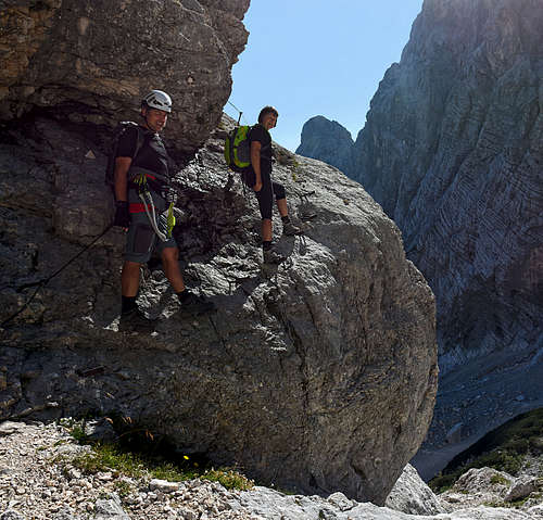
Now the final part of ascent to Spodnja Vrbanova špica starts. In the northern direction we soon reach its rocks and the marked path starts traversing exposed rocky slopes. It's well secured with pegs and cables. After that short ferrata section, the route exits on steep, but more ovegrown slopes. There protection devices are not needed any more, but to overcome steep slopes some additional care is still needed. We quickly gain altitude and the path reaches the summit ridge. There a magnificent view to the north opens.

To the summit some more rock climbing is needed. Again some steep, but very short passages are secured with iron and just some metres below the summit there's the final junction. The route on the nearby summit goes left, while the traverse to Visoka Vrbanova špica goes right. Less than 4 hours altogether.
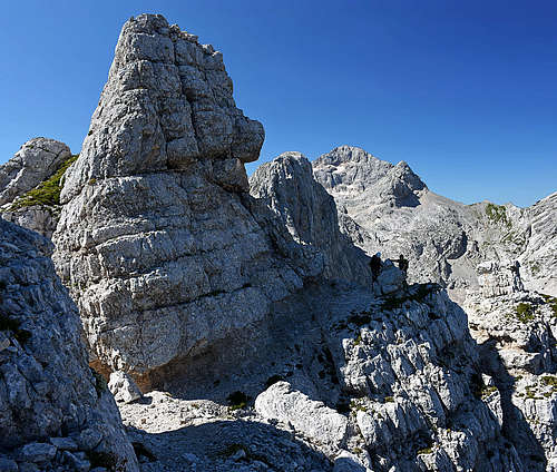
Connecting the two summits
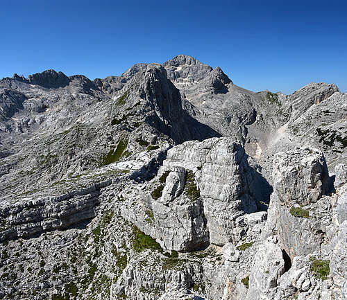
From the branching just below the summit of Spodnja Vrbanova špica the traverse route first descends a bit in the SW direction. So we detour two distinct, picturesque rock towers and approach the beautiful ridge plateau, named Plesišče (Dancing Stage). It's a big limestone slab which we just have to visit (a few minutes to the left of the marked path).
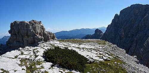
Then we continue by the beautiful ridge tour. The path goes up and down over a few ridge bumps, finally descending almost vertically on the notch which is the lowest point on the ridge. We did some more than half of the ridge and now the well marked path starts ascending again. The trail is still good, well marked, some ascents are steep. Finally we exit on the upper, more gentle summit slopes of Visoka Vrbanova špica and the summit itself. Some 1 h 30 min for the ridge traverse, from the parking lot some 5 hours.
The best option to descend is towards Staničev dom (hut) - 15 min.
Essential Gear
0. General. 950 m to 2408 m, exposition NE, marked path below in the valley, a medium hard, quite exposed ferrata to the summits. On the Swiss Hiking Scale the whole tour would be graded T5. Ferrata sections difficulties are graded B/C.
1. Effort. 1580 m, 5 h.
2. Power. 3 - medium.
3. Psyche. 3 - medium.
4. Orientation. 1 - no difficulties.
Emergency Escape Option
Being on the ridge between Spodnja (Lower) and Visoka (High) Vrbanova špica, we have one option to escape into Pekel basin (the upper part of Kot valley). Where the ridge is lowest (a bit more towards Visoka Vrbanova špica) we can descend from the notch by easy climbing into Pekel some UIAA II/I passages.
Of course, this can be (for any reason) also an option to get up to the ridge of Vrbanove špice.

