Toggle navigation
Mountains
Routes
Images
Trip Reports
Forum
What's New
People
Areas & Ranges
Articles
Trailheads
Canyons
Huts & Campgrounds
Albums
Logistical Centers
Fact Sheets
Lists
Custom Objects
Gear
Plans & Partners
WELCOME TO SUMMITPOST
SIGN IN
REGISTER
Ticino / Tessin
Additional Parents
Rheinwaldhorn / l'Adula
Image
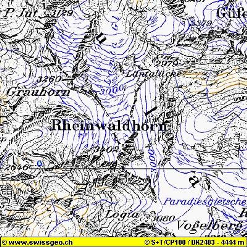
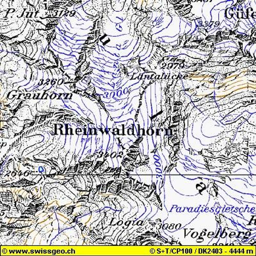
Map of Rheinwaldhorn with the...
View High-Resolution Image
Map of Rheinwaldhorn with the...
Map of Rheinwaldhorn with the information of official swiss map 1:100.000, taken with permission from
here
at www.swissgeo.ch. If you click on the link than you can zoom and see more on the original website!
« PREV
NEXT »
Mathias Zehring
on
Jun 8, 2003 7:01 am
Comments & voting
Other parents
Lat/Lon:
46.49680°N / 9.03960°E
Image ID:
21378
4674 Hits
71.36
% Score
2
Votes
Log in to vote
Comments
No comments posted yet.
to post!
Don't have an account?
Ticino / Tessin
(Area/Range)
« PREV
Viewing
#519 of 581
GALLERY
NEXT »
Mathias Zehring's Image Gallery
« PREV
Viewing
#1799 of 1879
GALLERY
NEXT »
Rheinwaldhorn / l'Adula
(Mountain/Rock)
Loading....
×
You need to login in order to vote!
User Name
Password
Remember me
Forgot your password?
Log me out when I close my browser.
Keep me logged in all the time.
sign in as a user
Don't have an account?
Register now for FREE
Rating available
Suggested routes for you
People who climb the same things as you
Comments Available
Create Albums
Register Here


