Toggle navigation
Mountains
Routes
Images
Trip Reports
Forum
What's New
People
Areas & Ranges
Articles
Trailheads
Canyons
Huts & Campgrounds
Albums
Logistical Centers
Fact Sheets
Lists
Custom Objects
Gear
Plans & Partners
WELCOME TO SUMMITPOST
SIGN IN
REGISTER
Hoyt Peak
Additional Parents
Image
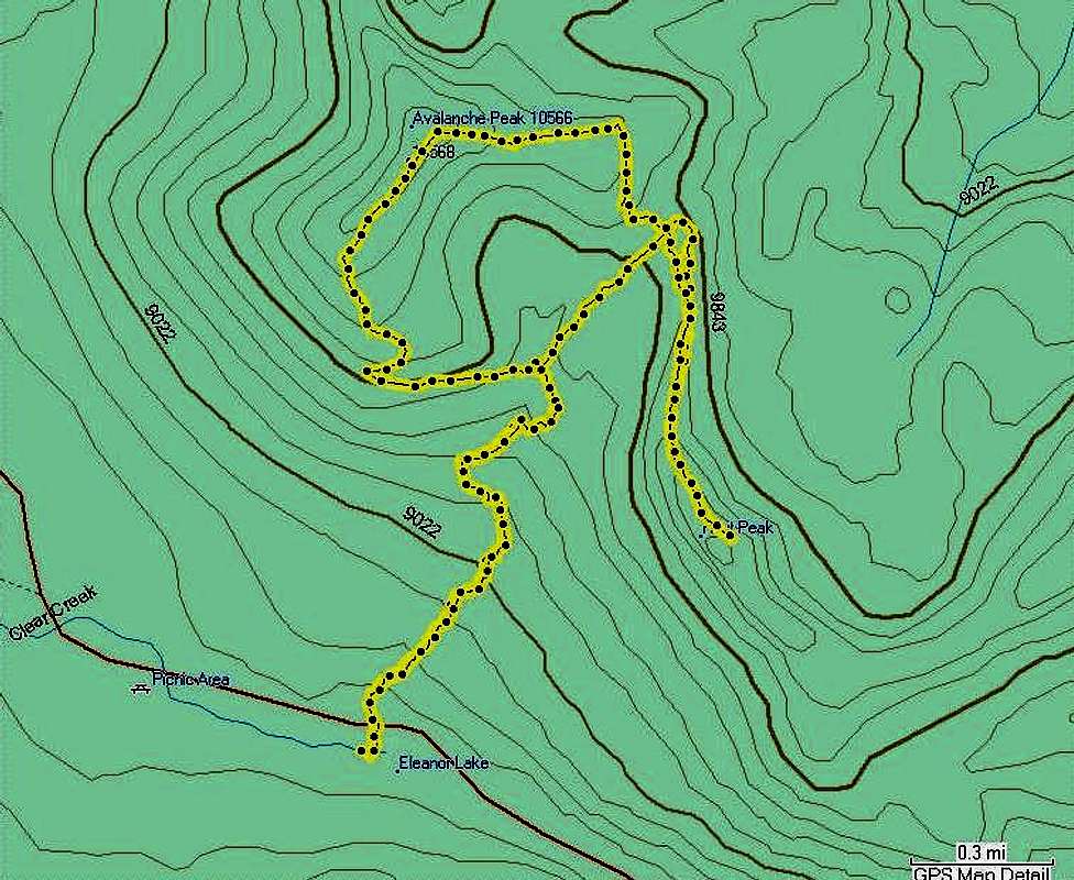
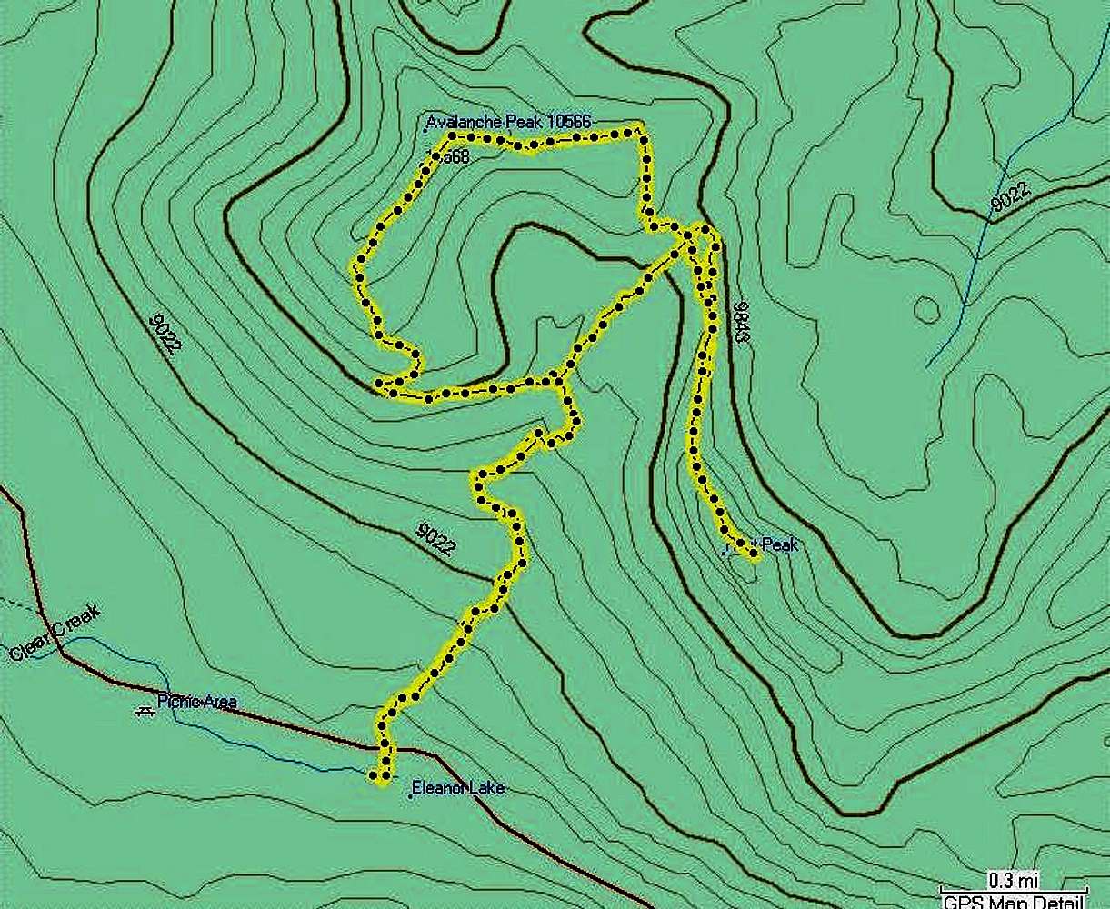
Hoyt Peak Topo
View High-Resolution Image
Hoyt Peak Topo
Topo of the route Bob and I used to reach both Hoyt & Avalanche Peaks.
GPS recorded 9jul07.
« PREV
NEXT »
Michael Hoyt
on
Jul 21, 2007 8:58 pm
Comments & voting
Other parents
Lat/Lon:
44.47699°N / 110.12636°W
Image Type(s):
Topo/Diagram
Image ID:
314614
2639 Hits
72.08
% Score
2
Votes
Log in to vote
Comments
No comments posted yet.
to post!
Don't have an account?
Hoyt Peak
(Mountain/Rock)
« PREV
Viewing
#31 of 33
GALLERY
NEXT »
Michael Hoyt's Image Gallery
« PREV
Viewing
#1323 of 1801
GALLERY
NEXT »
×
You need to login in order to vote!
User Name
Password
Remember me
Forgot your password?
Log me out when I close my browser.
Keep me logged in all the time.
sign in as a user
Don't have an account?
Register now for FREE
Rating available
Suggested routes for you
People who climb the same things as you
Comments Available
Create Albums
Register Here


