
|
|
Mountain/Rock |
|---|---|
|
|
35.62475°N / 118.23195°W |
|
|
KERN |
|
|
Hiking, Mountaineering |
|
|
Spring, Fall, Winter |
|
|
5244 ft / 1598 m |
|
|
Overview
Onyx peak is a fun and challenging hike in a high desert region. This peak located on the Northwest corner of the Jawbone-Butterbreadt region in the South Fork region of the Kern River Valley which is at the beginning of the East side of the Southern Sierra Nevada Mountains. Though the peak overlooks the town of Onyx (NE) the best access point is actually from the East in Kelso Valley. The hike is about 5 miles round trip with an elevation gain of 2500 feet.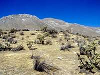
Onyx Peak
After parking start heading ENE toward the mountain on your left making your way for the ridge with the fewest rocks. I marked the approach in red on the following photograph.
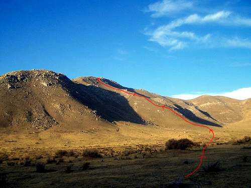
Onyx Peak Approach
After you cross the flat plain you basically just head North on the ridgeline, and the way is very steep as you climb up. There are ducks here and there which will assist you. At the top of this minor ridge turn right on the major ridge, and head ENE to the summit. You will get a break in the elevation gain for awhile, and then there is a brief rock hopping section where it may take awhile to locate the register. If you follow the "ducks" the register location is marked by a painted circle, and the benchmark is to the North of this area on a rock outcropping marked by a small cairn. The view is spectacular in all directions. Just a few of the landmarks visible from the summit are Lake Isabella, the Kern River Preserve, the Kern Plateau, Weldon, Onyx, Nicolls Peak, Heald Peak, the South Fork of the Kern River, Heald Peak, and the Kelso Valley. There is more information regarding Onyx peak at Kernvalleyhiking.com.
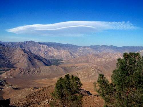
View looking East from Onyx Peak
It takes me about 2 hours to get up Onyx Peak, and 1 hour to get back down.
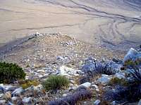
View looking down and South as I descend the ridge from Onyx Peak.
Getting There
View Larger Map
This peak is accessed...
--- From the West on Highway 178 turn South onto Kelso Creek Road. Drive 2.7 miles and turn left onto a dirt road just past Walker Road.
--- From the East on Highway 178 turn South onto Kelso Creek Road past Onyx. Drive 2.7 miles and turn left onto a dirt road just past Walker Road.
--- Note: It is also possible to access Kelso Creek Road from Jawbone (highway 14) though much of the way is either a dirt road or an ungraded paved road.
Take the smooth dirt road from Kelso for .25-.5 miles and park at the fence. There is a nice little parking area on the right side there.
Red Tape
There are no restrictions here for hiking. This peak lies within the Kiavah Wilderness, managed by the Bureau of Land Management. BLM information available hereFor more information you can contact:
Bureau of Land Management
Bakersfield Field Office
3801 Pegasus Drive
Bakersfield, CA 93308
(661) 391-6000 Bureau of Land Management
Ridgecrest Field Office
300 S. Richmond Road
Ridgecrest, CA 93555
(760) 384-5400
Camping
Camping is permitted anywhere for up to 14 days, after which you need to move at least 25 miles. No permits or fees are required. Campsite are available at Lake Isabella (recommended) Walker Pass, and also at Jawbone Canyon.Mountain Conditions
Hiking is primarily for Spring, Fall, and Winter, and the weather in this range can be extreme. During the summer it is very hot, during the winter the higher elevations get some snow, and wind can also be a factor in this region. Current weather conditions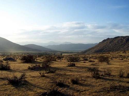
On the way back from Onyx Peak. Looking Northwest across Kelso Valley.