|
|
Mountain/Rock |
|---|---|
|
|
49.07499°N / 22.72655°E |
|
|
Hiking |
|
|
Spring, Summer, Fall, Winter |
|
|
4416 ft / 1346 m |
|
|
Overview
|
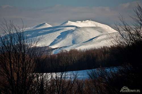
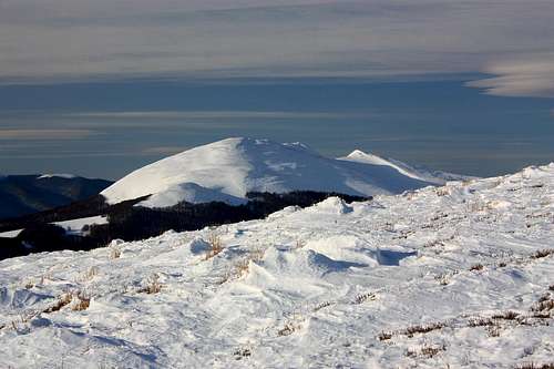
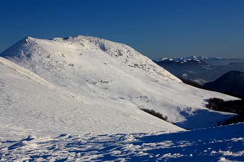
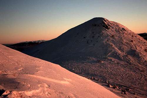
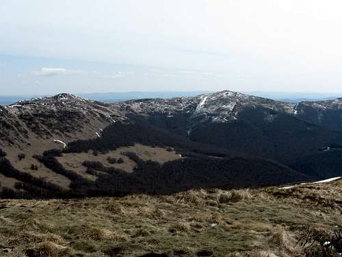
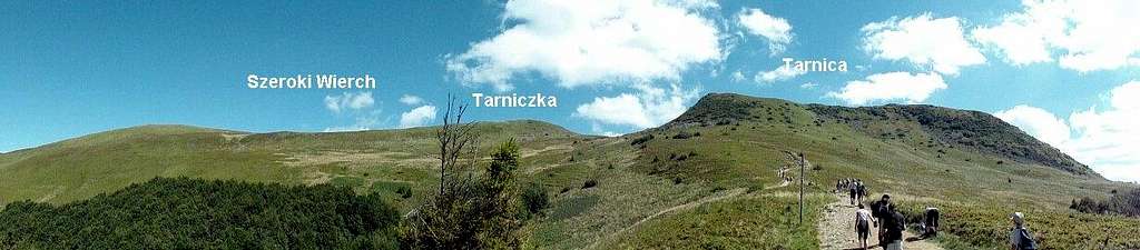
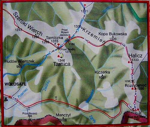
Tarnica at 1346 m, located some three kilometers north-east of the village of Wołosate, is the highest and the second most prominent mountain (484 m of prominence) in the Western Bieszczady. "Tarnica" as a name for a mountain sounds funny if one knows that this word - common in the Eastern Carpathians - actually means saddle. (It seems likely that this is one of the ancient Carpathian words which was adopted by Romanian shepherds and carried further to the north-west a few centuries ago.) However, the views of Tarnica prove that the name fits the mountain very well. The mountain, rising half a kilometer above the valley of Wołosatka creek, can be easily recognized by the characteristic u-shaped saddle that divides its northern summit (1339 m) from the highpoint of Szeroki Wierch, known as Tarniczka (1315 m). The saddle is called Siodło or Sidło (the latter is a polonized Ukrainian word), which translates as ... saddle! The elevation of this saddle is 1286 m although many maps read 1275 m.
The south face of Tarnica is fairly steep and rugged while the north face is gentler. There is a steel cross (please see this SP article by Paul Kuras) on the main summit of Tarnica installed to commemorate Karol Wojtyła's (future Pope John Paul II) visit in the early 1950s. 
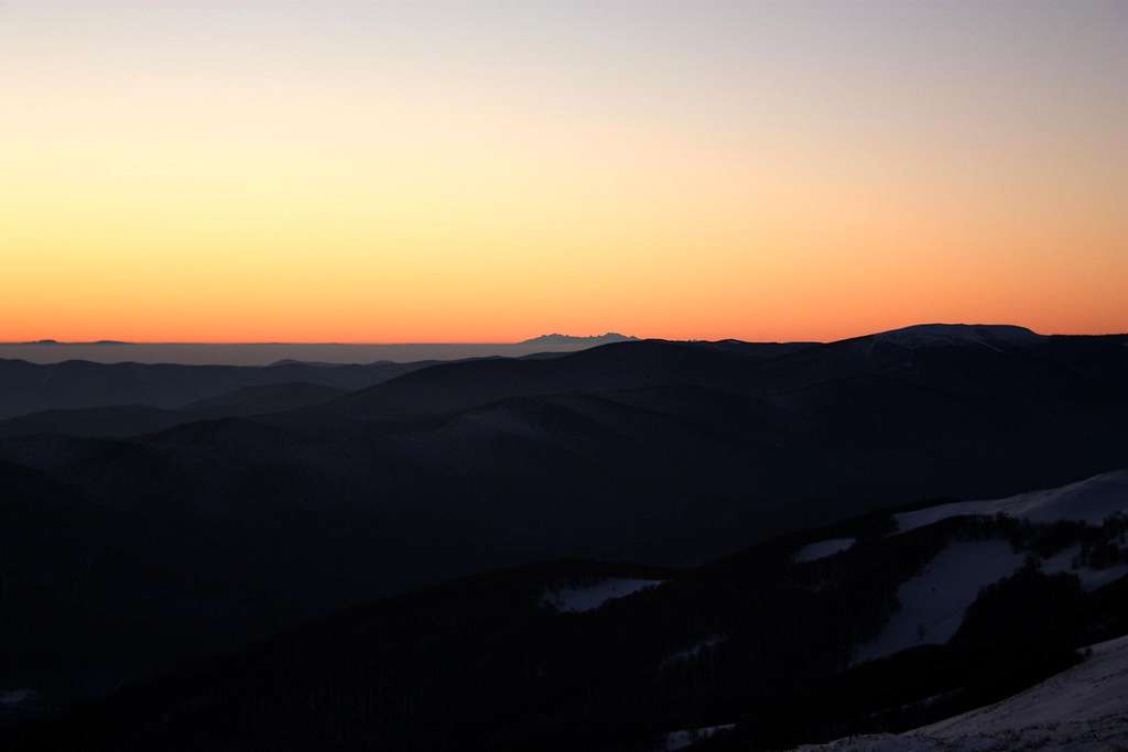
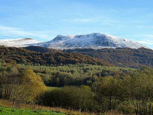
All of the grassy mountain tops (połoniny) of the Polish Bieszczady can be viewed from the top of Tarnica (Wielka Rawka – to the west, Szeroki wierch, Połonina Wetlińska and Caryńska– to the northwest, Bukowe Berdo to the north, Krzemień and Kopa Bukowska to the northeast, Halicz and Rozsypaniec to the east, Połonina Bukowska to the southeast). When weather conditions are extremely favourable it is possible to have spectacular views of the Slovak Carpathians. In the easterly and southerly direction, one can enjoy vistas of the Ukrainian Carpathians with Pikuj, the highest summit in the Eastern Bieszczady, the Gorgany to the left of Pikuj, Polonyna Borzhava to its right and - a little closer - Ostra hora and Polonyna Runa. It is sometimes possible to take telephoto shots of mountains lying two hundred kilometers away, such as the Tatras, or even nearly 250 km away, such as Ďumbier in the Low Tatras or some peaks in the territory of Romania.
A hike in the middle of the summer may not be a good idea as the trail often gets packed with tourists. |
Getting There & Routes
Please see the parent page to find out how to get to this corner of Poland by road. Tarnica is connected with the European walking route E8. Possible Tarnica hikes are listed in the table below.
| Trailhead | Marks | Time of Walk Up (hours) | Total Elevation Gain (meters) | Remarks |
Maps
 |
For more information please see the parent page.
Red Tape & Camping
 
|
Accommodation