
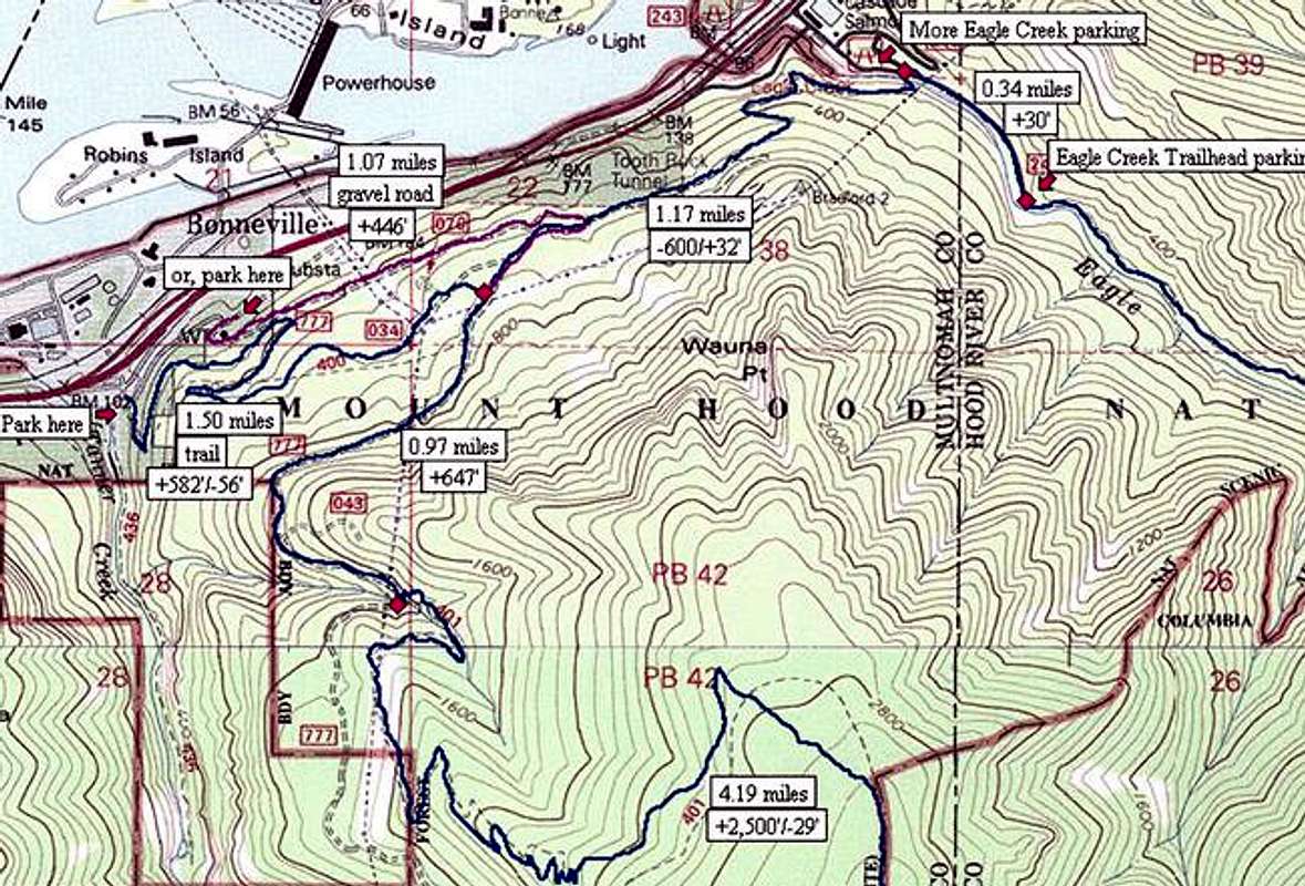
Lots of options make starting...
Lots of options make starting out for Tanner Butte a little daunting. Here's some detail of the beginning to help out. USGS map created with TOPO! software with trail elevations, alignment and mileages confirmed by GPS.


