-
 17310 Hits
-
 86.85% Score
-
 23 Votes
|
|
Mountain/Rock |
|---|---|
|
|
39.96607°N / 114.89588°W |
|
|
White Pine |
|
|
Hiking |
|
|
Spring, Summer, Fall, Winter |
|
|
10522 ft / 3207 m |
|
|
Overview
It is odd that Cherry Creek Benchmark is so obscure and remains nameless, though the latter is common in the state of Nevada. Still, the Cherry Creek Range sits prominently along the west side of US-93 between Currie and McGill, and its high point is both a Nevada Prominence Peak (coming in at #31 with over 3700’ of prominence) and rises all the way to 10,522 ft in elevation. Perhaps it is because the range, though high and wild, is surrounded by even more spectacular ranges such as the East Humboldts, Rubies, Schells, Deep Creeks, and the Snakes, to name a few higher ones, and thusly gets overshadowed literally and figuratively. The Cherry Creek Range itself ends shortly south of the highpoint as the Egan Range begins at Telegraph Hill and rises to almost 11,000 ft. south of Ely.This thickly forested (relative to Nevada) portion of the Cherry Creek Range possesses perhaps more allure than actual beauty. The peak would be of obvious interest to range highpointers and prominence chasers, but otherwise, one would have to appreciate the journey as much as the destination, as the highpoint only affords a partial view of the area (one only needs to walk around a little, however, to be able to see all the amazing ranges that surround the area). Other peaks in the range will probably have grander views than the actual range highpoint; this includes the subpeaks north, west, and southwest across Exchequer Canyon from Cherry Creek Benchmark, as well as the baresloped Pt. 10,459, another ranked 2K prominence peak a few miles north in the range. However, the Benchmark is the range highpoint, and worth visiting for that very reason.
The peak is surprisingly accessible, which makes its obscurity all the more odd. A paved road will get you to within less than four miles to where you would start your ascent, and even passenger cars will be able to get fairly close to the peak. That being said, the range is trailless and rarely travelled, and there is no simple way to the top; at the very least some light to moderate brush travel is to be expected, and the hiker should be knowledgeable and tolerant of backcountry travel and route-finding.
Getting There
The signed turnoff for the Cherry Creek ghost town is located around 92 miles south of Wells NV, and 45 miles north of Ely, along US-93. Take the paved road (NV 489) almost 8 miles to the ghost town of Cherry Creek, but don’t enter the town itself. Most of the roads leading north from Cherry Creek and before end up in Exchequer Canyon. I am highlighting the wider and probably better graded option. Take a sharp right right before a reduced speed sign as you approach the abandoned buildings of the town. There is a stop sign on the dirt road as it approaches the highway. Follow this wide path 0.4 miles to a five way intersection and take a wide left turn. There will be a small graveyard on your immediate right. You can see the road going into Exchequer Canyon at this point.0.8 miles from the 5-way the road splits. Bear right; the left option will get you eventually to the same canyon, but it winds about a little and is possibly slightly more rugged. The road ends around 7,100 ft or so with a large rock blocking any vehicular progress, between 3.5-4 miles from the pavement. You can probably push a passenger car driven carefully close to this point, but the road does narrow near the end. Obviously 4WD and high clearance can make it to the rock, but be aware the road is fairly narrow at the end with no place to turn around, so you will probably have to backtrack before you can bang a u-turn and park.
I decided to play it safe and parked my Camry around 2 miles from the pavement, right before the road curved into the canyon. There is a rusted and seemingly unused gate less than a mile before the big rock. Passenger cars can probably make past this point with careful driving. You can hike this all the way from the town of Cherry Creek if necessary, though that will make for a longer day.
The pavement ends at the ghost town, but passenger cars can probably continue west along the road as it traverses the range and bears north to become the Butte Valley Road. This road will provide access to the western side of the range and eventually connects to NV-229 leading west from US-93 near the East Humboldt Range.
Getting Up
Exchequer Canyon is only one way to access the peak. Some who signed the summit log ascended from the west and/or the north. The approaches via Exchequer is easiest for passenger cars.There are many ways you can approach this ascent from Exchequer Canyon. Follow the road past the rock as it passes by the New Century Mine structures (marked on topo maps) around 7,200’. The road fades into some sagebrush meadows a little less than a mile past the rock. You can try to gain the SE ridge some time before this. The terrain looks open to gain the ridge low, but there looks to be some up and downs as well as minor rocky outcroppings, though the latter could be avoided by some elevation loss. The Southeast ridge eventually joins the South Ridge at the false summit south of the Highpoint.
The easiest way to ascent the Highpoint is to follow Exchequer Canyon all the way to a 10,100’ saddle almost due west of the highpoint. The lower areas is the toughest part. Bear right as you pass the sagebrush meadows. In view will be some rocky outcroppings leading up a cone shaped summit that you’ve probably noticed along your way up. This is the 10,200’+ false summit where the South and SE ridges meet. Follow the drainage as it passes the high outcrops on your right. This will be the toughest part of the ascent, with some moderate bushwhacking and route finding. It’s not too difficult though, and the best way to stay on track is to keep within sight the low point of the drainage, bearing right when in doubt. (Note that the road might be hard to pick up on the way down. As you emerge from the bushes into the meadow, the obvious thing is to keep following the low point of the drainage along the left, as you have been during the canyon descent. Bear right instead, and pick up the road as it traverses a small shelf above the ravine itself).
Around 8,000’ the terrain gets easier. The canyon narrows and for the next few hundred feet you will find sheer cliffs on both sides. The drainage itself is easy to ascend. Admire the views, but be aware that during the rare bout of heavy precipitation this area looks like it could be prone to flash floods.
After you climb above the cliffy area and the drainage widens again you will come to a split in canyons a little above 8,300 ft. There is a collapsed mine structure and possibly an odd looking cairn. Take the drainage leading right. (The left canyon will take you eventually to Pt. 10,171 on the opposite side of Exchequer Canyon. If you want to do a major traverse of this cirque then you will likely ascend/descend this canyon at some point). After the intersection route finding is pretty straight forward. Follow the obvious drainage as it winds past dry deadfall and eventually pine needles as it ascends to the saddle, then contour east and climb the final 400’ or so to the highpoint. One can conceivably take a right at some point and ascend through the open pine terrain to gain the South Ridge at some point near the false summit or north of it. Be aware there might be some cliff bands, but they can probably be easily avoided (or climbed, if that is what you’re into).
Then, if you’re a real mountain masochist, or just plain dumb like I am, you can bear right and start ascending the slopes of the South Ridge just as the drainage bushwhack begins. I did this ascent traversing below and parallel to the cliff bands to the immediate northwest. The scree and loose dirt is brutal, the slope is steep, and the brush isn’t great for the first hundred feet or so. The only reason I’m even mentioning this is because after about 900 ft. of hell you gain the South Ridge and can follow the very pleasant, open terrain all the way to the South/False Summit, then traverse north to the true highpoint with minimal elevation loss. In a wooded range bereft of views, relative to the majority of Nevada ranges, this is possibly the most scenic route (unless you do a traverse of the peaks opposite Exchequer Canyon), but be aware that it is far from the most pleasant one. You can also gain the ridge sooner than I did to possibly ascend better terrain.
Views
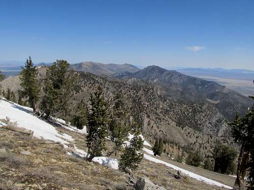
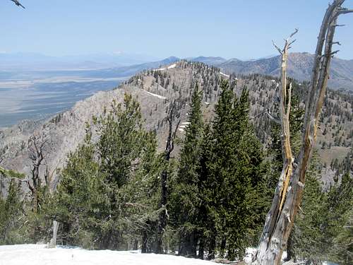
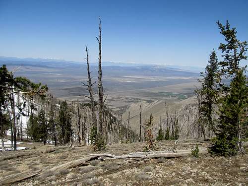
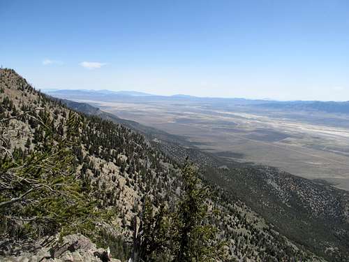
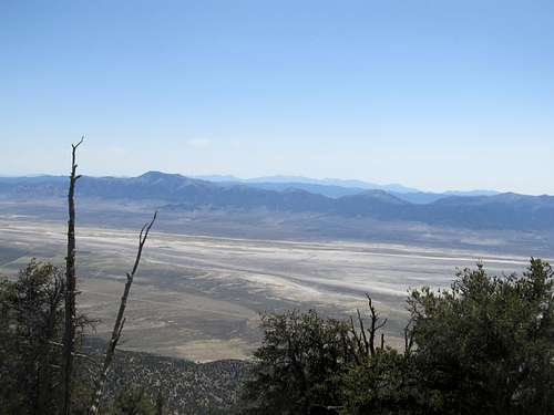
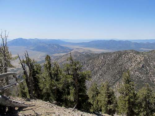
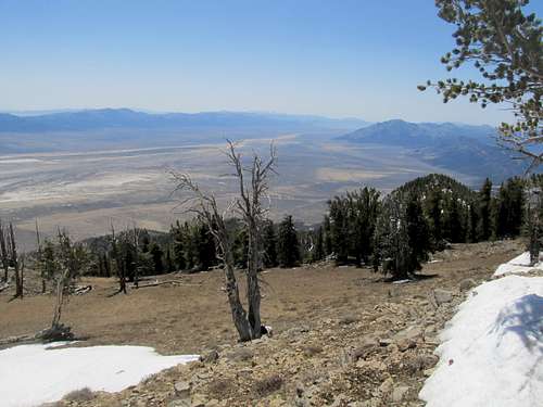
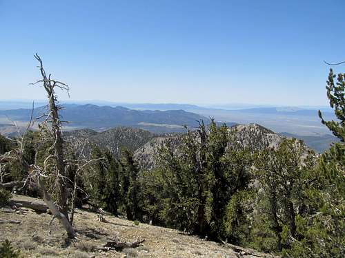
As for the views themselves, from the top one can see from Pilot Peak to the northeast down to Ibapah and the Deep Creeks, the majority of the Schell Creek Range rising from the Steptoe valley town towards McGill, and the beginnings of the Egan Range at Telegraph Hill. One can even see Wheeler or at least parts of the Snake Range peeking out from behind the Schell Creeks. The south/false summit has great views south and southwest (and possibly Hamilton, Currant, and/or Diamond in the distance). The Rubies and East Humboldts can be glimpsed from points near the summit, but if you want to see them clearly you can further north along the northern slopes, to the saddle to West Cherry Creek BM, and and up to West summit itself.When to Climb
Because of its ease of access one can probably climb this mountain all year long. Winter will probably mean a long day depending on how far you can make it towards Exchequer Canyon, but deep snow cover might make travel easier around brushy areas and scree fields. Winter equipment (snowshoes, ice axe, crampons) might be required, especially if conditions in the few areas above treeline are icy. Avalanches are probably rare in this area but definitely possible in the right conditions; if that’s the case try to stay along ridges and exercise common sense.Red Tape & Other Misc
Cherry Creek Benchmark and Exchequer Canyon lie adjacent to but not within the Goshute Canyon Wilderness. Observe all LNT principles nevertheless. Take care to respect private property and historical structures within the ghost town of Cherry Creek, but otherwise mostly everything is BLM land in this area.One can probably camp in many places in the open terrain. Lodgding is available about an hour away in nearby towns.
Make sure you gas up in Wendover, Wells, or Ely. Gas stations are rare in these parts, as is cell phone reception, so make sure someone is aware of your travel plans.
Exercise caution near old, abandoned mine structures.


romo - Oct 2, 2017 11:10 pm - Hasn't voted
nameless peaks in NV additionFrom the U.S. Board on Geographic Names - Principals, Policies and Procedures - Sec. 1 The BGN will not approve proposed names for unnamed features within wilderness areas, including unpublished names in local use, unless an overriding need can be demonstrated by the proponent. This includes Wilderness Study areas. That said many of the P2ks that are listed as Range or Mountain High Points and Benchmarks in Nevada are not allowed to be named. I recently checked with a Board member and Cherry Creek Benchmark being on the border of the wilderness will not be officially named.