Previously in Four months in Peru: Machu Picchu, trouble at the airport and off route on Vallunaraju.
Easy? Yeah, right!
![Wild flower in the Cordillera Negra]() A wildflower in the Cordillera Negra
A wildflower in the Cordillera NegraIn the southern part of the Cordillera Negra you'll find
Cerro Huancapeti. It's close to the edge of the map
[1], which gives it an elevation of 4976m.
![Lizard in the Cordillera Negra]() A sunbathing lizard in the Cordillera Negra
A sunbathing lizard in the Cordillera Negra
Most hills in the Cordillera Negra are very easy, so, expecting only a long hike, I started out in Huaraz by taking a colectivo to Recuay (3394m). From there, a good, albeit unsurfaced road leads over the mountain range to Aija, crossing it at a high pass at 4600m or so, near the Huancapeti mining plant. I could have taken a bus or colectivo up there, but that would be
too easy, or so I thought. I preferred to start much lower. At first I followed some trails, higher up I hiked cross country.
I made it as far as an unnamed summit at around 4800m. From there I could see another, higher peak, which might well be Huancapeti – but there was a valley in between and first I would have to descend at least 300m. It was late already, so I headed back.
A day later I tried again. I started earlier, and this time I got a colectivo to Ticapampa (3457m). Although only marginally higher than Recuay, it's also a few kilometres closer and that helps too. Again I followed trails, and I made good progress.
![East ridge of Cerro Huancapeti from the north]() (Part of) the east ridge of Huancapeti, seen from the north. I started by hiking up to the saddle on the right, then scrambled along the ridge to the left
(Part of) the east ridge of Huancapeti, seen from the north. I started by hiking up to the saddle on the right, then scrambled along the ridge to the left
In a few hours I reached the small Laguna Llacsha at the base of Huancapeti. From looking at it, I couldn't quite determine the highest point, and the map, being only scale 1:100 000, was no help. Perhaps it was that prominent rocky peak on the east ridge? It looked too hard to get there directly from the east, but a saddle west of the peak looked easy enough to reach, and perhaps I could follow the ridge from there.
As I hiked up to the saddle, another summit came into view further west. It was clearly higher, and the slope was very gentle. I knew I could easily hike up there. But I decided to have a little fun, and traverse the ridge to that false summit.
![A bird perched high on the eastern summit of Cerro Huancapeti]() A small bird occupies the summit block on the east ridge
A small bird occupies the summit block on the east ridge
It was a fun scramble indeed, but being alone and without any gear, I decided not to climb the last 3 meters. If you look at the picture, you'll understand. Besides, the summit was already occupied.
I scrambled back, then hiked to the higher summit. The slope was gentle, and when I got close to the top, I saw a huge cairn, and soon after I saw a whole lot more of them. Somebody must have been here before! No surprise though, being so easy to reach. However, past it I now saw another summit, which looked a lot harder to get to – and a little bit higher too!
Again it was getting late though, so I figured I had better go back now. And that's where I made a mistake. In hindsight, I should have gone back the way I came, because I knew that terrain. At Laguna Llacsha I could have followed the trails to the main road to the mining plant, and hitched a ride or even catch a bus down to Recuay.
However, the map showed that the road down from the high pass to Aija wasn't far from Huancapeti either. If I would descend cross country to the west, I should soon hit upon a small road leading to the main one, where I could hitch a ride or catch a bus up to the pass and beyond, to Recuay. And, in the back of my head, I thought that, after descending westward for a little bit, perhaps I would spot an easy way up to that potentially higher summit after all?
| Cairns on top of the false(?) summit of Cerro Huancapeti, with what appears to be a higher summit further back.
The photo doesn't show it, but a little beyond the cluster of cairns, the ridge drops down sharply, making it rather difficult to get there. |
A little bit later I discovered that the descent was a lot harder than I had expected. I found myself downclimbing a short steep face, where, really, I should have stopped and gone back up. The rock was a bit crumbly, and I realized it wasn't quite safe what I was doing. But I still thought, well, once I get down this hard bit, it won't be long to the road, and I can get back to civilization quickly. With that in mind, I continued down, quite slowly now because of the difficult terrain.
![Huancapeti, from central to southwest summit, seen from the northwest]() Looking back at Huancapeti from the NW, after descending the difficult bit. I came down pretty much straight from the central summit, which had all the cairns on top. However, I think that the one on the right is higher. As it is further away, the photo is misleading, but it clearly shows that it would be difficult to go there directly from the central summit.
Looking back at Huancapeti from the NW, after descending the difficult bit. I came down pretty much straight from the central summit, which had all the cairns on top. However, I think that the one on the right is higher. As it is further away, the photo is misleading, but it clearly shows that it would be difficult to go there directly from the central summit.
The sun went down, and it got real dark very quickly, but while it was still rough, it wasn't difficult anymore. In the distance, I occasionally saw headlights, but they seemed to be much lower than where I expected to get to the road.
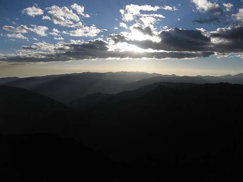
![Sunset over the Cordillera Negra]() Sunset over the Cordillera Negra
Sunset over the Cordillera Negra
Eventually, it flattened out a bit. I came upon a dirt road. Not the main one, but surely it would lead to it. According to my map, if I followed the road closest to Huancapeti eastward, at some point it would end, but from there a trail would go north and lead to the mining plant. All in all, I would have to ascend maybe 400m. On the other hand, following the road downhill would be easier, but then it went off the map. I was sure that it would hit the main road eventually, but couldn't tell how far.
I was tired, but figured I could still go uphill. I made my choice and went right. That would prove to be another mistake, be it not such an obvious one.
It was dark now. The road was rough, and clearly had not seen any sort of vehicle for quite a while. At the end I came to what looked like a small abandoned mine. However, there was no trail, just the end of the road. I roughly knew where I was, but the road didn't quite match with where my map said it should be. Frankly, with all the mining activity going on, I should have expected that there might be more roads than those on the map, and trails certainly would change over time.
If the weather had been bad, I could have spent the night in the mine, but it was a fine, starry night. I went back down the road, constantly looking for a trail going in the right direction. I didn't find it, but as the road made a U-turn to the south, opposite to where the plant should be, I studied the map, figured out where I probably was, and then went off track to the north, up a steep slope. Not steep enough to require the use of hands, but tiring nonetheless after an already long day. However, I figured, eventually I'll reach a high point where I can see either the plant or the road.
And this time, finally, it worked out as planned. It took a long time, but eventually I did indeed make it up to the ridge, and on the other side, pretty close actually, I saw the floodlights of the plant.
Carefully I worked my way down a bit, when suddenly a pack of dogs started barking, and a couple of lights appeared. Some of the workers at the mine had noticed my headlight coming down towards them, and, obviously, they were curious who that might be, to say the least!
After I explained where I had come from, and where I wanted to go, there was a bit of confusion. At first I understood that there still might be a very late bus that I could catch. But at the bus stop - yes, there was a genuine bus stop up there, including a bench and shelter! - I learned that there wasn't, and one of the workers offered me a place to sleep in one of their very simple shacks. I must say, it wasn't comfortable, and chilly to boot. I slept a bit, but as soon as the sun came up, I got up and started hiking, to get warm again. After an hour or so, I flagged down the first bus and got back to civilization.
Now, I must say, I only had to spend one night there, as punishment for some poor decisions. But I sympathize with these local workers; they definitely don't have it easy, having to sleep there all the time!
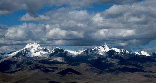
![Cordillera Blanca panorama]() Panorama of the Cordillera Blanca from the Cordillera Negra above Recuay
Panorama of the Cordillera Blanca from the Cordillera Negra above RecuayOne week earlier...
Planning
![Sunset on Vallunaraju]() Vallunaraju
VallunarajuI wasn't tired after climbing Vallunaraju, and it was still early afternoon by the time I got back in Huaraz. I discussed future possibilities with Edward, the owner of Edwards' Inn and an experienced mountain guide himself. After tossing around a few ideas, I settled on Nevado Maparaju (5326m) as my next goal. It's an easy climb, but there is a small glacier on top. I reckoned I could climb it by myself, and if I didn't like the look of it when I got there, I could always turn back, right?
Maparaju lies at the end of Quebrada Cayesh, right next to the famous needle of Nevado Cayesh. Climbing that would be way out of my league, but I was looking forward to simply seeing it up close. Quebrada Cayesh is a short side valley of the much longer Quebrada Quilcayhuanca. A dirt road leads to the valley entrance, but from there you'll have to walk. It takes the better part of a day to get to the base of Maparaju, so it would be a three day trip.
I bought supplies and went to the National Park office to get a permit, only to find it wasn't open anymore, even though it was well before closing time. It wouldn't be the last time I stood in front of a closed door... Then I popped in at Galaxia's, one of the agencies in town, to inquire if someone else was perhaps going my way tomorrow, if only to share transportation. No such luck.
I had dinner at Andino's, a popular hangout for climbers and a good spot to meet people. It was one of the places where I had put up a note that I was looking for partners, and I checked their message board for other people that I might join. The food is good, albeit slow in coming, and I had a nice chat with a Swiss guy waiting for his son to arrive in a week or two.
In the evening, I had another look at the map
[1] and my guidebook
[2], and by the time I went to bed, the nucleus of something bigger was starting to form in my mind. I would start as planned, but maybe I could add another, more adventurous climb to my trip...
Easy hiking and meeting fellow explorers
At breakfast I put my new idea to Edward, and he agreed it certainly was something worth trying. And with his assurance in the back of my mind, I packed a bit more food and headed out for a four day trip.
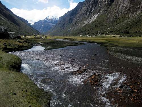
![Quebrada Quilcayhuanca]() Early on in Quebrada Quilcayhuanca
Early on in Quebrada Quilcayhuanca
I went to Galaxia again, to have them arrange a taxi. I figured they would be better at explaining to the driver where exactly I wanted to go. We made a stop at the park office to deal with the formalities
[3] and then we were off to the trailhead.
Some minor road works prevented us going all the way to the entrance of Quebrada Quilcayhuanca. I was already a bit later than I had planned, and that added almost an hour of walking to my day. I knew it was going to be a late one again, probably with cooking in the dark.
At first I made good time on an easy trail. In less than three hours I reached a small bridge over the small river coming down the valley. The turnoff to the Cayesh valley was on the other side, and I could see that it wasn't far away. After checking my map, I crossed. The terrain was open, mostly grassy, and a bit swampy at places. Where it was drier, there were some patches of low bushes. Only occasionally did I have a vague trail to follow now and the going was slower than on the trail. I more or less kept following the river. Eventually I came to another bridge and realized I had taken one bridge too early; It would have been faster to if I had stayed on the easy trail on the other side, and crossed here!
![Flowers in Quebrada Quilcayhuanca, with Pucaranra in the distance]() Flowers in Quebrada Quilcayhuanca, with Pucaranra in the distance
Flowers in Quebrada Quilcayhuanca, with Pucaranra in the distance
Not long after entering the Cayesh valley, I passed a couple of bright red tents. There was nobody around. The tents looked very familiar: as it turned out, they were the same brand and type as my own, a Hilleberg Nallo! Now what are the odds of that?
I considered camping in the same area, but eventually decided to keep going. I still had an hour of daylight left, and to continue now would make climbing Maparaju tomorrow a little bit easier. As I hiked deeper into the valley, three people descended towards me. They turned out to be Swedes, and suddenly their choice of tents made more sense.
They had been doing a bit of rock climbing today and were planning to climb Maparaju tomorrow. "At what time", I asked? Well, they wanted to start somewhere between 2 and 3 in the morning! That would be too early for me; being solo, I wanted to see where I was going. But it would be a good thing to have them going there ahead of me, because that would give me a trail to follow on the glacier.
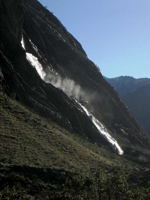
![Waterfall on the slopes of Quebrada Cayesh: good clean drinking water!]() Spraying waterfall in Quebrada Cayesh
Spraying waterfall in Quebrada Cayesh
An hour east of the Swedish camp I came to a nice clearing, close to a couple of waterfalls on the steep southern walls of the valley. The falls were high, but not very wide. As the water came tumbling down, part of it transformed into a spray of fine droplets. At the bottom only small rivulets carried the remaining water down.
The sun was about to set, so it was time to put up my tent. Edward had warned me not to take water from the main stream running down in the valley, so I took some from one of the rivulets. The Swedes didn't know, and I didn't think to warn them. When I later talked to them again, they did indeed remark that the water tasted funny.
The days in the tropics are never very long, so you can only walk so far in daylight. Thanks to the errands I had to run in the morning and the resulting late start, I had to cook in the dark. It wasn't the first time, and wouldn't be the last. But at least I was where I wanted to be.
![The end of Quebrada Cayesh]() The end of Quebrada Cayesh - the slopes of Maparaju are on the right, but the summit is out of view, as is the normal route
The end of Quebrada Cayesh - the slopes of Maparaju are on the right, but the summit is out of view, as is the normal routeMarginal weather
Early in the morning, there was a light drizzle going on. At first, I stayed in my tent, resigned that I couldn't climb Maparaju today, but later I changed my mind and at eight o'clock I headed out anyway. The temperature must have been around freezing, because soon after I started walking, the now intermittent drizzle changed into an occasional light sprinkling of snow.
I had directions for the route from Edward as well as from Biggar's book
[2]. Nevertheless, on the way up from the valley I didn't find the right trail. Sure, there were cairns, but they were not always obvious, and there were many cow paths to chose from.
Only later, on the way down, did I find that I should have left the valley floor no more than five minutes past the third waterfall, on a trail that gradually heads up the southern slopes of the valley. It was easy to spot when coming down, but hard on the way up.
![A big cairn shows the way on the trail to Maparaju]() The big cairn
The big cairnDeeper into the valley, I easily made my way up along cow paths, and I found the regular trail again just before reaching a very big cairn, at around 4550m. The weather had improved markedly by now. While the higher summits were still shrouded in clouds, it was dry now and visibility was good. At the cairn, the now very clear trail switched back sharply. The going stayed easy until around 4625m. At that point I had to get up a very short rock band and needed my hands – well, that is, one sufficed, it wasn't that hard. After that, it was walking again, following more cairns.
Higher up, the trail stayed on the rocks and scree west of the glacier. Once above its tongue, you could go on it, but I stayed on the rocks as long as I could. Almost at 5000m, just before reaching the saddle between Maparaju and San Juan, it could no longer be avoided and I had to get on the glacier. It was not steep at all. I didn't see any obvious crevasse danger and, despite the earlier drizzle, there was still a vague but discernible old trail. That looked good enough to me to continue.
To the left of the saddle was a steep-walled rock island. Even before the saddle, the trail on the glacier split in two. The left fork stayed on this side of the rock and headed up a steepish ice wall, the other one went to the saddle and then disappeared from view on the other side.
I didn't like the look of the ice, so I headed for the saddle instead. On the other side, the trail dropped just a little bit, then turned left as well and traversed around the rock on the other side. Instead of steep ice, I came to a snow slope, about 30º – not quite as steep as the ice, and much easier for self arrest. I laboured up the slope. Although I was well acclimatized, the lack of oxygen was still slowing me down.
![The slopes of Maparaju]() A secondary summit alongside the plateau - no need to climb this, the summit is well to the left
A secondary summit alongside the plateau - no need to climb this, the summit is well to the left
I reached a flatter section, almost a plateau, which I crossed to the northeast. On the other side, I climbed a slightly steeper section, about 40º, and before I knew it, I got to the very exposed, very small summit. And it was corniced too! Normally, I like to stand on the summit, but not with this one, I didn't dare! With all my weight on one foot well below the summit, I gingerly placed the other one on top, for fear of dislodging the cornice. For me, that was high enough to call it a summit. I had no intention of tumbling off the steep other side; from what I could see, it looked very deep indeed!
![San Juan east face]() The east face of San Juan from high on Maparaju
The east face of San Juan from high on MaparajuMost of the higher peaks would remain in the clouds most of the day. I had been fortunate enough that they rose high enough to have good visibility on Maparaju, and I along the way I could see the impressive icefall on the eastern slopes of Nevado San Juan, but unfortunately I didn't see Nevado Huantsán at all, and I couln't see Cayesh until I was back down in the valley. Judging by I photo in Brad Johnson's book
[4], it's much more impressive from Maparaju.
The way down was uneventful. But the belated start forced me to skip my plans for the rest of the day: I had wanted to pack up and move my camp to the upper Quilcayhuanca valley, but there was hardly enough daylight for that anymore. But at least this time I had light while I prepared my dinner. As I turned in, I knew that tomorrow was going to be a long day - I still wanted to add that other climb to my trip.
Getting close
It was a beautiful morning. I would start doing what I had planned for yesterday afternoon: walk back down the Cayesh valley, then turn right and go deeper into the Quilcayhuanca valley, up to Laguna Cuchilla. Ideally I would have camped there last night, or, if that would have been too far, then at least deep in the Quilcayhuanca valley. Unfortunately, the marginal weather early in the morning had put a stop to that.
So, what's the idea?
From Laguna Cuchilla, my plan was to turn west and hike up the slopes of the Quilcayhuanca valley, to Huapi pass, somewhere around 5100m. Edward had explained that hikers cross there to the Cojup valley, but mules cannot. Now, in Biggar's book
[2] I had read about Nevado Huapi aka Jatunmontepuncu (5415m), northeast of the pass. It has a small glacier on top.The normal route was easy, but starts down in the Cojup valley.
However, I had no intention of making a big detour by going all the way down the other side. Instead, I wanted to try and follow the ridge directly from the pass. Only if it would prove too difficult would I go back and try to reach the normal route instead. Now, I had no idea what to expect on the ridge, but with the normal route as backup plan, I figured I would have a good chance to get up there one way or another. And Edward thought it could be interesting, and was worth a try.
On the other hand, I thought, should I reach the saddle too late in the day, well, that would rule out the ridge, but then I could still camp down in the Cojup valley somewhere, climb the normal route early tomorrow and hike out. That would be another very long day, but at the end there would be restaurants, a shower and a bed.
So, that's it. Had I camped at Laguna Cuchilla, the pass wouldn't have been all that far, but I didn't. Now, the easiest route from my camp in the Cayesh valley would have been to retrace my steps back to the bridge in the Quilcayhuanca valley – the one just before the turnoff to Cayesh, that I missed on the first day - and then head up the valley from there. However, I figured I could cut the corner by going cross country and save a bit of time. How wrong could I be...
![Nevado San Juan]() San Juan from around the junction of Quebradas Cayes and Quilcayhuanca
San Juan from around the junction of Quebradas Cayes and QuilcayhuancaCrossing the stream in the Cayesh valley wasn't too hard. I easily found a good spot downstream from where I had camped, and got to the other side with dry feet. As on the south side, the terrain north of the stream was mostly open, a sandy bottom with a few shrubs and bushes, and either flat or sloping very gently. It was easy going. However, as I reached the Quilcayhuanca valley, the walls of the valley got steeper, and the shrubs thicker. I had no other choice than to descend to the river and try to cross – but this time there was no trail, no bridge, and down in the valley there were trees and thick undergrowth blocking my way. It was hard work to even get to the river, and when I finally did, it was at a point where I couldn't cross it without getting my feet wet. It wasn't wide or dangerous, but the water was flowing fast and the bottom wasn't clearly visible. In those conditions I didn't want to try and cross it bare-footed and risk my ankles, and obviously I didn't want to get my plastic boots drenched. So, I bushwhacked along the riverbank, looking for a better spot. At one point, it didn't look too bad. It was still too deep for my boots, but I could see the bottom. I took my boots off and entered the river. The flow was stronger than I had expected. I was almost swept off my feet; only just did I manage to keep my balance. I wasn't afraid of drowning, the stream was too small for that, but had I fallen, my pack would be drenched and my boots wet, and with freezing night time temperatures, that would have been unpleasant, to say the least. I would have had no other choice than to hike out.
I stepped back out of the water, and continued bushwhacking up and down the banks of the river, searching for a better place. Eventually I found one that didn't look too bad. Once more I took off my boots and gave it a try. Treading very carefully this time, I made it without incident. On the other side, the trees lining the river quickly gave way to a thinner cover of low shrubs, and before long I hit the trail again. By now it was ten o'clock. I estimated I had lost an hour by my cross country shortcut.
![Nevada Pucaranra and Nevada Chinchey]() Pucaranra and Chinchey from deep in Quebrada Quilcayhuanca
Pucaranra and Chinchey from deep in Quebrada QuilcayhuancaI felt strong today, and so I set a good pace hiking deeper into the valley. I passed a couple of tents on a beautiful meadow, but there wasn't a soul in sight. Where the vegetation was a bit thicker, the trail was clear. In contrast, on a couple of flat open spaces you could walk anywhere and the path diverged into vague trails going all over the place, but at the other end they always converged into one again. From my map, I knew that at some point I should take a side trail, going up the slopes of the valley, towards Laguna Cuchilla. However, I missed it, for when I suddenly spotted a clear zig zag trail veering off to the left and upwards, I was already past the junction. Perhaps at one of the flat open spaces the vague trails had converged not into one, but two trails.
Fortunately, the shrubs were not too thick, so again I cut across, and this time it proved to be easy. I quickly got on the zig zag trail, which I presumed would bring me to Laguna Cuchilla and from there to Huapi pass.
But the clock was running, and I was beginning to realize that summiting today was probably not on the cards. It looked like I would have to camp somewhere on either side of the pass, and hopefully climb the mountain tomorrow.
After going up the steep slopes for a while, I reached a large flat, grassy area. The elevation was about right for it, so I wondered, was this the dried out version of Laguna Cuchilla? Or was the real lake further away? I crossed the flats, then followed a vague trail upwards that was roughly going in the right direction. I saw the occasional cairn, and came to an area with a lot of small lakes – much too small to be Laguna Cuchilla. As I reached the first of the lakes, it was much too early to set up camp, and I still had not completely ruled out summiting today anyway. Higher up, the lakes seemed to be still water; I saw no streams going in or out. And as there were cows around, and dung all over the place, I didn't want to use that water.
![Nevado Pucaranra from the south]() One of the small lakes
One of the small lakes![Oblivious cows grazing in front of Pucaranra]() Oblivious cows near one of the small lakes
Oblivious cows near one of the small lakes
By now I knew I was well above Laguna Cuchilla should be. I thought that either it had been the flat area, or the trail simply didn't go all the way to the lake before turning west and up the slopes to the pass.
[5]
I was still going along at a good pace, and had still not yet completely given up on the summit. It would be late, but I started thinking, perhaps I could make it to the summit around sunset, and descend a little bit until I found a place to camp somewhere high on the normal route on the other side?
The path reached a talus field, and then I found myself on a moraine. Unlike further down, there were loads of cairns now
[6], but the trail itself was no longer obvious. I could clearly see the glacier south of Huapi, and the ridge that I wanted to climb. But which gap was the saddle? I couldn't tell.
![Jatunmontepuncu summit ridge]() I'm approaching the glacier. I don't know it yet, but I'll be camping on the ridge, by the rocks on the left.
I'm approaching the glacier. I don't know it yet, but I'll be camping on the ridge, by the rocks on the left.
There were no lakes anymore – and no flat spots to camp either. As I worked my way up, I passed the first snow field, but there was no water flowing from it. I kept wondering where the pass would be. Eventually I reached the glacier. It wasn't very steep, and there was an old trail. I knew this couldn't be the way to the pass, because that wouldn't go across the glacier. With that, I had to change my plan again. Go look for the pass, or try to find a way up from here? With the trail on the glacier, the choice was easy. Surely the trail would lead to the top, and even it it wasn't my original plan, I would follow it. It was getting a bit late to reach the summit, and I was hoping to find a flat spot to put up my tent.
It didn't materialize. With two hours of daylight left, I decided it was time to set up camp, but where? It wasn't flat enough... So, I put on my crampons and made for the ridge. And there I got lucky: I found a perfectly sheltered hollow on the glacier, right next to a rocky outcrop on the ridge. It didn't take much work at all to make it flat enough for my tent. At around 5250m, I had found a great camp site, I had clean snow to melt for water, and I figured that, with less than 200m left to ascend, I should be on the summit within an hour tomorrow. That should leave me plenty of time to get back to Huaraz.
![]()
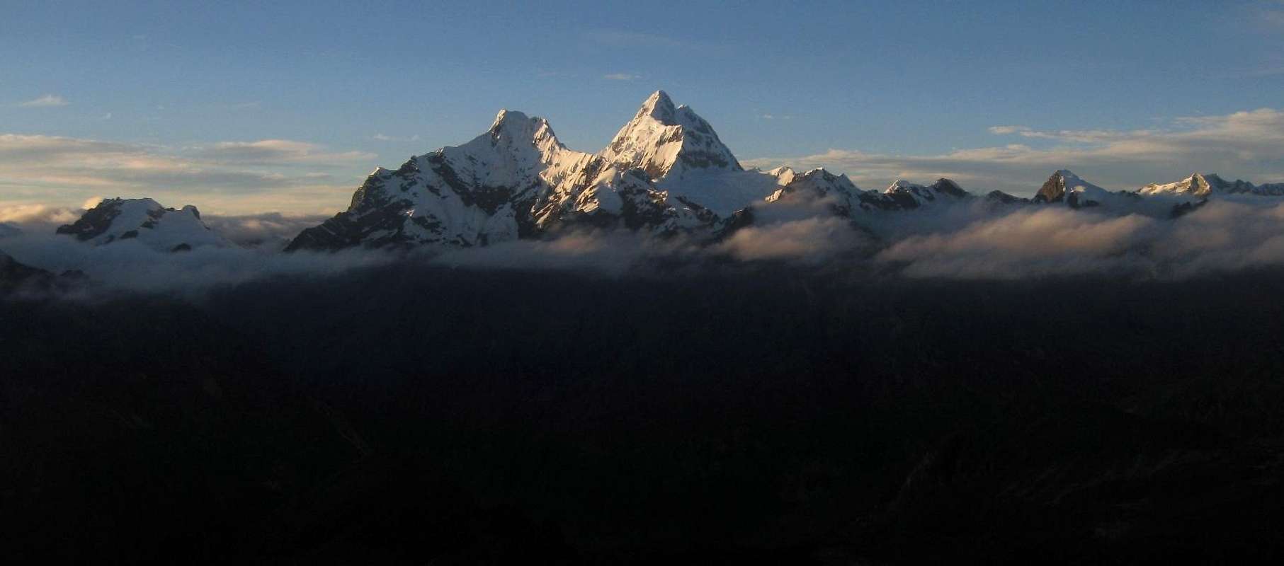
Panorama of the southern Cordillera Blanca from high on the slopes of Jatunmontepuncu
Sugar, cornices, a bergschrund - and, finally, the summit
I slept like a baby, right through my alarms, but still woke up early enough to enjoy a beautiful sunrise. It was well worth getting out of my tent for! A bit of rhyme had condensed on the inner wall of my tent. My thermometer said that it was -3ºC inside. Unless the weather is bad, I usually sleep with the door open to get some fresh air, so it must not have been much colder outside. Add the fact that there was no wind, and it didn't feel bad at all.
![Sunrise on San Juan and Huantsán]() Sunrise on San Juan and Huantsán | |
The stove I had brought was no good at altitude, and melting snow took forever. Yesterday that hadn't been a problem, since I had had plenty of time, but now I wanted to get moving. But after all the melting was done, I got delayed some more, this time thanks to my hiking poles. I had used them as additional tent pegs, and overnight they had frozen solid in the snow. I literally had to chop them out with my axe. By the time I was moving, it was half past nine. The sun was shining brightly now, and although it was still freezing, it felt downright pleasant. I was in high spirits.
![Looking down the long southwest ridge from Jatunmontepuncu (5415m)]() Looking down along the southwest ridge from my camp site. Huapi pass is one of the gaps - perhaps the first one? I'm not planning to go there anymore now, I'll head up from here
Looking down along the southwest ridge from my camp site. Huapi pass is one of the gaps - perhaps the first one? I'm not planning to go there anymore now, I'll head up from hereFrom my camp site, I went back to the old trail, but it didn't last more than few minutes before it ended! That came unexpected. After the footsteps yesterday, I had expected the trail to go all the way to the summit – why else would a trail be there? Instead, I had to make a difficult choice now: go back down and forget about the summit, or find a way up on my own. I saw a few crevasses further below, but not all that many, and none where I was going, so I decided to continue.
![]()
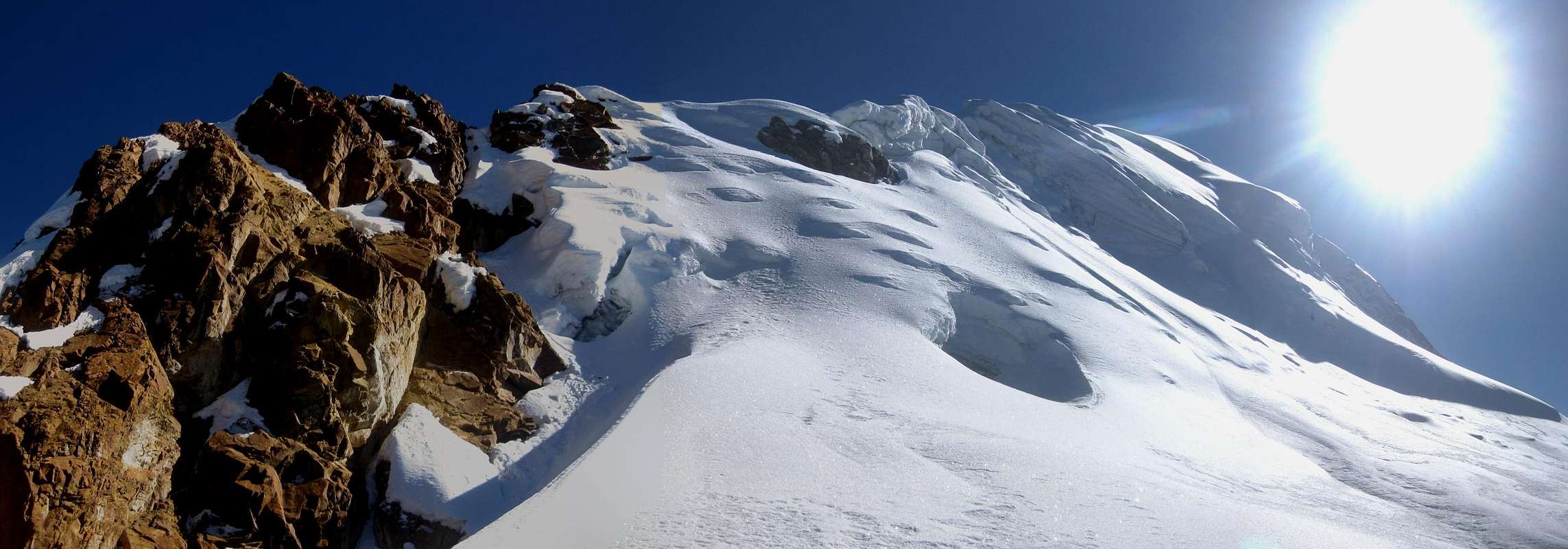
View to the southwest ridge and south face, from near my campsite. It's less than 200m to the summit from here. I don't like climbing those rocks on the left. Furthermore, high on the ridge, just right of center, the glacier looks a bit wild. Still more to the right, on the south face below the ridge, I must avoid getting too close to those seracs. I'll just have to traverse a bit to have better look, and decide later.
Simply following the ridge didn't look good. The rock outcrop right next to my camp was rough and crumbly. I preferred the snow and ice of the glacier.
![Nevado Tullparaju (5787m) from Nevado Jatunmontepuncu (5415m)]() Tullparaju
Tullparaju
I traversed the slopes, going east by northeast for a few hundred meters to get a better look. Without losing altitude, that put me away from the southwest ridge, so I could have a better look at it, as well as of the south face of the mountain. I could see a maze of seracs and steep snow and ice on the south face, right below what looked to be the summit. The direct route was out. Instead, I had to find my way up the ridge somewhere earlier on, and either follow it, or alternatively drop a bit on the other side to get on the normal route.
I saw two ramps that didn't look too steep.
The first one would reach the ridge not far above the rocks next to my camp site. However, I could see some wild ice and what looked like a couple of cornices on the ridge, and those might block my way. Perhaps I could easily pass them on the other side, but I couldn't be sure.
The second one looked only slightly steeper, and would reach the ridge past the cornices. Directly to the right of the ramp were some big seracs though, so I had to make sure I wouldn't end up under them. And, as if to make a point, there was some old avalanche debris lower down.
You guessed it, I chose the second ramp. At first, it was easy going, but as it got steeper, I started zig zagging. Looking back at one point, I thought the trail looked quite nice. But higher up, and a bit steeper still, the snow turned to sugary powder and my progress ground to a halt. Every time I put a foot higher, it sunk down deeply and I wasn't making any headway anymore. I was working hard to try and get up the slope, but in effect I was only traversing it now instead of zig zagging. I was breathing hard, but not getting anywhere. I decided to stop, and take stock of my situation.
With what I am doing, I am not getting any higher. I could go back down and try the other ramp. That would mean a lot of wasted time, and I still might find that I couldn't get past the cornices. I could go back down and forget about the summit. What I can't do is to go further to the right, for that will put me in the danger zone below the seracs. I certainly don't want that. So, the only option I have is to traverse left, and have a look at the snow conditions on the steeper slopes next to the ramp. After an exhausting traverse, I get lucky.
As it turns out, it is still powder, but not quite as loose as before. It is steeper now, next to the ramp, but no more than 50º, and while it is still hard work to gain elevation, I'm getting there. As I approach the ridge, it gets less steep and the snow becomes more solid.
I follow the ridge now, staying about a meter from the edge, since I can't see if it is corniced on the other side. Before long I start to see glacier formations over the edge, on the other side of the ridge. "Aha", I think, "It's not a sheer drop then"!
I follow the ridge a little bit longer, until I can look directly over the edge. Only a meter lower is a flat glacier. So much for the danger of falling through a cornice! And not only that, there are footsteps! After the uncertainty about finding a route, and the heavy exercise climbing that sugary slope, that makes me quite happy. This can't be anything but the normal route, I'm going to make it now!
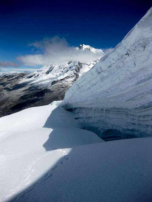
![The ice wall]() The right hand side of the bergschrund, with a big icewall across
The right hand side of the bergschrund, with a big icewall across
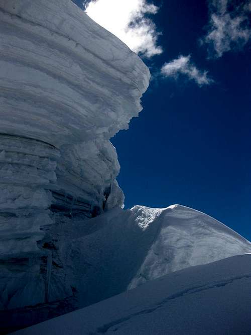
I drop my pack and follow the tracks. A minute later, my happy dream is rudely interrupted. The trail suddenly ends! The reason is obvious: a big bergschrund on the ridge is blocking the way, with a somewhat overhanging ice wall on the other side. It isn't all that high, but it is an insurmountable obstacle. The footsteps lead to the right hand side of the ridge. I can just look past the wall, to see a corniced ridge and a tantalizingly close summit, but there is no way across the schrund, several meters wide, and with vertical ice on the other side.
![The bergschrund]() View to the left hand side of the bergschrund, where the wall on the other side is lowest
View to the left hand side of the bergschrund, where the wall on the other side is lowestNow, I don't give up easily. This can be good as well as bad. Sometimes it gets me in trouble, but this time it pays off. For some reason, the trail doesn't explore any further, but that doesn't stop me just yet. First I want to have a look at the left hand side of the bergschrund. It's not very wide there, and the ice wall is only a little bit above my head. I can probably step over the schrund and climb it. However, I'm worried that it might be corniced, so I do not dare to try that.
I have a better idea. I can reach the top of the wall with my axe, and simply start chopping at it, until I have cut a window to see what's on the other side. Well, it is somewhat steepish, but it's not corniced! In high spirits, I scramble my way up, fully concentrated, because if I fall once I get on top of the wall, I will have to self arrest immediately or it's going to be too steep for it.
![Nevado Palcaraju (6274m) <small>and Laguna Palcacocha (4566m)</small>]() Nevado Palcaraju with Laguna Palcacocha below
Nevado Palcaraju with Laguna Palcacocha below
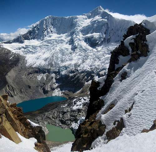
Although I have already seen the summit from below the schrund, on the right hand side, I have forgotten what it looked like. A false summit is just ahead, and I mistake it for the real one. When I get closer it, I see something else sticking out above. For a split second, I even mistake Pucaranra for the summit, of Huapi, and seeing the gigantic seracs I think I'm way out of my league, but I quickly realize my mistake. The final pitch is a 20m high slope, not overly steep, and then I'm on the top. It's a sheer drop on the other side, where a ridge connects with the impressive face of Pucaranra.
![]()
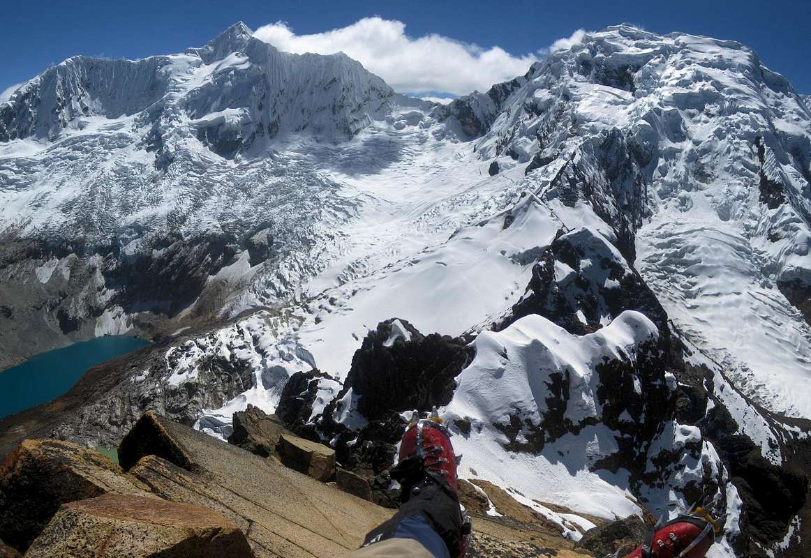
My feet appear to be dangling precariously from the summit of Jatunmontepuncu, while I enjoy the magnificent views of Palcaraju (6274m) and Pucaranra (6156m)
The views are breathtaking. Pucaranra dominates the scene, but Ranrapalca to the west and the beautiful pyramid of Tullparaju to the east make for a grand semicircle. And further away I see Maparaju, the mountain I had climbed two days ago, dwarfed by its higher neighbour San Juan.
I am happy, and feel as if I'm on top of the world. Never mind that all these beautiful mountains around me are higher, from here I can see them all, and this one I managed to climb on my own, without even a proper route description
[7].
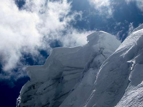
![Wild formations on the SW ridge of Jatunmontepuncu]() Wild formations on the southwest ridge, seen from the Cojup side
Wild formations on the southwest ridge, seen from the Cojup sideAll downhill from here
And yet, knowing I still have a long descent and hike out ahead of me, I don't spend much time on the summit. Instead of one hour, as I thought yesterday, it had taken me almost three hours from my high camp to get here. It's time to go.
I simply walk down to the tricky bergschrund. From above, I can clearly see that there really is no other way than where I had passed it. From the top of the wall, I jump down and over the scrund at the same place where I had crossed before.
Back at my pack, I have an early lunch. Munching on a chocolate bar, I suddenly feel something hard in my mouth. What's that? A stone in my chocolate? "That's no good", I'm thinking, "I could have broken a tooth on that"! I take out the stone, and roll my tongue along my teeth. That's strange... it feels uneven, as if there is something stuck. I try to, but can't get it out. Then I have a closer look at the stone, and it dawns on me: I have broken a filling - by eating chocolate! It doesn't hurt, but I know I have to get to a dentist soon, or it will. And how can I find a good one in Huaraz? I'm not looking forward to that.
![The final pitch to the ridge]() The crux of the normal route, getting on the SW ridge from the Cojup side. Just a short steep section right at the top.
The crux of the normal route, getting on the SW ridge from the Cojup side. Just a short steep section right at the top.
Ah well, it's not like I have a choice, so I quickly stop worrying. I start following the normal route down for a few minutes, until it peters away. Ahead of me, the steep ridge is a mix of rock and snow, to my right a slightly steeper snow slope. I can't see far along the ridge, but I can see that the snow slope quickly leads to much easier terrain, so that's what I chose and I start climbing down. The snow is hard, and although at the top the steepness reaches about 50º, that's just for a short bit. Quickly it gets easier, and I can turn around and walk down. Although I don't see a trail anywhere, I'm not worried. It might be explained by the fact that the snow is pretty hard on this side of the mountain, and besides, it's easy going now anyway.
I take out my map. Much further down, and to the southwest, there are some cliffs, but apart from that, the map shows no significant problems. With a scale of 1:100000, that doesn't say everything, but this suggests that any way down would be fine. And indeed, I don't encounter any difficulties. Occasionally I pass some rock bands in the glacier. Where they were a bit too steep for my liking, I go around, staying on the snow. On one of the easy rock bands, I chose to walk across. It's getting warmer, and I take off my mittens. No sooner than I've done that, I trip. It's always on ‘easy' terrain that these things happen! I suppose that when it's harder, I'm focused, but on easy ground I sometimes drop my guard.
I catch myself with my right hand. As a reward for my lapse in concentration, I get a few abrasions, and a patch of skin is missing from where my wrist hit the ground.
Using the water dripping from the glacier's edge, I clean out the dirt, then I disinfect the wounds with iodine and wrapped them all up. The rest of the descent I'm real careful now, because I don't want to fall on that hand again.
There is the occasional cairn now, but, as so often in Peru, they are far and few between. I don't worry. I know that, apart from the normal route which they must be marking, I will eventually come across the trail down from Huapi pass. When I don't see the next cairn or have a vague trail to follow, I just head down gently, going roughly southwest and wherever the going was easy. Sure enough, I hit upon the very clear trail, and it has plenty of cairns.
![Nevado Jatunmontepuncu (5415m) from Quebrada Cojup]() Looking back at Huapi from the Cojup valley. Knowing where to look, even the ice wall opposite the schrund is clearly visible!
Looking back at Huapi from the Cojup valley. Knowing where to look, even the ice wall opposite the schrund is clearly visible!
Without further incident, I make my way to the valley floor. I meet a small group of trekkers. Perhaps it was their tents I passed yesterday morning? They are setting up camp in a pretty spot almost all the way down in the Cojup valley, but I still want to get back to Huaraz today. I don't have much left to eat, and I don't want Edward to get worried.
The Cojup valley is not quite as long as the Quilcayhuanca, but it still takes a while to hike the length of it. By the time I get to the checkpoint at the entrance, it was shortly before sunset. I understand that the post is normally manned, but not at that late hour. More importantly, at that time of day my chances of catching a ride were zero. I had no other option but to continue hiking. Apart from the soles of my feet, which were feeling pretty sore, I felt as if I could keep walking forever – well, at least to Huaraz.
A few hours later I reached a small village, and, most fortunately, a taxi happened by to drop off a local family. Finally, my weary feet can have a well earned rest. Plastic double boots are not made for hiking...
![]()
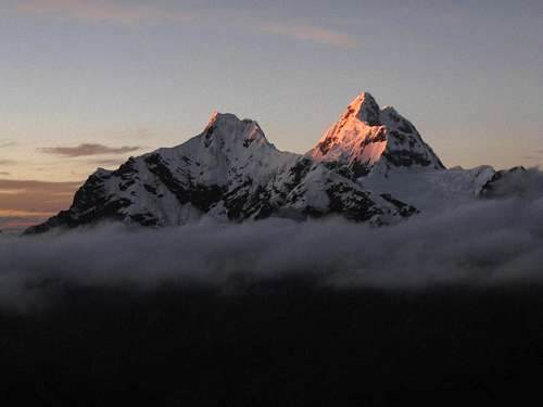
Alpenglow over Cashan and Shacsha, in the southern Cordillera Blanca, from the dirt road between the Cojup valley and Huaraz
Healing
Surprisingly, as I stepped out of bed the next morning, I felt neither tired nor sore – but to add to my broken molar and injured wrist, I found I had a rather unpleasant blister on my feet that would keep me from roaming the hills for a few days.
Edward escorted me to a dentist, who put in a new filling. A few months later, back in Amsterdam, I had my own dentist check it out; she thought it wasn't a bad job, but replaced it anyway. Her work lasted another year, then it broke again and the molar had to come out altogether.
For the abrasions, I went to one of the local hospitals
[8]. The doctor put some sort of ointment on it, to promote healing, bandaged it, gave me a prescription for antibiotics and told me to come back in a few days. She also told me I couldn't go climbing for a while, but with my blister I knew I wasn't going anywhere anyway. A few days later, she replaced the ointment and dressing, and again told me not to climb. However, this time my blister was healed well enough, so I figured I could go out for some easy stuff in the Cordillera Negra. And that's when my eye fell on Huancapeti, and how I ended up sleeping in a mining plant workers camp...
The story continues here: The Ishinca valley, Urus Este and the NW ridge of Tocllaraju
Notes and references
| [1] | Alpenvereinskarte Cordillera Blanca Süd (Perú), 2005, ISBN 3-937530-05-3. |
| [2] | The Andes - A guide for climbers, John Biggar, 3rd edition, 2005. ISBN 0953608727. |
| [3] | To enter the Huascarán National Park you need a ticket, which, in 2011, was 65 Soles, valid for a month. To go climbing unguided in the Cordillera Blanca, you need a permit, which was free, but you have to prove that you are a member of an alpine club to get it. The park officials were quite helpful. As I would keep coming back, it didn't take long before they recognized me and the process was even faster. |
| [4] | Classic Climbs of the Cordillera Blanca, Brad Johnson, 2009 revised edition, ISBN 978-0-9758606-1-8. |
| [5] | Later I talked to Edward, and he assured me that the lake still exists. I must have been close, but I must have gone up the slopes towards the pass too early, before I got there. It was not too steep, and there were many cow paths. I suppose I could have mistaken some of those for the trail for a while, before getting back on the real one higher up... |
| [6] | To reach Huapi pass, I believe this is where I should have turned west instead of continuing south towards the glacier. But looking west, I saw that the ridge was much longer than I had expected, so I opted for the direct approach instead. |
| [7] | Later I learned that I may have repeated the first ascent. It's an easy route, but having to find it all by myself made it so much more enjoyable. |
| [8] | Based on the advice of Brad Johnson[4], I went to Clinica San Pablo. |
![]()
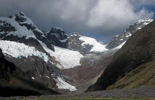
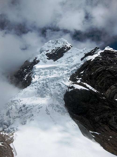
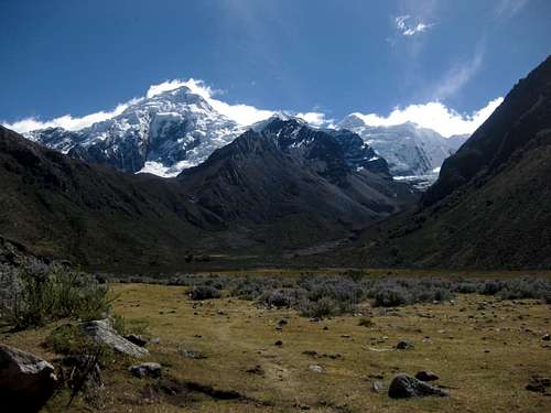
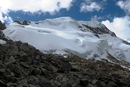
A distant view of Maparaju, from the NW, high on Jatunmontepuncu. Far to the right, at the edge of the image, the saddle with San Juan is visible, with the rocky outcrop that I chose to pass behind. Then came the tiring snow slope, followed by the easy plateau, and finally the somewhat steeper ridge - the one with the rocky face on the right, in the shadow, and a bright white and sunny glacier on the left, leading straight to the summmit, which, according to the guidebook[2], is the white one well left of center.
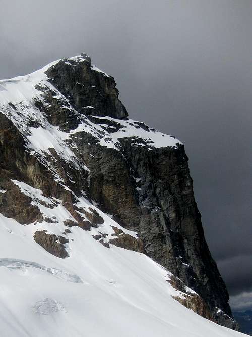
As several other climbers wrote in SP's summit log, the small rocky spire further left in this photo appears a pretty good candidate for the true summit too. I wondered about it for a bit, but the connecting ridge was corniced and that spire didn't look too easy, so I didn't go there to find out for myself.









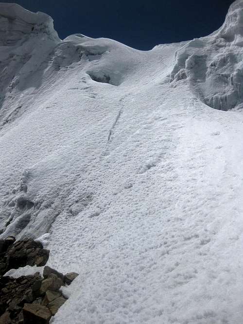
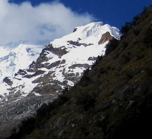

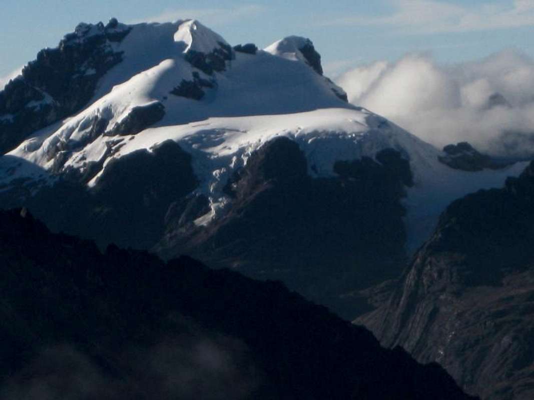


Comments
Post a Comment