
|
|
Mountain/Rock |
|---|---|
|
|
39.75070°N / 116.5804°W |
|
|
Eureka |
|
|
Hiking |
|
|
Spring, Summer, Fall |
|
|
9147 ft / 2788 m |
|
|
Overview
Fagin Mountain
Nevada is a great state for exploring, even today, as there are so many mountain ranges that seldom get visited. Thanks to the growing interest of evaluating a mountain by its prominence, many of the out of the way areas are now beginning to have some visitation by a group of dedicated "peakbaggers" who are fascinated by the prominence concept. Fagin Mountain is another of those truly unknown mountains where its summit is rarely visited, having recorded relatively few ascents in over 20 years. Those were in:
1994, 1995, 2000, 2002 2006, 2007, 2010 and 2013.
The biggest challenge of this mountain isn't in getting to its top due to technical or other reasons, the biggest challenge is finding your way to it. Hopefully it is the purpose of this page to help in aiding the few that might be interested.
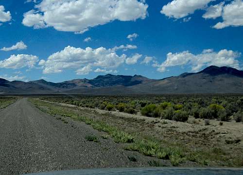
Located off of Nevada's famed "Loneliest Highway", US 50, between the towns of Eureka and Austin, is Fagin Mountain. As you travel eastward from Austin, you may well note the large mountain on the north side of the highway off in the distance, and you will be getting your first glimpse of Fagin Mountain.
Fagin Mountain is the range highpoint of the Simpson Park Mountains, also known as the Simpson Park Range, which cover an area of approximately 310 square miles. US Route 50 crosses the very southern end of the range at Hickison Summit between Eureka and Austin. The range is named after James H. Simpson, who surveyed a transportation route just south of the range in 1858 but I have not been able to find out who Fagin Mountain was named after.
With a prominence of over 2200', Fagin Mountain ranks #132 on this peakbagger list.
One of the great things about mountains in Nevada is that so many of them offer a "feel" of adventure and generally it is rare (with a few exceptions) to run into another visitor during your visit. Plan accordingly and be prepared to be totally self reliant. Thanks to resources like peakbagger.com and lists of John, and now this page on summitpost, information about this peak is now available. I'd ask those who visit this mountain to please sign the register log here and add information about your visit.

Nearby Pony Express route
Getting There
If coming from Eureka, head west on Hwy 50 and look for the signed Three Bars gravel road that is west of Eureka about 25 miles from the center of town. 39.5222 116.3675) This is a good graded road that goes due north. In about 10 to 11 miles from Hwy 50 take the left fork (39.6651 116.4576) towards the Ferguson Ranch. Another 5+ miles will take you by the Ferguson Ranch that is a working ranch but is little more than a double wide mobile home.The good road turns into the ranch but just before the gate of the ranch, take a rougher road (39.6961 116.5675) 1.6 miles where another road goes sharply uphill to the right (39.7100 116.5840 Elev 6870) and turn onto this road, following it over a small hill and then down into Ferguson Creek. The road here gets worse the further you go on it. It crossed the creek a couple of times, passed some cows and in about 2.0 miles from the right turn passed a spring at the head of the valley. For those who don't have real high clearance or 4WD, this might be a good place to park and walk from. Of course, you can park earlier, much earlier, if you get uncomfortable on this "road". For the more adventurous off road drivers, you might drive up to the saddle. From the spring up to the saddle is about a mile and it gains about 900 ft. This is a steep narrow rocky nasty 4WD road. If you drive to the saddle at about 8,450 ft stop at a barbed wire fence and gate and you've found your trailhead. Me, I would definitely walk the extra mile as this is no place to get in trouble. Both Ken Jones and Dennis Poulin drove their vehicles (on different visits) to the saddle and I (the more timid of the three) would have stopped near the springs at 7400 feet and hoofed it from there (I rode up in Ken's 4 runner).
If coming from Austin, it is about 45 miles to the Three Bars turnoff mentioned above.
 Fenceline to the summit Fenceline to the summit |  Surrounded by brush Surrounded by brush |  Register Register |
Route
Our route: (see getting there above)If you park near the springs at 7400', it is about a 4 mile round trip effort and near 1800' of elevation gain. If you can make it up to the saddle, then, it is about one mile round trip with less than 700 feet of elevation gain. The last bit to the top is a bushwhack (easy) and has some rocks to scramble over but it is relatively non technical. The summit area has a small cairn of rocks with a glass bottle register in it. The actual highest point is probably about 20 feet north but hidden in the brush.
Other ways of accessing the mountain are possible and I know that Brad Boeser who visited the mountain in 2010 went a different way. See his trip report here.
However, the shortest and most direct approach I believe to be the route we were able to take.

Map of Ferguson Ranch area

Route map
Red Tape
We found no signs indicating that we were on private land although it is possible that the land crossed is private. Often there is a mixture of private and BLM land and it is always best to be respectful and exercise proper judgement in the case that you are crossing private property.The Elko office for the BLM would be able to aid any requests for information:
You can email the Elko District at elfoweb@blm.gov or call at (775) 753-0200.
 Summit cairn Summit cairn |  View to the south View to the south |  View to the north View to the north |
When to Climb
This mountain could most likely be climbed during any season but would of course depend on the weather. Snow or rain would make it a poor time as dirt roads in Nevada will generally become impassable when they become wet. Pay attention to the weather and plan accordingly.Click for weather forecast

Click for weather forecast
Camping
There are no organized campgrounds in the area but primitive camping on BLM land is allowed. Always follow the leave no trace ethic and pick up after yourself. Motels can be found in Eureka and Austin.  View to the northwest View to the northwest |  Looking down at the saddle Looking down at the saddle |  View to the southwest View to the southwest |
One of the great things about mountains in Nevada is that so many of them offer a "feel" of adventure and generally it is rare (with a few exceptions) to run into another visitor during your visit. Plan accordingly and be prepared to be totally self reliant. Thanks to resources like peakbagger.com and lists of John, and now this page on summitpost, information about this peak is now available. I'd ask those who visit this mountain to please sign the register log here and add information about your visit.
Summit visitors
Peakbagger.com has a pretty good listing of who has been to this summit.Since Ken Jones and I made our visit in 2013, eight others have been to this one as well.
External Links
Pony Express in NevadaNevada DOT road conditions
Prominence map for Nevada: Click on my profile page to see a map that covers the prominence peaks in Nevada and also, click on this link for a summitpost listing of the Nevada prominence peaks.