


gimpilator - Jan 8, 2015 5:10 pm - Hasn't voted
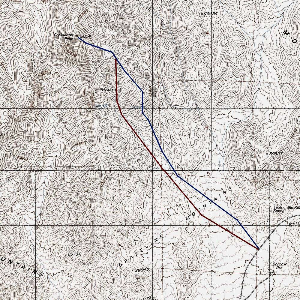
CorrectionWe tried to ascend the ridge route using the blue line approximation. We kept thinking that something must be wrong because there was no sign of frequent travel and there were no cairns. Also, the ridge where the blue line turns directly north looks very craggy and has steep loose slopes and cliffs. We decided to bail down into the canyon route for the remainder of the ascent, which was a good choice.
After reaching the summit, we descended the ridge route and found that it is actually on the next major ridge further east. The path on that ridge is easy to follow and well cairned. For anyone planning to ascend the ridge route, please see my separate map.
In summary, as you said, the above map is only an approximation. The basin below the peak is a maze of small ridges and washes. We do not hold you responsible for our experience getting off route.

Bob Sihler - Jan 9, 2015 9:30 am - Hasn't voted
Re: CorrectionThanks for this. I am going to add your map to the page and update the information.
When I climbed the peak, I didn't make a track but did have a copy of this photo saved on my phone:
http://hwstock.org/cork/html/corkmap.htm
His beta is usually very good, and the diagram seemed to fit what I did about right, particularly because I had views of the wash route for much of the way once I got on the ridge. And in his TR accompanying the map, he mentions that the ridge never has to get harder than Class 2, which also comports with what I did.
So without having my own track, I can't say I'm entirely sure whether I followed his or yours. It seems there are two "ridge routes"!
Anyway, I appreciate the feedback and will edit the page accordingly.
gimpilator - Jan 10, 2015 10:19 am - Hasn't voted
Re: CorrectionVery interesting! Check out this route image I just found in his 2011 trip report (first image). It appears as though in recent years, the furthest east variation has become the standard. I don't doubt that you went up that way. Did you climb it back in 2005?
Bob Sihler - Jan 12, 2015 11:35 am - Hasn't voted
Re: CorrectionI did it this past April.


Comments
Post a Comment