
|
|
Mountain/Rock |
|---|---|
|
|
26.82343°S / 68.64808°W |
|
|
Hiking, Mountaineering |
|
|
19784 ft / 6030 m |
|
|
Overview
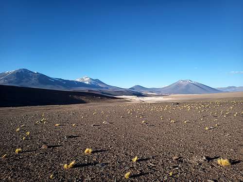
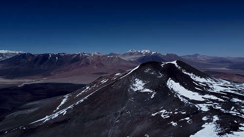
This volcanic peak just barely qualifies among the Andes 6000 m summits, and is largely ignored by climbers in favour of the numerous taller mountains nearby. Regardless, it is an interesting objective for its remoteness and the pristine nature of the climb; aside from the summit register, most climbers will likely not see any evidence of other human activity on the mountain. Numerous high peaks are visible from the summit, including Ojos del Salado, El Muerto, Cerro El Condor, Incahuasi, and Nevado Tres Cruces.
Peña Blanca has two summits of similar altitude. Both exceed 6000 m, but the southwest summit is approximately 20 m higher than the northeast. The col between them is less than 150 m below the main summit.
This climb is non-technical and presents few challenges other than the long approach and high altitude.
Getting There
As Volcán Peña Blanca is entirely in Chilean territory, the simplest approach is from Chile. Departing from Copiapó, bike, drive, or hitchhike approximately 230 km along Ruta 31 towards Paso San Francisco.
One or more acclimatization stops should be planned for climbers who have not recently been at similar altitudes. There is an obligatory check-in with the border police at the outpost adjacent to Salar de Maricunga.
By Bicycle - Considering the altitude gain of nearly 4000 m from Copiapó, fit cyclist can expect to cover this distance in about 4 days. There are safe and reliable water sources just beyond the La Puerta encampment (100 km from Copiapó), at the border outpost (173 km), and at Rio Lamas (203 km). After that, you will likely be reliant on melting snow for your water. There is little chance of finding water near the highway beyond Rio Lamas, so be sure to collect enough for 2 days (or more) before the next refill. There is a culvert under the highway where the approach continues on foot; this is an excellent (and highly inconspicuous) place to stash your bicycle. It may be feasible to ride some of the gravel side-roads (or even the desert plateau itself) with appropriately fat and soft tires to continue farther by bicycle.
By Car - By car, this trip should take approximately 6 hours. As of summer 2022, the entire road was in sufficiently good condition that an average car could reliably make the trip. However, it may be difficult or impossible to find a safe parking spot off of the road without 4WD. Just beyond the aforementioned culvert, there are several locations where a 4WD vehicle can exit the highway and park beside the road. It is not known how the border police will regard a vehicle parked in this manner. As an alternative, there are rough gravel side-roads that depart the highway earlier and could shorten the hiking approach by about 2 km. Please be considerate of the pristine environment; the track of even a single vehicle on the desert ground takes a decade or more to dissipate in this area, so drivers should confine their activities to established roads and trails.
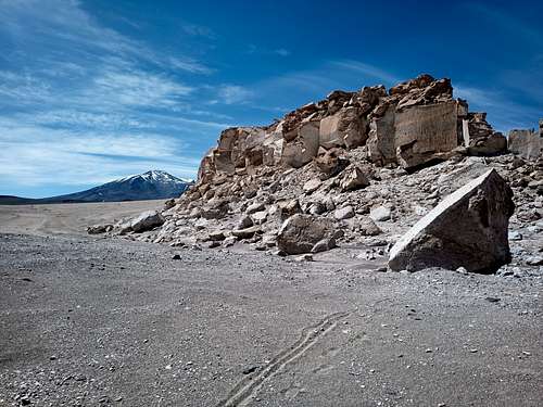
Just prior to passing through some prominent tan bluffs, you will leave the highway and continue on foot heading north towards the mountain. Aim for the col just to the right (east) of the Pena Blanca summit. The slope begins to become significant approximately 8.5 km from the highway at an altitude of about 4700 MASL. Depending on the state of your acclimatization, this may be a reasonable area for a camp. Otherwise, there are numerous potential spots as the route continues - you will likely be able to find a campsite nearby almost anywhere you choose to stop.
Route
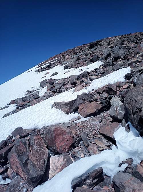
From the plateau southeast of the summit, continue up a system of scree gulleys. Many variations are possible, but the easiest line will generally continue to climbers' right (away from the summit) until about 5400 MASL. From here, continue up towards the col between the two summits of Peña Blanca.
As you enter the col, you may consider either ascending to climbers' left up the rockier east ridge, or else continuing on nearly level ground past several small (and often frozen) ponds to approach the main summit from the north up a slope of loose material. Some or all of the route above 5500 m may be covered in snow during summer months.
The vicinity of the summit is a broad plateau, while the summit itself is found on a narrow ridge of rock about 15 m above the adjacent terrain. A Banco de Chile summit register is present on this peak, although entries in the logbook are rather sparse.
Descend a similar line as you came up.
The adjacent peak El Ermitaño offers the unusual opportunity of tagging two 6000 m peaks in quick succession. This can be done quite reasonably in a single day from a camp on or near the intervening col.
Red Tape
The Chilean agency DIFROL issues permits for all activities in border areas. As this mountain is not actually on (or even very near) the international border, it is uncertain whether or not the permit is obligatory. However, the permit is free and easily obtained via online form, so there's no reason not to register your expedition.
When to Climb
The climbing season in this area extends from December to late March. It is certainly possible to attempt this peak at other times of the year, but winter climbers should be prepared for extreme cold, sustained high winds, deep snow, snowstorms, and the likelihood that the highway might not be plowed frequently (or at all).
Camping
Camping is permitted everywhere in the area. There are some excellent sites near Rio Lamas, as well as very scenic locations for a high camp on the broad col between Pena Blanca and El Ermitano. Climbers might also consider staying at the local refugios, especially Refugio Claudio Lucero (3 km south of the highway towards Ojos del Salado) and Refugio Laguna Verde.
External Links
-