Toggle navigation
Mountains
Routes
Images
Trip Reports
Forum
What's New
People
Areas & Ranges
Articles
Trailheads
Canyons
Huts & Campgrounds
Albums
Logistical Centers
Fact Sheets
Lists
Custom Objects
Gear
Plans & Partners
WELCOME TO SUMMITPOST
SIGN IN
REGISTER
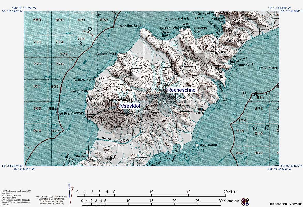
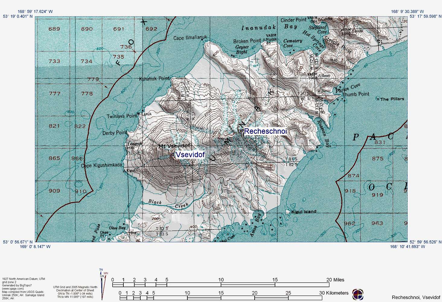
Vsevidof Topo Map 2
View High-Resolution Image
Vsevidof Topo Map 2
Image created by the Alaska Volcano Observatory using BigTopo 7 software and AllTopo 7 U.S. Geological Survey topographic maps. Please cite the Alaska Volcano Observatory, the U.S. Geological Survey, BigTopo 7, and AllTopo 7 when using this image.
« PREV
NEXT »
The_Cat_Guy
on
Jul 10, 2017 4:22 pm
Comments & voting
Other parents
Lat/Lon:
53.12407°N / 168.69429°W
Image Type(s):
Topo/Diagram
Image ID:
1002996
1133 Hits
71.06
% Score
1
Votes
Log in to vote
Comments
No comments posted yet.
to post!
Don't have an account?
Vsevidof
(Mountain/Rock)
You are at
the First
Image
Viewing
#1 of 1
GALLERY
You are at
the Last
Image
The_Cat_Guy's Image Gallery
« PREV
Viewing
#72 of 321
GALLERY
NEXT »
Vsevidof
(Mountain/Rock)
Loading....
×
You need to login in order to vote!
User Name
Password
Remember me
Forgot your password?
Log me out when I close my browser.
Keep me logged in all the time.
sign in as a user
Don't have an account?
Register now for FREE
Rating available
Suggested routes for you
People who climb the same things as you
Comments Available
Create Albums
Register Here


