Toggle navigation
Mountains
Routes
Images
Trip Reports
Forum
What's New
People
Areas & Ranges
Articles
Trailheads
Canyons
Huts & Campgrounds
Albums
Logistical Centers
Fact Sheets
Lists
Custom Objects
Gear
Plans & Partners
WELCOME TO SUMMITPOST
SIGN IN
REGISTER
Williams Lakes
Additional Parents
Image
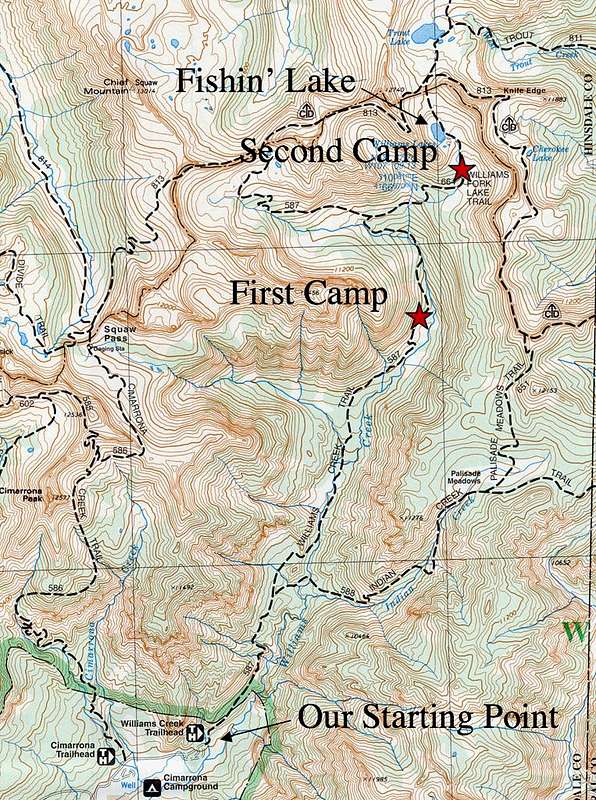
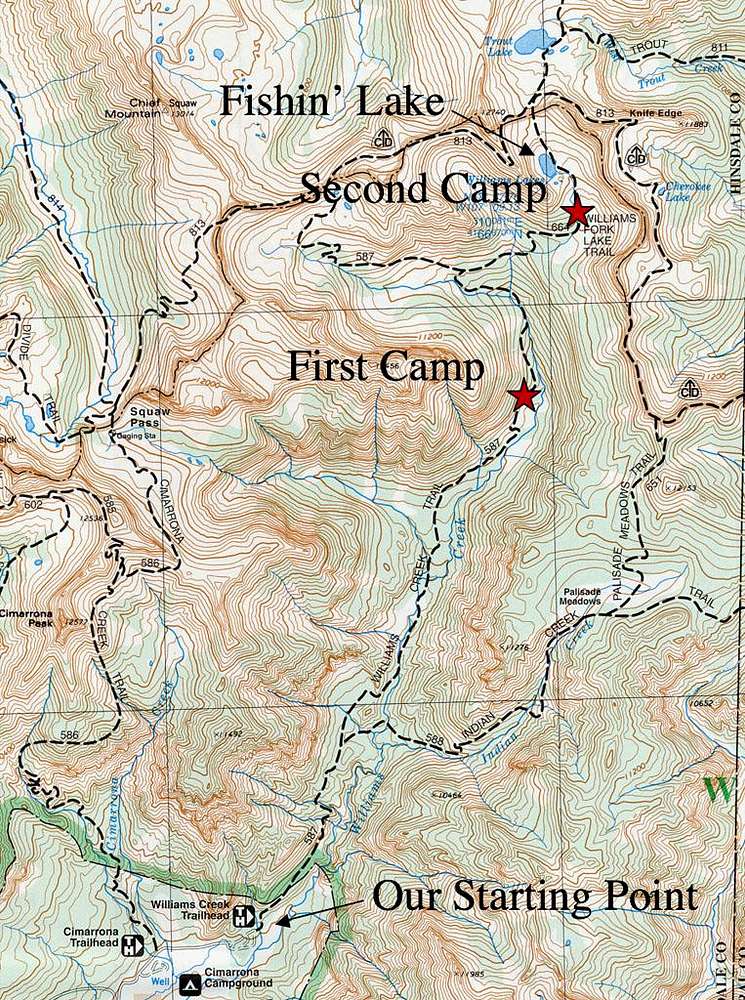
Williams Creek Trail Map
View High-Resolution Image
Williams Creek Trail Map
The topo map showing the trail and the campsites we used in July of 2004.
« PREV
NEXT »
strawd
on
Feb 24, 2008 6:24 pm
Comments & voting
Other parents
Lat/Lon:
37.62933°N / 107.15217°W
Image Type(s):
Hiking
Image ID:
383290
3287 Hits
0
% Score
0
Votes
Log in to vote
Comments
No comments posted yet.
to post!
Don't have an account?
Williams Lakes
(Route)
« PREV
Viewing
#7 of 8
GALLERY
NEXT »
strawd's Image Gallery
« PREV
Viewing
#35 of 37
GALLERY
NEXT »
×
You need to login in order to vote!
User Name
Password
Remember me
Forgot your password?
Log me out when I close my browser.
Keep me logged in all the time.
sign in as a user
Don't have an account?
Register now for FREE
Rating available
Suggested routes for you
People who climb the same things as you
Comments Available
Create Albums
Register Here


