
-
 3100 Hits
-
 79.78% Score
-
 11 Votes
|
|
Route |
|---|---|
|
|
47.52653°N / 10.91838°E |
|
|
Skiing |
|
|
Winter |
|
|
Most of a day |
|
|
ski tour for advanced |
|
|
Overview
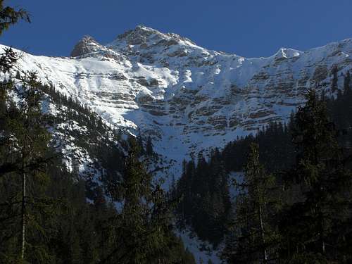
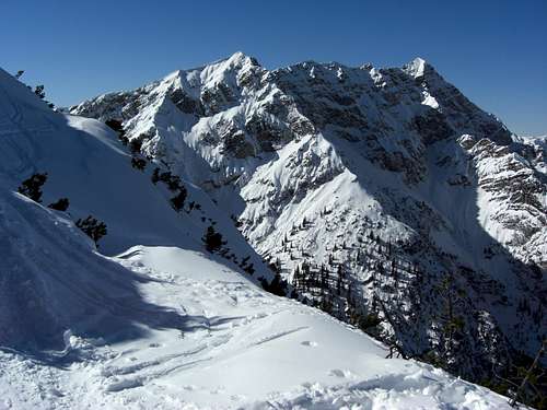
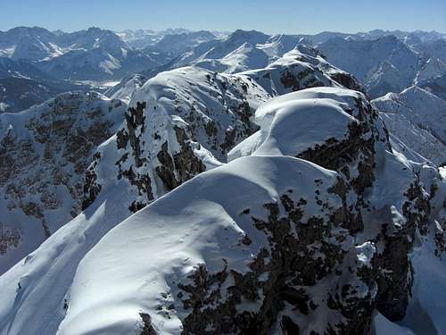
Kreuzspitze north cirque (Hochgrieskar)
Kreuzspitze hosts one of the best powder snow ski tour routes of the area. Nowadays far away from being an insider route, Kreuzspitze ski route still is an enjoyable winter outing.
The route uses the north cirque of Kreuzspitze and Kuchelbergkopf, the so called "Hochgrieskar" and its drainage valley, named "Hochgries", which is in fact more a broad chute than a valley. In the upper parts of the route you reach - at last - the sun and the west ridge with its spectacular views. The westernmost outlook of the west ridge is called Schwarzenköpfel.The summit block can be a challenge, depending on the snow conditions. It is the steepest part of the rather steep ascent and requires sometimes crampons, sometimes a bit of mixed rock scramble and steep snow. In good years with much snow the experienced skier can push forward and reach the summit ridge with skies; only some steps away from the summit.
The whole route is steep and straight without any twirls and squiggles. In three to four hours you reach the summit, within one hour you´re back at the trailhead. This makes the route a half days undertaking for the fast and speedy early birds. For those who know how to relax on a sunny summit and enjoy the great panorama. it will be a bit less of “most of a day”.
Getting There
Kreuzspitze ski route overview
The trailhead is alongside the road Linderhof (Germany) – Reutte (Austria), road number L255 / St2060.
- Coming from München or Garmisch-Partenkirchen (highway A95, road number B23) take raod number B23 to Ettal and, 500 m after leaving Ettal, St2060 to
Graswang and Linderhof. Continue on that road until you cross the Linder creek on a road bridge. Go on for about 2,5 km until you reach a forest road, branching off to the right at the first righthand clearing in the dense woods.
Sometimes with tons of snow the clearing is the only orientation for the right place. Park your car alongside the road on its south side – up to now (2012) it
is tolerated to leave the car here even if you block a part of the road.
- Coming from Reutte take road number L255 to Plansee and Ammerwald Hotel. Some km after Ammerwald there are two switchbacks and a bridge across Linder creek. After about 600 meters you reach the above mentioned clearing and the forest road on your left side.
Route Description
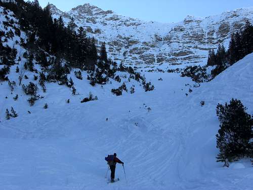
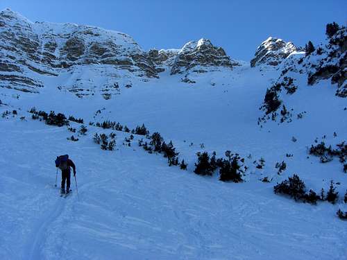
 Kreuzspitze Ski Route Overview
- Scramble up the snow walls on the south side of the road L255 and head straight into the woods opposite of that point where the forest road branches off the road.
- After 100 meters you reach the erosion bank of Linder creek. Work your way down that 30 m high bank into the river bed of Linder creek and cross the dry river bed to the southeast. Enter the woods and ascend the woods in southeastern direction until you reach the lower end of the drainage chute of the Kreuzspitze north cirque.
This sounds a bit difficult to find but normally there is a ski track you can follow.
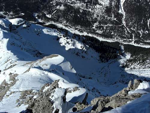
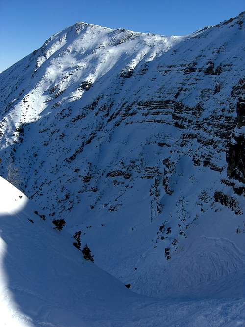
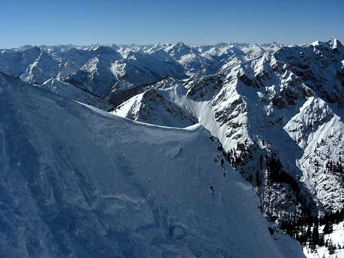
- The route now follows the drainage (Hochgries) up to the north cirque. When the chute gets wider near the lower end of the steep cirque, stay on the left (orographic right) side of the drainage and enter the lower part of the Hochgrieskar cirque.
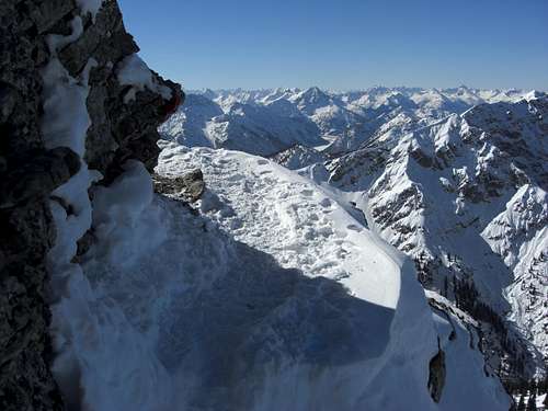
The cirque is surrounded by steep northern walls of Kuchelspitzkopf, Kreuzspitze and the Kreuzspitze west ridge. By entering the lowest parts of the cirque, you can see high above on your right another chute, which leads you out of the cirque and up to the west ridge of Kreuzspitze to the point, called Schwarzenköpfel (1897 m).
- In the middle of the cirque there is a sort of moraine ridge with dense thickets of dwarf pines. Look for a possibility to overcome this moraine ridge from left to the right. After that, zigzag up the steep slope and the upper chute to reach the west ridge, Schwarzenköpfel and the sun.
![Kreuzspitze Ski Route]()
North cirque of Ammergauer Kreuzspitze![Kreuzspitze Ski Route]()
North cirque ascent![Kreuzspitze Ski Route]()
West ridge view of Geierköpfe
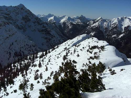
- The route stays now on that west ridge or on its southwestern and southern side. The first part is steep and involves some fights with dwarf pines, especially in years with low snow cover. Cursing guaranteed. Then the ridge gets smoother, almost level and you catch the first sight of the steep summit block. Follow the ridge until you reach the beginning of the upper west ridge, the summit slope and the summit block.
- In years with good snow cover you can zigzag up half the way of the summit slope to the ski depot, the slope then has enough snow to ascend it with skies. The upper west ridge itself is mostly blown clear of snow and offers the possibility for an ascent by foot.
 Kuchelbergkopf and north cirque | 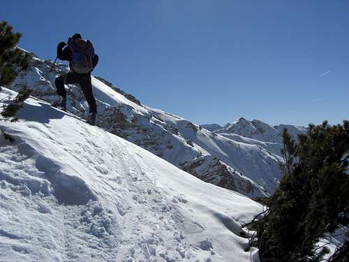 Kreuzspitze west ridge with Schellschlicht summit |  Summit block of Kreuzspitze |
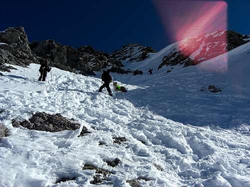
- The main ski depot is below the lowest rock face of the summit block to your left. Ascend steeply by foot on the right side of that rock face and turn right to a secondary col. To your left you may see the red markings of the summer ascent. Don´t follow them!
- From the secondary col ascend steeply to your left below a rock face until you reach a short rock scramble part and a steep snow field which directly leads up to the summit east ridge. You can ascend this snow field or better, at its beginning, turn right and ascend a short ledge to the right. At its end turn left and ascend directly (snow, scree, easy rocks) to the upper end of the above mentioned snow field.
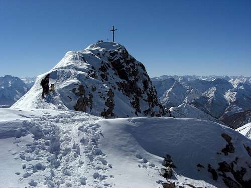
Some steps lead you to the eastern summit ridge.
The nearly level summit ridge leads you exposed to the summit.
Summit ascent
Summit ascent
Summit ascent
- Descend Kreuzspitze the same way. To enter the upper chute of the north cirque, leave the Kreuzspitze west ridge at the point when it gets steeper, to your right.
There is a secondary chute dropping down in that upper chute of the north cirque; better for downhill than another fight within the dwarf pines. This chute is narrow and very steep so better try to stay upright!
- Below the upper chute you can use the whole of the cirques slopes for your powder downhill fun.
Kreuzspitze summit (03-03-2013)
Essential Gear & Route Condition
Kreuzspitze west ridge traverse to Schwarzenköpfel
Difficulty: Advanced.
Steep ski tour with likewise steep downhill slopes. Short bits of a narrow and steep chute. The summit block ascent and descent is steep andexposed.Kreuzspitze ski route is not a beginners route. The route has ascents on steep slopes and consequently steep downhill parts. The ascent of the summit block is in steep, sometimes iced terrain.
Full ski and avalanche gear is required. Crampons are recommended for the summit block ascent, depending on the snow situation.
Check the Bavarian avalanche bulletin here.
Current Weather:
Maps & Guide Books
Kreuzspitze south ridge, Lechtal, Mieming and Ötztal Alps
Maps
- Topographische
Karte 1 : 50.000, Karwendelgebirge, Werdenfelser Land, UK L 5, Bayerisches
Landesvermessungsamt München
- Topographische
Karte 1 : 50.000, Füssen und Umgebung, Bayerisches Landesvermessungsamt München
- Alpenvereinskarte
Bayern, scale 1 : 25.000, number BY 6, Ammergebirge West, Hochplatte,
Kreuzspitze; 2012
Guide Book
- Alpenvereinsführer alpin, Allgäuer Alpen und Ammergauer Alpen, Bergverlag Rother, München, 2008