-
 1718 Hits
-
 78.27% Score
-
 9 Votes
|
|
Route |
|---|---|
|
|
45.88629°N / 7.33508°E |
|
|
Hiking |
|
|
E |
|
|
Overview
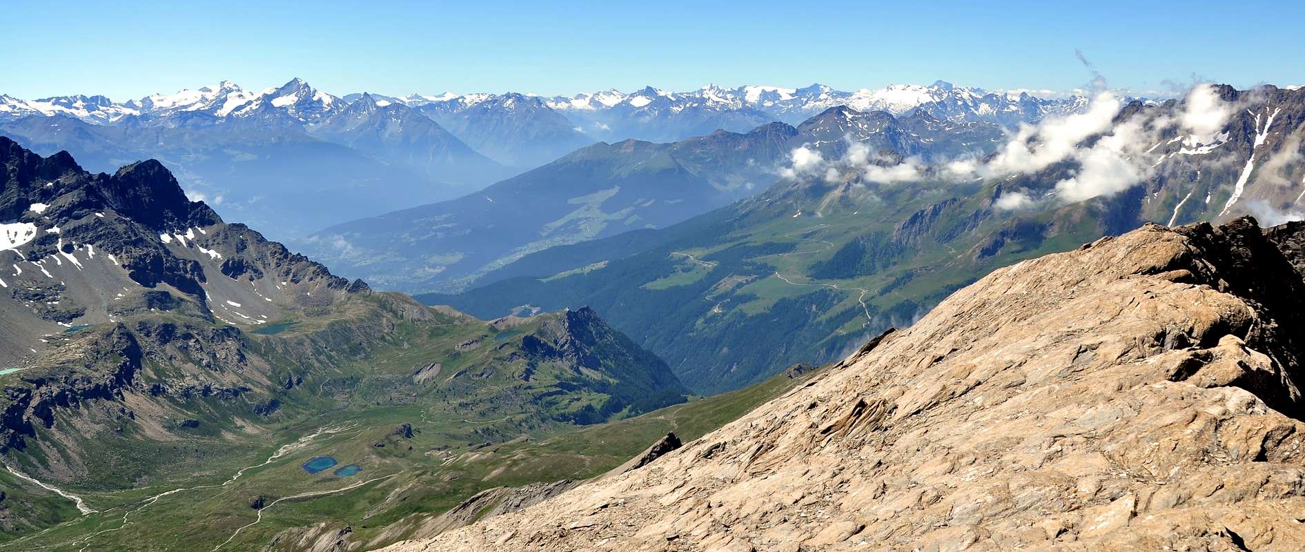
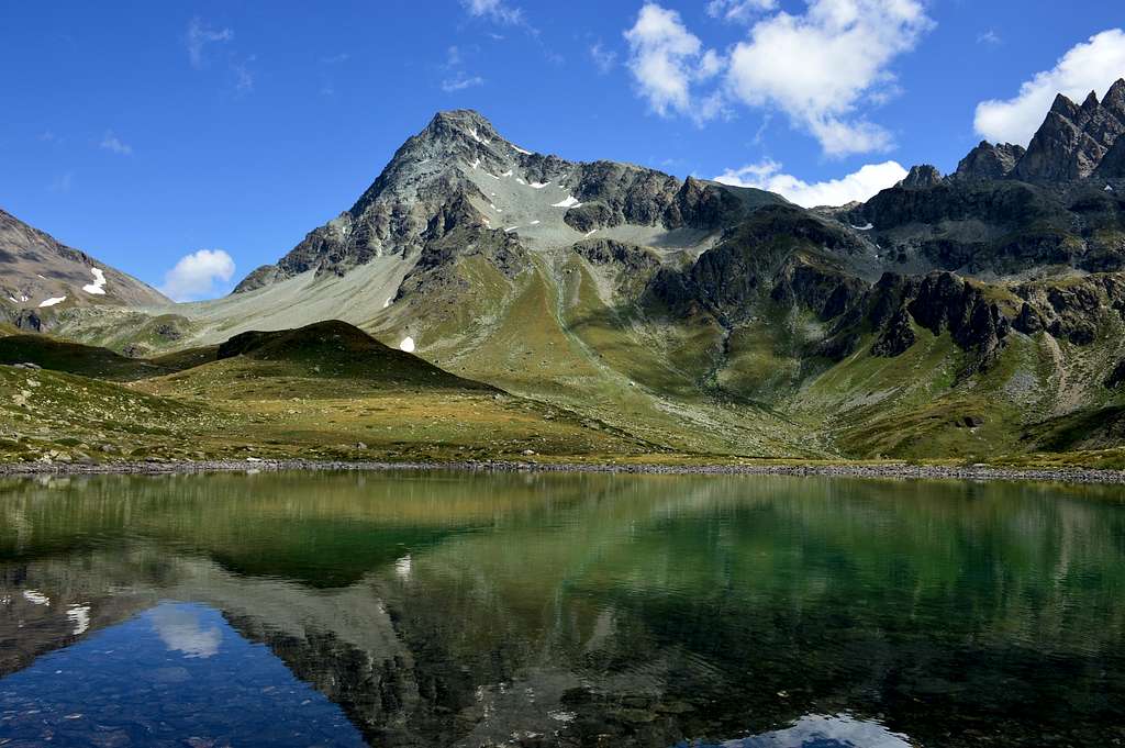
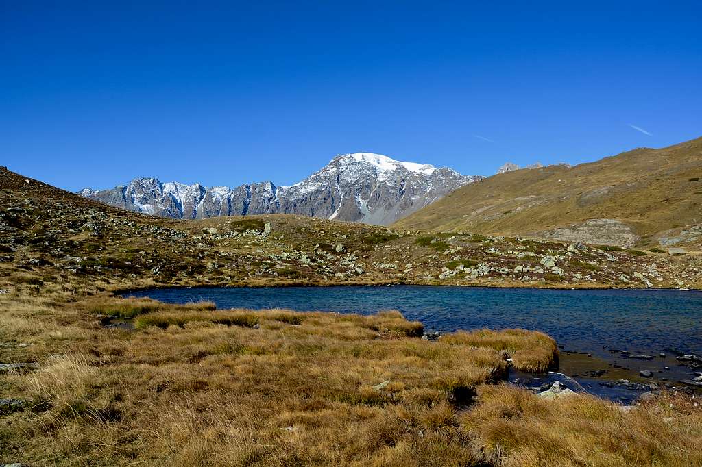
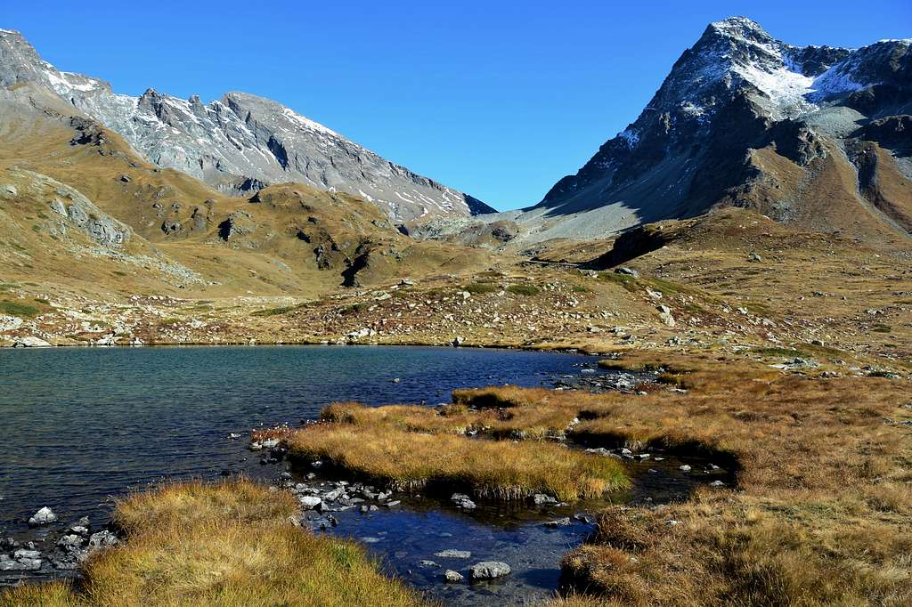
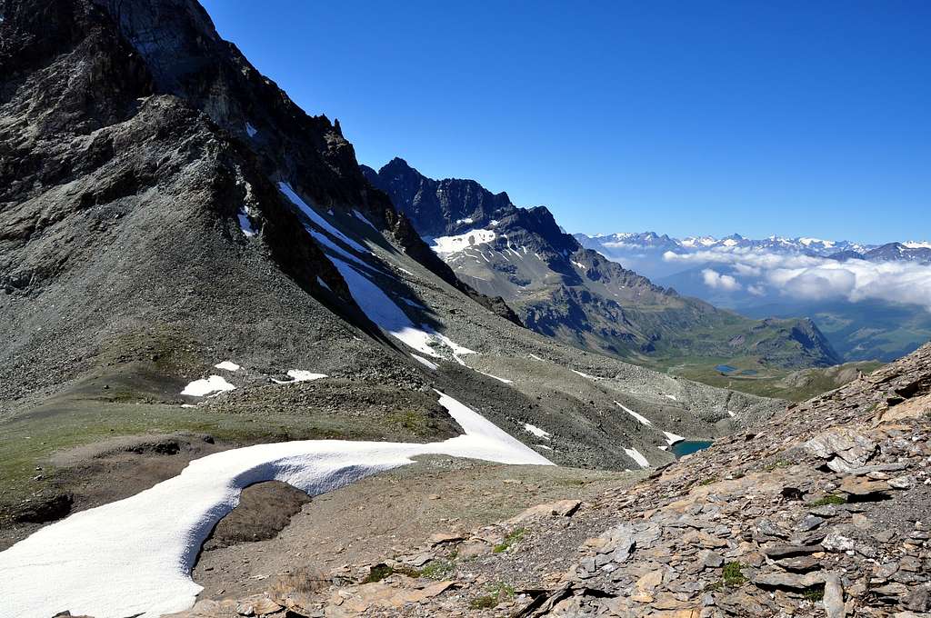
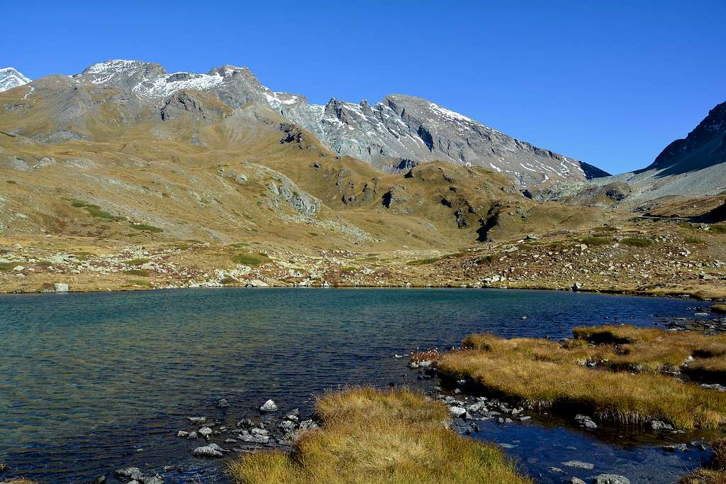
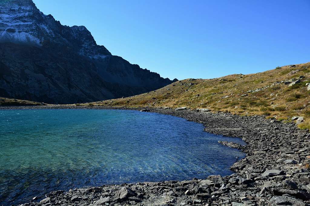
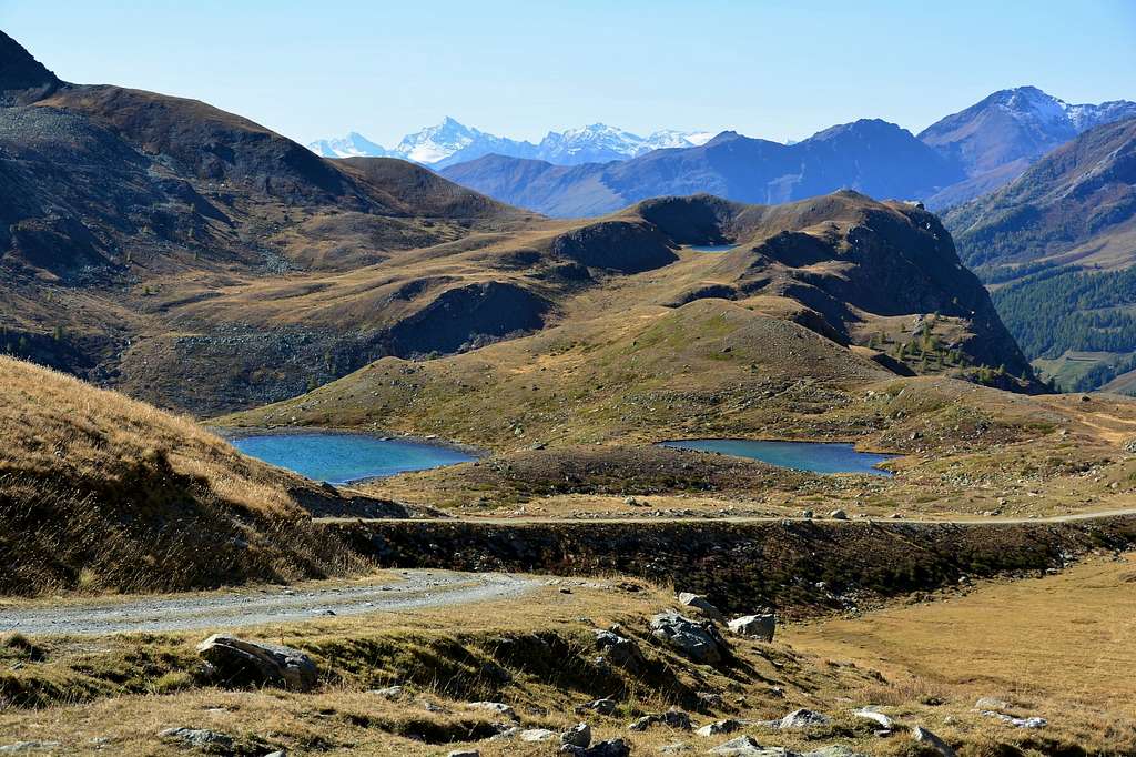
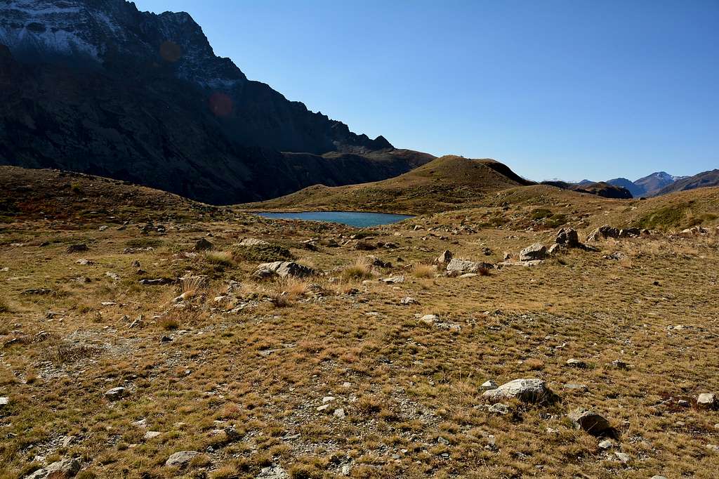
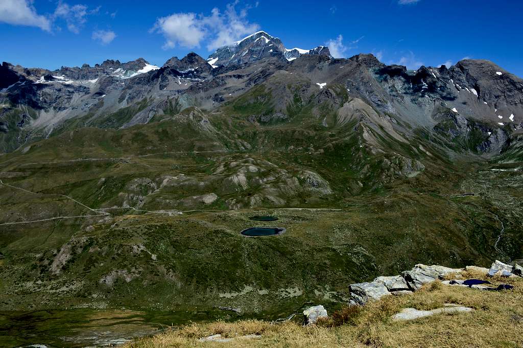
The itinerary is practically the same as the one that leads to Lac Fenêtre up to the Lombardin Pasture (2.309m) where after about 0h'10 you reach these two small twin lakes located in a very suggestive panoramic point in the valley of the "White Waters". to the east you can admire Mont Gelè and the magnificent and long wall of the Morion group, while from the small promontory above the view sweeps from the Grand Combin to the north to Mont Velan and its satellites to the west while the Grivola and part of the Gran Paradiso in the South. Their waters range from a stupendous emerald green to an intense blue.

L'itinerario è praticamente uguale a quello che conduce al Lac Fenêtre fino all'Alpeggio Lombardin (2.309 m) dove dopo circa 0h'10 si raggiungono questi due piccoli laghi gemelli posti in un punto panoramico molto suggestivo nel vallone delle "Acque Bianche", a est si può ammirare il Mont Gelè e la magnifica e lunga muraglia della catena del gruppo del Morion, mentre dal sovrastante piccolo promontorio la visuale spazia dal Grand Combin a nord il Mont Velan e i suoi satelliti a ovest mentre la Grivola e parte del Massiccio del Gran Paradiso a Sud. Le loro acque vanno da uno stupendo colore verde smeraldo ad un blu intenso.
Getting There
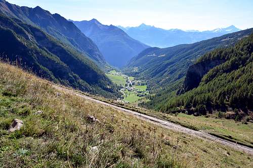
From Torino, Milano, etc: Motorway A5. Exit at Aosta Est. From Switzerland: through the Grand Saint Bernard Tunnel or the namesake pass. From France: through the Mont Blanc Tunnel or Petit Saint Bernard Pass. It is not necessary to take Motorway A5: you can drive on SS.26, in the direction of Aosta. Specific Road from Aosta Town: From Aosta East exit of the motorway, follow along the SS.27 for the Gran San Bernardo Tunnel After about ten KM turn to the right toward Valpelline (964m), it and turn to the left to get Ollomont (1.335m) and the small built area of Glacier (1.549m), where you must start walking.
 |
 |
 |
 |
 |
Dall'uscita del Casello Autostradale di Aosta Est, proseguire sulla SS.27 in direzione del tunnel del Gran San Bernardo; dopo circa un decina di chilometri svoltare sulla destra verso il Paese di Valpelline (964 m). Dopo averlo superato svoltare sulla sinistra e raggiungere il Paese di Ollomont (1.335 m); proseguire sino alla Frazione di Glacier (1.549 m), dove inizia l'itinerario a piedi.
Route Description
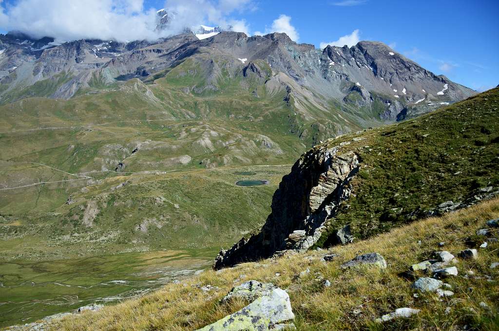
Starting with approach from Glacier Hamlet: with the previous route from "Farinet House" (2.010 meters about) continue Eastward through the trail n° 5 until it reaches the farm dirt private road from the Alpage Commune de By into the homonym Basin inserting the same reaching Balme de Bal Pasture (2.128m). From this continues independently as route n° 5/TdC to overlying Alpage of Lombardin (2.309m), from this point after about 400 meters on the left there is a large clearing from here you go down slightly on an almost non-existent difficult path and you will be at the lakes one a few meters from the other (2.318/2.326) meters.
 |
 |
 |
 |
 |
Partendo con avvicinamento dal Villaggio-Frazione di Glacier: con l'itinerario precedente dalla "Casa Farinet" (2.010 metri circa) continuare verso Est tramite il sentiero n° 5 sin a che questo raggiunge la strada poderale dalla Commune de By inserendosi sulla medesima raggiungendo l'Alpe Balme de Bal (2.128 m). Da questa continua autonomamente come sentiero n° 5/TdC sino alla soprastante Alpe Lombardin (2.309 m), da questo punto dopo circa 400 metri sulla sinistra si trova un grande spiazzo da qui si scende leggermente su sentiero malagevole quasi inesistente e sarete ai laghi uno a pochi metri dall’altro (2.318/2.326) metri.
Difficulties
E.
E.
Essential Gear
For hiking.
Da escursionismo.
 |
 |
External Links
- REGIONE AUTONOMA VALLE D'AOSTA the official site.
- FONDAZIONE MONTAGNA SICURA Villa Cameron, località Villard de la Palud n° 1 Courmayeur (AO) Tel: 39 0165 897602 - Fax: 39 0165 897647.
- SOCIETA' DELLE GUIDE DELLA VALPELLINE Etroubles-Strada Nazionale, n° 13 - Tel +39 0165 78559 - Valpelline-Loc Capoluogo, n° 1 - Tel +39 0165 713502 (AO) Italia.
- A.I.NE.VA. (Associazione Interregionale Neve e Valanghe).
Important Informations
- Protezione Civile Valdostana località Aeroporto n° 7/A Saint Christophe (Ao) Tel. 0165-238222.
- Bollettino Meteo (weather info) Tel. 0165-44113.
- Unità Operativa di Soccorso Sanitario Tel. 118.