
-
 7463 Hits
-
 0% Score
-
 0 Votes
|
|
Route |
|---|---|
|
|
39.11220°N / 107.06°W |
|
|
Hike Approach, then Scramble |
|
|
A long day |
|
|
Class 3 / 11-14 miles, 4500-5200 feet |
|
|
Approach
Use either the standard approach from Lead King Basin, or take the side trail from one of the switchbacks of 115, higher up towards Meadow Mountain. This higher trail affords you with some awesome views, and it involves much less elevation gain: about 200 feet. However, it is not as well-maintained. Either way, go the two-plus miles to Geneva Lake, and continue following the Trail Rider Pass trail east from there.
 |  |  |
Route Description
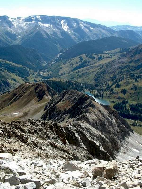
After coming out into the open above the trees, now on the east side of Hagerman's SW Ridge, look up and you will see the obvious, deep gully leading up to the ridge. Follow the base of this up to steep grassy slopes, leading to a small saddle in front of the first ominous buttresses along the ridge.
Bypass the first minor buttress to the left (west), then climb straight up the intimidating buttress behind it (class 3). This may look implausible, but keep going up and you will find a way.
Above the first buttress, the route levels out and is mostly class 2 or 2+ talus-hiking for a short while. The whole time, however, you are previewing the final, steep 900 feet to the summit.
Climb straight up the ridge-line, contouring to the east when necessary. At 13,600 feet, cut to the left (west) of the ridge when it becomes too jagged, and follow a white-colored gully full of loose rocks for a couple hundred vertical feet.
Back on the final stretch of the ridge, take a few exposed steps along a kind of knife-edge, then scramble the final remaining feet to the summit.
I did not feel the rock on this ridge was overly loose, and I actually had a lot of fun. Still, it requires some caution and care in places.
Read my trip report Here.
 |  |  |  |
Essential Gear
No special gear required. Early season may require ice axe and crampons.
Miscellaneous Info
If you have information about this route that doesn't pertain to any of the other sections, please add it here.