
-
 2473 Hits
-
 82.48% Score
-
 15 Votes
|
|
Mountain/Rock |
|---|---|
|
|
43.21197°N / 5.45232°E |
|
|
Trad Climbing, Sport Climbing |
|
|
Spring, Fall, Winter |
|
|
656 ft / 200 m |
|
|
Overview
Aiguille de Sugiton
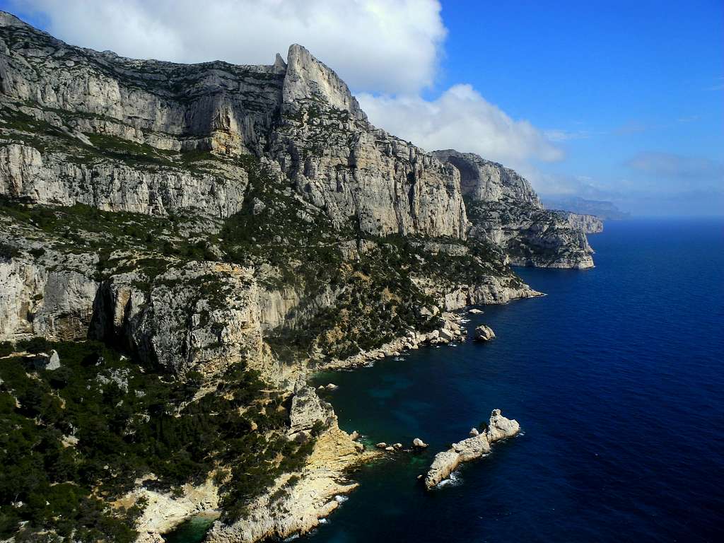
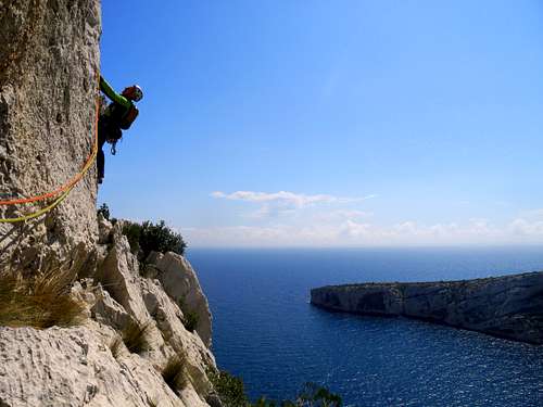
Between Marseille and Cassis the Mediterranean coast forms one of the finest limestone massif of the world, wild and well preserved despite being close to civilization: the Calanques of Marseille. A truly magical place for many outdoor activities, including climbing and hiking. In Les Calanques the entire rock is limestone.
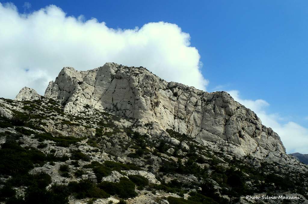
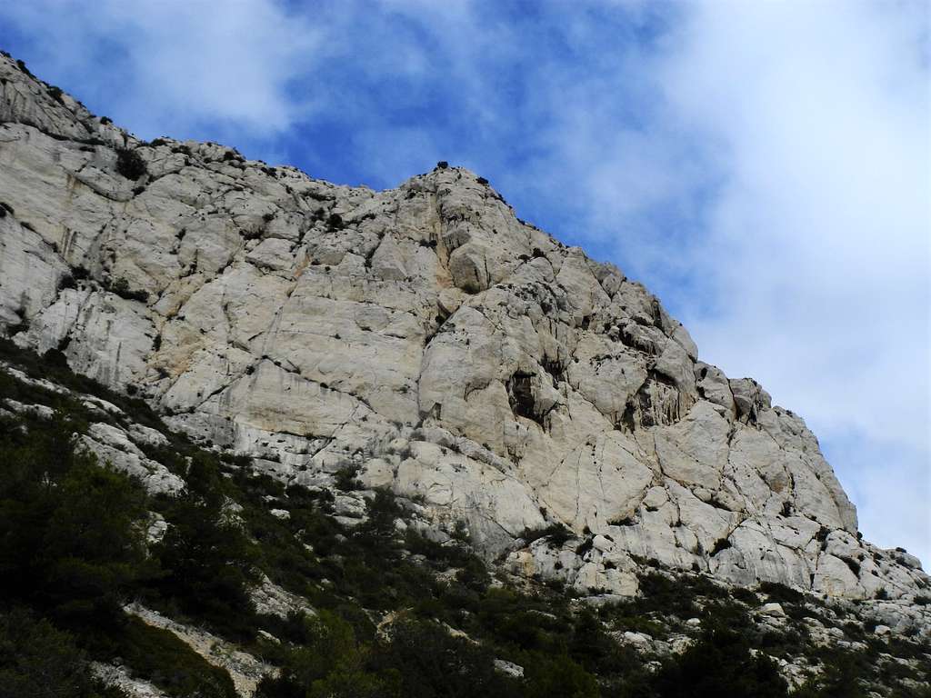
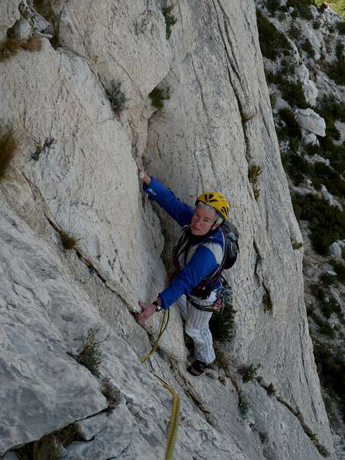
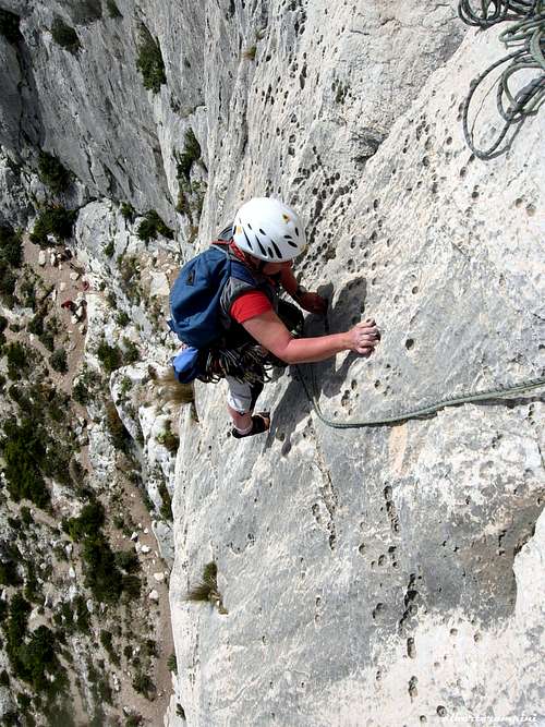
The Aiguille de Sugiton is located in the Calanque de Sugiton, one of the finest sectors in the whole massif, along the crest between the Calanque de Sugiton and the Calanque de Morgioux. In fact, the Aiguille de Sugiton has two distinct walls with different orientations, South-East and South-West, with the advantage of being able to choose sun or shade depending on the season. Both the SE and the SW walls offers beautiful climbing routes. Like the Grande Candelle, the Aiguille de Sugiton is a real albeit small summit accessible only by climbing. The climbing is mainly on slabs and the rock shows water drops of superb quality.
Getting There
Road access
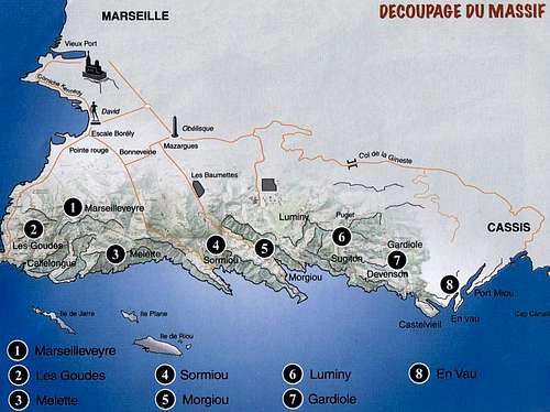
From Cassis, take the road D559 in the direction of Marseille ( towards West). After crossing the Col de Gineste, the road descends to the East end of the town of Marseille. After the village of Vaufrèges and before Le Redon, there is a round-about. Turn left towards Luminy, that is soon reached. The neighborhood of Luminy is located in a wooded area southeast of Marseille. A bit isolated from the rest of the city, Luminy is bordered by Mount Puget and the crest of the Escampons. Especially known for its university center and its many schools, Luminy is the ideal starting point to reach in less than an hour the coves of Sugiton and Morgiou. In front of the university center there is a large car park where you can leave your car before taking the main path that starts at the school of art and architecture.
Approach path
The shortest approach is from the port of Morgioux. From the port take the path marked in red on the left bank of the bay. After passing a small cape you are under the SW wall. Exit the main red path and climb up the slope to reach the base of the walls and the various climbing routes. To reach the SE face continue on the main red path, reach the Cape Sugiton and then skirt the aiguille to reach the SE wall.
When the road to the port of Morgioux is closed during the hot months you must start from Luminy. From the parking of Luminy take the main path in the direction of the Col de Sugiton. From the Col de Sugiton take the path that descends to the bottom of the valley towards the Calanque de Sugiton and reach the beach. Traverse to the other side and take the GR, go up the metal ladder to reach the base of the SE wall.
Sectors and main routes
All the routes and relays are well equipedd and protected. The limestone rock is excellent. The South-West exposure offers an ideal orientation for winter or mid-season climbing days. The sectors are also relatively protected from the wind, the view of the sea and the Calanques is magnificent.
- South-West wall
The South-West wall overlooks the bay of Morgioux and is divided into various sectors: the Secteur Crépuscule, the Secteur Aie Aie Aie, the Secteur Angelvin.
Secteur Crépuscule
- Le Crépuscule L1 5a - L2 5c
- Ludovic 6b
Secteur Aie Aie Aie
- L'Italienne L1 5c - L2 5b - L3 5b
- Les deux pins L1 5a - L2 5b - L3 5b
- Superveteran
Secteur Angelvin
- L'Angelvin L1 5b - L2 5b
- South-East wall
The South-East face dominates the bay of Sugiton and features the Secteur A.N.P.E. and on the right the small North face with the Normal route, which follows an edge called Arete du Vallon.
Secteur A.N.P.E.
A sector that has some multipitch routes with a maximum of 4 pitches, some two pitch routes and some single pitches.
- L' A.N.P.E. L1 5c - L2 5c+ - L3 5b
- L' AJ L1 5c - L2 5c - L3 5b - L4 6b
- T'Aimes les vols, canard? L1 5a - L2 6a+ - L3 6b
- La Directe L1 3b - L2 4b - L3 4c - L4 4c
Descent: a 50-meter rappel, divisible in two, on the route A.N.P.E.
- Arete du Vallon L1 4c - L2 3c - L3 3a - L4 4a
It is the longest and easiest route on the Aiguille de Sugiton. A great classic with limited difficulties, still interesting today. A popular route for decades, so much of the rock is polished.
Access: from the beach of Sugiton go up the bottom of the valley along a good path to the foot of the obvious ridge.
Descent: rappel 35 meters from the top of the route onto the SW face, Secteur Crepuscule (climber's right hand). Scramble down a few feet, then turn right and hike NW about 80 ft to reach the pass at the NW end of the Aiguille Sugiton. Cross the pass and scramble down NE + E to find two-bolt anchor. Rappel 10 meters, then scramble down to base of Arete route.
Red Tape
The Aiguille de Sugiton is situated inside the Calanques National Park; the climate is dry and the winds may sometimes be violent, with a high risk of fires. Starting from June to the end of September the roads leading to the bays of Sormiou, Morgioux and Callelongue are closed from 7h to 19h. Check the park official website to know the prohibitions and permissions for the access during the summer months: Calanques National Park

When to climb
All year round excluding the summer really too hot and with various access restrictions as said at the previous chapter. An excellent advice for planning a climbing trip: the best season goes from October to May.
Where to stay
A great place to stay is the little town of Cassis with wide possibility of accomodation, including a good campsite:
Camping Les Cigales Avenue de la Marne - Cassis Phone 00330442010734
Meteo
Guidebooks and maps
 |
 |
 |
 |
 |
"Escalade Les Calanques” by Andrè Bernard - Gilles Bernard - Pierre Clarac – Hervè Guigliarelli – Bernard Privat Ed. Nota Bene
"Alpes du Sud - Provence" by Hervé Galley - Editions Olizane
“Calanques Escalade” by Jean Luois Fenouil and Cèdric Tassan – Ed. VTopo
Map: "Les Calanques de Marseille a Cassis" 3615 IGN 1:15.000