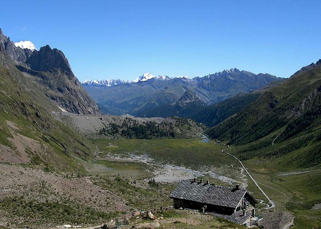
By car through the Val Veny mountain road until the car park at La Visaille / Plan Lognan or (500m below) at Plan Veny (near the picnic area). Private access to this road is regulated from 1 to 20 Aug. - By the bus service – one trip each 40 minutes. In Courmayeur the bus can be taken from the Bus Station (near the tunnel highway entrance). From Bourg St. Maurice (France) By car, taking the direction to Bonneval-Les Chapieux-Beaufort, you reach after 20 km Les Chapieux car park, shops, one little hotel). From here, a non metalled road (closed in winter!) traverse the lonely (and sparlesly populated) Valle Des Glaciers, and reaches in 7 km Les Mottets (very good hotel-refuge).
Moving the cursor one can see the overall scene
Route Description
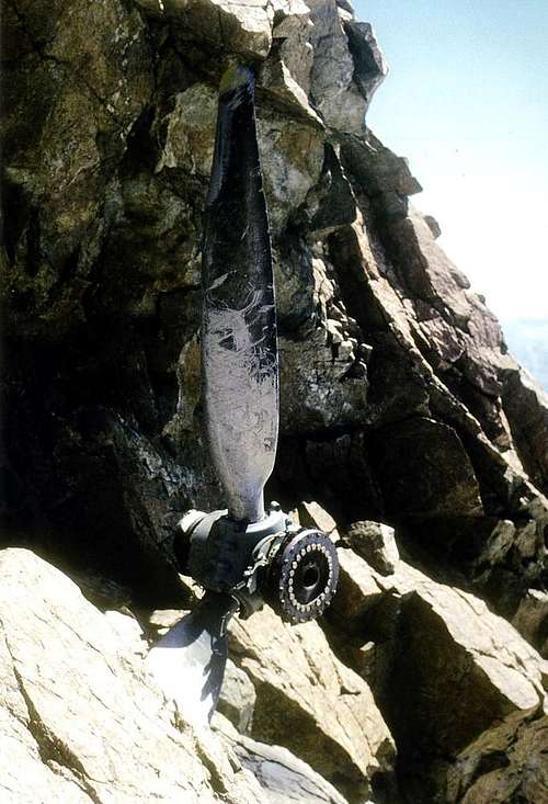
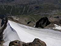
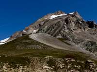
From the barrier of the carriage of the Valley Veny to the Elisabetta Refuge (2.197m; 1h'15); for the comfortable path that goes to the Tsa of the Lex Blanche (2.280m), on the plan of the "Tour De Mont Blanc" toCol de la Seigne (2.514m; 1h'00). Follow toward north the crest of boundary overstepping easily in succession "La Montagnes des Glaciers (2.744m) and the elevations at the quotes 3.013m-3.210m and 3.331m; the last can be avoided going more to west on a small glacier (30°/35°) leading to the final ridge on the Petite Aiguille des Glaciers (3.471m; 3h'30/4h'00 from the Refuge). Overcome it on steep rocks, but not difficult; come down along the crest N-NW to a small pass. From there climb again the pyramid truncates along the South crest with direction N-NW to the Quote 3.624m, then N-NW to the peak. Overcomed the first prominence without difficulty, continue along the pseudo-rectilinear crest as far as against the summit pyramid, actually keeping right till to a fork (delicate); the terminal wall is steep even if made of non difficult rocks (II°/II°+), but delicate for the instability (great rocks to be climbed with attention). Before going out on the Southern foresummit one can see, inserted vertically in the stone, the helix of an airplane fallen during the II° War; from here to the peak there is the possibility of snow frames (8h'00 from the car).
Descent: Not simple, it asks for prudence. Go down along the Northern crest near the second to last channel toward North, then turn to West along a little couloir (N-NW Wall) supporting to the rocks of a rib (very delicate with verglass); from the Glacier des Glaciers with a long transverse first to South, then South-East one returns to Col de la Seigne.
Dalla barriera della carrozzabile della Val Veny al Rifugio Elisabetta (2.197 m; 1h'15); per il comodo sentiero che passa alla Tsa della Lex Blanche (2.280 m), sul tracciato del "Tour de Mont Blanc", al Colle della Seigne (2.514 m;1h'00). Seguire verso nord la cresta di confine oltrepassando facilmente in successione La Montagnes des Glaciers (2.744 m) e le Quote 3.013 m–3.210 m e 3.331 m; questa ultima può essere evitata più ad ovest su un piccolo ghiacciaio (30°/35°) che porta alla crestina SE finale delle Petite Aiguille des Glaciers (3.471 m;3h'30/4h'00 dal Rifugio). Superarla su rocce ripide, ma non difficili; scendere per la cresta N-NW a un piccolo colle. Da questo risalire la piramide tronca per la sua cresta Sud con direzione N-NW sino alla Quota 3.624 m, poi N-NE sino alla vetta. Superato il primo risalto, senza difficoltà, continuare per la cresta pseudo-rettilinea sin contro la piramide sommitale tenendosi sulla destra sino ad una forcella (delicato); la parete terminale è ripida di rocce non difficili (II°/II°+), ma delicate per l'instabilità (grandi massi da arrampicare con attenzione). Prima di uscire sull'Anticima Sud, si trova incastrata nella roccia in verticale l'elica di un aereo schiantatosi durante la II° Guerra Mondiale; da questa alla vetta con possibilità di cornici (8h'00 dall'auto).
Discesa: Non semplice, richiede prudenza. Scendere per la Cresta Nord sin nei pressi del penultimo canale verso Nord, poi svoltare ad Ovest per un canalino (Parete N-NW) appoggiandosi alle rocce di una costola (molto delicato con verglass); dal Glacier des Glaciers con un lungo traverso prima a Sud, poi a Sud-est si rientra al Colle della Seigne.
Essential Gear
Mountaineering equipment, including rope, iceaxe, and crampons.
A.I.NE.VA. (Associazione Interregionale Neve e Valanghe).
Great Crossing From: de la Lex Valley - de la Seigne Pass - Montagnes des Glaciers - Petite Aig. des Glaciers - S Ridge Aig. des Glaciers in ascent (N-NW Wall in descent) - Dôme de Neige - de la Seigne Pass: Osvaldo Cardellina, Camillo Roberto Ferronato, Giuseppe Lamazzi and Marco Cossard, (Jul 29th, 1979).
Acknowledgements
I am greatly indebted to my friend "Osva" for the detailed description of the route.
Parents refers to a larger category under which an object falls. For example, theAconcagua mountain page has the 'Aconcagua Group' and the 'Seven Summits' asparents and is a parent itself to many routes, photos, and Trip Reports.

 10263 Hits
 81.18% Score
 13 Votes