
|
|
Route |
|---|---|
|
|
38.53258°N / 109.60038°W |
|
|
Hiking |
|
|
Spring, Summer, Fall, Winter |
|
|
Half a day |
|
|
Hike |
|
|
Overview
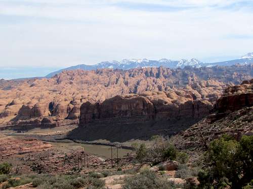
Amasa Back is a peninsula created by a U-turn bend in Colorado River near the town of Moab, Utah. The peninsula creates a mesa that sits at an average elevation of 4600 ft, roughly 600 ft above the level of the river. Several hiking/mountain biking trails as well as four wheel drive roads go to various points along the length of the peninsula providing fantastic views of Colorado River, Behind the Rocks Wilderness, La Sal Mountains and the colorful cliffs of Dead Horse Point State Park. The area is usually advertised as a mountain biking trail but hikers are welcome (to me, some parts of the trails appeared too difficult to bike but the hiking was straight forward).
The 10.4 mile loop described here will take you to Pothole Arch and Jackson Hole Viewpoint. A small portion of the route will follow a rough four wheel drive road. On the day that I did my hike, I did not see any motorized vehicles.
Getting There
From the southern parts of Moab, Utah (where McDonalds is) turn from Route 191 (Main Street) west onto Kane Creek Road. This road goes to follow the eastern banks of Colorado River. In less than 5 miles, pavement ends and the road enters Kane Springs Canyon. The large parking area at the end of pavement is your trailhead.
Route Description
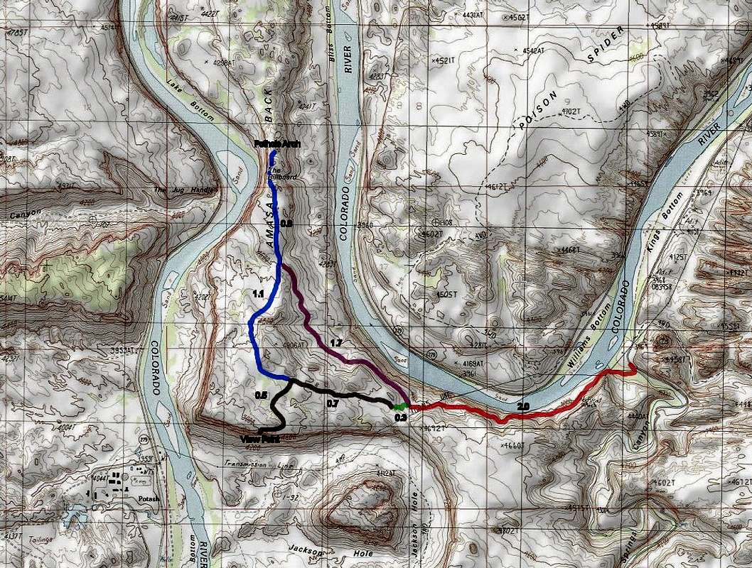
See above map.
Trailhead Elevation: 3970 ft
Lowest Elevation: 3940 ft at Kane Spring Creek crossing
Highest Elevation: 5000 ft at Jackson Hole Viewpoint
Distance: 10.4 mile loop
When I was in the area, trails were marked by dashed lines on the rocks and junctions were signed.
Jackson Trail:
Go to the east end of the parking area and follow the trail down into a wooded area by Kane Spring Creek. You will have to cross the creek. If the area is flooded, this may be difficult to do. On the day that I was there, I was able to cross without any difficulties.
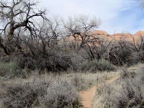 Wooded area
After crossing the creek, the trail heads west going parallel to the creek for some time.
 Kane Springs Creek Kane Springs Creek |
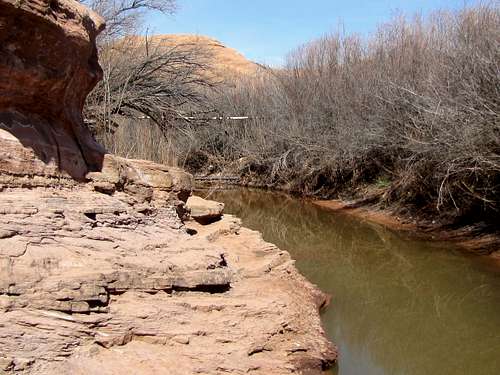 Kane Springs Creek Kane Springs Creek |
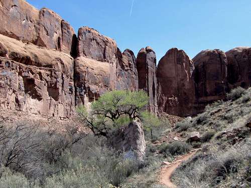
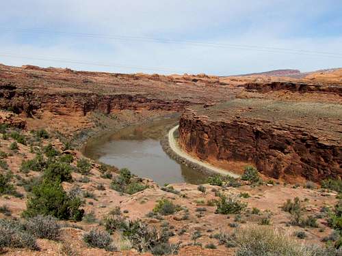
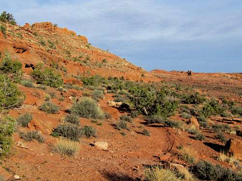
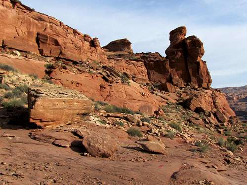
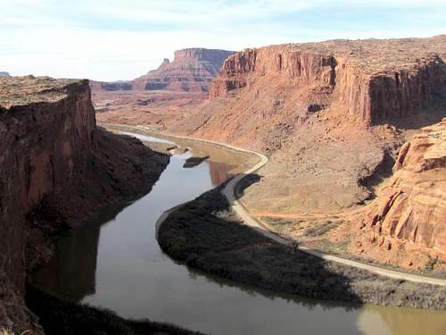
The trail then turns southwest, gets out of the wooded area and begins to climb the walls of the Amasa Back Mesa. Colorado River will be in good view.
 |
 |
 |
 |
 |
 |
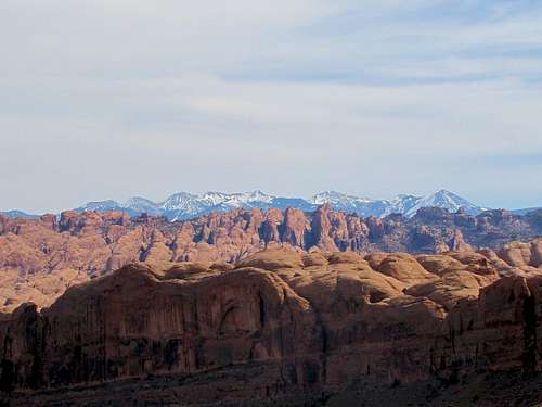
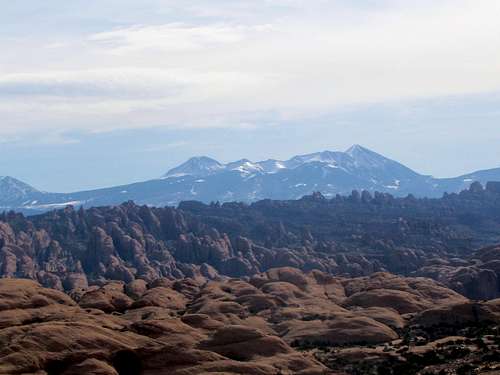
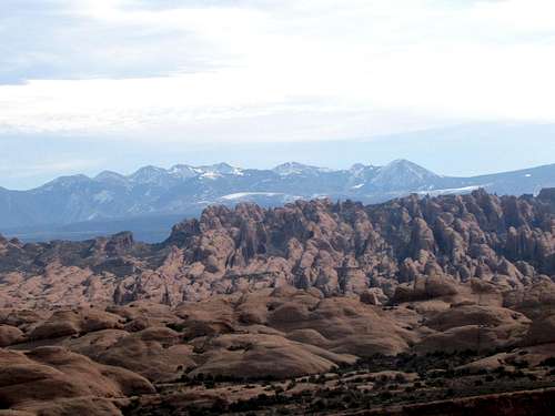
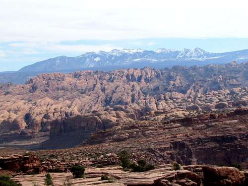
As you go higher, you get great views of the La Sal Mountains with a foreground of Behind the Rocks Wilderness.
You will soon reach a junction. This is the start of the loop. This description goes right and returns from the left.
Rockstacker Trail:
At the junction, turn right and follow Rockstacker Trail further up the walls of the Amasa Back Mesa.
 |
 |
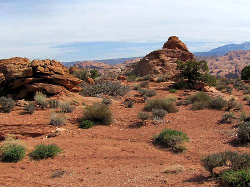
Pothole Arch Trail:
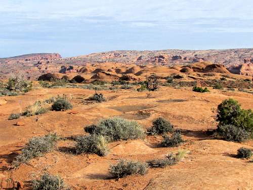
You will then reach the top of the Mesa at the junction with Pothole Arch Trail. Turn right and follow the trail over the slickrock terrain toward Pothole Arch.
 |
 |
After 0.8 miles, you will reach the end of the trail at the small Pothole Arch.
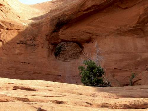 Pothole Arch
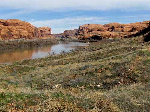
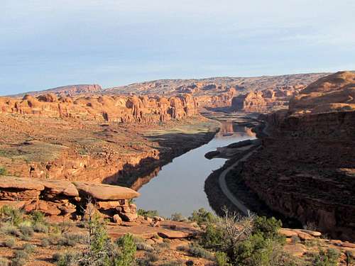
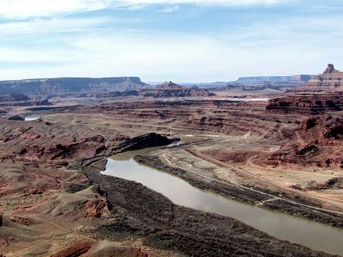
Colorado River from the eastern edge of Amasa Back Mesa:
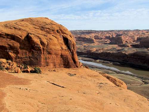 |
 |
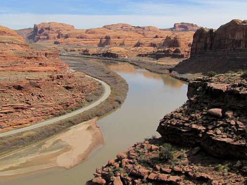
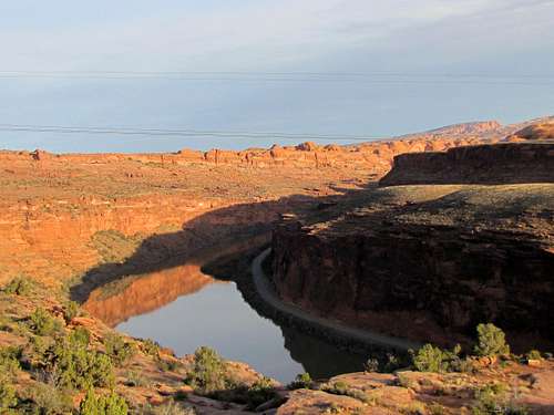
Colorado River from the western edge of Amasa Back Mesa:
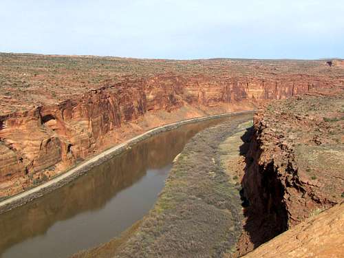 |
 |
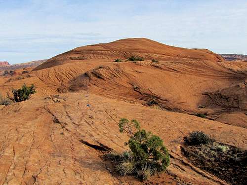
Retrace your route back to the junction with Rockstacker Trail but go straight remaining on Pothole Arch Trail travelling on the surface of the mesa. The trail will slowly go up giving you good views of the La Sal Mountains.
 |
 |
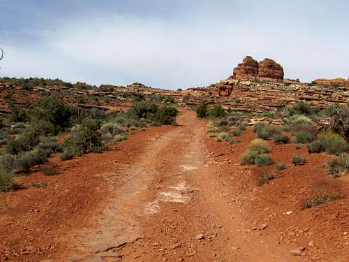
Four Wheel Drive Road:
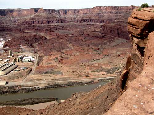
You will then reach the junction with a four wheel drive road. Turn right and go half a mile to the end of the road at Jackson Hole Viewpoint on the edge of the mesa.
Potash Mine and the red cliffs of Dead Horse Point State Park will be in good view.
 |
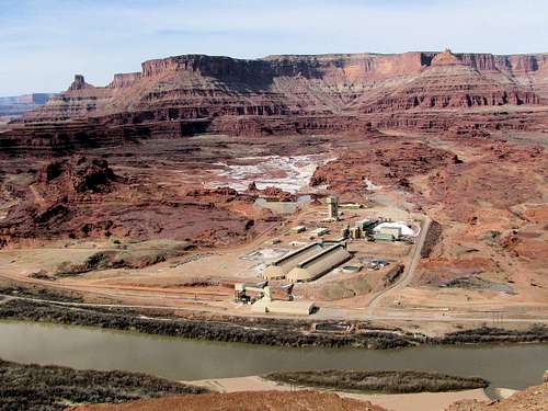 |
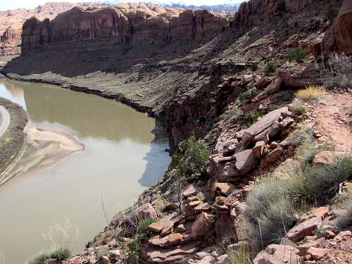
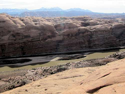
Looking straight down the edge of the mesa at Colorado River 1000 ft below:
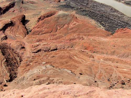 1000 ft drop
The canyons of Colorado River:
Jackson Hole refers to a butte that rises above the valley below. It is said that in the geologic past, Colorado River used to make a turn around this butte.
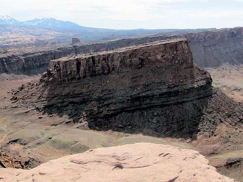 Jackson Butte
La Sal Mountains and Behind the Rocks Wilderness:
Retrace you route back to the junction with Pothole Arch Trail. At the junction, turn right and follow the road down the surface of the mesa.
 |
 |
Connecting Trail:
After 0.7 miles, you will see a short trail that takes you back to Jackson Trail. Leave the road and follow this trail and then Jackson Trail back to the parking area.
 La Sal Mtns & Behind the Rocks Wilderness
Essential Gear/ Red Tape
Hiking equipment.
No permits/fees required.