Comments
No comments posted yet.

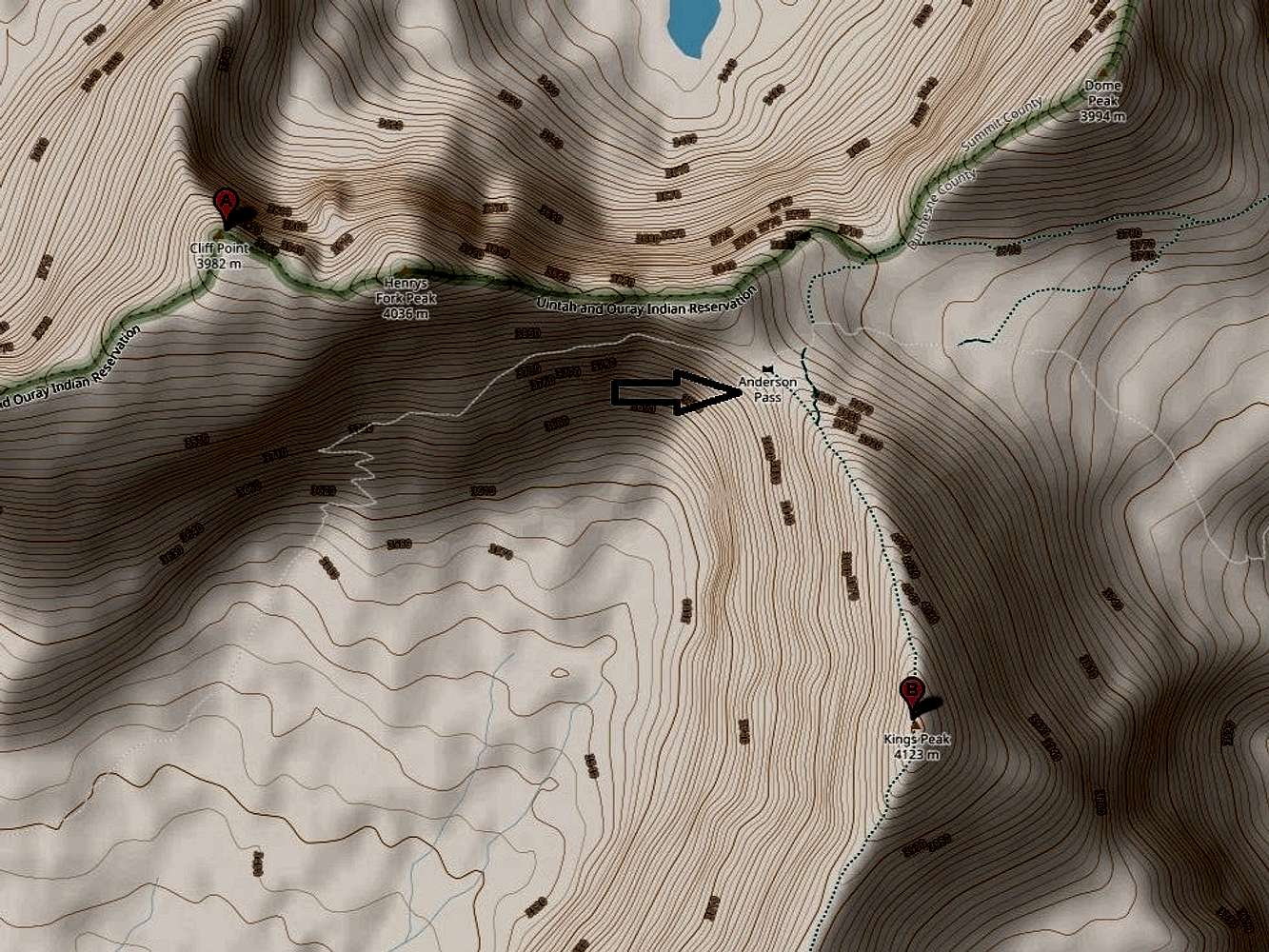
To climb Cliff Point, following your trail of choice into the High Uintas Wilderness area and make your way to Anderson Pass (the highpoint of the Highline Trail). From Anderson Pass follow a bearing of 323 degrees for about 250 yards to the obvious prominent point known as Anderson Knob at 12,895 feet. From Anderson Knob head due west along the crumbling, often exposed, ridge toward 13,260-foot-tall Fortress Peak (aka Henrys Fork Peak) located about three quarters of a mile away. Expect to do some class 3 scrambling. The exposure at times can be unnerving since parts of the ridge are as narrow as three feet with huge drop offs on either side. Overall, the views in all directions are breathtaking. From Fortress Peak downclimb in a westerly direction, angling toward the left, less exposed side. Once off Fortress Peak the terrain will become easy class 1 walking over rocks and soil. Continue half a mile to Cliff Point.
Kings Peak, Utah's tallest mountain, and Cliff Point are separated by only one and a half strait line miles. Therefore, any approach route leading to Kings Peak also gets one within striking distance of Cliff Point. In the Approaches Section of the Kings Peak page learn more about the Henrys Fork Trail and the Yellowstone Creek Trail both of which are feasible routes leading to Anderson Pass.
Access the full map which contains the image above at ACME Mapper.
This picture is included as part of the Cliff Point page.

You are at the First Image | You are at the Last Image |

