

-
 3553 Hits
-
 81.84% Score
-
 14 Votes
|
|
Route |
|---|---|
|
|
45.91529°N / 7.42118°E |
|
|
Mountaineering |
|
|
Spring, Summer |
|
|
Most of a day |
|
|
Alpine PD |
|
|
Overview
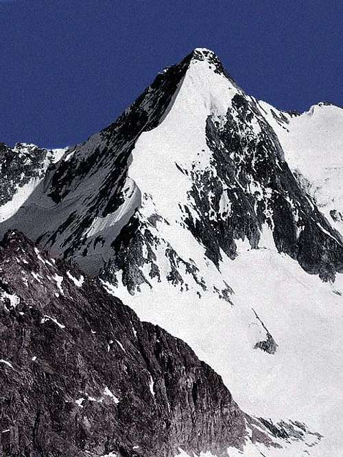
Becca Rayette 3529 m
Becca Rayette 3529 m is a beautiful snow-covered mountain belonging to the Pennine Alps in the Western Alps and located on the main boundary between Italy (Valpelline, Aosta Valley) and Switzerland (Wallis). To well identify its location, the shape end the height of this summit is to be specified that the Becca Rayette is not to be confused with the minor summit situated nearby and called Noeud de la Rayette or simply La Rayette, which reaches the lower altitude of 3352 m and is an easier mountain and less severe, often summited in Spring with skis. It should also be added that while the inhabitants of Valle d'Aosta call this peak "Becca Rayette", the Swiss have always called it Bec d'Epicoun.
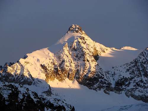 Becca Rayette at sunset
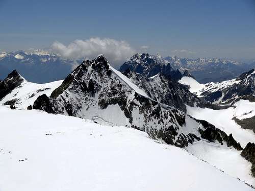 Becca Rayette
Another curiosity: the mountain is often frequented by the Swiss alpinists and less by the Italians, despite the construction of the Refuge Crête Sèche on the Valpelline side. The climb to the summit along the North Ridge is however highly recommended for the beauty of the mountain lines and the unique views to the 4000s in the region.
Getting There
To climb the North ridge (Becca Rayette standard route) starting from Ruz you must take the Valpelline road.
Road Access to Valpelline
- From Turin and Milan: follow the A5 Motorway and exit to Aosta Est. Follow the road S27 towards Gran San Bernardo Tunnel, getting after about 10 km. to Variney m. 782; here you must leave the road to Grand San Bernardo and turn to right towards Valpelline m. 960, the valley’s main resort. Exit Valpelline, ignoring the road to Ollomont on the left, and carry on along Val Pelline main road. The road is reaching Oyace m. 1377, Bionaz m. 1606, the main resort of the upper valley, and Dzovenno. Leave the main road and turn to right to Ruz m. 1697 (parking). A "not well visible" wooden panel help for Telephone number and open/close label of Refuge Crete Seche. Go ahead about 2,5 km and park the car in the tiny village of Ruz, just before the road becomes unpaved.
- From France via Mont Blanc tunnel or Petit St. Bernard pass. Follow Aosta direction via SS n.26. or Motorway A5 (exit Aosta Ovest because itdoesn't exist an exit to Aosta Est driving from Aosta to Turin). Once reached Aosta, follow the Grand St. Bernard direction. If you are on the old road for Grand St. Bernard, it joins the new one at Variney. Follow Valpelline, Place Moulin Lake direction. From Variney. Follow Valpelline, Place Moulin lake direction.
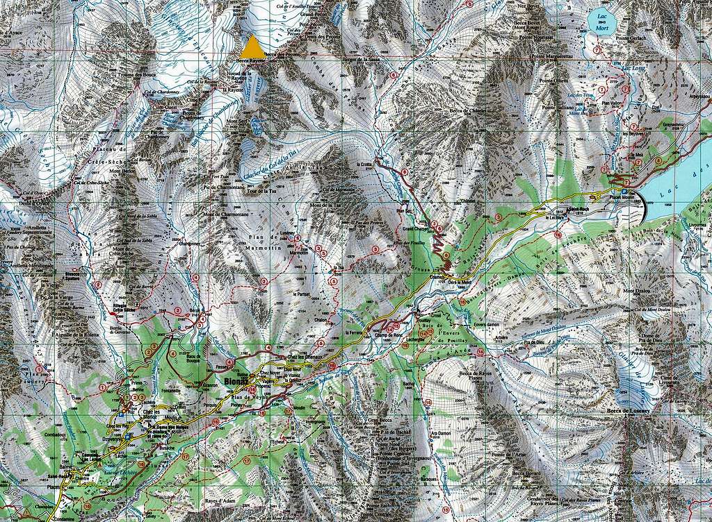
This route may be climbed also from Switzerland starting from the Cabane Chanrion.
Route Description
Becca Rayette North ridge from Ruz (Valpelline)
Summit altitude: m 3529
Difficulty: Alpine PD
Difference in level: 1100 m from Rif. Crête Sèche
Hut: Rifugio Crête Sèche m 2410
Starting point: Ruz, upper Valpelline
A fine climb up an interesting ridge inside a wild environment. The itinerary follows at first a good path, then a glacier to keep the start of the N ridge. The ridge is on snow or ice, with some rock climbing in the upper part.
Approach to Rifugio Crête Sèche
From Ruz di Dzovenno car park follow the road with paved sections alternate with dirt sections (cars not allowed). The road gains altitude with long hairpin bends first in the NE direction to the Baou de Bouque Alp m. 2129 and the Alpe Berrier m. 2192. In some places it is possible to follow some traces in the wood cutting the road. After getting the Alpe Berrier 2192 m continue along the Alta Via n. 3 which gently leads to the Rifugio Crête Sèche 2410 m.
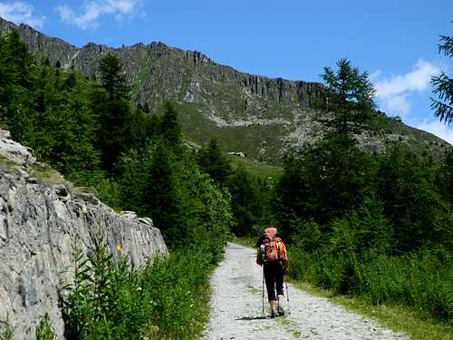 Starting the approach to Rifugio Crete Seche
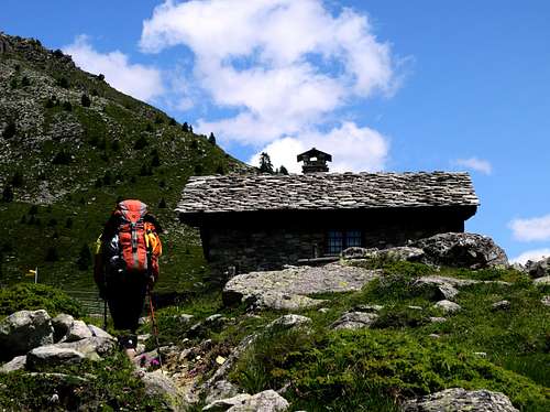 Nearing an old alp on the way to Refuge Crête Sèche
Route report
From the Rifugio Crête Sèche follow in the W direction the path n. 2 W in the obvious Comba di Crête Sèche valley, overcoming a first step where it rises the Bivacco Spataro. After the next long Plan de la Sabla plateau 2610 m, reach the Colle di Crête Sèche 2899 m, where there is a big stone cairn signing the boundary between Italy and Switzerland. Continue along the border ridge in an East direction and then take another ridge into the small valley that goes up to Colle di Chardoney, leading to Colle di Chardoney 3185 m.From here it is necessary to descend for about one hundred meters in altitude to set foot on the Glacier d'Epicoun Glacier, which must be crossed to the north east to get the bottom of the North ridge of Becca Rayette.
 Becca Rayette North ridge
A snow slope (30°/40°) leads to the snowy North shoulder of the mountain. In late summer it is possible to find this stretch with little snow and therefore icy. For this reason it is advisable to climb the mountain at the beginning of summer. After reaching the slender and exposed North ridge, it is easily followed by keeping to the right. At the end of the ridge a steep rocky part is bypassed to the right. Along a final mixed stretch (a single move of III UIAA) you get to the top.
Essential Gear
Rope, harness and helmet, ice-axe and crampons, full glacier gear
Red Tape
No fees no permits required. Cars are not allowed on the road beyond Ruz.
Huts and Bivouacs
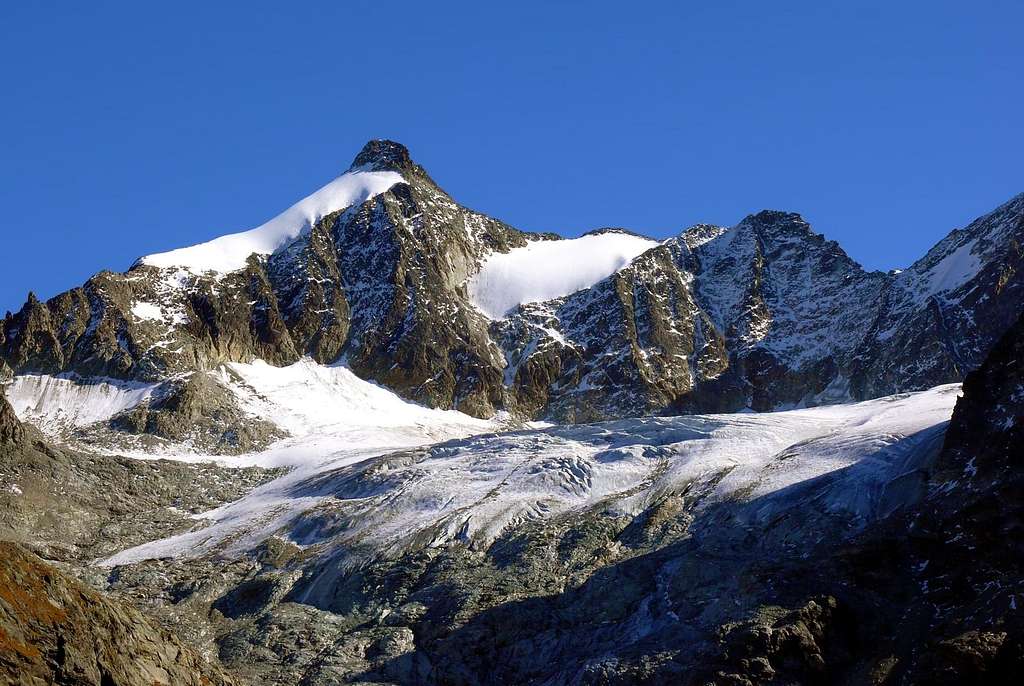
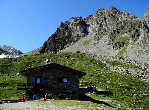 Rifugio Crete Seche
 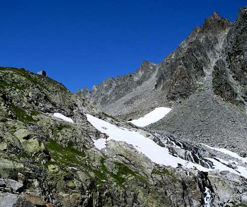 Bivacco Spataro
- Rifugio Crete Seche 2.410 m.
Size: 88 places (8 winter hut)
Phone: +39.0165.730030 or +39.347.0330713 (Daniele's mobile phone, hut owner)
Website: www.rifugiocreteseche.com
- Bivacco Spataro 2.600 m. - 9 places, bad conditions
When to climb
Mountaineering: early Summer
Ski-mountaineering: late Spring
Meteo
Meteo Regione Valle d'Aosta
Meteo Switzerland
Guidebooks and maps

"Alpi Pennine" Vol I by Gino Buscaini - Guide dei Monti d’Italia CAI-TCI
"La Valpelline" Foglio 115 -scale 1:30.000 - IGC (Istituto Geografico Centrale)