
|
|
Mountain/Rock |
|---|---|
|
|
50.72299°N / 16.30431°E |
|
|
Hiking |
|
|
Spring, Summer, Fall, Winter |
|
|
2799 ft / 853 m |
|
|
Overview
Borowa has always been there, however, it used to be overshadowed by Chełmiec, the second highest massif in the Wałbrzych Mountains sitting nearly ten kilometres to the northwest. For years Chełmiec was believed to be the highest while in fact it turns out to be three metres lower than Borowa. That discovery made Borowa a little more frequented, but the foundation of its today’s popularity is a modern observation tower erected on the summit in the late 2010s. 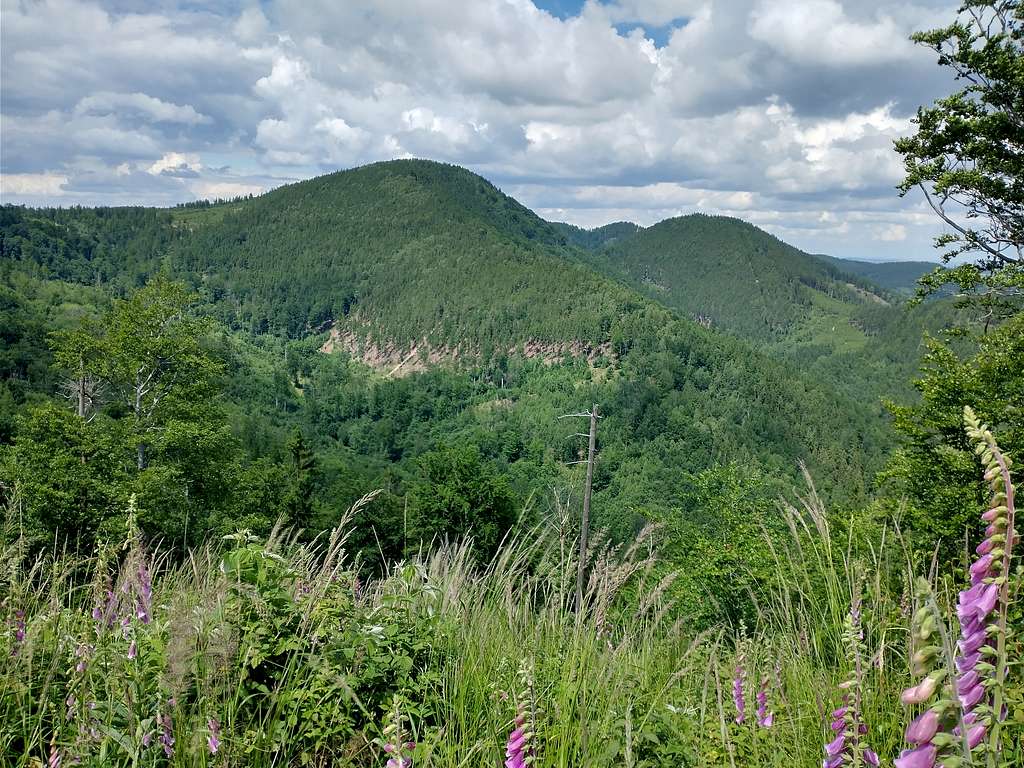
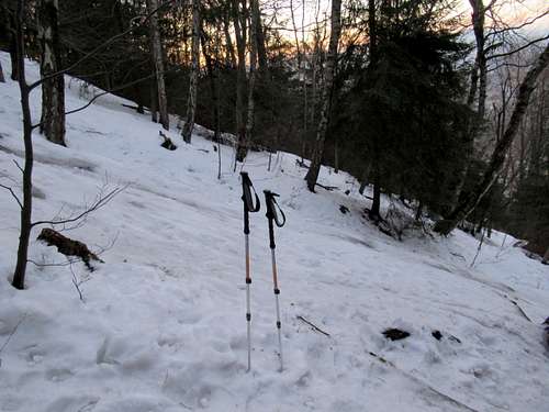
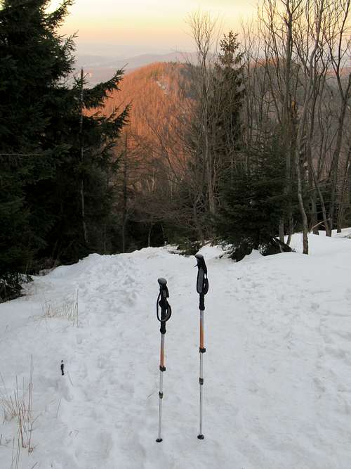
I have climbed Borowa three times so far, the main reason being the location of Borowa between the fairly wild and rugged Suche Mountains - my favourite range in the Central Sudetes – and the railway station in Wałbrzych. Apart from the tower, Borowa has another feature I enjoy, especially in wintertime: the descent down the mountain’s north side, recently signed with black marks. The slope is steep, about 30 degrees, and the trail runs straight down so when it is icy you need to stray into the forest to avoid the most troublesome sections unless you are wearing crampons or at least decent mini-crampons. Glissading is not advisable as you can easily bump into a tree or a rock. This stretch of the trail, between Kozia Przełęcz (Goat Pass) and the summit, has been informally named the Route of Pain. The height of Kozia Przełęcz, which separates Borowa from Kozioł, is exactly 200m less than the elevation of Borowa's summit. 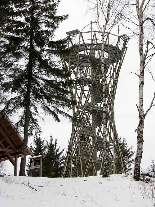
The name Borowa means "of the forest" and seems to be a reference to the German name of Wałbrzych, which was Waldenburg. The German name of Borowa was just Schwarzer-Berg. What is left of it is the name Góry Czarne (Black Mountains: Wołowiec 776m, Kozioł 774m) often used for the ridge running from Borowa to the north, towards the centre of the city of Wałbrzych. Another ridge – of Jałowiec – Borowa sends to the southeast. (South of that ridge, on the other side of Rybna brook, lie the Suche Mountains.) 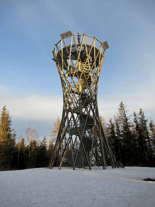
|
Summit Views
|
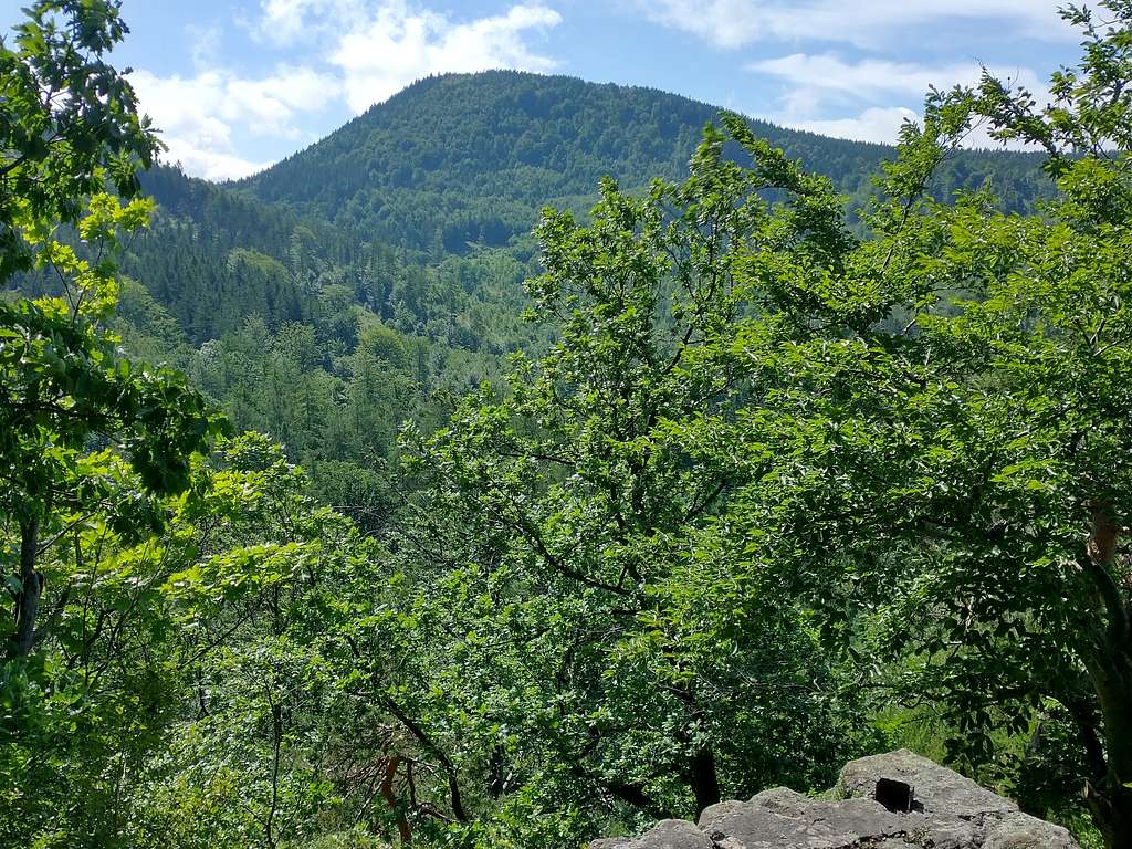
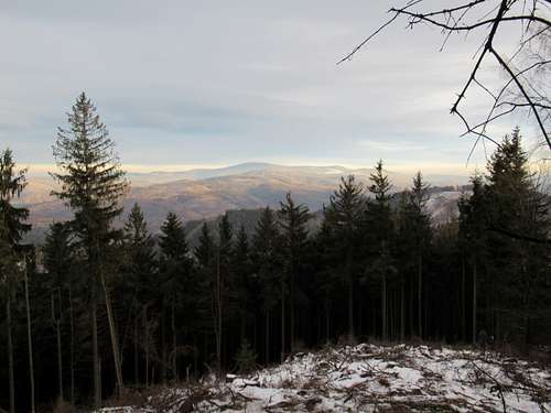
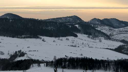
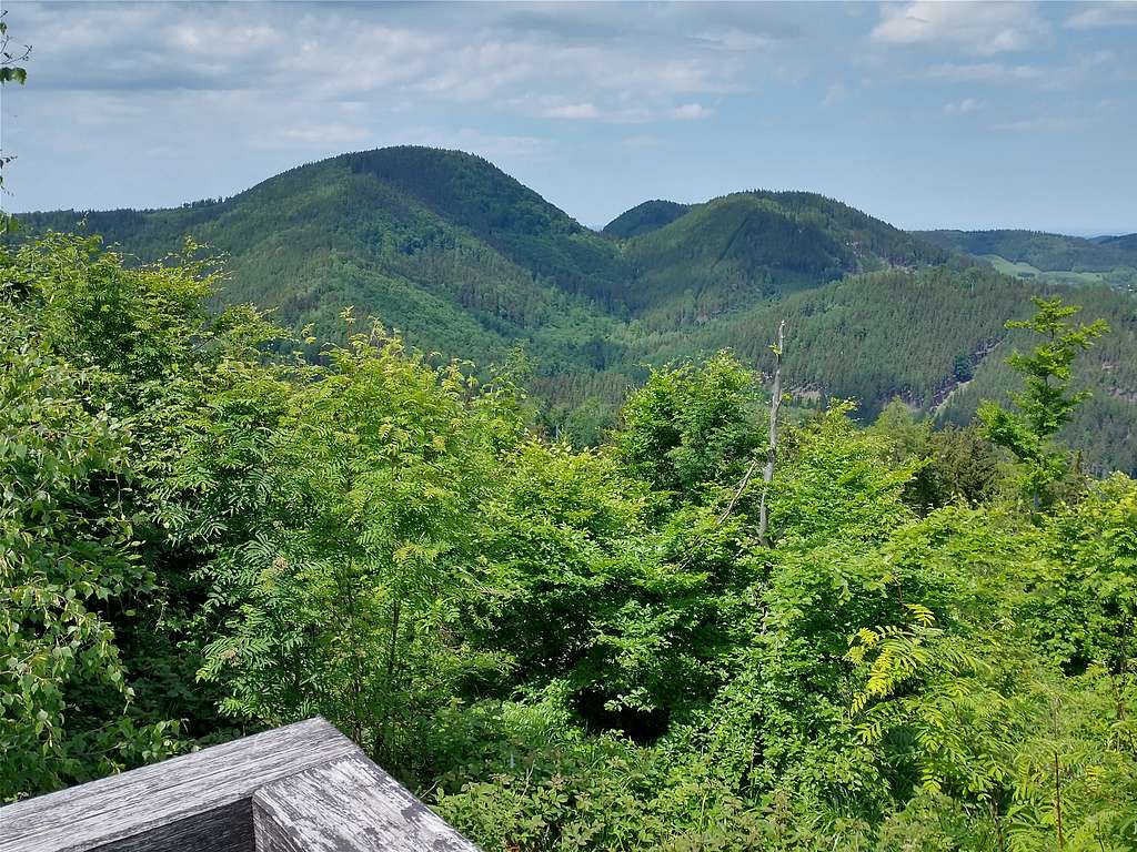
Most hikers and weekend strollers – Borowa's summit is located on the administrative boundary of Wałbrzych – seem to climb Borowa in the evening in order to watch the sun setting behind the Giant Mountains (Karkonosze), crowned with the pyramid of Śnieżka that dominates the western horizon. But there is much more to see here: in the south the Suche Mountains unfold end to end; in the southeast is the massive, flat ridge of the Sowie Mountains with the landmark of an old, whitish viewing tower on Wielka Sowa; in the northeast Ślęża at 719m seems to be much higher than it really is; and in the northwest Chełmiec, the usurper, rises almost to the same height as Borowa. 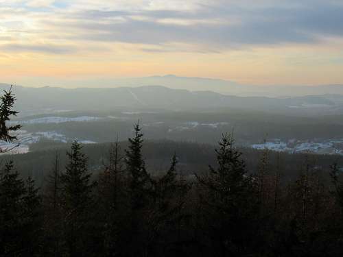
|
Getting There, Maps & Routes
|
Wałbrzych lies about 80 km southwest of Wrocław, the capital of Lower Silesia. (The rail and road links between the cities are good.) A hike to the summit from the train station called Wałbrzych Główny (Main), which lies on the outskirts of the city, takes approximately 1.5hrs. You can opt for either the red, gentle but rather mundane, or yellow marks. The latter climb Zamkowa Góra, i.e. Castle Mountain, which features old castle ruins and gives a magnificent view of Borowa, then take you to Kozia Przełęcz and the Route of Pain (please see Overview). To get to Kozia Przełęcz without climbing Zamkowa Góra, you have to follow some unmarked paths or forest roads.
By road, via Rusinowa and Kamieńsk, you can get close to Kozia Pass (just a few hundred metres away), which translates to about 40 minutes’ walk-up to the summit. It will take about the same amount of time if you approach from the west, having left your car in the hamlet of Kamionka, just north of Rybnica Leśna. There are also several options making your hike longer – just have a look at the map.
|


Red Tape
No red tape except that camping is not allowed.
When to Climb
|