
Comments
No comments posted yet.
|
|
Trip Report |
|---|---|
|
|
47.70700°N / 90.5242°W |
|
|
Jul 2, 2020 |
|
|
Hiking |
Cascade River Loop Trail
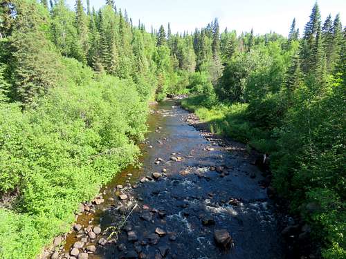
Cascade River State Park sits on the north shore of Lake Superior 96 miles to the northeast of Duluth, Minnesota. A trail starts on Route 61 at an elevation of 625 ft near the shoreline of Lake Superior and follows (for the most-part) the west bank of Cascade River up through the forest to a dirt road at an elevation of 1360 ft where you can cross the road’s bridge over the river and then follow another trail on the east bank of the river down to the starting spot creating a 7.5 mile loop hike. I went up the west trail but after crossing the road’s bridge, at the start of the east trail, I saw a sign that said the bridge over Trout Creek several miles down trail was broken and crossing the creek might not be possible depending on the amount of water. I did not want to risk it so I returned via the same way that I went up.
Lookout Mountain
Near the beginning of the west trail, I went one mile up a side trail to a high point known as Lookout Mountain (1200 ft elevation) hoping to get good views of Lake Superior. Unfortunately, the top of the mountain was heavily forested and where I found a small break in the forest, haze over the lake made it indistinguishable from the sky.
Hiking Distance: 10.7 miles
Total Elevation Gain: 2050 ft
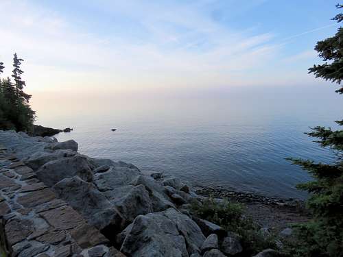
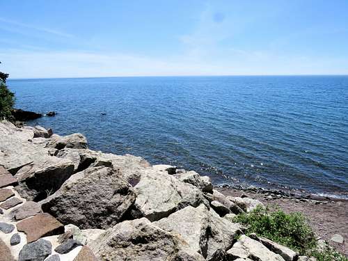
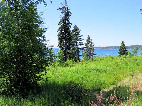
Started my hike at a pull off on Route 61 at 6:00 a.m. (elevation 625 ft). Nobody was there. Went to the south side of the road to get a view of Lake Superior.
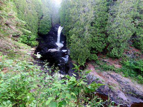
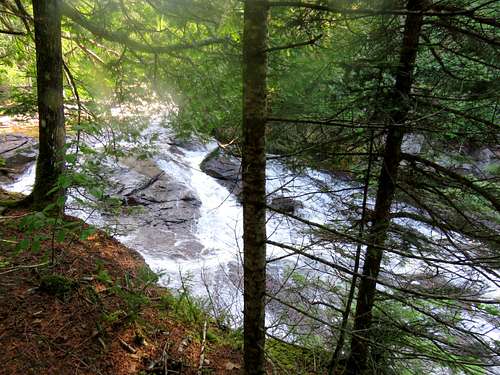
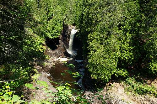
Came back to the north side of the road and went in the forest following the west trail uphill. After only 500 feet, I reached a good view point for Cascade Falls.
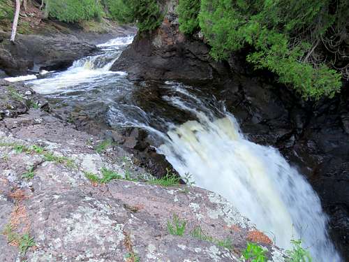
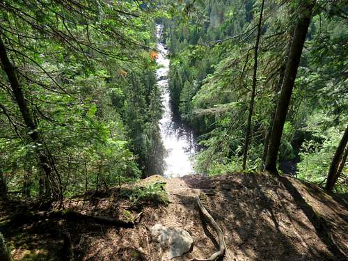
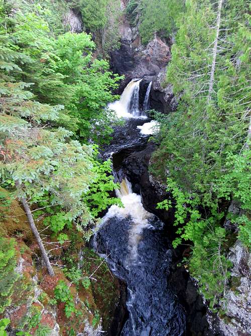
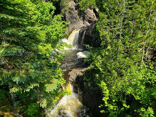
A little farther up the trail, I was at top of Cascade Falls.
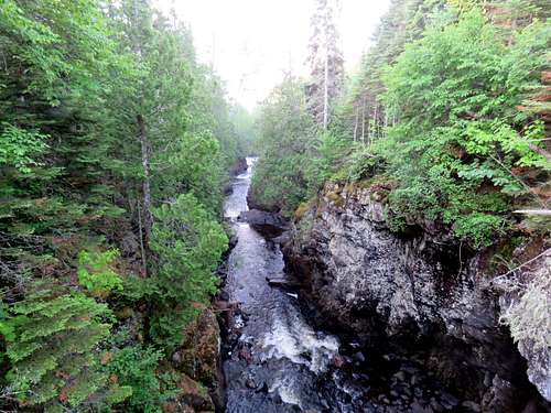
And then I reached a bridge that Crossed the river. I went on the bridge to take these photos.
|
|
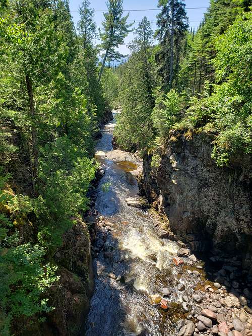
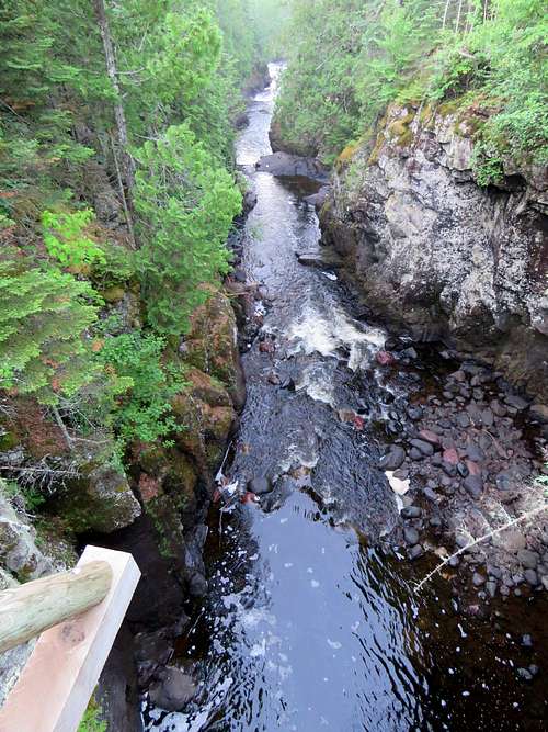
Another view of the canyon.
After 0.6 miles, at an elevation of 835 ft, I reached a place called Ninety Six Steps. The west trail went 96 steps down to reach the river.
I temporarily left the west trail and got on Superior Hiking Trail heading west up toward Lookout Mountain. The trail did some downhill and then uphill in the forest. I had no lake views even where there was a break in the forest.
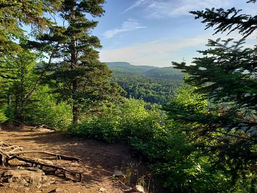
One mile after Ninety Six Steps, I reached the top of Lookout Mountain at an elevation of 1200 ft. I was disappointed to get no views of Lake Superior. In one spot, there was a small opening in the trees but what could have been a tiny view of the lake, was indistinguishable from the sky due to the haze. I was, however, able to look to the northeast and get a good view of the forested hilly terrain.
I then went back down to Ninety Six Steps going down the steps to follow the west trail uphill along the west bank of Cascade River in the forest. Went by a place where two people who had camped had just got up.
|
|
|
|
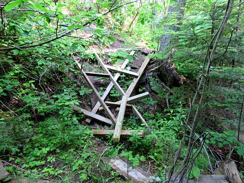
At an elevation of 940 ft, I reached a spur trail where a sign said 0.3 miles to cascades. I did not go on the spur trail and remained on the main trail which went away from the river going up a slope steeply. I did not see the river again until the very top. From the junction of the spur trail, the main trail went up 130 vertical feet up the forested slopes and then went down a little to cross a small side stream. Just before the side stream, there was a collapsed wooden step-way on the trail. There was no good place to bypass the debris field. I climbed down the area being careful not to get injured by the exposed rusty nails.
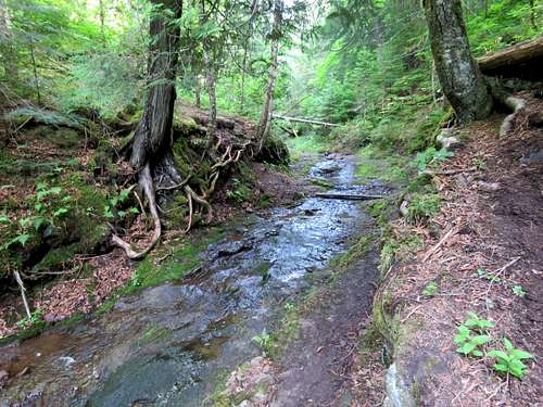
Following the trail uphill, I crossed a second side stream.
|
|
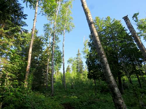
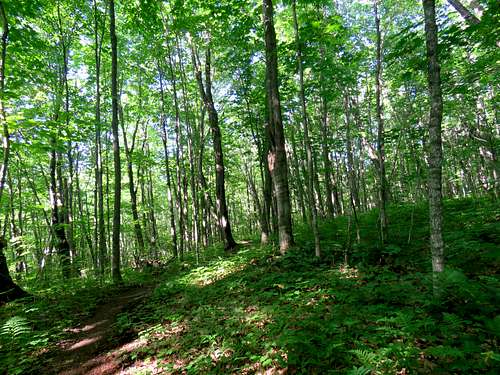
After the second stream, the trail went up very steeply until the slopes finally eased. I found myself in a dense forest with a lot of pesky mosquitos despite my bug repellent.
Just before going on the the dirt road, I reached an edge where wall-like slopes dropped 125 vertical feet below me into the Cascade River Canyon.
Reached the dirt road at 9:15 a.m. (elevation 1360 ft). Followed the road east going downhill to cross Cascade River over the road's bridge.
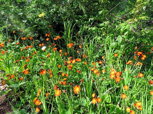
Flowers by the road.
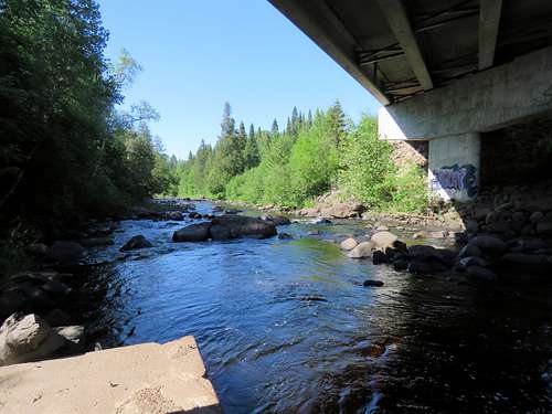
Went under the bridge where I found the perfect spot to have my lunch by the river (1260 ft elevation).
After resting for some time, I got on the trail on the east side of Cascade River to follow it back to Route 61 but I noted a sign that said the bridge over Trout Creek (several miles ahead) was broken and creek crossing may oy may not be possible depending on the amount of water. I did not want to risk it so I decided to go back down the west trail where I had come up from.
Went back up the dirt road and got on west trail following it downhill.
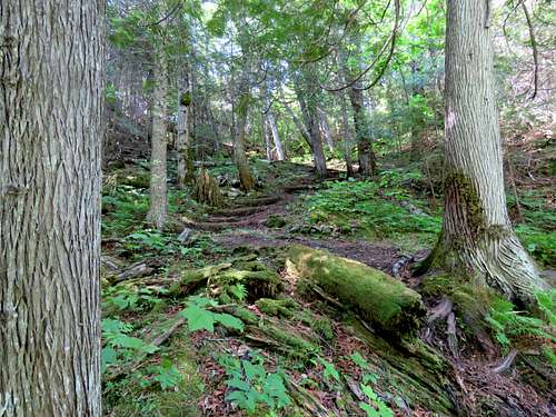
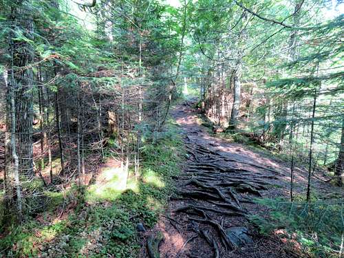
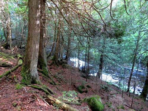
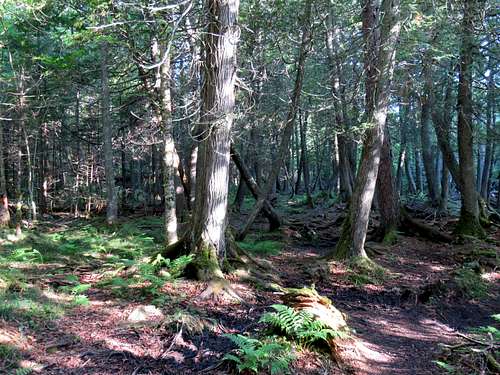
In the forest.
Once I reached that spur trail to Cascades, I followed it down to reach the river. It reached a spot where to continue, I had no choice but to cross the big river. I did not want to do that so I went back on the main trail without seeing any cascade.
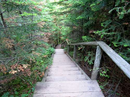
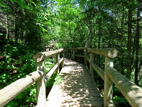
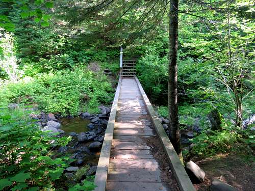
After Ninety Six Steps, I began running into people. Boardwalks near the beginning of the trail.
Views of the waterfalls again.
|
|
Reached my car on Route 61 at 12:05 p.m. A lot of people where there. Views of Lake Superior.
|
|