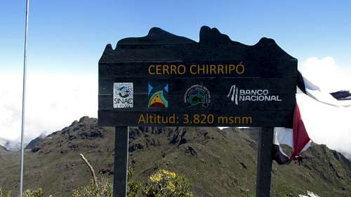
Cerro Chirripo, High Point of Costa Rica, 3820 meters, 12,533’, Sunday Jan 19, 2014
Getting there.
Frontier flight 86 from Denver DEN Friday Jan 17, 12:55 pm to San Jose SJO Saturday Jan 18 6:06 am.
Costa Rica is in the Central Time Zone - UTM -6.
We were picked up at the airport by Rohel Romero, owner of Hotel Uran. Hotel Uran is a little over 100 meters from the trailhead in San Gerardo de Rivas. We considered taking the bus and also looked into renting a vehicle. But after considering our options we decided to pay for private transportation.
One of the factors is having to buy a permit for the mountain. These have to be bought in person at the park office the day before you enter. Space in the hut is limited. Most of the spots are sold-out months in advance. 10 spaces are saved to be sold as daily walk-in tickets. The office is open until 4:00 pm. However, if people from the previous day bought for an extra night, that cuts into the 10 available. So the earlier you get there the better. What we found out after arriving, was you pretty much have to be there when the office opens at around 6:30 am. People literally camp out overnight.
What this means for most people who don’t have days to burn, is having to do the mountain in one long day. Even if the hut is full, single day admission is available for $15.00 US per person.
We looked into taking the bus to save money. Aside from the extra time, we were scared off by the numerous warnings of thievery in Costa Rica. There are buses that run from San Jose to San Isidro de El General. But unlike Mexico City which has a large bus station near the airport, the buses in San Jose pick up at a street side bus stop. That would have us dragging large bags in an environment where that would leave us vulnerable.
When I looked into renting a vehicle, the daily charge plus fees and insurance soon added up to as much as hiring a ride. Costa Rica is known for navigation being a challenge. And like other countries to the south, the driving patterns are not what we’re used to in the US & Canada.
After breaking free of the city Rohel stopped for lunch where we had really good café con leche. Since Rohel had another client to pick up later in the day, he handed us off to another driver, Tigre, at about the half way point. Tigre took us to a grocery store in San Isidro and then to the park office in San Gerardo de Rivas.
National Park information:
We walked into the park office at around 11:30 am hoping for a spot the next night at Base Crestones. We were not surprised to learn we had to buy a day pass, or come back the next day. Coming back the next day wasn't going to work because of our plans to join family in Manuel Antonio after the hike. When it came to a choice to do a one-day the following day or wait until Monday, the weather prediction helped the decision. It was to be clear on Sunday but some showers on Monday.
Mountain Forecast:
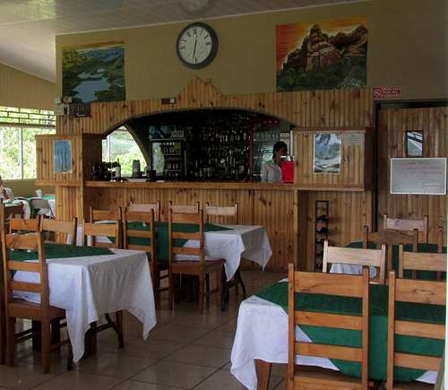
Hotel Uran has a nice restaurant with a good selection of meals. We relaxed with a pop while waiting for our room. Most of the tables are inside, but there are a couple tables outside as well. The front desk area has a small gift shop. The room was basic with a private bathroom with hot water. Breakfast was included. And importantly the hotel has Wi Fi. This is really big since Americans get gouged by their providers if they use their cell phones internationally. Our exchange of emails with Rohel over the past several weeks helped immensely with getting everything organized and answering several questions. In addition to picking us up at the airport, Rohel drove us to Manuel Antonio which was our next stop after the mountain.
Hotel Uran:
Next door to Hotel Uran is Casa Mariposa. It’s not a hotel, but describes itself as a guesthouse and hostel. There is a shared kitchen and bathroom, no Wi Fi but a shared computer. There are both private rooms and dorm rooms in a beautiful setting.
Casa Mariposa:
San Gerardo information:
We now had the reality of doing the entire round trip in one day. Trailhead elevation is under 5000’ and summit elevation is 12,533’. The is some elevation loss along the way so the cumulative gain is well over 8000’. We didn't get hardly any sleep on the overnight flight and now faced getting up in the middle of the night to begin the hike. The upside of no sleep on the flight is we were able to fall asleep early.
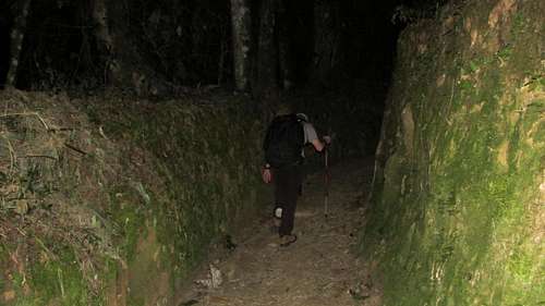
We set the alarm for midnight. I have no memory of it going off and hitting snooze. At 12:15 Dorthe spoke to me and I slid out of bed. There wasn't much to do so we walked out the door around 12:50 am. The hotel is just a few minutes from the trailhead with last minute adjustments we were walking up the trail at 1:00 am. My GPS hadn't settled in yet, so my trailhead waypoint is from the day before.
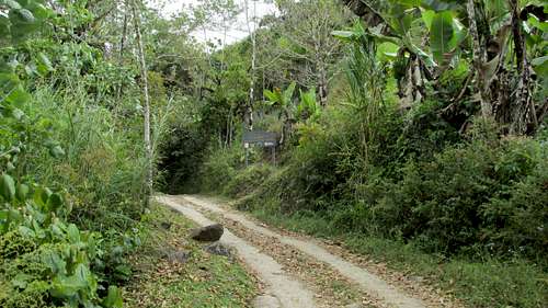
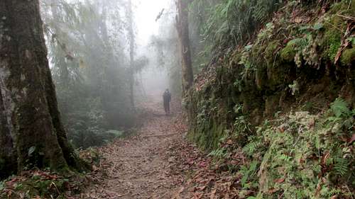
![Chirripo Trailhead]() Chirripo Trailhead
Chirripo Trailhead
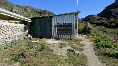
The trailhead is easy to find. Hotel Uran is on the left side of the road when heading uphill. A little over a 100 meters up the hill there is a cluster of signs on the right marking an obvious trail. One upside of the round trip in one day is not packing a sleeping bag or as much food - although prepared meals are an option when staying at the hut.
![Chirripo Trailhead]() Chirripo Trailhead
Chirripo TrailheadFood: At the grocery store we bought fruit, packaged meat, cheese slices, peanut butter & bread along with chips for afterwards. From the US we brought trail mix, Gu and bars. Note, you might have issues entering the country with any food that isn't in its original package.
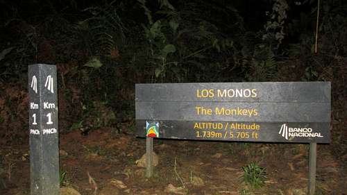
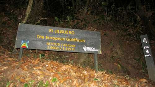
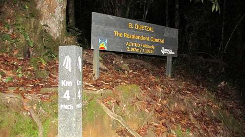
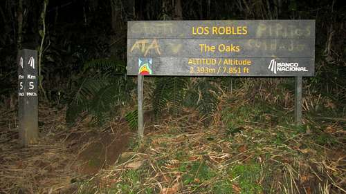
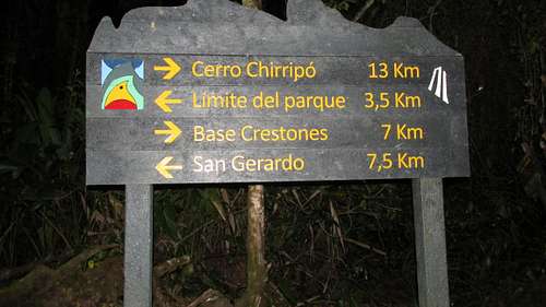
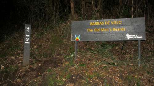
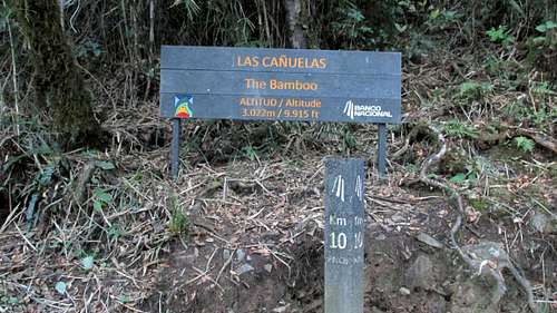
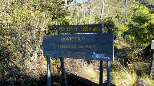
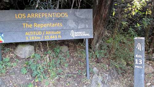
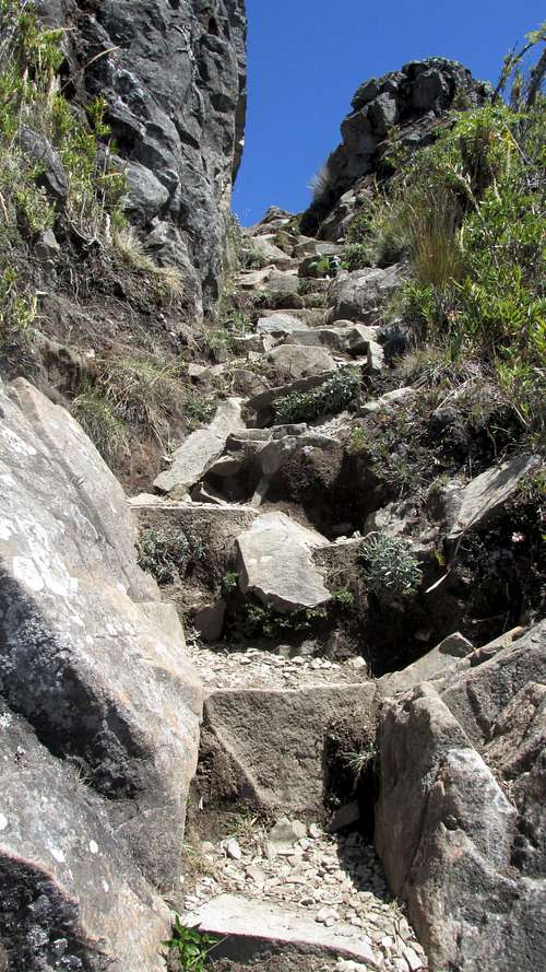
The first few kilometers of the trail are serious about going uphill. There is a post marking each of the 14 kilometers between the trailhead and Base Crestones. Most also have additional signage with a name and elevation. Banco Nacional apparently sponsored the signs!
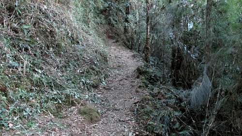
I started off wearing a fleece jacket, but shed that as soon as my body warmed to the hiking. The trail is easy to follow. It’s usually the only viable route through the jungle, and seems to be on a hillside more often than not. There are not very many places where someone could easily get off to the side off the trail to take care of business.
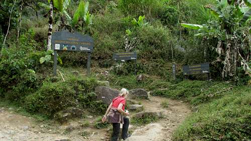
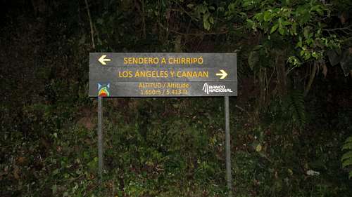
![Canaan Intersection]() Canaan Intersection
Canaan Intersection
There is an intersection about half way up the first kilometer. A right turn off the main trail is to Los Angeles Y Canaan. That’s apparently an alternative way to access this trail. It would really suck to make a wrong turn here on the way back! Turning left is for Sendero (path) A Chirripo. There is a sign post for Hotel Uran and San Gerardo on the return.
![Hotel Uran Sign]() Hotel Uran Sign
Hotel Uran SignThere are several places where the path shows having eroded into the landscape. But unlike a lot of places, braiding of the trail is not an option!
![Chirripo Path]() Chirripo Path
Chirripo Path![Chirripo Km 1]() Chirripo Km 1
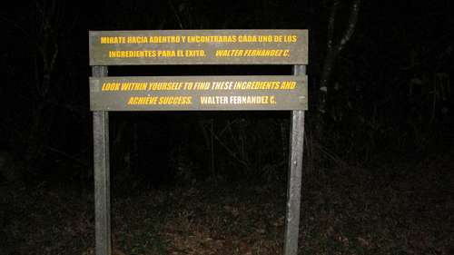
Chirripo Km 1The first of many inspirational signs!
![Inspirational Sign]() Inspirational Sign
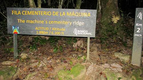
Inspirational Sign![Chirripo Km 2]() Chirripo Km 2
Chirripo Km 2Having the altitude along with the kilometer posts was great for keeping track of our progress. The signs gave us something to look forward to while hiking along by headlamp.
![Chirripo Km 3]() Chirripo Km 3
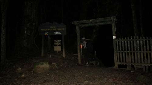
Chirripo Km 3![Chirripo National Park Entrance]() Chirripo National Park Entrance
Chirripo National Park EntranceThe uphill eases a bit approaching kilometer 4. In the dark you might not notice the signs for the Cloudbridge Reserve on the left as you approach the park entrance. Just inside the obvious Park Entrance Gate is the sign for kilometer 4.
![Chirripo Km 4]() Chirripo Km 4
Chirripo Km 4After reaching the park entrance and kilometer 4 I felt like we now had a significant stretch of trail behind us. But there was still lots to go!
![Chirripo Km 5]() Chirripo Km 5
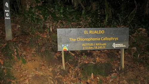
Chirripo Km 5![Chirripo Km 6]() Chirripo Km 6
Chirripo Km 6The uphill continues for the next couple kilometers. With the park entrance behind, the next major landmark to look forward to the is the hut. Between kilometer 6 and the hut there is some up and down that is responsible for some of the cumulative elevation gain.
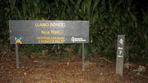
![Chirripo Km 7]() Chirripo Km 7
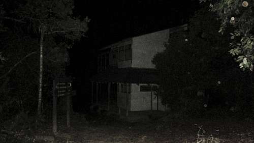
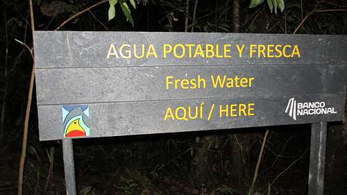
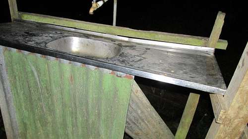
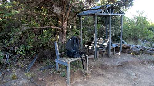
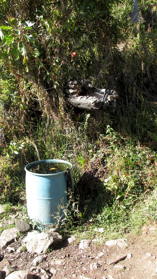
Chirripo Km 7The hut is a few hundred meters past kilometer 7. I tried the door and found it locked. The hut appeared to be vacant. A roof extended over a deck that wrapped around 2 sides. The water source was a sink outside on the deck. Although the water is indicated as potable, we choose to SteriPEN it anyway. This is the halfway point to Base Crestones.
![Chirripo Lower Hut]() Chirripo Lower Hut
Chirripo Lower Hut![Chirripo Lower Hut Sign]() Chirripo Lower Hut Sign
Chirripo Lower Hut Sign![Chirripo Lower Hut Sign]() Chirripo Lower Hut Sign
Chirripo Lower Hut Sign![Chirripo Lower Hut Sink]() Chirripo Lower Hut Sink
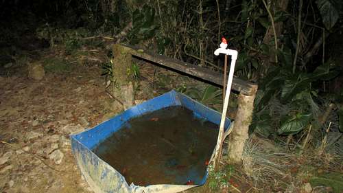
Chirripo Lower Hut SinkAfter the hut there is a low point and then the trail gets back to heading uphill. Not far but separated from the hut is a pack animal water trough.
![Chirripo Pack Animal Trough]() Chirripo Pack Animal Trough
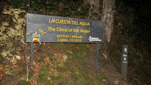
Chirripo Pack Animal Trough![Chirripo Km 8]() Chirripo Km 8
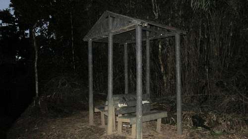
Chirripo Km 8![Chirripo Km 9 Bench]() Chirripo Km 9 Bench
Chirripo Km 9 Bench![Chirripo Km 9]() Chirripo Km 9
Chirripo Km 9
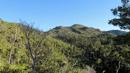
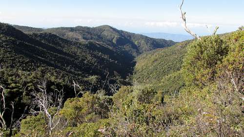
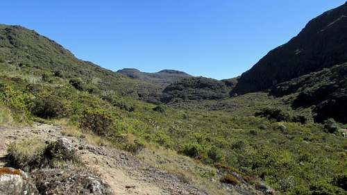
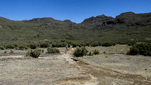
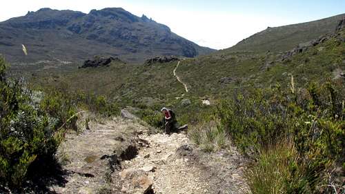
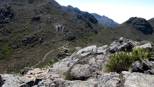
It started becoming daylight after Km 9. We were able to get some views of the route ahead. The trail is on a hill side, rising to the left. Below on the right is the Rio Talari valley. There is some up and down as the trail wraps around the hill sides.
![Chirripo Daylight!]() Chirripo Daylight!
Chirripo Daylight!
![Chirripo Km 10]() Chirripo Km 10
Chirripo Km 10
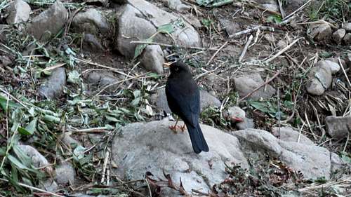
This bird followed us along the trail for several hundred meters.
![Chirripo Bird]() Chirripo Bird
Chirripo Bird
![Chirripo Path]() Chirripo Path
Chirripo Path![Chirripo looking ahead]() Chirripo looking ahead
Chirripo looking ahead![Chirripo Km 11]() Chirripo Km 11
Chirripo Km 11![Chirripo 11 Rest Bench]() Chirripo 11 Rest Bench
Chirripo 11 Rest BenchBetween 11 & 12 Km there is a high point with a bench. Then the trail starts losing some elevation with some more up and down.
![Chirripo 11+ Rest Bench]() Chirripo 11+ Rest Bench
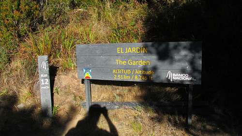
Chirripo 11+ Rest BenchThe Km 12 sign has an elevation that is wrong. You are a couple thousand feet higher than the 8,245’ indicated.
![Chirripo Km 12]() Chirripo Km 12
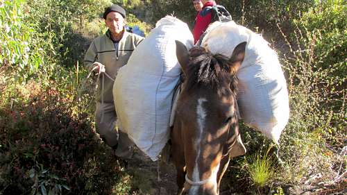
Chirripo Km 12![Chirripo Horse]() Chirripo Horse
Chirripo HorseBetween Km 12 & 13 there is a low point at a switch back with a watering trough. The trough also has a water hose. Knowing we could refill our water at Base Crestones we didn't get any here. The trail then gets serious about some uphill again.
![Chirripo Horse Trough]() Chirripo Horse Trough
Chirripo Horse TroughRio Talari is to the south of the trail most of the way to Base Crestones.
![Chirripo Rio Talari]() Chirripo Rio Talari
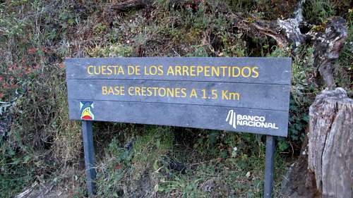
Chirripo Rio Talari![Chirripo 1.5 Km to BC]() Chirripo 1.5 Km to BC
Chirripo 1.5 Km to BC![Chirripo Km 13]() Chirripo Km 13
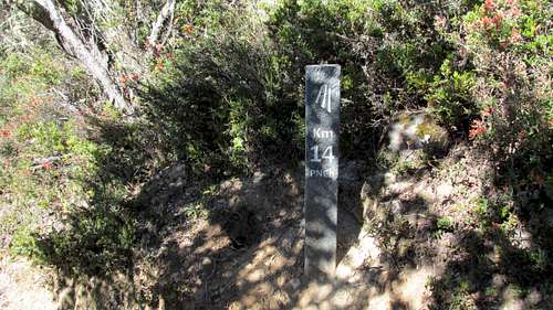
Chirripo Km 13The Km 14 sign doesn't have an elevation but is above 11,000’.
![Chirripo Km 14]() Chirripo Km 14
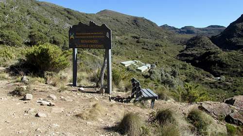
Chirripo Km 14After Km 14 the trail then levels out a bit before you are presented with a view of Base Crestones. It’s a short stroll downhill to Base Crestones.
![Chirripo Crestones View]() Chirripo Crestones View
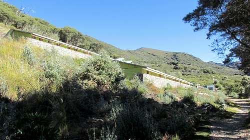
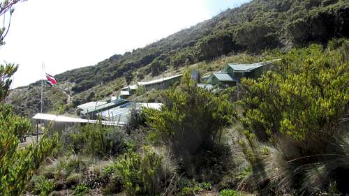
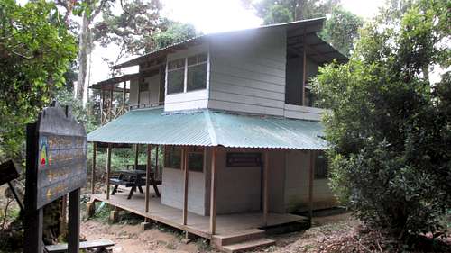
Chirripo Crestones ViewThe hut is a large complex of buildings on the left side of the path. It was 8:30 am. Not great time, but still in good shape for making the summit.
![Chirripo Base Crestones]() Chirripo Base Crestones
Chirripo Base CrestonesThe ranger at Base Crestones was outside when we arrived. After checking our permits he strongly suggested we were carrying too much stuff for going to the summit. We did have too much. We packed the clothes we would for an edge of summer Colorado fourteener. I wore a pair of hiking pants, no long johns, but with an extra pair of fleece pants in my pack. My insulating fleece jacket stayed in the pack after taking it off during the first kilometer. There was never any thought of wearing the wind stopper fleece. Nor did I need the winter hats, neck gator or mitten shells! Although moisture is common on this mountain, we had a clear day up high. I wore a baseball hat the entire time. The light marmot shell probably would have been good if it had rained. And we packed plastic ponchos in case there was downpour!
![Chirripo Elevation Sign]() Chirripo Elevation Sign
Chirripo Elevation SignFor water we were directed to a kitchen sink inside a dinning area. Some cooks were preparing some meals for clients. I was directed to the sink during a pause in the action. Again we SteriPENed the water. We left Base Crestones around 9:00 am.
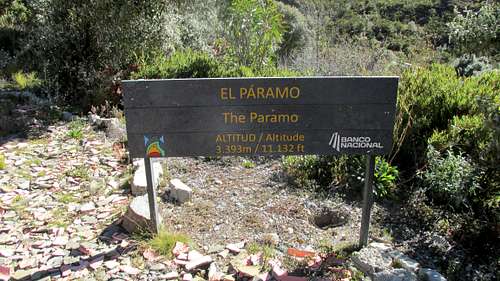
The complexion of the hike changes above Base Crestones. The jungle trees give way to foliage that lives with less moisture. The summit is just 1500’ above Base Crestones with moderate elevation loss along the way. The sign at Base Crestones indicates it is 5.1 Km to the summit and 2.3 Km to Valle de los Conejos.
![Chirripo Base Crestones Distance Sign]() Chirripo Base Crestones Distance Sign
Chirripo Base Crestones Distance Sign
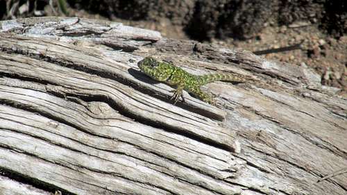
Above Base Crestones there were several of these lizards, ranging in color from green to brown.
![Chirripo Lizard]() Chirripo Lizard
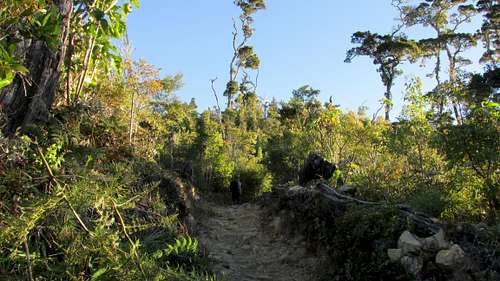
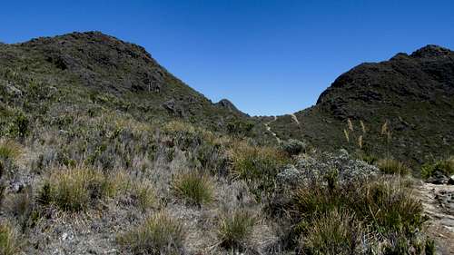
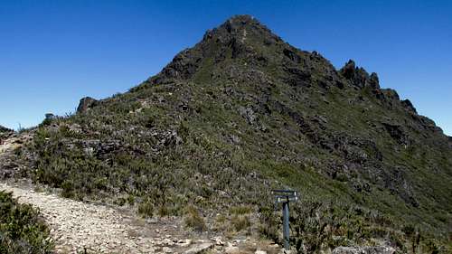
Chirripo LizardIt’s important to note there are multiple destinations above Base Crestones with constructed paths. Whereas through the jungle the obvious main trail is the only possible route with just a few marked intersections, that is less true above Base Crestones. The path is still easy to follow but not as wide as below Base Crestones.
![Chirripo Above Treeline]() Chirripo Above Treeline
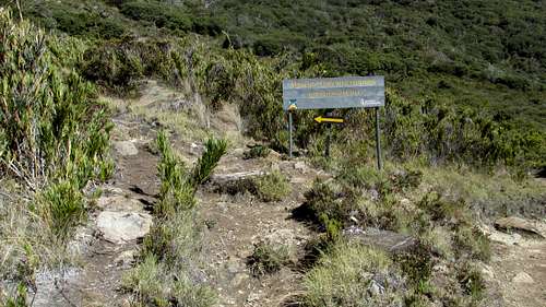
Chirripo Above TreelineIn the first kilometer past Base Crestones is the signed intersection for Cerro Ventisqueros. The main path for Chirripo continues straight.
![Chirripo Ventisquenos Int]() Chirripo Ventisquenos Int
Chirripo Ventisquenos IntThe next place of note for route finding is a climb up a rocky area with some cairns. On a clear day, navigation shouldn't be an issue. But if it were foggy you would have to take care to spot the next cairn so you would hit the path on the other side.
![Chirripo Rock]() Chirripo Rock
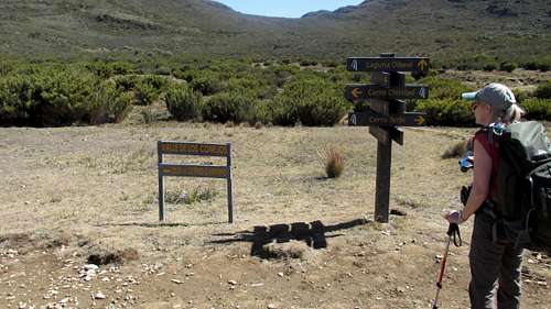
Chirripo RockValle de los Conejos has a covered rest bench and a four way intersection. We did not see any rabbits! A sign says the remaining distance is 2800 meters. Chirripo is to the left which is north. There are so many high points surrounding Valle de los Conejos it wasn't until after this turn I realized which pass we were heading for.
![Chirripo Valle de los Conejos]() Chirripo Valle de los Conejos
Chirripo Valle de los Conejos At first the uphill is gentle but then steepens a bit. There is a false pass on the way to the real pass.
![Chirripo Looking North]() Chirripo Looking North
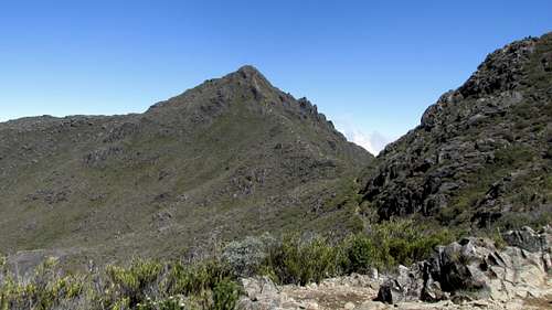
Chirripo Looking NorthWe could see Chirripo through the pass as we approached. This pass is the saddle between Cerro Piramide on the right (east) and Cerro Nuevo on the left (west).
![Chirripo Pass]() Chirripo Pass
Chirripo PassWhen we looked across to the summit from the saddle we knew that after 10 hours of hiking we were getting close. There’s a little bit of elevation loss as the trail skirts the west side of Piramide on its way to the Paramide - Chirripo saddle.
![Chirripo Pass]() Chirripo Pass
Chirripo PassLooking back from the Piramide - Nuevo Pass.
![Chirripo Pass]() Chirripo Pass
Chirripo PassAt the Paramide - Chirripo saddle there is another intersection. Off to the right is the trail for Valle de las Morrenas. We of course were continuing straight up Chirripo.
![Chirripo Saddle]() Chirripo Saddle
Chirripo Saddle
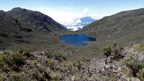
Lago San Juan is below to the left (west) during the final push to the summit.
![Chirripo Lago San Juan]() Chirripo Lago San Juan
Chirripo Lago San Juan![Chirripo Looking Back]() Chirripo Looking Back
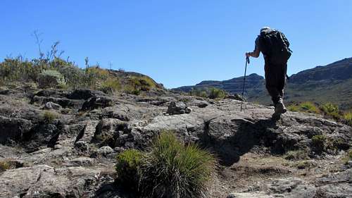
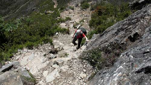
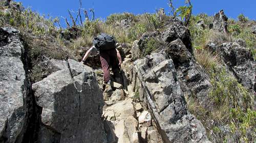
Chirripo Looking BackThe trail steepens as it switchbacks up Chirripo. There’s about 400’ gain from the saddle. Higher up the trail has a bit of easy scrambling. It would be YDS class 2, maybe considered 2+ in Colorado. A person could find some third class moves if they wanted. There’s a few spots where the trail braids. If you’re not used to scrambling, just make it a point to take a good look and the easiest line should present itself. If it is wet there are a few spots where you’ll want to be careful.
![Chirripo Near Summit]() Chirripo Near Summit
Chirripo Near Summit![Chirripo Near Summit]() Chirripo Near Summit
Chirripo Near Summit![Chirripo Near Summit]() Chirripo Near Summit
Chirripo Near SummitWe could see the summit sign above as we got close. The summit is not real big, but there’s room for a few parties at the same time. After our 1:00 am start we summited at 11:30 am. That’s not great time. I read trip reports where people did it a few hours quicker. But if you have to do the round trip in one day, you want to err on allowing more time. We were fortunate with the weather. For us it stayed clear up high.
![Chirripo Summit]() Chirripo Summit
Chirripo SummitWe didn’t meet a lot of people on the trail. We were passed by a young woman in the first kilometers. Then some porters and pack animals passed us. Around dawn we met a pack train coming down. Then we caught a few heading up and passed some coming down as we approached Base Crestones. Above Base Crestones there were a few more parties on the trail coming and going. But there weren't the numbers we expected considering the size of Base Crestones and the difficulty in getting lodging there. There are a lot trails up high for hikers to explore, and apparently it’s common to spend multiple nights at Crestones. So that would mean less people on the Chirripo summit trail at any given time.
![Chirripo Summit]() Chirripo Summit
Chirripo SummitWe were also pleasantly surprised the vast majority of hikers were Costa Rican. Usually when we go to a foreign mountain, there are other Americans, Europeans, Canadians and maybe some Japanese. Most of the locals on the mountain will be working in various capacities. As we were leaving San Juan we commented to our driver how many joggers we were seeing. He told us how many Costa Ricans are getting into physical fitness. Climbing Chirripo is like graduating.
![Chirripo Base Crestones]() Chirripo Base Crestones
Chirripo Base CrestonesWe left the summit around noon and got back to Base Crestones around 2:00 pm. We reloaded our packs and took on more water. We left Base Crestones around 2:15 for the long return hike.
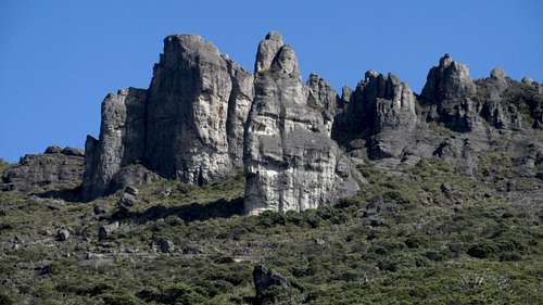
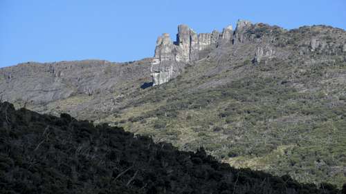
![Chirripo Rocks]() Crestones
CrestonesThese photogenic rocks, known as Crestones are across the valley from Base Crestones.
![Chirripo Rocks]() Crestones
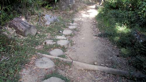
CrestonesAt several places along the trail, "Tree Cookies", made from tree trunks, helped with muddy spots. Even without mud, they seemed to help by breaking up the cadence on the long return hike.
![Chirripo Trail Cookies]() Chirripo Tree Cookies
Chirripo Tree Cookies
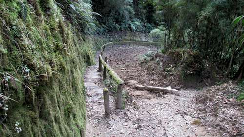
There were multiple places where the trail split. The hopelessly muddy pack animal side was separated from hiker side by a railing. An extra post serves to keep the pack animals on the proper side.
![Chirripo Split Trail]() Chirripo Split Trail
Chirripo Split TrailAs the afternoon wore on we could see the clouds below us starting to rise. The sky was still clear above and we got back to the lower hut around 4:30 pm. We decided we didn't need to take on more water.
![Chirripo Agua Hut]() Chirripo Agua Hut
Chirripo Agua HutBuy now we were feeling the length of our day and some flying insects were becoming real aggravating. I was timing ourselves between kilometer signs and starting to predict our arrival time back at the hotel. One of our concerns was getting there in time for the restaurant to still be open. We really wanted a burger, fries and a couple beers!
![Chirripo National Park Gate]() Chirripo National Park Gate
Chirripo National Park GateWe continued on through the cloud of bugs and got to the 4 Km Park at dusk. As the light was fading the fog was rising. But as we descended into the fog the bugs became less. Whether it was the fog if they settle down at night anyway we didn't know. But they weren't there pre-dawn on the way up.
![Chirripo Fog]() Chirripo Fog
Chirripo FogEven though we had an obvious path to follow, visibility became an issue. Our headlamps were absorbed by the mist so we could only see the immediate trail around us. The mist got thicker and the damp made the trail slick. We each hike with a single trekking pole and these became real important for traction.
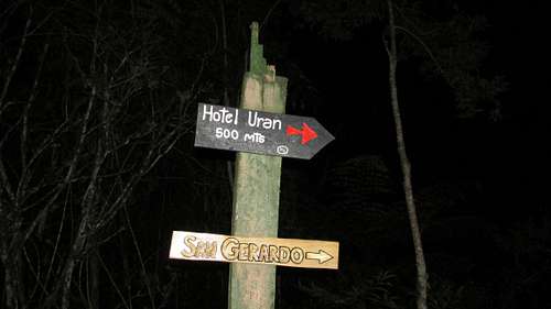
The last 3 kilometers in the dark with heavy misty fog were a challenge. I knew there would be the intersection in the last kilometer, and it shouldn’t be problem to stay on the main trail. But I wanted to be sure. I kept checking my GPS. The track had already started overwriting itself, so I couldn’t use backtrack. But I did have waypoints for each kilometer and the intersection. So I knew when to watch for each kilometer sign in the fog, and when to watch for the intersection. We were happy to see the intersection with the sign indicating Hotel Uran 500 meters -> & San Gerardo ->. This intersection is at a turn in the path, so a right turn was what we wanted. It was so foggy I couldn’t see if it was straight or a left turn to go the other way.
We made it back to the trailhead at about 7:00 pm. The restaurant was still open. It was full with people watching a Presidential election debate. Unlike an American audience they all were listening intently with no comments, grunts or other obvious reaction. The debate ended and the crowd filtered out and we ate our burgers and drank a couple beers.
![Chirripo - Restaurant]() Chirripo - Hotel Uran Restaurant
Chirripo - Hotel Uran RestaurantWater: I carried two 1.75 liter bottles of water. I took on a liter at the Agua hut and another liter at Base Crestones. A person could carry smaller bottles if they carefully planned out their water stops. But I did drink over 5 liters during the hike!
The following day we had the “Chirripo Waddle!” Most of my stiffness was my lower calf / Achilles area. Walking down steps was the hardest. We went for a walk up the road to the Cloudbridge Natural Reserve. One of the Cloudbridge trails is the same one we saw at the Km 4 Park Entrance. This can be combined with the Chirripo trail for a loop. We kept it easy and just did a couple of the waterfall trails.
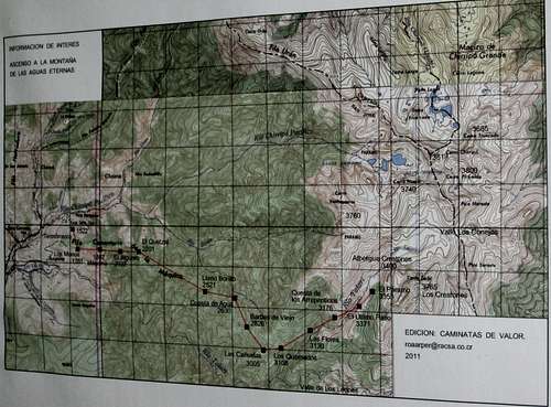
![Chirripo Map]() Chirripo Map
Chirripo MapFor a map I ordered topos from OmniMap. I then enlarged the portion with the hike 2X on an 11 17” photocopier and spliced them together.
The two 1:50,000 sheets that covered the hike are:
1 1 64-435134442 $18.95 Costa Rica 1:50K topo #3444-2 San Isidro
2 1 64-435135443 $18.95 Costa Rica--1:50K topo. 3544-3 Durika
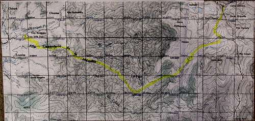
The sheets have a 1 Km grid but the coordinates don’t match UTM. I was able to compare some UTM coordinates I found online to the map coordinates and come up with a fudge factor. I then labeled the map with my fudged coordinates. The yellow highlighter line is roughly transferred from this map supplied by mvanderbilt
![Cerro Chirripo Map]() Cerro Chirripo Map
Cerro Chirripo MapGPS Coordinates: Waypoints taken with a Garmin eTrex Vista HCx
The elevations tended to run a bit low compared to the signs on the way up. However when I got to the summit the elevation was a bit high. The elevations were closer to the signs or a bit high on the way down. All of my waypoints were taken on the way up except the Trailhead (day before) and Horse Water (way down)
UTM 17 P WGS 84 Elevation Feet Decimal Degrees North & West Elevation Meters
X Y Z feet Time Date Lat N Long W Z m waypoint
0214384 1047181 04203 09:00:58 am 21-Jan-14 9.46366 83.60109 1281 Park Office
0216148 1047913 04812 08:35:27 am 21-Jan-14 9.47040 83.58508 1467 Hotel Uran
0216223 1047829 04987 02:11:00 pm 18-Jan-14 9.46964 83.58439 1520 Trail Head
0216190 1047760 05025 12:55:01 am 19-Jan-14 9.46902 83.58469 1532 near TH
0216142 1047392 05407 01:14:28 am 19-Jan-14 9.46569 83.58511 1648 Canaan Int
0216385 1047299 05677 01:27:46 am 19-Jan-14 9.46486 83.58289 1730 Km 01
0216908 1047294 06039 01:50:01 am 19-Jan-14 9.46486 83.57812 1841 Walter sign
0217124 1047296 06132 01:58:01 am 19-Jan-14 9.46489 83.57616 1869 Km 02
0217786 1047259 06680 02:28:50 am 19-Jan-14 9.46460 83.57013 2036 Km 03
0217881 1047331 06791 02:39:42 am 19-Jan-14 9.46525 83.56927 2070 Km 03+ Bench
0218377 1047237 07089 02:58:06 am 19-Jan-14 9.46444 83.56476 2161 Km 04 Park Ent
0218786 1046702 07677 03:33:08 am 19-Jan-14 9.45963 83.56100 2340 Km 05
0219370 1046665 08093 03:58:07 am 19-Jan-14 9.45934 83.55568 2467 Km 5+ Ches
0219508 1046580 08126 04:04:39 am 19-Jan-14 9.45858 83.55441 2477 Km 06
0220358 1046271 08149 04:24:28 am 19-Jan-14 9.45584 83.54665 2484 Km 07
0220572 1046110 08156 04:31:06 am 19-Jan-14 9.45441 83.54470 2486 Hut Agua
0221192 1046099 08482 05:03:46 am 19-Jan-14 9.45434 83.53905 2585 Km 08
0221469 1045441 09127 05:37:19 am 19-Jan-14 9.44842 83.53649 2782 Km 09 Bench
0221539 1045402 09195 05:45:02 am 19-Jan-14 9.44807 83.53585 2803 Km 09
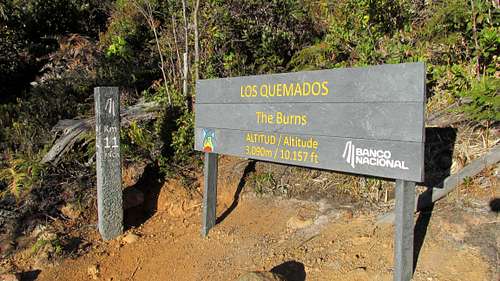
0222010 1044848 09767 06:14:45 am 19-Jan-14 9.44309 83.53153 2977 Km 10
0222478 1044916 10157 06:49:21 am 19-Jan-14 9.44374 83.52728 3096 Km 11
0222842 1045272 10381 07:04:23 am 19-Jan-14 9.44698 83.52399 3164 Km 11+ Bench
0223274 1045374 10259 07:24:23 am 19-Jan-14 9.44793 83.52007 3127 Km 12
0223940 1045680 10395 07:47:28 am 19-Jan-14 9.45074 83.51402 3168 Km 13
0224607 1045986 11037 08:27:08 am 19-Jan-14 9.45355 83.50797 3364 Km 14
0224807 1046151 11034 08:34:14 am 19-Jan-14 9.45505 83.50616 3363 Crestones View
0224950 1046353 10975 08:41:04 am 19-Jan-14 9.45688 83.50488 3345 Base Crestones
0225387 1046974 11256 09:29:00 am 19-Jan-14 9.46252 83.50095 3431 Ventisqueros Int
0225759 1047162 11354 09:42:21 am 19-Jan-14 9.46425 83.49757 3461 Rock Area
0226583 1047285 11426 10:01:54 am 19-Jan-14 9.46541 83.49007 3483 Conejos Int
0226607 1048736 12179 10:58:18 am 19-Jan-14 9.47853 83.48994 3712 Pass
0226770 1049061 12176 11:08:54 am 19-Jan-14 9.48147 83.48848 3711 Saddle
0226752 1049358 12584 11:46:04 am 19-Jan-14 9.48416 83.48868 3836 Chirripo Summit
0223827 1045726 10380 02:50:19 pm 19-Jan-14 9.45115 83.51505 3164 Horse Water
Comments
No comments posted yet.

