
-
 17060 Hits
-
 86.85% Score
-
 23 Votes
|
|
Route |
|---|---|
|
|
Hiking |
|
|
Spring, Summer, Fall |
|
|
Half a day |
|
|
Class1-2 |
|
|
Overview
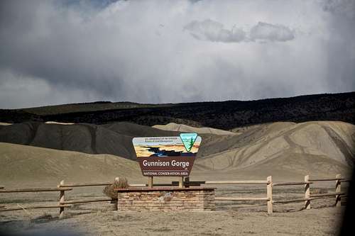
Gunnison Gorge
Chukar Trail is a popular trail located within Gunnison Gorge National Conservation Area. There are several trails leading down to the Gunnison river and Chukar Trail is the least steep and the shortest one. Ute Trail is longer and described in several Colorado Hiking books, this one has only very short descriptions on-line. The trail is easy to follow from a well marked trailhead with a large parking lot, picnic tables and vault toilets.
Gunnison Gorge is located about seven miles north of Montrose in western Colorado, just downstream from the Black Canyon of the Gunnison National Park. It encompasses over 57,000 acre as of public lands in Montrose and Delta counties. The distance from Grand Junction is about 50 miles south.
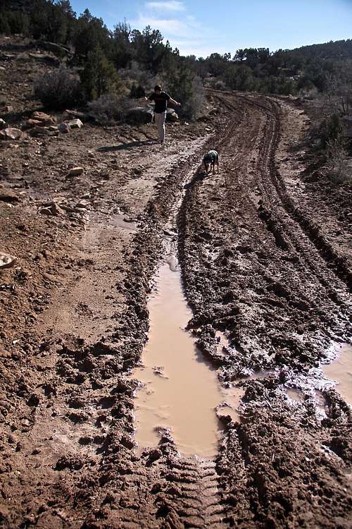
The four main trails into the Gunnison Gorge are accessed via the Chukar, Bobcat, Duncan and Ute access roads are located along the main Peach Valley Road. The turn offs for each trail are well marked. The roads are dirt roads, can be impassable in wet conditions. 4 WD vehicles recommended.
The Chukar Road and trail provide the main approach access for boaters.
The Chukar Road and trail provide the main approach access for boaters.
| Trail | Miles | Elevation | Trail Description |
| Chukar | 1.1 one way 2.2 total |
560 feet drop (5960'-5400') |
Moderate. Adobe clay with sand/rock outcrops. Very heavy foot, horse and boater use. Limited hiker camping spots & river access. |
| Bobcat | 1.5 one way 3.0 total |
840 feet drop (6100'-5300') |
Difficult. Undeveloped, hard to follow with steep descent in the last 0.5 miles on rocky face. Good river access. There are 2 spots for camping. |
| Duncan | 1.5 one way 3.0 total |
840 feet drop (6100'-5300') |
Difficult. More commonly used that above Bobcat. Last 0.5 miles very steep with loose scree (stay on the north side). Good river access. 3 spots for camping. |
| Ute | 4.5 one way 9 total |
1,200 feet drop (6500'-5300') |
Moderate trail, the longest one. Very well developed and easy to follow. Gradual slope with steeper section at the lower section. Great views. Good river access, 4 campsites. |
Getting There
Muddy roads
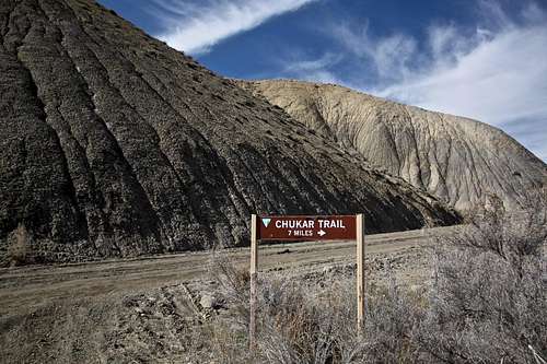
Chukar Trail
Turn east onto well marked Chukar Rd. and continue 7 miles to the Chukar trailhead parking lot. The road becomes rougher, but could be passable by 2WD vehicle in good conditions. The first ~ 5 miles are slightly uphill, then it starts to drop into the gorge. The road may be impassable when wet. I made it to the parking lot only during the summer, early spring conditions stopped me higher up due to clay mud.
There is a nice large parking area with shaded picnic tables, outhouse, and user registration and fee collection box. There is another outhouse at the river end of the trail.
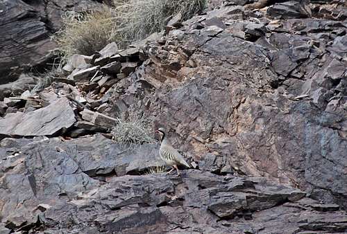
![Chukar on Chukar Trail]()
Chukar on Chukar Trail
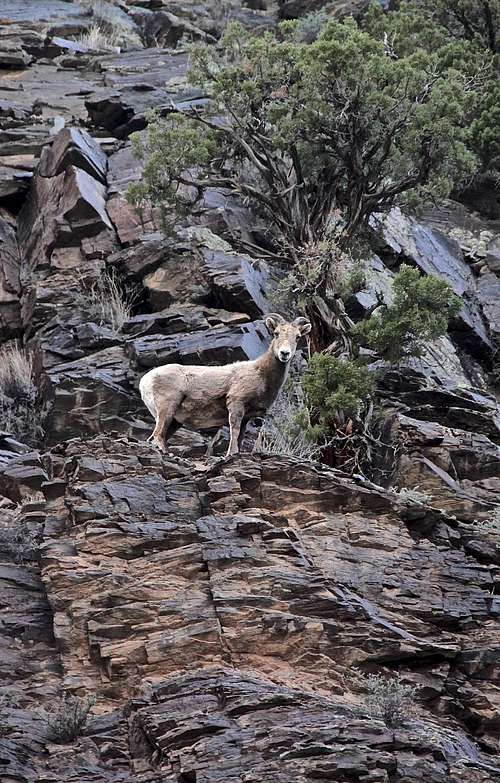
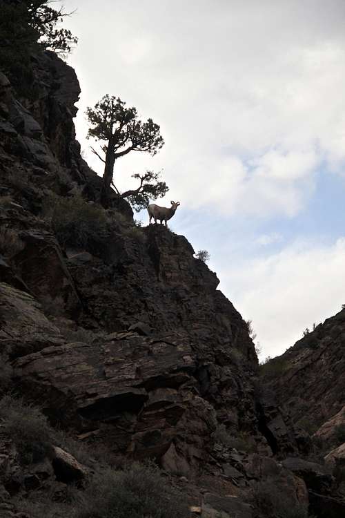
![Desert Bighorn Sheep]()
Desert Bighorn Sheep
 Click for weather forecast
Route Description
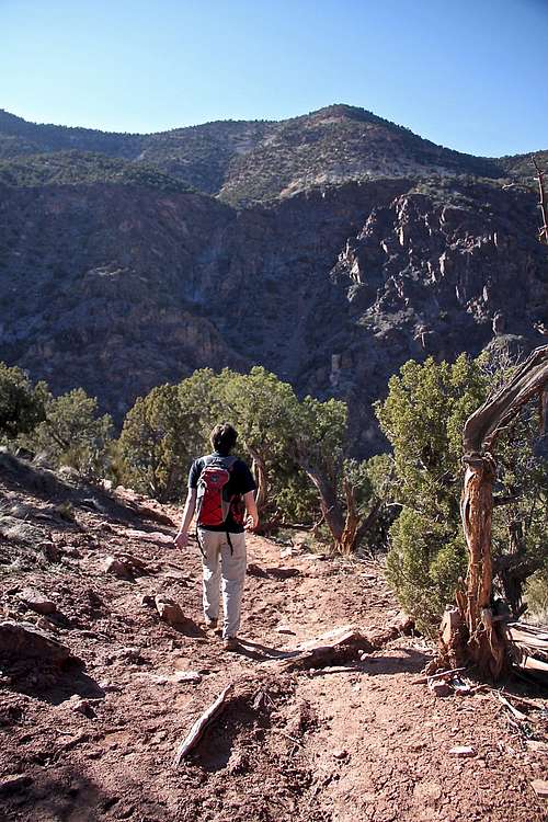
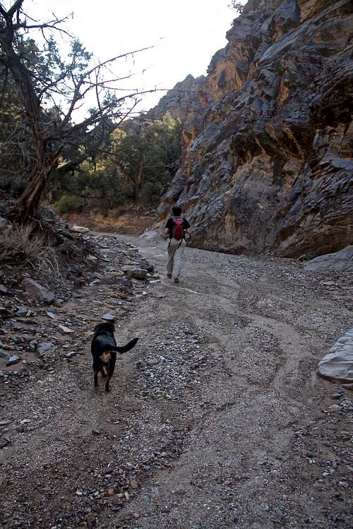
Chukar Trail - This is by far the most heavily used trail in Gunnison Gorge Wilderness. During the boating season kayakers, rafters and fishermen use the trail to carry down boats and gear for day and overnight trips. It can get crowded. However, if you go on weekdays or off season, you will be the only one there. (I hiked the trail twice and never met anyone on the trail or the parking area, but I did plan to come off season and mid week). The trail starts at the well marked parking area and is easy to follow.
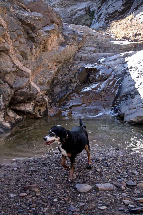
Descend down past the large BLM information board and fee registration station. Follow the well establish trail as it descends gradually through juniper trees into the canyon and ends by the river. In the close proximity of the river the trail follows a narrow, rock walled gorge. This is a nice place for studying geology. It is nice to see here the transitions from the hard, dark, erosion-resistant metamorphic rock of the Gunnison uplift to the softer, pastel shaded sedimentary layers laid down on top of it by ancient inland seas. You may spot chukars or mountain sheep that frequent this end of gorge.
 Chukar Trail Chukar Trail |
 Chukar Trail Chukar Trail |
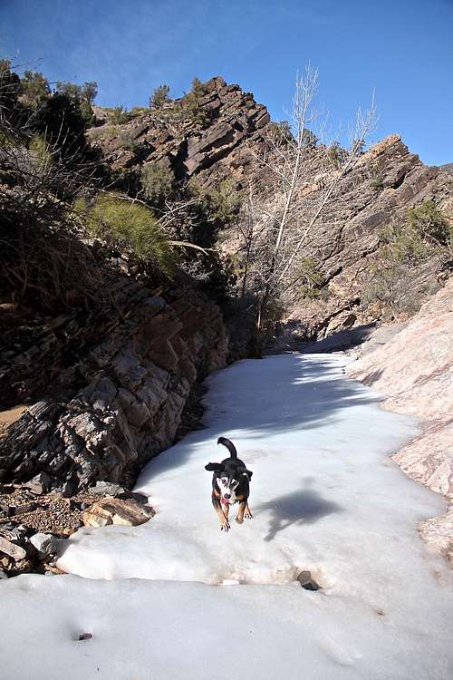 Chukar Trail Chukar Trail |
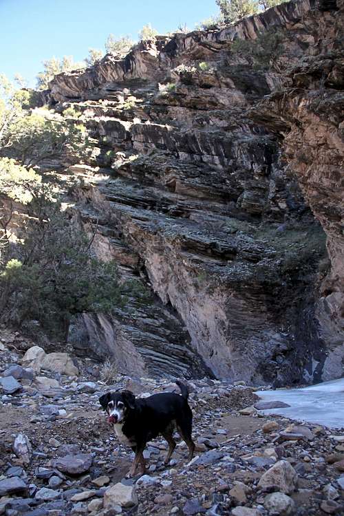 Chukar Trail Chukar Trail |
 Chukar Trail Chukar Trail |
 Chukar Trail Chukar Trail |
 Bighorn Sheep Bighorn Sheep |
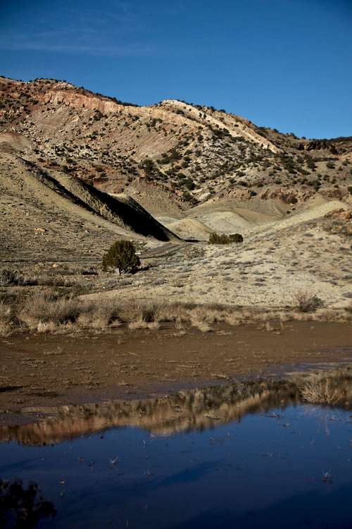 Scenery along Chukar Rd. Scenery along Chukar Rd. |
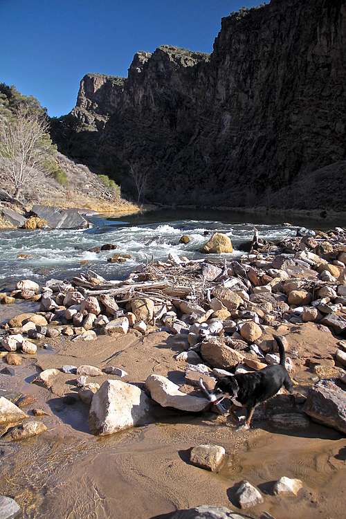 Gunnison River Gunnison River |
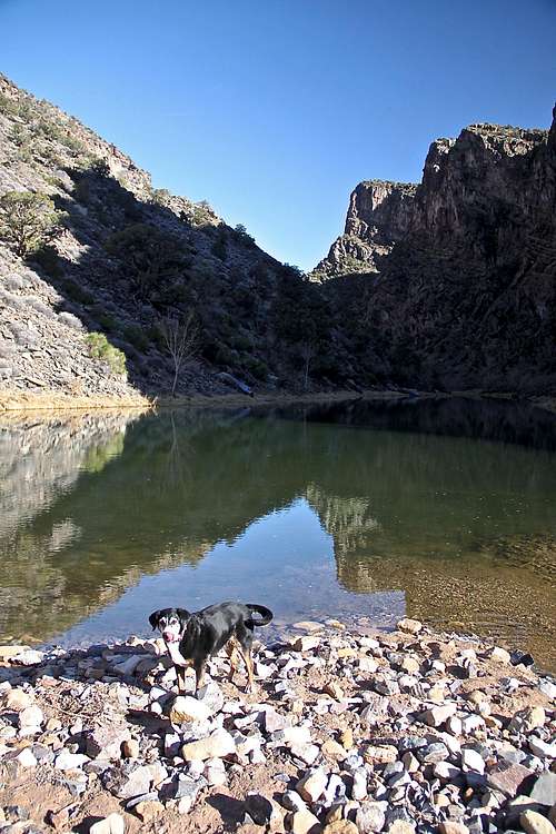 Gunnison River Gunnison River |
Fauna along the trail
Chukar on Chukar Trail
Desert Bighorn Sheep
It was interesting to see Chukar on the trail. Chukar is a game bird in the pheasant family.
The Colorado Division of Wildlife has reintroduced bighorn sheep into the area. The area supports over 50 bighorn sheep year round.
Other species include: deer and elk, coyotes, bobcats, rabbits, several species of raptors, and numerous small birds and mammals. Several thousand ducks and geese concentrate in the lower portion of the canyon during the winter.
The Gunnison river provides excellent fishing for trout.
Weather Information
Essential Gear
Comfortable hiking shoes. Consider trekking poles. Camera. Nice picnic sites - so pack your lunch/snacks.Sunscreen in the summer. Bring plenty of water.