
-
 4536 Hits
-
 87.76% Score
-
 25 Votes
|
|
Mountain/Rock |
|---|---|
|
|
46.20038°N / 11.50902°E |
|
|
Trentino Alto Adige |
|
|
Hiking, Mountaineering, Scrambling, Skiing |
|
|
Spring, Summer, Fall, Winter |
|
|
8547 ft / 2605 m |
|
|
Overview
Geographical classification: Alps - Eastern Part > Lagorai > Cima delle Stellune
Cima delle Stellune m 2605
Cima delle Stellune m 2605 is a massive mountain belonging to the Western Lagorai Group, a wide range lying in the Eastern part of Trentino. It's one of the most important peaks of the range and it's located along the chain running in the West-East direction from Passo Rolle to Passo Manghen, at the head of three important valleys: Val Moéna to North-West, Val Sorda to South and Valle Stue to West. Its summit marks the boundary amongst Cavalese, Molina di Fiemme and Pieve Tesino.
It is possible to climb Cima delle Stellune starting from different valleys, anyhow the upper section of the Normal route – starting from Forcella Val Moena m. 2193 - is always the same for the various approachs. The peak is frequented by scramblers and alpinists in summer and fall in reason of the interesting climb, the wild and wonderful environment and the remains of the WWI. In wintertime and early spring Cima delle Stellune may also be a satisfactory goal for ski-mountaineers.
La Cima delle Stellune m 2605 è una bella montagna appartenente al Gruppo del Lagorai Occidentale, una vasta area montuosa situata nella parte orientale del Trentino. È una delle cime più importanti e si trova lungo la dorsale che corre in direzione ovest-est da Passo Rolle a Passo Manghen, a capo di tre importanti valli: la Val Moéna a nord-ovest, la Val Sorda a sud e Valle Stue a ovest. La sua cima segna il confine tra Cavalese, Molina di Fiemme e Pieve Tesino. E' possibile raggiungere la cima partendo da diverse vallate, comunque la parte alta del percorso normale - partendo da Forcella Val Moena m. 2193 - è sempre lo stesso ed in comune ai vari avvicinamenti. La vetta è frequentata dagli escursionisti in estate e in autunno a causa della salita interessante, dell'ambiente selvaggio e meraviglioso e dei resti della prima guerra mondiale. In inverno e all'inizio della primavera Cima delle Stellune può essere un obiettivo soddisfacente anche per gli scialpinisti.
Getting There
The peak may be climbed rising along three different valleys: Val Campelle/Val Sorda, Val Moena and Valle Stue. The starting point to summiting from Val Campelle/Val Sorda is the village of Strigno, in Valsugana.
From the A22 Autobrennero exit Trento and take the road 47 to Pergine Valsugana, Levico, Borgo Valsugana and exit to Strigno. Reach the village of Strigno and here take the road rising to the Rifugio Crucolo, pass it and follow the road rising along Val Campelle, getting to Ponte Conseria m. 1468, Beyond which cars are not allowed. Parking.


The starting point for summiting from Val Moena is the village of Cavalese, Val di Fiemme
From A22 Autobrennero exit Egna-Ora and follow the road to Val di Fiemme to Cavalese m 1072 (24 km from Egna – Ora). From Cavalese take the road to Cascata m. 849, turn to left, cross a wooden bridge, leave on the left a road and continue on the main one, ignore another road (to Salanzàda) and reach a wide pull-out at about 1000 m. Parking. Not residents cars are not allowed beyond.


Route
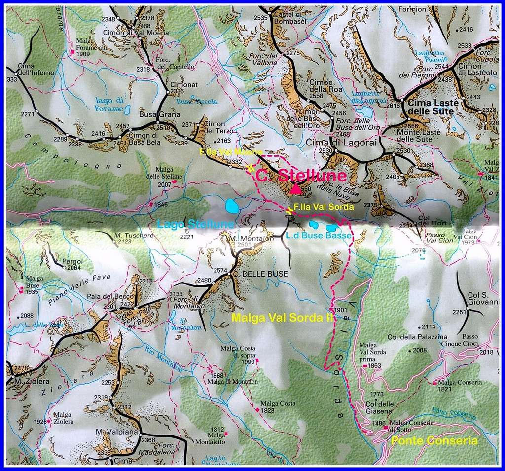
Cima delle Stellune Normal Route from Ponte Conseria
Difficulty: Alpine F
Difference in level: 1137 m from Ponte Conseria
A very interesting and panoramic route inside a wild environment, following at first a good path, then scrambling up a steep rocky slope
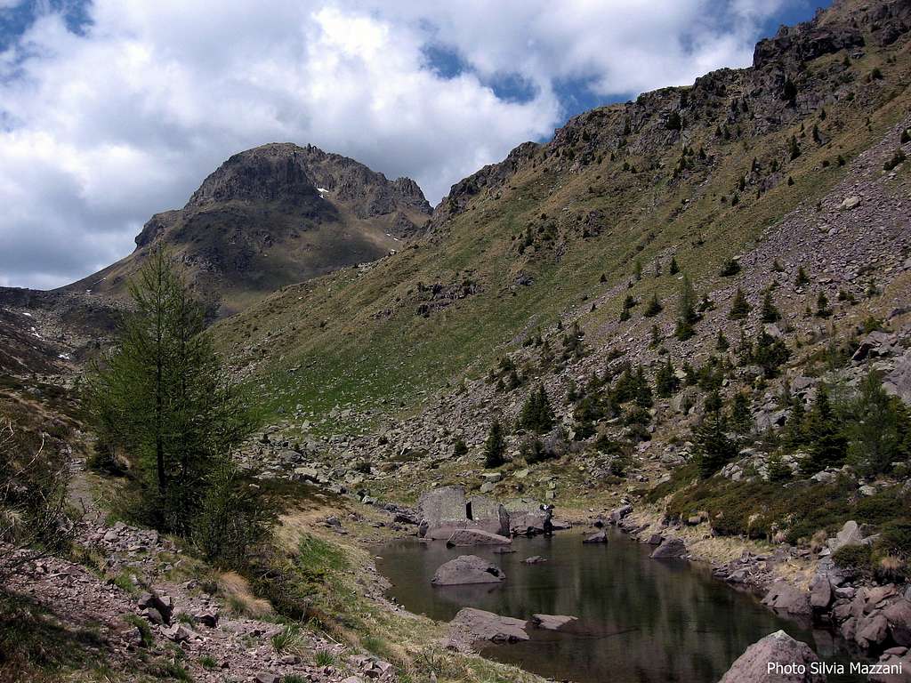
From Conseria Bridge m. 1468 cross the river and follow the road as far as the third hairpin. Some tens after the third hairpin a path starts on the left, entering the Val Sorda and skirting the river, then crossing it on a bridge, Ponte Quarelo m. 1660. After the bridge the path rises along the left side of the valley (right orographical), through a fresh wood of larchs and firs, at first with steep hairpins, then traversing to East and reaching the wonderful pastures of Malga Val Sorda II m 1901.
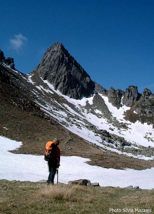
The superb rock pyramid of Montalon |
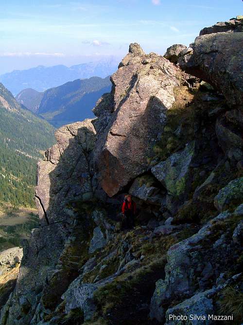
Scrambling up |
The path passes the alm and rises steeply, then turns to right (East). After the crossing of a stream and a brief climb the trail meets the path n. 312 coming from Passo Val Cion. Turn to left (North) and skirt the two nice water mirrors called Laghi delle Busse Basse, at the altitude of 2135 m and 2193 m .
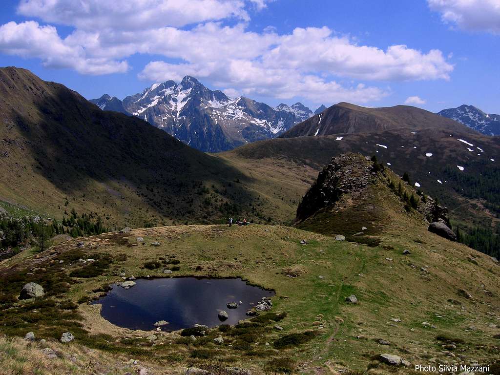
From here the saddle of Val Sorda and Cima delle Stellune are perfectly visible.Reach the Forcella di Val Sorda m 2256 (2 hours from Ponte Conseria) and turn to right along a path crossing the whole Western side of Cima delle Stellune and getting to the wide saddle of Forcella di Val Moena m. 2193.


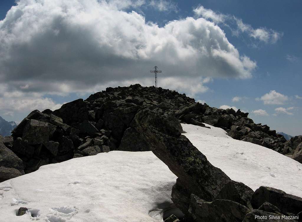
During the hike you can enjoy the superb view of Lago delle Stellune, located about 200 meters below. Cross the saddle and head to East, following the path n. 321 only for a few meters and leaving soon it to take on the right the narrow military track leading to the summit. At first the route overcomes a very steep rocky slope with some easy climb and then crosses the steep slope where a snow field remains till last Spring. Then the steepness begins to decrease. After an easy section, the track becomes steep again and leads to the iron summit cross and summit log. The views are wonderful.


Descent: following the same route
Essential gear
No particular gear required for summer ascents. In early summer crampons and axe are useful.
Red Tape
No fees no permits required. Cars are not allowed on the road after Ponte Conseria.
When to Climb
Summer and Fall are the best period for scramblers and hikers. Naturally the best period for ski-mountaineering goes from February to May.
Meteo
Meteo Trentino
Dolomiti Meteo - Trentino
Guidebooks and maps

“Lagorai – Cima d’Asta” - Collana Guide dei Monti d'Italia CAI-TCI-Guidebooks
- Maps
"Lagorai - Cima d´Asta" KOMPASS N. 626 "Lagorai" Tabacco scala 1:25.000 – Foglio 014