
-
 2034 Hits
-
 84.27% Score
-
 18 Votes
|
|
Mountain/Rock |
|---|---|
|
|
44.53410°N / 9.50245°E |
|
|
Emilia-Romagna - Liguria |
|
|
Hiking, Sport Climbing, Scrambling |
|
|
Spring, Summer, Fall |
|
|
5335 ft / 1626 m |
|
|
Overview
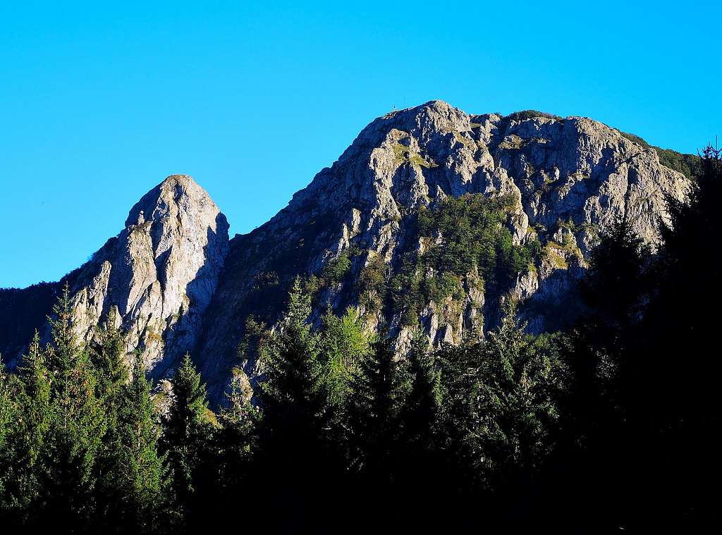
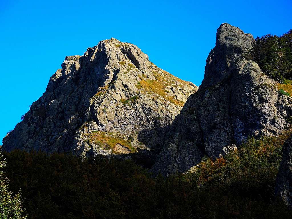
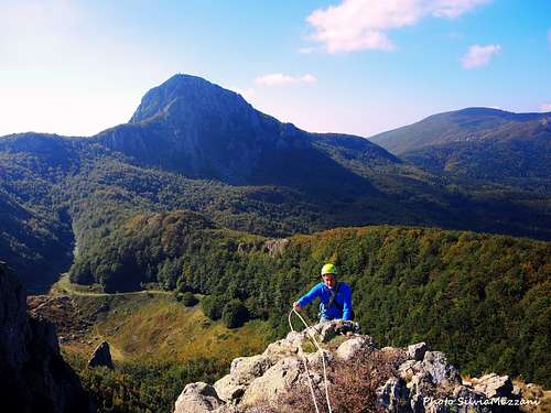
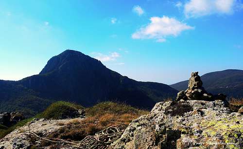
Cima Janusz Korczak 1626 m
The scenic Monte Penna mountain area with its lush Apennine beech forests is located in the Appennino range, group Penna-Aiona-Maggiorasca, between the provinces of Parma and Genova. A fine unnamed rocky peak at an altitude of 1626 m is located in this group to the North-East of Monte Penna main summit, between Passo del Chiodo and La Nave. It was enhanced in the summer of 2015 by opening a short but interesting route of four lengths of rope running along the South ridge of the peak. Considering that this summit was unnamed, the first climbers of the route proposed the denomination of Cima Janusz Korczak, Polish doctor and pedagogue deported to Treblinka. The route is instead dedicated to the character of Irena Sendler, a Polish nurse who rescued about 2500 children during the Second World War.
This is an area of great environmental and landscape beauty and is attended throughout the year by fans of multiple disciplines: from walkers to climbers during the summer, from climbers on ice and mixed routes to the cross-country skiing and walkers with snowshoes along the magnificent beech forest rings that wind around the mountains during the winter. The views from the summit are broad and open, from the Tyrrenian sea in the South West direction and further away the Alpi Apuane, to the close Monte Penna with Pennino, to Monte Maggiorasca in the West direction.
Getting There
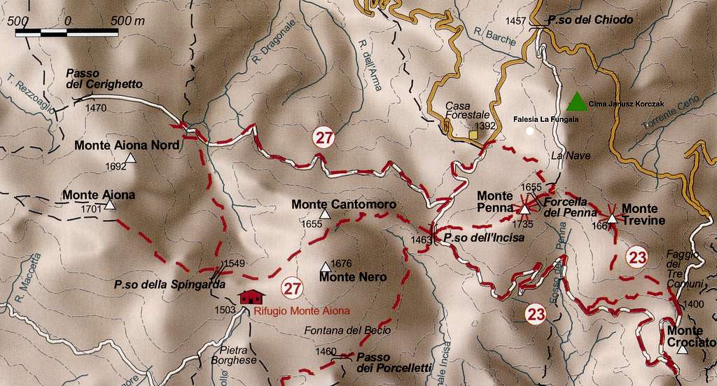
The starting point to climb the mountain is the parking lot near Passo del Chiodo 1457 m. The Monte Penna group is located on the border between the provinces of Parma and Genova and very close to the province of Piacenza, so it's possible to reach Passo del Chiodo from different sides.
- from Parma across Pontestrambo - Take the highway Parma-La Spezia, exit Borgotaro, pass Borgotaro and Bedonia, pass Bedonia and when you reach the locality Pontestrambo, leave the main road and turn right towards Passo della Tabella, where you continue on the asphalt road to the Passo del Chiodo, then take the road to Casermette del Penna
- from Parma across Passo del Tomarlo - Take the highway Parma-La Spezia, exit Borgotaro, pass Borgotaro and in Bedonia take the road to Anzola and Passo del Tomarlo. From Passo del Tomarlo turn to left on the road to Passo del Chiodo-Monte Penna, here take the road to Casermette del Penna and Casa Forestale
- from Lavagna follow the signpost to Cogorno and Carasco, then take the road SS586 in the direction of Santo Stefano d'Aveto. Cross the Passo della Forcella and continue driving to the villages of Cabanne and Rezzoaglio. In Rezzoaglio take the road SP654 towards Santo Stefano d'Aveto, pass Magnasco and Villanoce and reach Gramizza. Here follow the road signposted Foresta del Penna, pass Amborzasco and Casoni, reaching the Rifugio Casermette del Penna
- from Piacenza take the road SP 654 (Val Nure) and reach the Passo del Tomarlo, from here to Passo del Chiodo and Rifugio Casermette del Penna
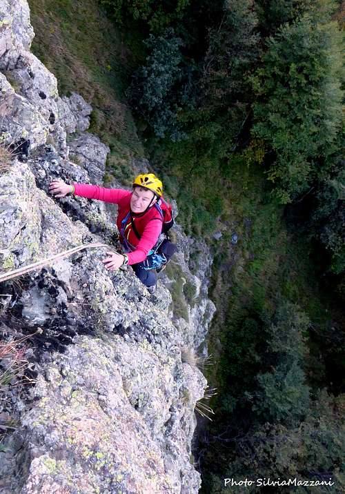
Spigolo Irena Sendler
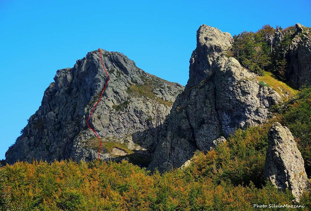
Cima Janusz Korczak South ridge (Spigolo Irena Sendler) - French scale
Difficulty: 5c max, 6a for the Bitterol variant
Length: 130 m
Equipment: the route is well equipped with bolts
Exposure: South
Pleasant and rewarding climb located in a fine and panoramic environmental context. The route is fully equipped with bolts.
Approach
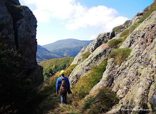
From the Tomarlo Pass descend briefly towards S. Stefano d'Aveto, take the forest road of Monte Penna on the left and reach the Passo del Chiodo 1457 m. Parking area. From the pass take a cart track closed by a bar (signs for "La Nave", sign no. 831). After a few bends the path reaches a kind of saddle in the woods (pole), from where it descends slightly, reaching a small grassy clearing, beyond which the cart track begins to descend more markedly towards the valley called "La Nave". Just before the clearing, leave the main path and exit to the left, descending towards large boulders, then go up the slope on the opposite side towards the base of the evident face of the Cima Janusz Korczak. Once you reach the base, cross to the right until you reach the south corner (30 minutes from the parking lot).
L1 - First climb easily along inclined rocks, then overcome a steeper wall going to the left to belay on a small terrace, 4c 30 m
L2 - From the belay exit to the right and go up a grassy slope to the left, aiming at a kind of oblique dihedral-chimney to the left. Climb it and exit on a ledge where you stop, 4a, 30m
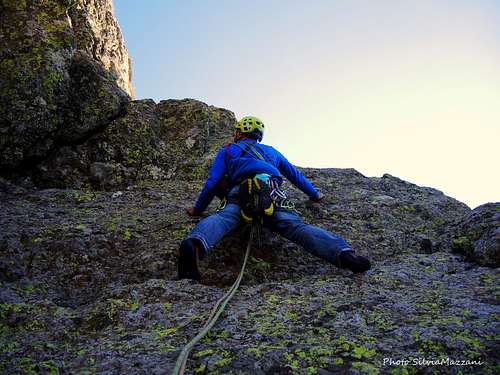
L3 - Climb up in the direction of a spike on the left, overcome a short wall and on a grassy slope reach a comfortable belay under a compact slab, 4b, 30 m
L4 - Climb the slab (5a), exit right on an edge, then obliquely on the left on rocks gradually easier to the belay at the end of the wall, 5a, 30 m
Variant Bitterol: Alternatively - from the third belay below the compact slab - it's possible to climb a crack (6a) on the left of the originale route slab, then a slab with small clear holds, reconnecting to the last fix in common with the original route.
Climb the easy rocks of the summit ridge, getting shortly to the summit cairn
Descent: from the top you go down to the east (right) through a meadow and easy rocks, heading towards a small fork, beyond which downclimb a grassy gully with an easy passage on rock, following which you quickly return to the attack - 10 minutes from the top
Essential gear
Normal climbing equipment (10 quickdraws, 2 x 60 m ropes, helmet, harness).
Red Tape

No fees no permits required. This mountain area belongs to the Parco Naturale Regionale dell'Aveto, a protected area of considerable natural and landscape interest. This park shows a high level of environmental preservation, so let's respect the common rules for the preservation of the environment.
When to Climb
The best period goes from May to the end of October
Accomodation
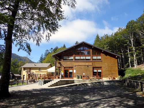
- Rifugio Casermette del Penna
- Rifugio Monte Penna
- Rifugio Faggio dei Tre Comuni
Meteo
Meteo ARPA Emilia-Romagna
Meteo ARPAL Liguria
Guidebooks and maps

NEW - "Arrampicaparma" III updated edition - Alberto Rampini, Silvia Mazzani - IDEA MONTAGNA 2019
- "Appennino Ligure e Tosco-Emiliano" - M. Salvo, D. Canossini - Collana Guide Monti d'Italia TCI-CAI, 2003
- "Vette e sentieri in Val d'Aveto e valli circostanti" - Fabrizio Capecchi, Andrea Parodi - Andrea Parodi Editore