
-
 724 Hits
-
 80.49% Score
-
 12 Votes
|
|
Mountain/Rock |
|---|---|
|
|
46.75511°N / 11.79562°E |
|
|
Bolzano |
|
|
Hiking, Skiing |
|
|
Spring, Summer, Fall, Winter |
|
|
7198 ft / 2194 m |
|
|
Overview
Cima Lasta/Astjoch 2194 m
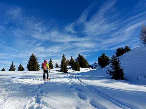
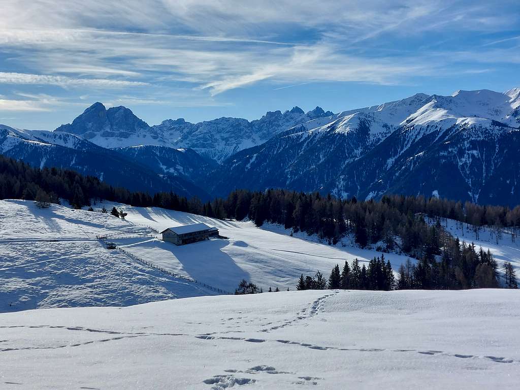
Cima Lasta 2194 m aka Giogo d'Asta (Astjoch is instead the Tyrolean toponym) is the most important peak of the Lusneralm - Alpe di Luson, a grassy wavy plateau between the Badia, Pusteria and Isarco valleys. The mountain is located on the edge of the Odle/Geisler dolomitic group in the area nearby the Val Pusteria/Pustertal bordering the Putia/Plose group. It is an essentially grassy peak that can be traveled on in all seasons, becoming much more interesting during the winter months, when it offers an excellent opportunity for an ascent on skis or snowshoes, or with crampons, depending on the snow conditions. Very famous and popular in reason of its beautiful environment and broad panorama, it can be climbed from the side of Alpe Luson, an open and panoramic plateau popular with cross-country skiers, by means of two itineraries, quite similar, which converge at the upper part.
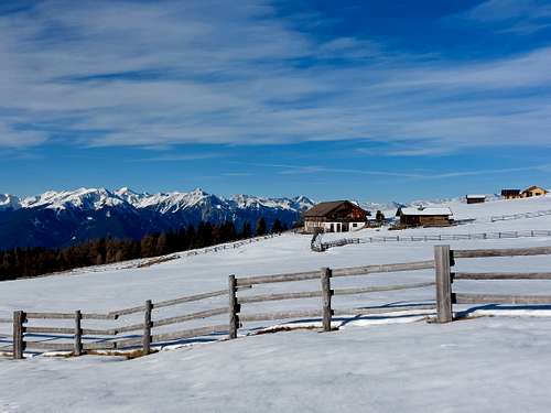
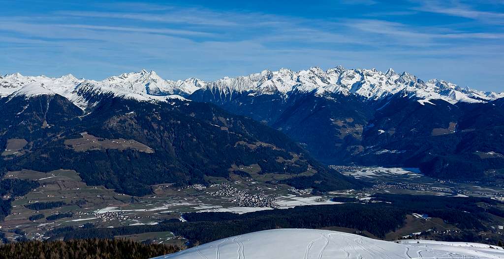
Cima Lasta offers a fine summit panorama towards the Sass de Putia and the Odle, the Plose, the Monti di Fundres and up to the peaks of the border ridge between Italy and Austria. Along the paths to the summit, you go through the large pastoral environment of the Rodengo and Luson Alps with the presence, moreover, of various refuges along the way. An other route climbs up from the Val Pusteria (longer). In this case, the starting point is Ellen-Elle, a tiny fraction of San Lorenzo di Sebato, a few km. from Bruneck - Brunico.
Getting There
Road to the Alpe Luson
From A22 Autobrennero exit Bressanone, drive in the South direction to reach the town and here take the road SP30 to Alpe Luson. Ther are two routes, the first starts from the parking Zumis near the village of Luson, while the second starts from the Tulper Gampis parking lot. To reach this parking take the road to Rodengo and at the crossroad follow the right direction (signpost "Parkingplace"). Pass the first Parking lot (Herol) and drive up to the Tulper Gampis Parking lot (open only in winter).
Road to Elle
Another route starts from the village of Elle in Val Baadia. From A22 Autobrennero exit Bressanone and take the road to Brunico (Val Pusteria), reaching San Lorenzo di Sebato, a few km. from Bruneck - Brunico. Continue along the road towards Val Badia. After about 2.3 km, turn right, following the signs to "Elle". On a narrow paved road, past the few houses of Elle, you reach the "Kreuzner" parking lot at 1560 m.
First route from Alpe Luson - From Zumis Parking lot
Cima Lasta from Alpe Luson (from South-East)
Summit quote: 2194 m
Difficulty: E, EI in winter
Difference in level: 450 m from the Zumis parking lot
Exposition: S
Starting point: Zumis parking lot 1749 m
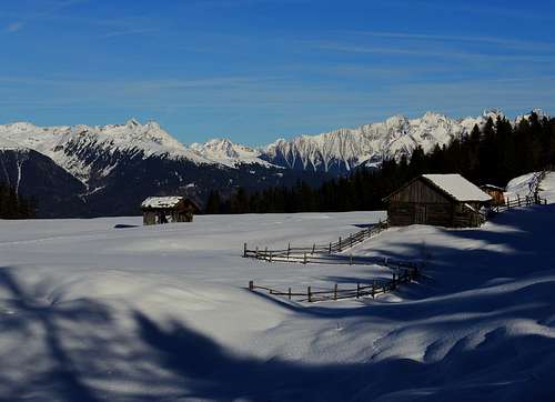
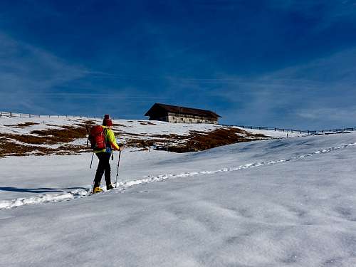
From the Zumis car park 1749 m (reachable on a narrow road from Luson), follow the path n. 4 up and down in the woods towards the Roner Hütte 1832 m. On a mule track you reach the refuge from where you follow the track number 2 which leads, among wide pastures, to the Pianer Kreuz chapel. Then, after crossing the magnificent pastures of the Lusner Alm, you reach the Campoforte/Starkenfeldhütte refuge 1936 m. The Rastner Hütte is also located nearby.
From Rifugio Campoforte, follow the trail number 67 which leads to meet some crossroads. Now the trail becomes 2/67 which, still following the road, reaches a grazing plateau between the Priller and Steiner pastures.
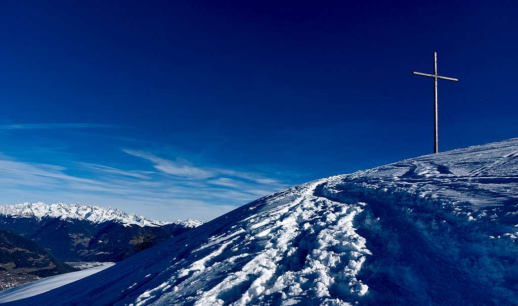
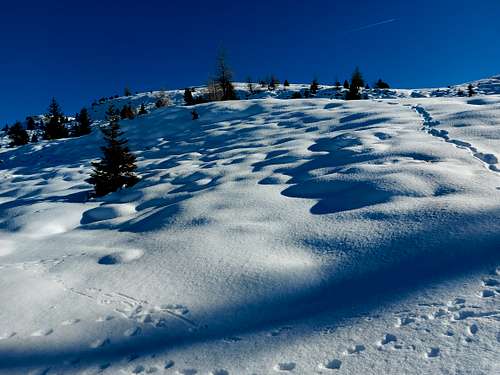
Leave the road and follow the wide track to the left (signs, trail sign 67), which begins to climb at steeper turns. Near a plateau (signs) turn left again leaving the mule track and following a path which with some steeper stretches reaches the broad and flat summit of the Cima Lasta/Astjoch 2194 m. High cross with summit book, stone orientation table for the recognition of the wide circle of peaks visible from the summit. Cima Lasta offers a very broad panorama towards the nearby Sass de Putia and the Plose, then the Vedrette di Ries, the Alti Tauri, the Dolomites and the Pusteria and Isarco valleys
Second route from Alpe Luson - From Tulper Gampis parking lot
Cima Lasta from Alpe Luson (from South-East)
Summit quote: 2194 m
Difficulty: E, EI in winter
Difference in level: 400 m from the Tulper Gampis parking lot
Exposition: SE
Starting point: Tulper Gampis Parking lot 1809 m
From the Tulper-Gampis car park, take trail n. 3 (signpost Starkenfeldhütte) which climbs slightly uphill alongside a fence.
The road, now marked 67, continues and reaches a clearing from which the path that will take us to the summit branches off. With a first stretch of walk in the woods we arrive at the junction with path 10 for Campill and from here with a steep climb we aim decisively for the top.
At an altitude of 2194 we reach the cross erected on the panoramic peak of the Astjoch. A huge cross with summit book, stone orientation table for the recognition of the peaks all around. Below us we have the Val Pusteria.
Route from Elle
Cima Lasta from Elle (from North)
Summit quote: 2194 m
Difficulty: E, EI in winter
Difference in level: 635 m from Kreuzner parking
Exposition: North
Starting point: Kreuzner parking, Elle
Follow the winter toboggan run for a short while, and after a farm, take the path 67, in the SW direction, reaching the Walderalm 1908, in a beautiful malga location overlooking Brunico. Continue along the wood crossing a forest road, at the beginning of the pastures of the Alpe di Luson. At first head to the left, then return to the right. you go up the broad grassy ridge North of the Einhauserer farms reaching the wide summit with its high cross.
Red Tape
No fees no permits required. Please note that the Tulper Gampis parking lot is open only during the winter season
When to Climb
All year long
Accomodation
Different possibilities in Alpe Luson.
Meteo
Guidebooks and maps
Kompass 1:25.000 Val Pusteria, sheet 1