Cloudripper: What's in a Name?
For my 2nd annual "Fly across the country just to hike for a few days" trip, the first question needing resolution was where to go. I had an enjoyable trip
climbing Tahoe's highest peaks the summer prior, and felt like it was time to move to higher, more challenging terrain. Some folks in the forum recommended the Mammoth Lakes / Bishop area as a good next step, and I quickly booked the flights and hotels. My first trip to the Sierra was officially scheduled. The only bad news was that I had 11 months to wait.
During my initial survey of which peaks to climb, I was looking for fun class-3 terrain in the 12-13k feet range. One peak immediately stood out, simply because of its name:
Cloudripper. With a name that cool, I simply had to include it on my list. Fortunately it had an enjoyable-looking class-3 route (west chute), so the decision was easy to make.
Months later as I was finalizing my plans, the steepness of the chute became more apparent as I was reviewing pictures on SP. Having never climbed a steep chute like this, I asked in the forums if a helmet would be adviseable for rockfall protection -- the answer was a resounding "yes". Amazon came to the rescue as usual, and I was ready for what I pretty much knew would be my most challenging hike yet -- the climb to Cloudripper from South Lake, and the descent over Vagabond on the way back.
Cloudripper was slated for day-3 of my trip. I climbed Mt. Dana on the first day to make sure I'd be good at ~13k altitudes (having never been above 11k). No problem. The second day was some harder terrain at similar altitudes. Now it was time for what was destined to be the highlight of the trip.
The Hike
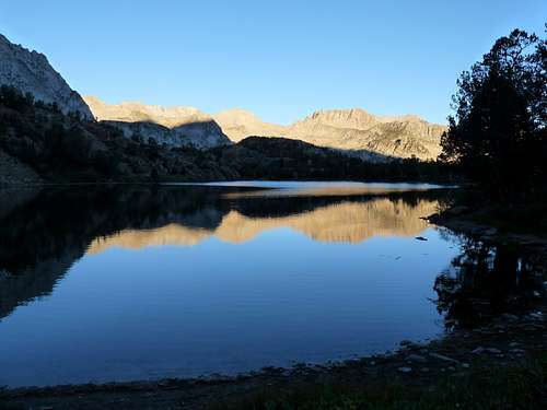
The start from South Lake at 05:30 brought immediate relief -- it wasn't windy like the 2 days prior. Rain chances were also pretty much 0%. As the sun rose and lit up the tops of the peaks to the west, things were looking good.
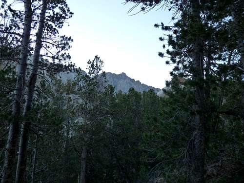
![Cloudripper2]() Cloudripper in the distance
Cloudripper in the distance![Sun4]() Sunrise
Sunrise
The first part of the route is 3-4 miles of on-trail travel, to and around Chocolate Peak and the Chocolate Lakes.
![Cloudripper5]() From afar; Chocolate Peak visible on the right
From afar; Chocolate Peak visible on the right![Cloudripper6]() Heading to the base
Heading to the base
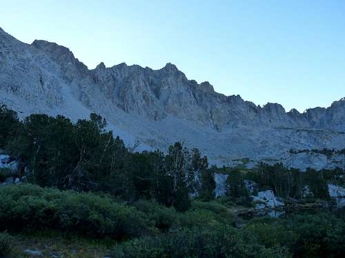
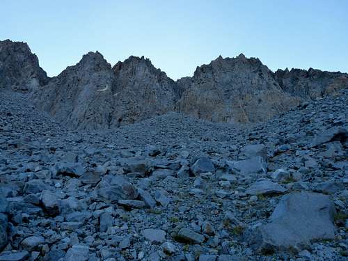
Once past the upper Chocolate Lake (~11.1k feet), you veer left and begin climbing the talus on the west slope of Cloudripper. The west chute and the summit loom large.
![Cloudripper7]() Heading to the base
Heading to the base![Cloudripper8]() At the base; West Chute straight ahead
At the base; West Chute straight ahead
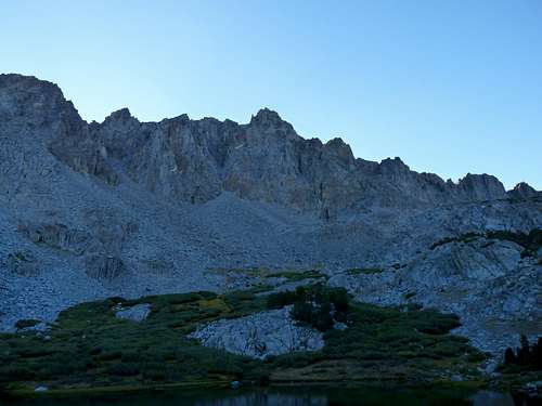
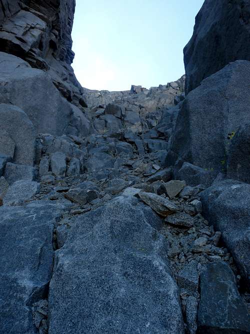
Once at the base, a decent amount of talus separates you from the chute. Easy scrambling takes you upwards.
![Cloudripper9]() Approaching the chute
Approaching the chute![Cloudripper12]() Approaching the chute
Approaching the chute![Cloudripper13]() Approaching the chute
Approaching the chute![Cloudripper15]() At the chute
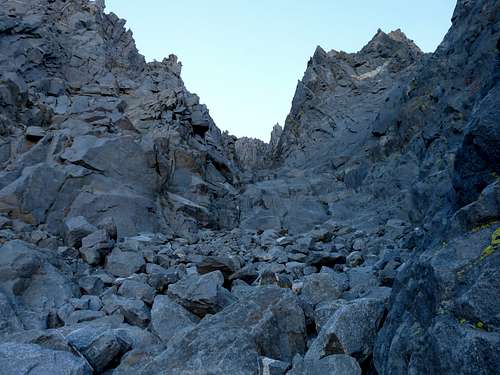
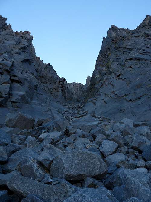
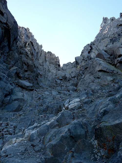
At the chuteThe Chute
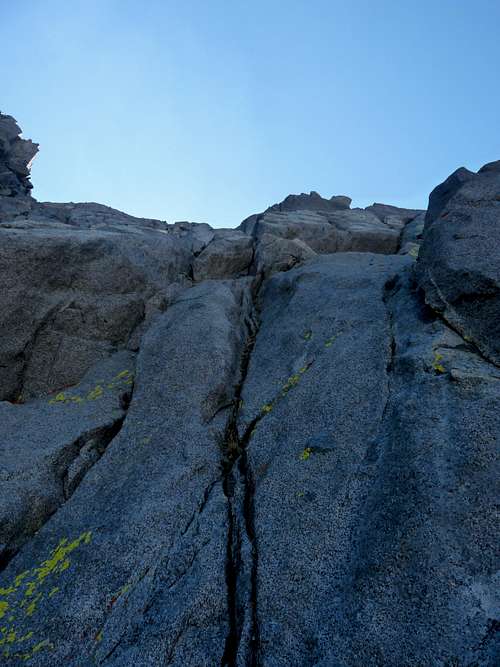
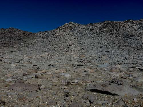
You enter the chute around 12k feet, leaving about 1500 feet of in-chute climbing to reach the summit. Terrain varies between loose scree, stable talus, and solid granite of various steepness depending on where you choose to be in the chute. Staying on the right or left walls mostly keeps you on solid class-3 granite (with optional class 4-5 climbing depending on how high up on the walls you go). I found the climbing to be great fun all the way -- steep enough to be exciting, but with lots of holds (perfect for a climber like me who isn't interested in putting himself in significant danger).
![Cloudripper18]() The West Chute
The West ChuteRoute finding is a non-issue until you get to a "Y" about halfway up the chute. (It's actually more like a 3-pronged pitchfork, as there's a narrow "far left" option which was the steepest-looking of the 3 -- maybe even unpassable without rope.) My pre-hike research (trip reports and the Cloudripper climber's log on SP) was no help here because some people said go left and others said go right. So I figured I'd wing it. I ended up going right because there was about ~50 feet of loose gravel/scree to deal with on the left before reaching more solid rock, while the right side was solid from the get-go.
It was around this point that it hit me that I was in complete silence. No wind, no planes, and no other people anywhere in the chute. I rested for a few moments to take it all in. I had been waiting for this for almost a year, and here I was. Doesn't get any better than this.
![Cloudripper21]() Steep walls in the chute
Steep walls in the chute![Cloudripper24]() Steep walls in the chute
Steep walls in the chuteAfter the "Y" it's pretty much "Find your own way to the top". The granite got steeper the further up I went, to the point where I was concerned about potentially having to climb back down if for some reason I ran into an obstacle more difficult than class-3.
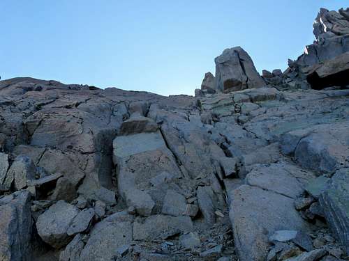
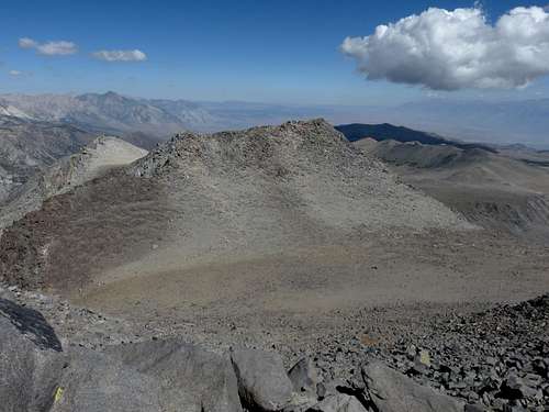
But all went well and I reached the ridge a couple hundred feet to the south of the summit.
![Cloudripper28]() On the ridge
On the ridge![Cloudripper29]() Looking down from the top of the chute
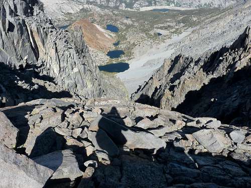
Looking down from the top of the chuteA short scramble later and I had made it. The views did not disappoint, and the non-existent wind (which I wouldn't have thought possible at 13,525 feet) allowed me to hang out for a good half hour or so and take it all in.
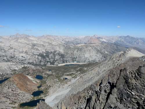
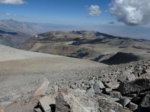
![Cloudripper32]() Looking southwest (South Lake in the middle)
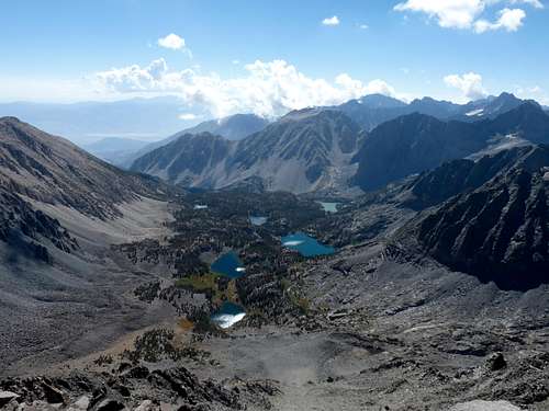
Looking southwest (South Lake in the middle)![Cloudripper33]() Looking east
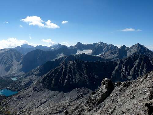
Looking east![Cloudripper34]() The Palisades
The Palisades
The Descent
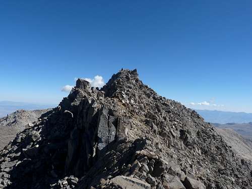
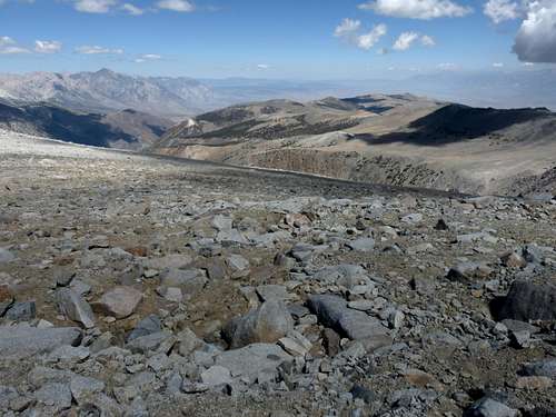
After that, it was time to start the downclimb. Back in the planning phase I had decided against downclimbing the chute for two reasons: It's steep, and it's always a bonus to have a different route back to the car for variety purposes. The route down and over Vagabond (a neighboring peak to the north, and about the same height) was a logical choice. I would head towards Green Lake, pick up a trail heading northwest to Brown and Bluff lakes, then another trail heading southwest back to the South Lake parking lot.
Going over Vagabond entails about 500ft of downclimbing on Cloudripper's north slope, then back up Vagabond about the same amount. It's pretty much all medium/large talus.
![Cloudripper36]() Vagabond from Cloudripper
Vagabond from Cloudripper![Cloudripper37]() Walking up Vagabond
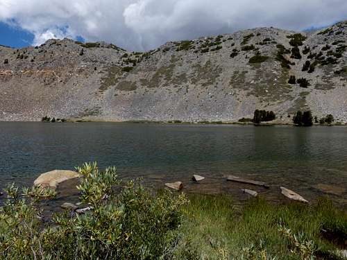
Walking up VagabondOnce I reached Vagabond, I saw what lied ahead to the south -- seemingly endless talus between me and Green Lake. I knew it was going to be a slow, boulder-hopping trek to the lake. And it was -- at least 2 hour's worth. The talus was mostly stable, but just loose enough that every step had to be planned; and steep enough that hands often had to be used for balance. The lake never seemed to get any closer whenever I looked up at it. But finally I arrived and found the westbound trail.
![Cloudripper40]() Green Lake in sight
Green Lake in sight![Cloudripper41]() Endless talus
Endless talus![Cloudripper42]() Getting closer, maybe
Getting closer, maybe![Cloudripper43]() Finally there
Finally there(Shortly before getting to Green Lake, I noticed a loose chute off to my left (West) which looked a lot more descent-friendly than the boulder route that I had chosen. One would get there by heading northwest along a ridge from Vagabond's summit. My view wasn't great so I can't say for sure if the whole route is passable, but if I ever do Cloudripper again I'll be checking it out for sure.)
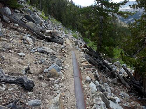
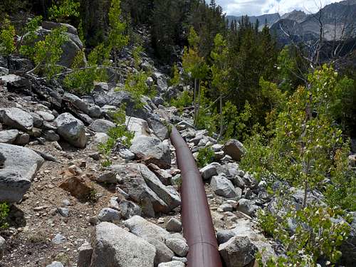
A guy at Green Lake gave me what turned out to be a pretty good tip. Once the trail passes Bluff Lake heading northwest and starts to steeply descend, you can make a left turn and follow an old pipeline (literally walking on the pipeline) directly back to South Lake parking. This cuts the distance significantly, and also avoids having to descend and re-climb several hundred feet. By the time I got to the pipeline, additional elevation gain was the last thing I needed. The pipeline was a fun way to avoid it, and I was back to the car at around 2pm and on the way to Bishop for a seriously big meal.
![Cloudripper45]() Follow the pipeline
Follow the pipeline![Cloudripper46]() Follow the pipeline
Follow the pipelineLooking forward to returning to the Sierra next year. In particular, the view of The Palisades from Cloudripper immediately had me thinking "I gotta go there." Only 11 months to wait.


Comments
Post a Comment