
-
 21483 Hits
-
 71.06% Score
-
 1 Votes
|
|
Route |
|---|---|
|
|
51.09501°N / 115.13861°W |
|
|
Hiking, Mountaineering, Trad Climbing, Ice Climbing, Mixed, Scrambling |
|
|
Spring, Fall, Winter |
|
|
Most of a day |
|
|
WI3 |
|
|
5.7 (YDS) |
|
|
6 |
|
|
III |
|
|
Overview
An ultra classic mini alpine climb. It combines ice, rock and snow, all at a moderate grade and high quality. Several waterfall ice pitches, WI3, lead to snow gullies and rock bands, 5.7 with many options higher up to add more rock pitches of varying difficulties. With snow fall, the rock section can be quite challenging. This climb is a great experience for those who want a taste of winter alpine climbing, covering a lot of different terrains in a somehow short route.
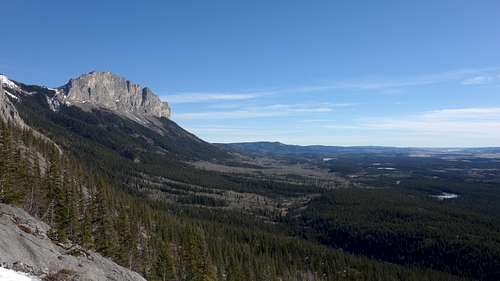 View across to Yamnuska Peak from the first ice step
Getting There
From Canmore, drive east toward Calgary on Highway 1A, and park in a paved lot on the South side of the Highway 1.7 kilometers east of the Continental Lime Plant. Cross the Highway to a gated travel road that accesses the dump, and walk up the road about 100 meters until a full fence gate. Follow a good trail to the right, and along the outside of the fence to the NE corner of the dump, then turn left and continue along the north boundary of the fence to the NW corner, where the trail continues through the trees towards the large gully. There is unfortunately a ton of garbage in this area due to wind blowing the crap out of the dump. Follow cairns up to treeline and continue up a boot path up the base of the ice which is always a good WI3 flow to start the route.
Do not drive up to the road even if the gate is open as you will likely get towed or the gate closed behind you (the gate closes at 4:30 in the afternoon).
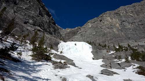 First ice step First ice step |
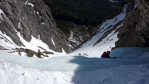 One of the WI2 steps One of the WI2 steps |
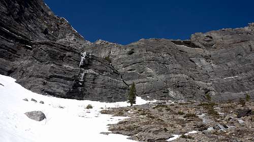 The left facing crack The left facing crack |
Route Description
Follow 100 meters of easy angled snow and ice to a 25 meter ice fall and climb the WI3 ice. Make an anchor in the ice at the top to belay anyone. Most parties solo this ice, as well as all the subsequent ice on the route since it is mostly WI1 and 2. Continue up the canyon past a couple short ice steps, to where it opens up into a huge bowl. Turn left here, past another WI2 step, and ascent to the right end of the first rock band. The left facing crack is a good 30 meter pitch averaging 70-80 degrees in steepness. The slab offers many features to climb on and I felt the difficulty wasn't greater than 5.6. A good tree anchor is found at the top of the pitch. Just beyond is a short 10 foot 4th class scramble to where it opens up again into a large boulderfield. Pass a double bolt rappel anchor on a large boulder, and scramble up the talus, trending right towards the long sweeping ledge leading northward. See the route topo below for the options on the upper face. Choose your finish and once you reach the ridge between Loder Peak and Goat Mountain, walk the ridge south to the summit of Loder Peak.
For the descent, after reaching the summit of Loder Peak, most people will opt to follow the southwest ridge directly to the 1A highway which will take roughly 2 hours. With your big boots on, this will frankly suck, as you will then have to walk the highway an additional 1.2 miles back to the trailhead. If no one is climbing below you, you may decide to rappel the route, which is not too bad but double ropes will be required. You will likely also have to make your own anchor to rappel the upper part of the route. An alternative descent is straight down the back of the ridge into Jura Creek, but this is a bit more difficult requiring some route finding.
 Coire Dubh Intergrale Route Topo with Upper Variations Shown
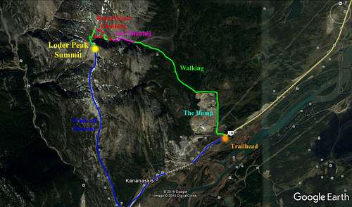 Coire Dubh Intergrale GE Overview Map
Gear
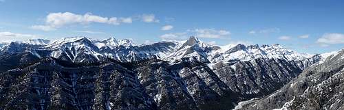
Loder Peak summit panorama
-2 Ice tools
-A few ice screws
-Small cams up to BD 2"
-Small to medium nuts
-Slings, cordelette.
-2 60 meter double ropes
Be very aware of parties above you knocking rocks down. We did the route as the last party on a beautiful Sunday with at least 12 other people on the route that day. We also descended the route afterwards. Needless to say, my eyes were always watching above me.
Camping/Red Tape
Car camping is common at the trailhead, and at many other pullouts along Highway 1A. Better to sleep in your car than put up a tent though. No permits or fees required to climb here.
External Links
Canadian Rockies Avalanche Forecasts