
-
 19853 Hits
-
 80.85% Score
-
 13 Votes
|
|
Canyon |
|---|---|
|
|
47.77711°N / 90.27635°W |
|
|
Hiking |
|
|
Overview
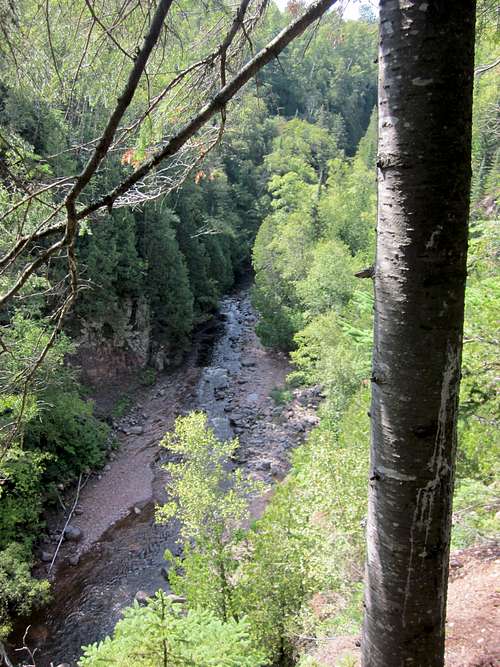
In 2013 I made my first trip to the North Shore of Lake Superior, and fell in love. Dramatically different than the rest of the midwestern United States, it offers accesible wilderness to an area of the country badly strapped for it. The Northwoods cannot completely hide the rocky ridges of reddish purple volcanic rock that 'soar' 1300 feet. The interconnected lakes of the Boundary Waters are legendary among canoeists. And of course, it all is bordered by the magnificent shoreline of the world's largest freshwater lake. To this list one has to add the canyons that cut through the hard igneous cliffs of the Sawtooth Mountains, almost all sporting beautiful waterfalls. Many of these have become State Parks worth exploring. The gorge of the Devil Track River, while not a State Park, is wild and challenging, and has brought me back repeatedly, in both summer and winter.
In addition, one has the option of taking a trail along the rim, or of cautiously exploring the trail-less gorge itself.
The name of this river comes from the Objiwe. “Devil Track River” is badly mistranslated "Manido bimadagakowini zibi", meaning the ‘spirits (or God) walking-place-on-the-iceriver.’” (MN Historical Society).
In Devil Track Gorge - Summer
 In Devil Track Gorge - Winter
Getting There
Grand Marais Minnesota is 2 hours along the north shore of Lake Superior from Duluth, and makes an excellent base for exploring the North Shore. There are two starting points, depending on what your plans are in exploring the gorge.If exploring the Devil Track River trail (a portion of the Superior Hiking trail) that parallels the rim of the gorge, drive 6 minutes northeast of Grand Marais on Route 61 to County Route 58, and turn left. In about a mile or so a parking area for the Superior hiking trail will appear on your left. This is your starting point for the Devil Track hike alongside the canyon.
If exploring the gorge itself, which has no trails and will require wading in the summer or snowshoeing/skiing in the winter, you can park before or after the Route 61 bridge over the Devil Track, about 5 minutes from Grand Marais along Route 61. Do not park on the bridge itself. There are wide shoulders near the bridge, and it is apparently not an issue to park there. You can drop down to the River from either side of the bridge.
Along the Rim: Devil Track River Trail
The Superior Hiking Trail is a continuous 310 mile trail that stretches across the North Shore from Duluth to near the Canadian border. A great hike that parallels the Devil Track gorge takes a section of that trail for three and a half miles beginning at the parking lot of route 58.
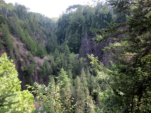
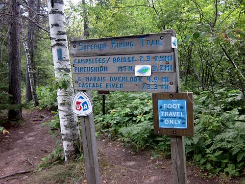 Devil Track Trailhead
Like the rest of the Superior Hiking trail, this hike will be an up and down hike through deep forest. While the trail generally follows the canyon rim, views of the gorge are sporadic, though the ones that you see into this steep walled gorge are very fine.
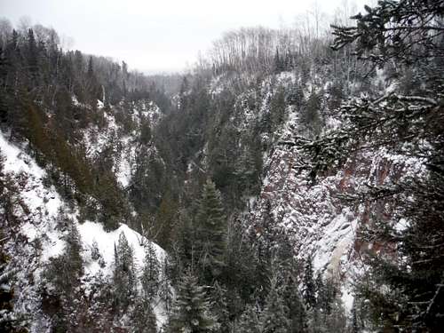
Devil Track Gorge - Winter
 Devil Track Gorge - Summer
The trail is well maintained and well traveled. Even in winter in may be packed down enough to forego snowshoes, though you will want to have at least microspikes.
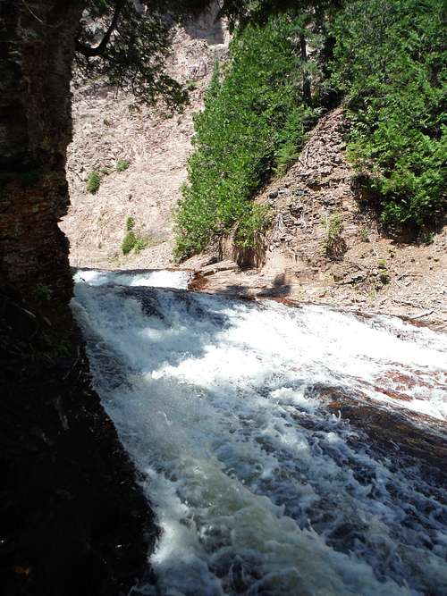
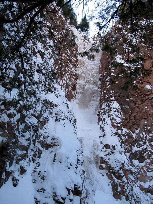
One sight you will not see is mighty Barrier Falls, the large fall that keeps the Devil Track gorge from being ascended by the curious (or even descended by kayakers). Though a sign alerts you to its proximity, you will hear its roar but be unable to see it.
Barrier Falls 'Overlook' - Summer
 Barrier Falls 'Overlook' - Winter
The 2.3 miles that it takes to reach the river itself does not sound very far, but I can attest to how exhausting it can be on both a hot humid summer day and a frigid winter day.
But the trail will eventually descend and intersect with river at a very scenic footbridge. A register can be signed, and this is a great place for a break.
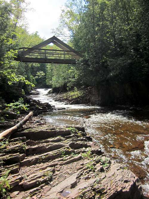
Devil Track River Bridge
 Small Fall, near Devil Track Hiking Bridge
Bonus Hike: Pincushion Mountain
Once done enjoying the Devil Track at the bridge, you will definitely want to continue over the bridge, taking the trail south of the Devil Track to Pincushion Mountain, a small prominence of the Sawtooth Mountains with killer views.Continue on the Superior Hiking Trail for less than a mile until you hit the leafy opening on the left signed for Pincushion Mountain. Follow the trail then head up the smooth dome to view the sapphire grandeur of Lake Superior.

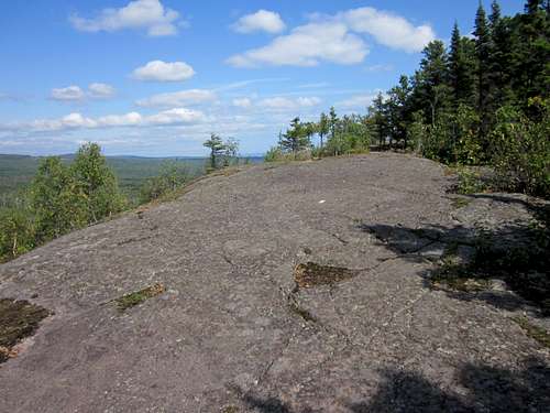
Pincushion Mountain Dome
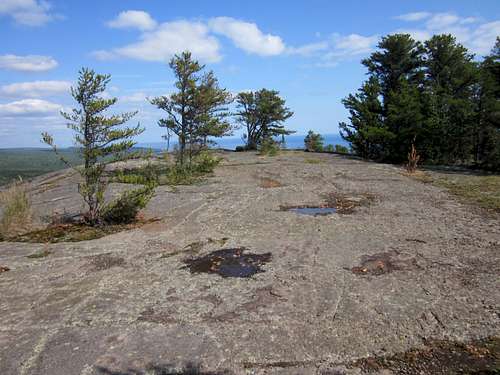
Pincushion Mountain Summit
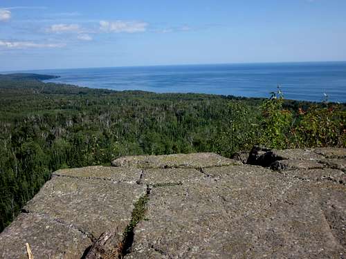 Lake Superior North from Pincushion Mountain
Once done enjoying the views, return the way you came. It is also possible to continue through the Pincushion Mountain maze of cross country ski tracks to route 12, though I have not tried this.
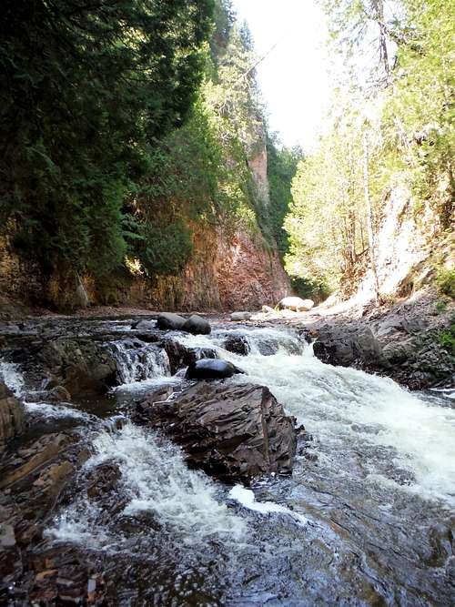
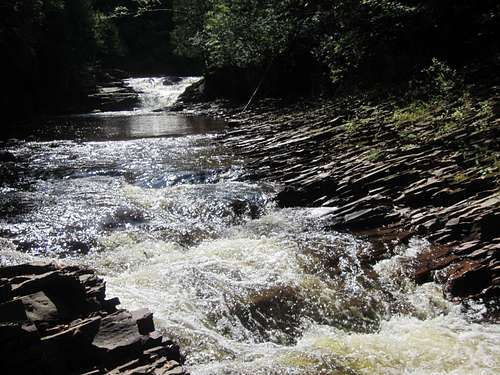
Hiking within the Gorge - Summer
After summer and winter hikes along the top of the Devil Track Gorge, I began to long for the opportunity to try to hike within the gorge, in a Zion Narrows sort or way. I wanted to be in the canyon, and especially longed to see Barrier Falls. My first attempt in summer, made at the spur of the moment, found that the Devil Track was shallow in August (ankle, knee, and sometimes thigh deep) and slippery. Since I did not tell anyone where I was, was alone, and was not properly equipped (trekking poles are a must), I quickly abandoned the effort. But I vowed to come back better prepared.The Devil Track is a wild river, and should not be undertaken without consideration of yourself, water conditions and weather. It is not well traveled and you are on your own. Do not undertake lightly.
There are no trails - only occasional gravel bars that disappear as you go upstream. The water is cold and fast.
Starting near (but not on) the Route 61 bridge over the Devil Track, make your way up the wide shallow river fairly easily. Calf deep water broken by gravel bars make easy walking. But soon the gorge sides get higher, and the river gorge more narrow. There way is pleasant and beautiful. You may have to cross the river a number of times. There is a small fall maybe a mile (? - it was hard for me to estimate distance) that announces faster water ahead.
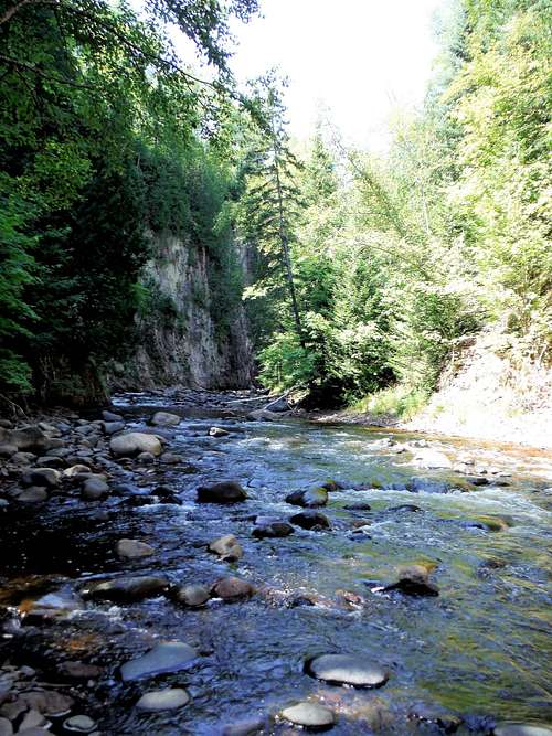
In Devil Track Gorge - Summer
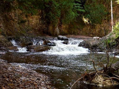 In Devil Track Gorge - Summer - The Small Fall that Signals the Beginning of Rapids
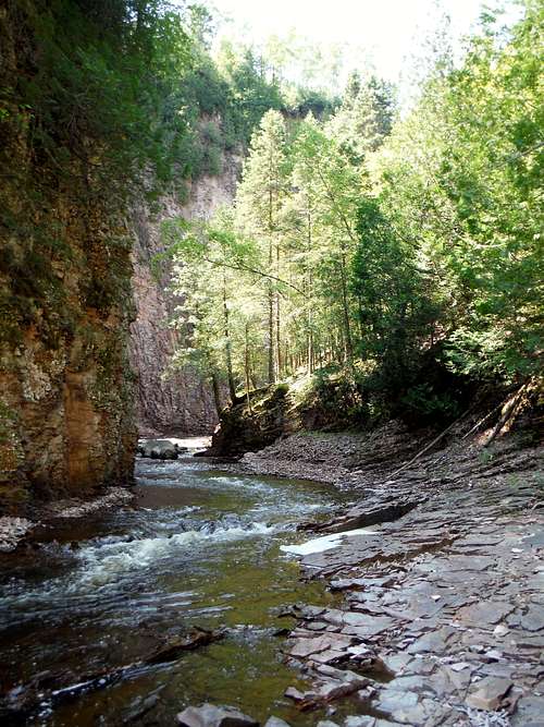
In Devil Track Gorge - Summer
I did go a little way through the part where the true rapids begin, but turned around when the gorge narrowed and the water rushed fast and steep. The rapids, flashing around a narrow 90 degree turn in the gorge, were too fast for me to safely cross to better ground.
 Devil Track Gorge - My Turnaround Point
Though I did not reach my goal of Barrier Falls, there was plenty to enjoy without being foolish, and I turned around when I felt I could not continue without exposing myself unnecessarily. But up to that point I was comfortable and enjoyed myself immensely.
I know from cruising the internet that people have gotten to Barrier Falls, but I can offer no knowledge of the river beyond this point. All depends on the rivers water levels, which you will have to judge for yourself.
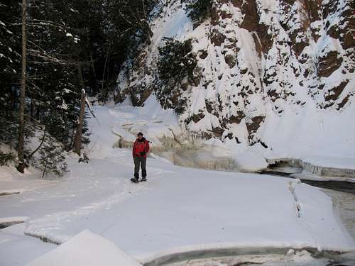
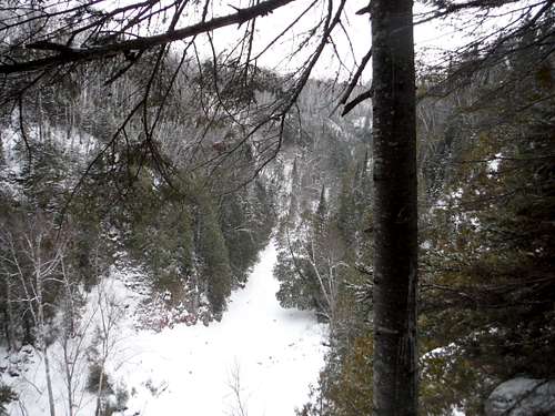
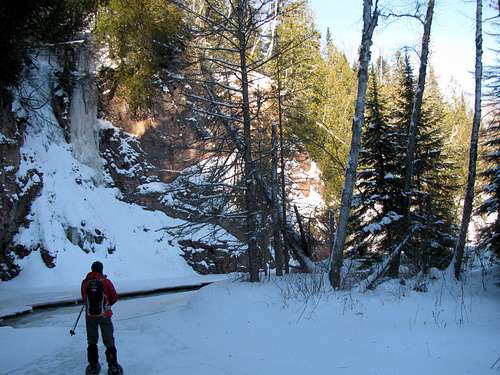
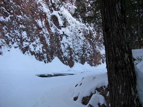
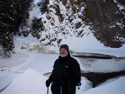
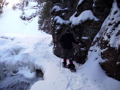
Snowshoeing within the Gorge - Winter
Several winter trips to the area made me consider if the same trip up the gorge of the Devil Track could be done on snowshoe. I am sure that Barrier Falls could be reached by this method, though my one attempt at this was thwarted. Back in January 2017 there were many open seams of water in the thick ice. We were able to advance further up the rapids, but conditions were such we thought it wise to turnaround short of Barrier Falls. Still, it was a memorable trip well worth the effort.The starting point is again near the Route 61 bridge, though a huge berm of snowplowed snow will have to be down-climbed. The winter scenery is dramatic.
In Devil Track Gorge - Winter
 In Devil Track Gorge - Winter
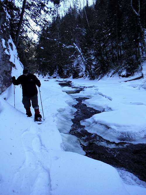
In Devil Track Gorge - Winter
 In Devil Track Gorge - Winter
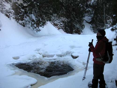
In Devil Track Gorge - Winter - The Small Fall
 In Devil Track Gorge - Al Baltis at our Turnaround Point
In Devil Track Gorge - Turnaround Point
 Returning Down Devil Track Gorge - Winter
On our trip back, SPer and lifetime friend Al Baltis triggered a thunderous boom when the ice shelf he was snowshoeing on cracked apart and separated from the gorge wall, which then caused a chain reaction of ice shelves to detach. Al nimbly jumped to safer ground. While the water was not deep, the noise was epic.
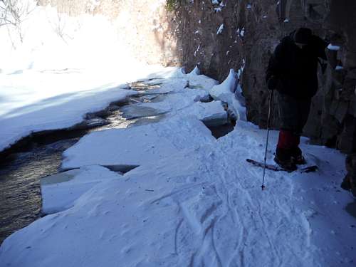 Big Al after Thunderous Ice Failure
Some SPers do more than just sight see at Devil Track Gorge. Take a look at this...
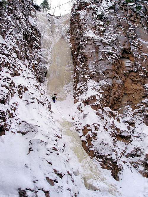 Photo by mcmedved - Ryan on Nightfall
Some qualified Ice Climber will have add routes to this page. I certainly cannot.
Red Tape
None. No fees, no permits.Camping
There are campsites just before and after the hiking bridge across the Devil Track. These remote sites are free but first come, first serve.External Links/Resources
A great resource on the area is the book 'Hiking the North Shore', by Andrew Slade.Good maps can be had from either:
MacKenzie Maps (see map 100 - Grand Marais area)