-
 2702 Hits
-
 79.78% Score
-
 11 Votes
|
|
Mountain/Rock |
|---|---|
|
|
43.87579°N / 103.45777°W |
|
|
Pennington |
|
|
Trad Climbing, Bouldering, Scrambling |
|
|
5460 ft / 1664 m |
|
|
Overview
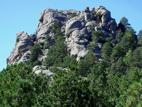
Sitting in the shadow of Mount Rushmore, Doane Mountain often gets ignored by many climbers in the Black Hills. Having the Wrinkled Rock Climbing Area and Old Baldy Mountain nearby only adds to the diversions. However, Doane Mountain can provide some fun climbing, scrambling and bouldering opportunities while you are in the area.
Also known as “Reardon’s Rock”, Doane Mountain is sometimes confused with an unnamed mountain across the highway. The name Doane was a Robinson family nickname and was applied to this summit in honor of Jonah L. Robinson, who was known for coming up with the idea for the Mount Rushmore National Memorial.
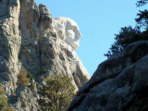
According to Lists of John , this summit is 5,460 feet above sea level and has about 200 feet of prominence. It is found in the Mount Rushmore USGS Quad map. The summit affords exceptional views of Mount Rushmore to the north, Black Elk Peak to the west and Iron Mountain to the south.
Getting There
Doane Mountain is just past the Mt. Rushmore exits on Highway 244 about 3.5 miles southwest of Keystone, South Dakota, or 24 miles southwest of Rapid City by way of Highways 16 and 244.
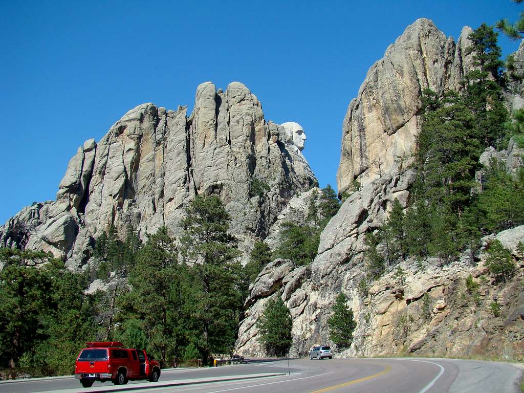
If you choose to park at Mt. Rushmore, you will have to pay a parking fee, which goes up periodically. However, if you prefer free parking, drive on around the big bend on Highway 244 and park at the “Washington’s Profile” parking area. From there, you can cross the road and bushwhack your way up to the route(s) you wish to try.
Climbing & Scrambling Route Information
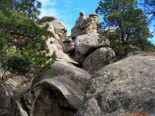
Mountain Project lists 5 rock climbing routes, from 5.8 to 5.12, on Doane Mountain, plus a couple bouldering opportunities on the south side. There are also many more climbing routes on the rocks and spires immediately to the north of Doane Mountain, going all the way over to the Wrinkled Rock Climbing Area.
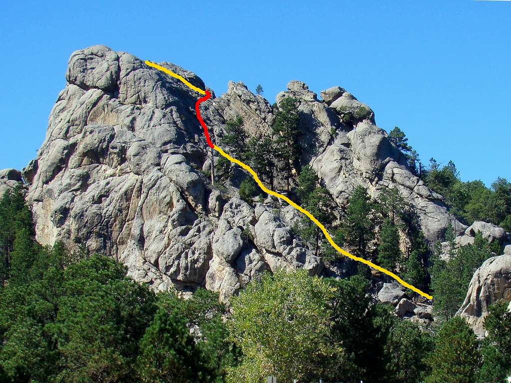
Probably the best scrambling route requires a bushwhack from the “Washington’s Profile” parking lot around the north side and looping around to the south side. There is a ledge under an large overhang that slopes up to a somewhat exposed area (marked red on beta) that goes up to the final push to the summit. This exposed area is one of those that scramblers argue about, with the more prudent climbers taking safety measures while the more self-assured scramblers take their risks for a short, but scary climb through this area.
Red Tape
There are not many restrictions to climb here. However, there are strict limitations here and throughout the Black Hills about campfires, fireworks, cigarette disposal, etc. Thousands of acres of forest have been destroyed in the Black Hills due to fires in recent years, so there is little tolerance on the part of officials toward careless behaviors.
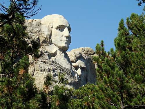
It’s important to note that there are some areas around Mt. Rushmore itself that are clearly off-limits to any kind of climbing, and they are normally well-posted. Should you have any questions, please contact the Mt. Rushmore National Memorial headquarters at: (605) 574-2523
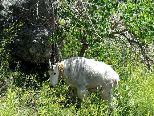
Should you encounter one of the many mountain goats seen in the area, please keep a respectful distance.
When to Climb
While the granite on Doane Mountain is good quality, no careful climber wants to be on it when it is icy, nor when there are lightning bolts flying in the area. So, please check the latest forecast and conditions here before you climb:
Mt. Rushmore – Keystone Area Forecast & Conditions
Area Camping Options
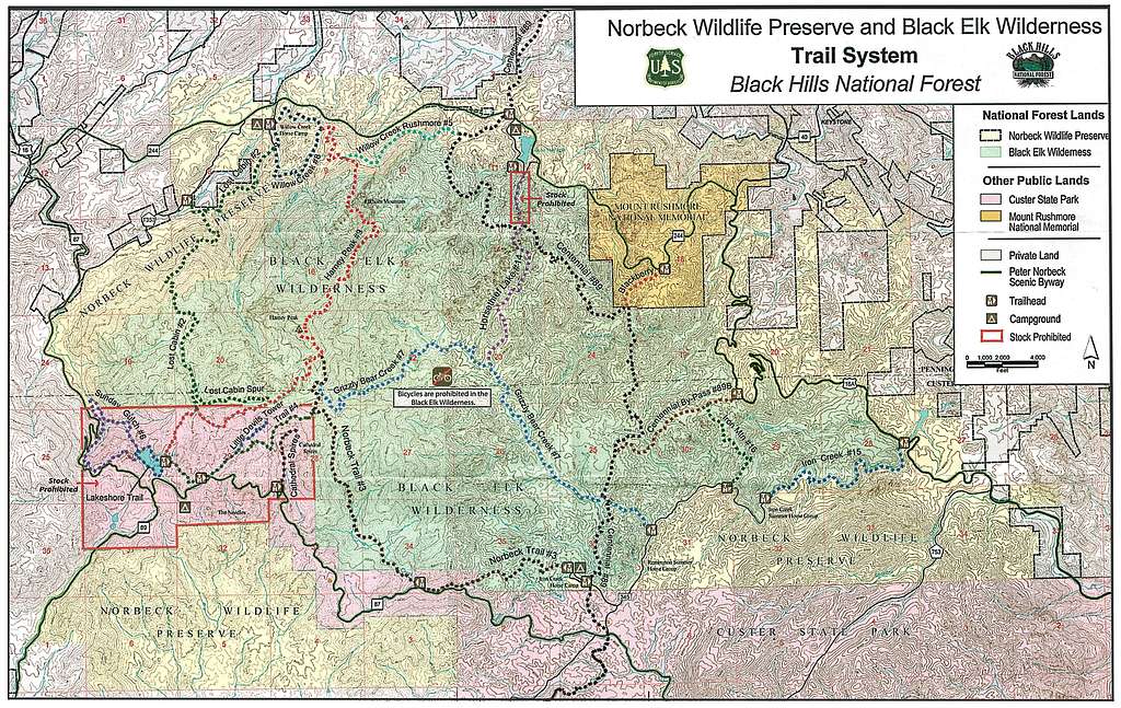
Dispersed camping is allowed in the Black Hills, and this area is right on the edge of the Black Elk Wilderness Area. The Blackberry Trailhead is just across Highway 244 from Doane Mountain, and gives you full access to the trail network throughout the wilderness. A PDF trails map with regulations is available by clicking here:
Black Elk Wilderness Trails & Camping
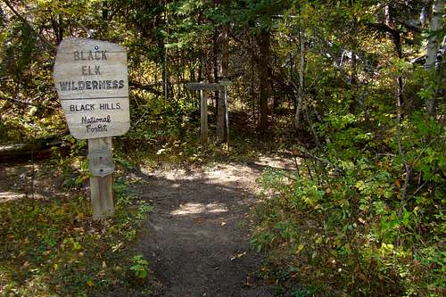
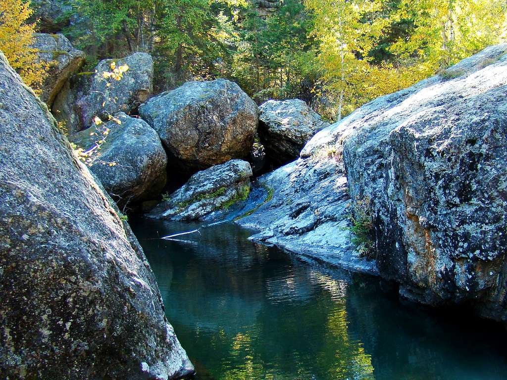
Photo at Bottom of Page: Grizzly Bear Falls, about 1 mile south of Doane Mountain and Mount Rushmore, in the Black Elk Wilderness.
If you prefer other camping or lodging options, check the link below for up-to-date information: