Prologue: Skip ahead for actual mountains and pictures
I muddled through a year of work and stress in New Jersey, haunted every day by my failure to get any worthy views from the summits of McGuire, Taylor, Piquett and Leidy mountains due to the severe haze in August of 2015. Sleepless night by sleepless night I swore vengeance on these peaks, particularly McGuire (see trip report posted just before this one). But I was trapped by disdain for repeats and fretted about how I could salvage those days on the peaks without costing me a chance to explore new peaks and areas. I figured that the only way I could live with repeating several peaks was if I had a whole goddamn month off…time enough to get enough new summits checked off my lists whilst still going back and recapturing certain peaks whose summit views had eluded me.
Fortunately I had built up enough vacation days and goodwill for my employer at the time for them to agree to four consecutive weeks off that summer for me, and as the months counted down I started to draw vague outlines for a gameplan, though still hesitant to fully embrace the concept of repeating any peaks, even my holy Salmon River grail of McGuire. Then fate threw me a curveball when my old manager whom I had worked for back in Salt Lake called to offer me a new and fully remote position at his new company. I accepted but they wanted me to start as soon as I could, thus crunching my timeline a bit. I had a very good friend’s wedding coming up in two weeks (my roommate’s twin brother’s), and that pretty much made for my two week notice to my company. The problem was that the wedding was a Saturday, thus eating up at least two prime weekend days when I could have started my trip; I was able to extend my start date a two days back to a Wednesday. So while I still had four weeks to climb for summer ’16 I found myself with less flexibility…plus, aside from my accrued vacation days I now would not be getting paid while on the road.
Then fate threw me yet another curveball. My old company milked all the life out of me those last few weeks, literally, as I trained endlessly my tasks, talking nonstop and especially near the end when I was recording training videos for a week straight. My throat has always been the Achilles heel as the source most of my flus and illnesses, usually graduating from soreness into severe congestion, phlegm, then usually running its course after 3-4 weeks with the last 8 days a toil with a very itchy throat and hacking cough. The stress and strain had already contributed to me running through this process earlier in January, getting me sick for the first time in two and a half years years on my birthday no less (my last illness being Labour Day Weekend 2013 on Tweedy Peak in Montana and climbing Currant Creek and Mt. Watson in the Uintas while ill). Now it struck again; my last day was Thursday and I was already running behind, not leaving the office until five with still a shit ton of errands to run as well as a date in the city. Leaving Friday on a delayed timetable having to stock up on Gu and other supplies, I found myself stuck 7 hours in the NYC to Boston weekend traffic, going from the early pangs of a sore throat just after crossing into Connecticut to suffering through a full blow delirious fever by the time I reached my friends’ house in Massachusetts.
Fortunately I was not contagious (I’m pretty sure), but my throat was swollen up in pain all Saturday and I was not able to enjoy fully the wedding of one of my best friends (though that didn’t stop me from drinking all night and wandering along with everyone else to a nearby dive bar till 1 AM or so). Sunday morning I agreed for some reason to drive my roommate back to our apartment; I would not be going out of my way at all as I live right on I-95/80 off the GW Bridge, but my roommate being a slowpoke as usual we dawdled in town for quite awhile before setting off west through, once again the running theme, disgusting Connecticut traffic.
I was essentially driving straight from Massachusetts to Montana to meet Sam Grant at the trailhead of Crazy Peak in less than 3 days, with a quick stop in Jersey to drop off the roommate and pick up a phone charger. This and the traffic put me a few hours behind schedule but I still made it to around Mansfield Ohio by Sunday night. I gained some time Monday avoiding the worst of Chicago traffic and made it about an hour past Sioux Falls. What killed my progress the entire trip was the continued pain and itching of my throat, which I could only try and relieve by the constant consumption of water (and coffee, etc), which meant that I would need to stop and take a bathroom break pretty much once every 90 miles, setting me further and further back from where I needed to be. I required a mid-trip oil change in Mitchell SD, where the technicians toad me that the tread in my tires were fucked due to a bad alignment, which I would have to fix in Rapid City.
Despite this further setback I decided that I needed to check out Badlands National Park, a worthy destination that had always eluded me. I did the standard park loop drive and enjoyed it fully, stopping and gawking at nearly every viewpoint; it was a brutal 90 degree plus and humid summer day on the plain though, and I found myself severely fatigued (and not to mention my throat completely decimated) every time I walked even twenty feet or so outside from my car to a nearby overlook. Self doubt already filled my entire drive thus far about whether my body in its weakened condition could handle a peak, much less one as difficult as Crazy, and after a few hours in the Badlands I wasn’t sure if I could even gain a hundred feet. I also tripped on the sandy badlands dirt near a parking lot and bloodied up an arm and leg really bad.
The alignment fix in Rapid City would take several hours but at least the shop was close enough to downtown where I could walk to a nearby brewery, inside an old firehouse no less, and down enough beers to soothe my throat for a few hours. I continued on through the late evening, taking the back roads through Belle Fourche and traversing the dull plains of southeastern Montana before meeting I-90 again near Little Bighorn Battlefield (though I was pleasantly surprised by some pretty low wooded hill country near the Cheyenne Reservation east of Ashland). It was dark by the time I passed Billings, and I was pretty sick (still) and exhausted driving down the progressively bumpy and rutted road to the Big Timber Trailhead mere minutes before midnight. If only I had known that my tribulations were just beginning.
While I experiencing FOMO in cube life a month or so before, Greg had gotten Crazy via an alternative route, stumbling upon a rough dirt road leading up to the base of the east ridge while looking for a quiet camping spot for the night with his dog Oquirrh. Seeing that he was so close to the peak he ended up climbing Crazy via this mostly unknown route (I haven’t seen much on it since Pat Caffrey’s description in his guidebook from the 70’s), and gushed to me afterwards about how easy and basic it was and how surprised he was that no one seemed to ascend and slash or post any information about it. I had discussed with Sam which option we wanted to pursue for Crazy, with me leaning East and Sam towards the standard West Ridge. With my doubts about how I could even physically function the next day I favored the easiest route possible, while Sam wanted the challenge of the West Route. Another question was start time…he wanted to get an early start as we had a long drive to Cody for the Absarokas, next on our list. I was already tired and late to the trailhead, and wanted to get a full night’s sleep to hopefully prevent my sickness, whether it was an actual flu, head cold, or just side effects of a severely damaged throat, from getting any worse.
Sick & Crazy - July 20th, 2016
I got a knock on the window around 7 AM in the morning and saw that Sam was already all ready to go. I was still groggy and my throat felt shitty enough for me to want to stick to the easier East Ridge; Sam seemed set to go on the West Ridge, and I didn’t want to make him wait for me; as it turned out we both were pretty comfortable in going our own way for the day on Crazy, then meeting up afterwards in Wyoming, chatting for all of 15 seconds or so before he took off and I went back to sleep.
Or tried to. Around 10 minutes of tossing and turning in my truckbed I realized that it wasn’t happening, and I might as well get an early start on what would be a long and slow day for me. I brushed and washed up and backtracked halfway back down the main road towards the highway to find the junction to access the East Ridge.
Greg had texted me step by step GPS directions to get to the trailhead, and yet I still wasted probably 30-40 minutes taking the wrong turn, failing in my weakened state to open a cattle gate that was completely stuck. After prying at it for what seemed like hours I finally got it open, only to drive in and realize that the road quickly disappeared in a small creekside meadow. Confused, I drove around a bit trying to find the road, then backtracked and restudied Greg’s directions before realizing that I likely turned prematurely; no wonder the gate was impossible to open…no one had likely touched it in years.
I found the right turn and continued on, following Greg’s instructions as the road got rougher and rougher, the last two miles featuring some steep creek crossings and even steeper rocky 4WD sections. It was not a fun drive but I made it safely to a flat area along the base of Crazy’s East Ridge, just below 6,900 ft just before the road drops into the South Fork Big Timber Creek drainage and presumably ends per the maps. Now came the hard part…seeing whether my body could actually make the climb.
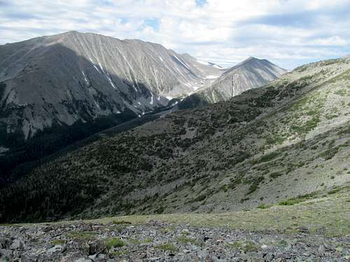
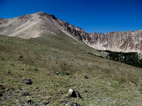
I started down a dirt road for what seemed like half a second before veering off into open woods at a gentle grade; so far so good as the terrain was gentle and the tree/brush cover mild and sparse. I started climbing more and more through the woods as I glimpsed signs of views left as well as bits and pieces of a stock trail; I lost it quite a few times going up but managed to follow it at the edge of the drainage on the way down. My body was still cooperating at 7,600 feet at a flat spot where the real brunt of ridge stood out like a sore and dusty thumb, rising what looked to be a thousand feet or so above the lower woods. Here would be the true test of my fitness and I embarked after taking quenching a few extra sips from the more than abundant waters I had packed.
It took me a few extra rests and a few extra sips of Aquafina, but I emerged triumphantly atop the first open bump along the ridge thinking I was halfway there; after all, I had gained close to half the elevation required and could seemingly see the summit from where I was. Add how Greg had stressed how basic this route was, and how accurate he had been thus far, I fell under the illusion that the peak was in the bag.
And I was wrong. Granted, not having done the standard West Ridge route I can’t compare difficulty, and the standard route likely rates harder with a more mentally psyche out factor with its notch, but all I can say is that you can’t entirely discount the East Ridge.
Maybe the climbing isn’t as bad, and it’s definitely a few hundred feet less elevation gain, and perhaps my personally fatigued state didn’t help, but I found the East Ridge to be a complete mindfuck.
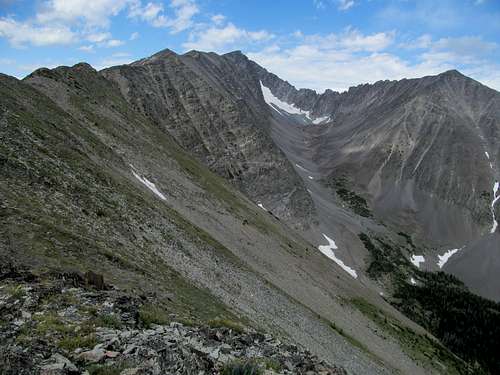
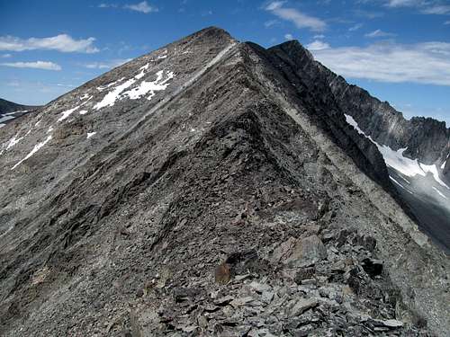
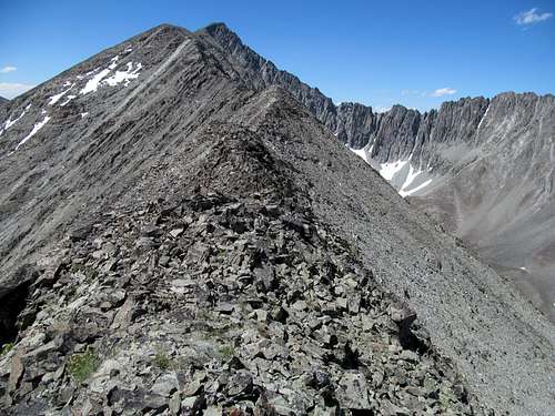
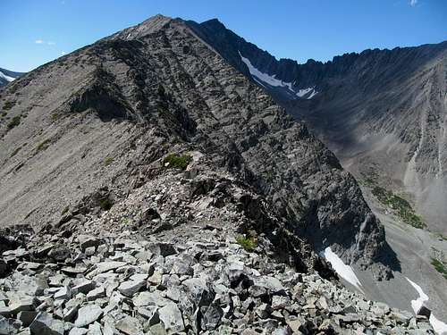
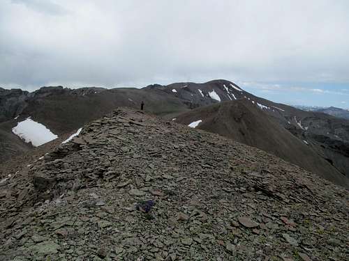
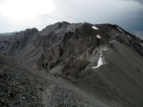
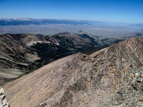
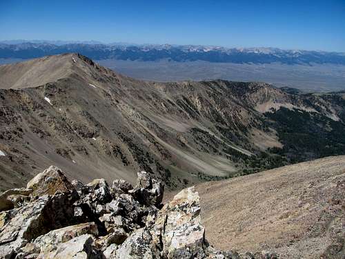
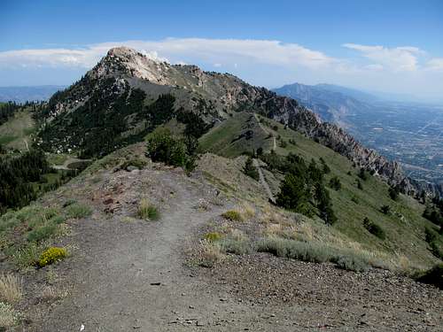
Once you emerge from the trees the ridge seems to last forever, with no truly difficult spots but constant scrambling that keeps you on your toes, especially if you don’t know what’s coming up ahead. The key is to constantly stay on the ridge crest as much as you can, ignore the mild exposure and occasional narrow spots, and trust that the ridge won’t cliff out on you ahead, which it mostly doesn’t. You’ll find yourself going up and down and up and down and so forth, and each time you think you’ve reached a benchmark you’ll see an astonishingly long flat or even downsloping traverse ahead of you with tricky footing ahead of yet another steep climb or scramble.
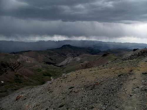
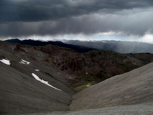
At least the conditions seemed to improve for me. The forecast had been sunny with a mild chance of storms after noon, but the morning had been overcast and even now as I emerged above treeline I felt sparse drips of rain for a few moments. Darker skies seemingly awaited me further up, but gradually skies cleared by the time I was testing my boots along the neverending ridge. I found out later that Sam had not been so lucky, experience a short but heavy hail storm higher up around the same time when the clouds had been its heaviest.
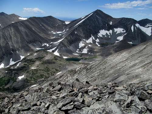
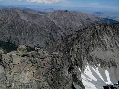
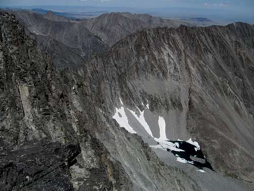
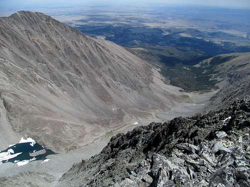
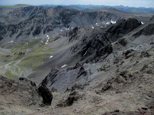
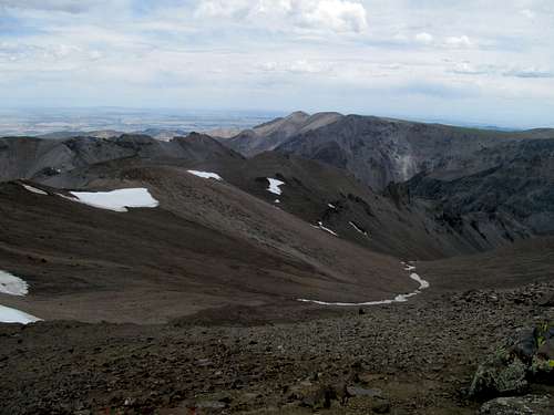
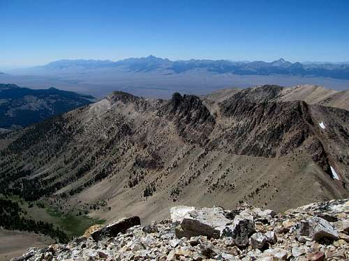
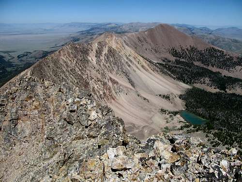
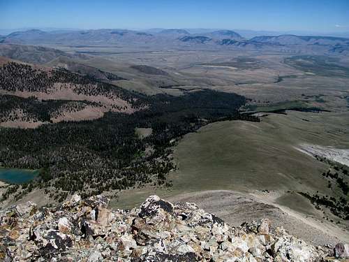
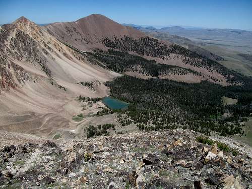
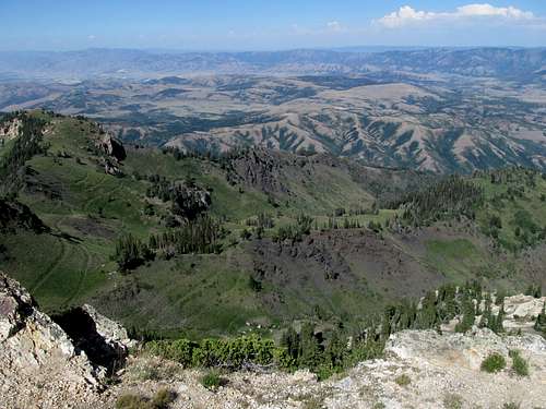
I made the mistake of not trusting the ridge on my way up, often clambering clumsily along the left side through occasionally loose rock before climbing back to the ridge, then bailing off after coming up on another unvetted section. While the eastern approach may or may not be more scenic than the standard one past and above Blue Lake, it did have some cool vantage points of Hidden Lake to the right and Crazy Lake to the left, along with a constantly awe inspiring vantage point of the totally technical Big Timber to Crazy ridgeline.
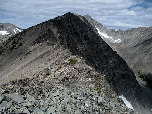
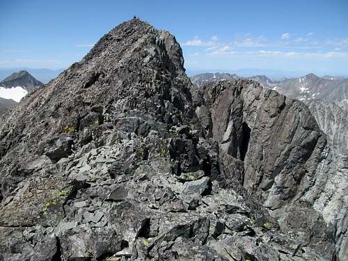
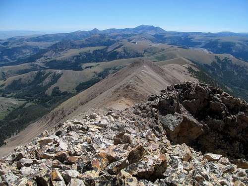
It seemed like I was crawling inch by inch judging by how slowly the summit seemed to approach me, and I could only hope that I was getting close by the time I could see a few people on top. They seemed to spot me too, and probably wondered where the fuck I was coming from, but they were probably too far to see the chagrin on my face when the East Ridge delivered me one last kick in the balls before the top: yet another elevation loss, probably the biggest along the ridge for maybe a hundred feet or so down a boulder field.
The descent was rickety, loose and thoroughly unenjoyable, but alas one final prelude before the last few steps approaching the summit.
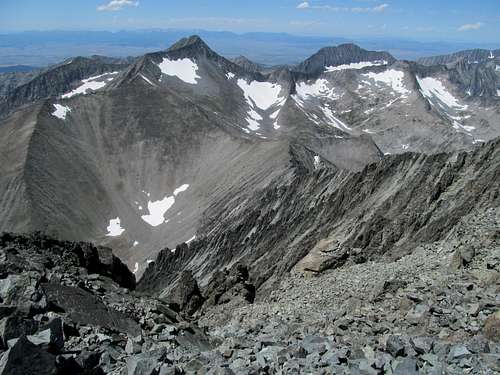
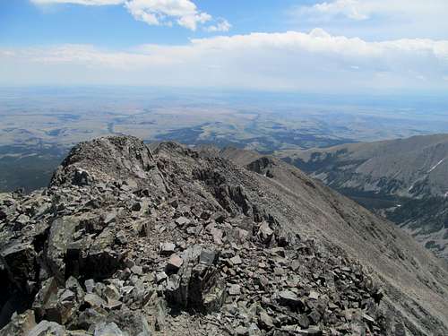
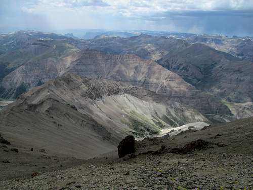
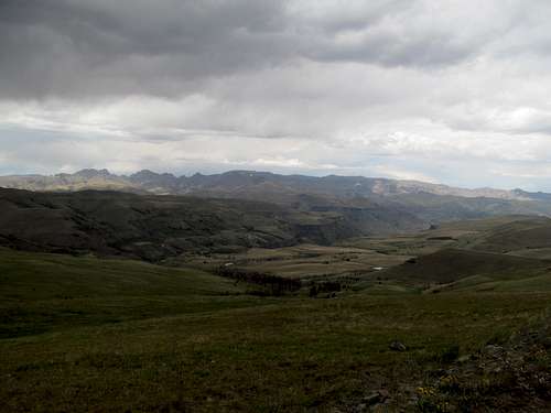
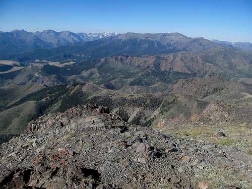
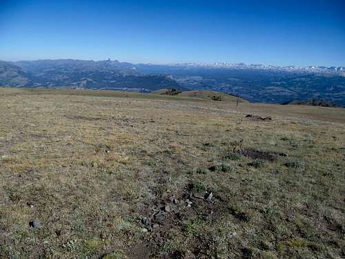
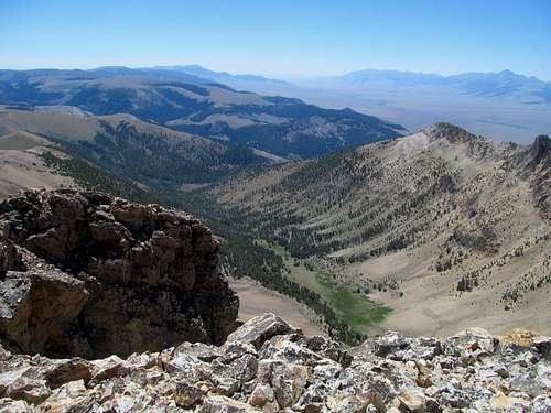
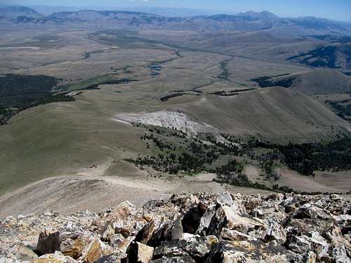
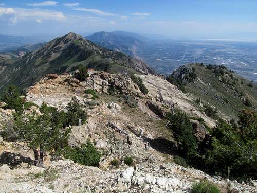
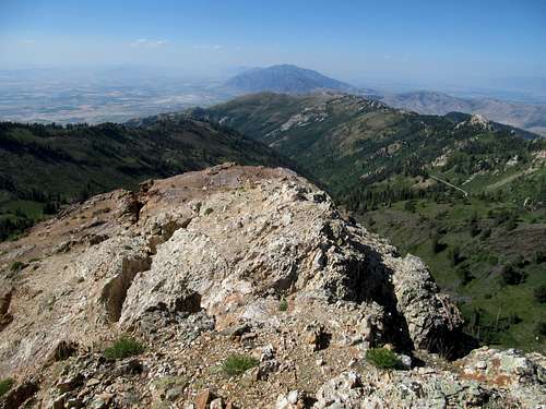
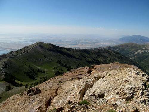
The views were admittedly great, ranging from thunderstorms over the Beartooths to the south and the faint outline of the suburban Bridgers to the west.
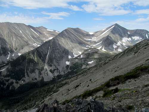
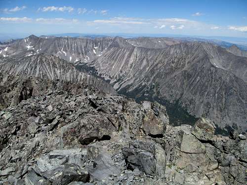
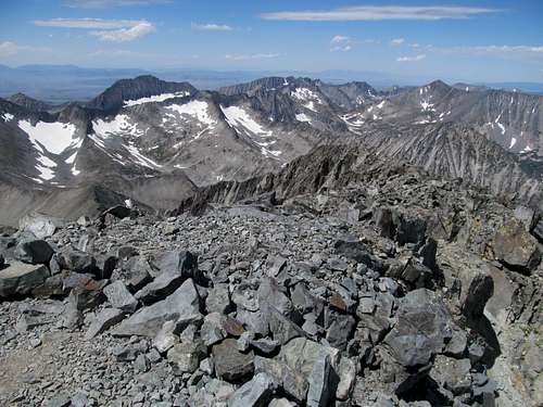
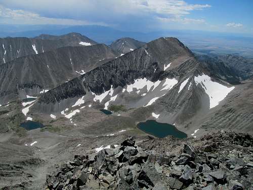
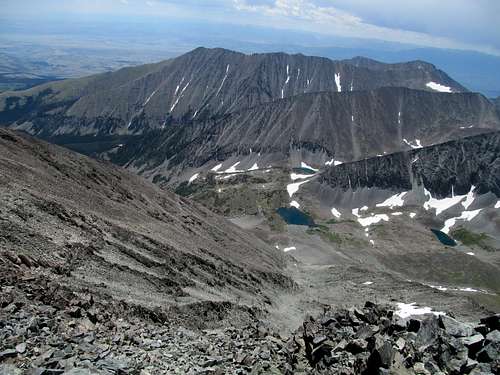
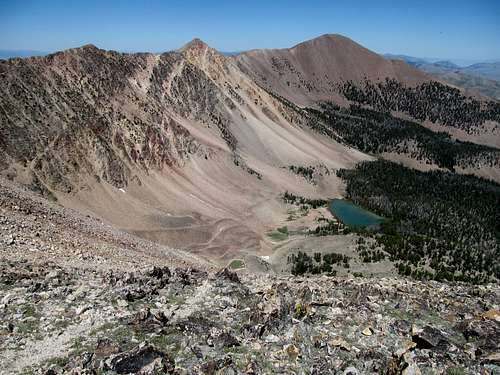
The true spectacle lies in the heart of these isolated mountains though, as the symmetrical ridges of the peaks above Crazy Lake which had graced my journey the entire way up the ridge was joined by vistas of endless granite chunks to the north past Conical Peak and the more impressive and intimidating façade of Iddings Peak.
I talked a few bro groups up on top, all locals from the area, and found out that they had encountered Sam on their way up and he had actually sustained some injuries from being caught in a rockfall. It was somewhat horrifying to hear but they indicated that he was in good shape, having made it to the summit in record speed and all despite that. One by one they left me to enjoy the solitude of Montana’s most prominent spot on my own, and I did so.
It’s weird…when I’m climbing peaks on the reg it becomes pretty stale, but when I return east for a year at a time I enter a different universe and, when looking back to the mountain days, see an alternative reality and question quite rationally my ability to ever climb one of those things again. The idea of sitting on a small mountain perch above all seems a romantic notion that does not befit the reality sitting on top of, well, a bunch of rocks. I gave myself ample time to pursue these avenues of thought before heading down.
Every up climb, beginning with the first, was a pain in the ass on the way back. Knowing the nooks and crannies of the ridge however allowed me to proceed efficiently, staying along the ridge crest as much as possible.
I thought I was moving fast, but rocky sections along the ridge forced me to crawl cautiously with every step and make the ridge stretched out ahead of me look longer than it actually was.
As I approached the end of the ridge where the talus gave way to dirt amidst a darkening sky I felt relief thinking the worst of the day was over. Alas a slow jog down back into the trees began the last act of this tragedy, and what should have been an easy, basic downclimb saw my natural inclination towards clumsiness conspire with my fatigue, amplified by whatever sickness I had in my throat and sinuses, and every possible bad luck bounce hitting its mark. I seemed to fall in every slick spot, trip on every branch, get scratched by every bush, get my backpack caught on ever stray branch on my way back to the car.
Lost Wallet Day in Yellowstone - July 21st, 2016
By the time I got back I was delirious in every possible way physically and mentally. I usually keep my wallet and car keys in a small compartment in my backpack, and remember specifically taking my keys out to unlock the 4Runner. I also remember vividly having my wallet, phone and camera all in the same pants pocket and thinking it was too much. At some point I may have taken my wallet out and placed it on top of the car, but who knows.
My muscles and joints creaking, my throat irritating, and my skin warding off mosquitoes, I changed socks, shoes, pants etc and packed everything up. Everything besides my wallet, apparently.
Sam had already arrived in Cody and was going to check into a motel, and I very much looked forward to joining him…preferably not too late so that we could check out one of the several breweries in town. I endured the long drive out along the jeep track and cruised straight through town and back to I-90, stopping 40 miles later in Columbus before gassing up for the mountain roads to Cody. Well that was my intention before I realized that my wallet was missing. I immediately thought back to my disembarking at the trailhead and pondered one of the many ways I could have left it behind there. I texted Sam to let him know that I had to go back to the trailhead to look for my wallet, and he wished me luck.
Based on my calculations I (barely) had enough gas to make it back to Big Timber, up to the Crazy Trailhead, and back into Big Timber before running out. Hopefully I would have my wallet and cards to refill on gas by then. I stopped at every spot I remembered getting out of the car to take a picture, and endured once more the awful dirt road leading to the saddle where I parked. I searched every inch in that area, retracing several times my initial steps back along the faded jeep track towards the East Ridge. I found nothing, and wondered if I had placed the wallet atop the car, after which it could have bounced loose and fallen into some gully or ravine. I stopped again at several spots along the way back to the highway with no luck.
I figured the wallet must have fallen down a ravine and been lost forever. Someone would later mail remnants of it (aka my drivers license and not much else) back to my parents’ house (address obtained from my license); gone were the cash and cards…so much for honest good ole’ country boys. Thinking on it now, it’s probably less likely I left my wallet on that rarely traveled jeep road, and more likely that it bounced out of my pocket and car somewhere along the gravel road where I got out to take a picture, or even at the damned gas station where I first noticed it was missing and panicked.
But my immediate crisis was what to do now. I had checkbooks, but was not encouraged by the fact that the lone gas station still open in town refused to take a check. I paid with quarters I had in the car, enough to maybe take me to Bozeman or Billings. Luckily enough I managed to give my sob story to the last remaining vacant hotel in town and convinced them to take my check; the guy at the front desk sadly exclaimed that he figured he’d have to pay for me if the check bounced…I assured him that my bank account was good for it.
I would have plenty of panic the next day over what to do when you lose your wallet on the first day of a month-long vacation thousands of miles from home. For now, I just really wanted to clean up, shower, sleep in a warm bed, and try to rest my body, mind and soul.
I stopped at every single bank in town trying to get one of them to cash a self-written check or accept a wire or transfer of money from mine own account at Bank of America. No such luck as, despite all the technological advancement in the world these days, it still proved impossible to access my own money. I sweated outside and inside my car making hours of phone calls (and mostly waiting on hold) before eventually getting a western union money transfer from my bank…apparently the only way I could access my own funds. This meant I had to drive 40 miles or so west to Livingston for the nearest western union station, which turned out to not actually exist. Nice. Which meant that I had to further stretch out my very limited supplies of gas to get myself to Bozeman, where I was finally able to get myself enough cash until I got my credit card, which I had the bank mail to Greg in Salt Lake, or get a temporary debit card, which I could only do in person at the nearest Bank of America…likely Coeur d’Alene.
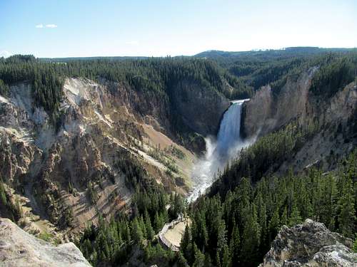
Sam already knew not to count on me for the day, so he made the brutal four hour drive from Cody for a quick dayhike of Cloud Peak. With funds finally finagled (thank God I had my passport in my car, else I really don’t know how I could’ve managed this wrinkle in events), I got myself some solid food (not granola bars or bananas) for the first time in two days, then stopped at a brewery in Bozeman to chillax for a few. I still wanted to make a day out of the day, so I retraced my way back to Livingston and braved the crowds and zoo of Yellowstone, hoping make some progress on my quest to chip away at the basic tourist spots of the park in between pursuing more serious peak goals in the area. I figured after all the stress from the day my psyche would be best served by really checking out Yellowstone Lake and the West Thumb for the first time in hopes that the calm waters would soothe my nerves, but time spent at the Grand Canyon of the #ystone and the mud volcano trails ended up taking most of the day.
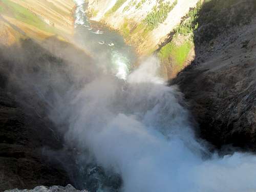
Having seen so many pictures of the Yellowstone Falls and even visited once a pawn a time when I was a wee one, I ventured several hundred feet down one of the trails along the canyon and found myself shocked that I was standing right next to the famous goddamn Lower Falls itself…guess that’s why they called the trail “Brink of the Lower Falls”.
I saw platforms on the other side of the waterfall and wondered how people could get across…I guess there’s a road and a whole other system of trails on the other side. Baffling that even at 31 and a Yellowstone vet (having hiked Sheridan, Electric & Washburn within its premises) I was still learning new thangs about the park. Fascinated about the other side of the falls, I nevertheless decided to save that for my next basic go-round in the park.
I breathed in the various sulfuric fumes along the extended mud volcanoes trails, reliving once more yet another cherished childhood memory of a beautifully boiled and charred hellscape.
Between that and the usual dumb slow tourist gawk jams I was running late and could only pause briefly at Yellowstone Lake before venturing towards points unknown east of the park.
And truly unknown because I had never ventured in this area between Old Faithful and the Bighorns to the east whether in childhood or casual drive-by, and I looked forward to belatedly surmounting my first Absoraka Peak. I enjoyed the unvarnished alpine beauty by the park’s eastern entrance all the way down until the sublime north woods faded into the plaid dry cowboy plains that I was more familiar with.
Sam had had a long but successful day on Cloud, the peak obviously taking its toll on the clock for him, and we arrived in town at around the same time. I had a chance to get a quick grocery resupply before meeting him at a small quaint brewery outside of downtown. Our originally plan in this area had been Francs and Trout and possibly Windy along with something else further west for Sam on his way back to Salt Lake Sunday. With an iffy weather forecast, Sam tired from hours of driving and hiking on Cloud, and me still weighed down by my physiological ailments as well as fatigue from the whole losing your wallet and money in the middle of nowhere thing, we decided on a later start and a shorter day on Francs.
Quite Franc-ly - July 22nd, 2016
Sam’s an early bird, so what would have been an average wakeup for me Friday morning was probably absurdly late for him. Greg had warned us that the drive from Cody to the trailhead would be a long and horrid 4 hours, but somehow we made it in maybe 2 and a half or so hours; not to say that the road wasn’t shitty, because it definitely was at times and especially the steep and excessively rocky section ascending up to the Phelps plateau proper. What made things worse were the four gates we had to open and close en route to the plateau, and one gate in the steep section that posed difficulties in particular as both Sam and I had to work our trucks extra hard to get from park to 4-Lo up the near vertical rubble. I led the way and thus had the responsibility of opening each gate, then waited for Sam to charge through and bind them shut (he had the more difficult task). The fact that I was out of breath even ascending through the cold drizzly mid-morning in my (albeit) sneakers towards each gate should have struck me an ominous prelude for the day to come.
Our progress was helped by the quality of the road above the plateau, with plenty of smooth 40-50 mph sections plagued by intervals of bumpy and mild rocky sections, a shame really as most of the road above treeline would be passenger accessible. The specter of Francs loomed ahead until the road got too close for a visual and ended with a whimper at a grassy saddle.
Francs was nowhere in sight and I wasn’t sure if I had led us to the right spot, but Sam was able to ascertain via his saved GPS tracks that we were at the right starting point. It was cloudy, cold and very windy and I felt near out of breath just packing up and putting on my layers…again not a good sign.
I had briefly glimpsed over a few TR’s and route descriptions for Francs, always just assuming that it would be easy due to its stats. Even in my normal, slightly above mediocre shape, the initial ascent up point 11,870 would have kicked my ass. On a chilly day and my body still apparently fucked in some way I found myself really falling behind Sam early, struggling to catch my breath after every few hundred feet. It was steep and the footing wasn’t great, especially near the top. I caught up with Sam there and Francs was still nowhere in sight, blocked by several summits that we would have to surmount.
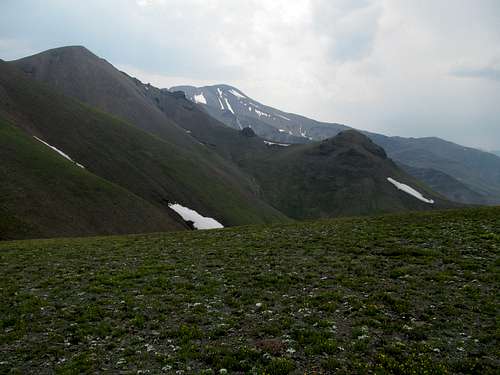
The terrain looked gentle and harmless…something to the effect of a pastoral Kansas prairie raised 10,000 feet higher; the more modest slope here which would normally mean quick progress for me only resulted in a delay to my fatigue and need for water and rest breaks. We nudged up a named subsummit named Reef Benchmark and glimpsed a broad tongue-like ridge ahead of us.
We followed mostly level terrain to traverse around point 12,509, aiming for the cleft draining the flat summit of 12,578 ahead, apparently the last bump before holy Francs itself.
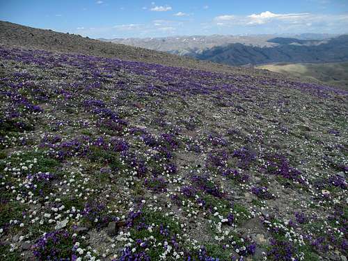
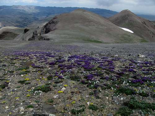
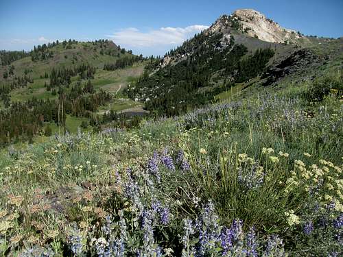
Here the wildflowers went from lit to lit AF…the most surreal hues of purple I had ever seen stretching down the higher tundra in bands of small, graceful colonies. Sam was awaiting me here per usual, but he probably didn’t mind the dallying here due to the presence of such vivid imagery.
We spent a few extra minutes taking pictures and changing/rearranging our packs before moving on, recalling how Greg had gushed about how beautiful the wildflowers were on Francs and along the Phelps Mountain Road; hearing my descriptions he noted that his experience the previous year didn’t even have the abundance of purple fields adorning Sam and I’s peripherals now.
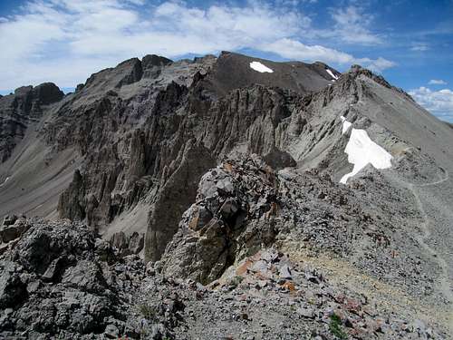
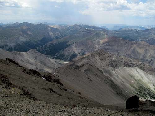
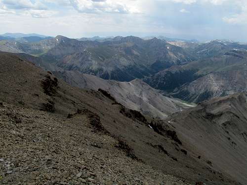
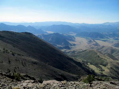
Past 12,578 just ahead was our first view of Francs, and it is indeed glorious; looking nothing like the gentle lump you usually see in pictures, the mountain’s left flanks resembled either a sharp toothed ogre or the structure he bit into. Reminded of the Absarokas’ volcanic past and dismayed at the sight of yet another few hundred feet of elevation loss, we scampered down the dusty and obvious trail to the last low saddle before.
The views down into and across the Francs Creek drainage were a highlight of this section, and Sam thought he spotted a pack of grizzlies down there (I did indeed see animals, but thought they may have been elk).
The sun finally emerged and alas at the worst time: just as Sam and I were about to buck and ascend the steep last 800 feet of the mountain. To sound like a broken record, any other time this would be an afterthought, but as the day dragged each stretch of elevation gain felt like double that. We sidestepped around a brief cliffy area reminding me slightly of Crazy two days before, then continued a slightly tedious sidehill as the trail looped around the edge of jagged rocks representing Francs’ eastern façade.
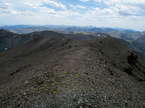
I labored up the steepest stretch of the loose trail, Sam a distant memory ahead. Upon topping out I was disappointed to see how the true summit still a few uphill waves away and again, despite how super easy the terrain these last few steps to the top were, I felt each step and breath weigh heavier and heavier. Sam was barely a speck in the distance by now, making sure he tagged the summit amidst the darkening clouds; the inclement weather had arrived ahead of schedule, with the timetables further screwed by my tedious progress.
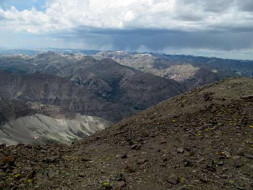
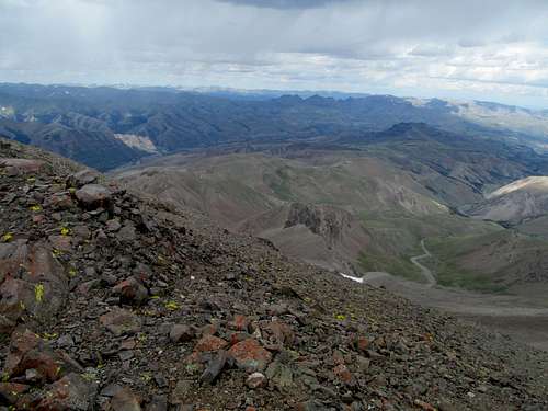
I barely gasped my way to the top before it seemed pretty imperative to leave. To the south, among endless wondrous ridges and heretofore unseen peaks by me, storms and precipitation were already pouring down and making its way north towards us.
Sam continued to wait patiently for me to take my requisite pictures, and I regretted the condition of my body and lamented my old employer once more as it continued to inflict its damage on me from beyond the grave, this time denying me the opportunity to enjoy the fantastic views from Francs Peak for little more than a few minutes.
We ran (or I tried my best to keep up) down the ridges and observed the progress of the storm. The first waves of it luckily bypassed us to the west as it made its way northeast towards Carter Mountain, though not without leaving us with several memorable booms of thunder. I did not much enjoy the often crumbly trail heading down Francs’ northeast flanks but it was merely the respite to the hundreds of feet my cement shoes had to gain on the long and exposed route to safety.
Sam had several feet on me as this arduous robbed me of whatever air remained in my lungs. By the time I topped out the weather had further deteriorated, with another wave of the storm emanating by sight and sound a direct course for our ridgetop return route over Reef Benchmark. We retraced our course circling around 12,509, but faced a decision with the rain starting to splatter down on our shoulders at the shoulder below Reef Benchmark. I favored, both due to my doubts about yet another few hundred of elevation gain as well as my fears of lightning exposure, an escape down into the drainage below, which Sam said should connect us back to the trailhead with some minor elevation gain down the road (in hopefully what would be less exposed high terrain). Sam maintained (and still does) that he say several grizzlies directly down in our escape drainage, though I looked and thought the bears looked more like large boulders. We instead decided to half-measure it, engaging in a brutal talus strewn sidehill around the left of Reef BM. Both of us swore at the slippery rocks as we tumbled down the worst of the terrain during the worst of the storm, my only consolation being that in theory we were safer from a lightning strike. Sam was surprisingly having the worse of the talus, most likely because he didn’t have my hiking sticks, which allowed to run for my life at a reasonable pace for once on this trip. I offered one to Sam but he was all set.
Sam bemoaned about whether we should have followed our ascent route back up Reef. The sun came out for a moment but we were still sidehilling and the terrain was still shitty. After side-crossing down into a sketchy drainage, Sam thought the best course of action was bear right and ascend several hundred feet back up to the initial bump (11,870) above our vehicles, and I once again trailed behind Sam by several hundred feet trudging step by step up the endless high tundra.
We knew the downclimb down 11,870 would be very steep and slippery near the top; Sam thought that better terrain could be found on the right (east). Some parts proved to be an improvement but other areas proved that there was really no optimal way up or down that thing. The sky was getting dark once more by the time we reached our cars, and we counted ourselves to be lucky to not be outside once the brunt of the storm arrived.
We were both comfortable with the composition of the road to know that the storm would have a limited effect on it. I asked Sam whether he wanted to grab Phelps, an extra ranked summit, on the way out, but thankfully he declined. Both of us were exhausted, Sam by the sidehill, me by every other damned thing, so we cruised down the road back to Cody (with the four requisite gate passages on the way down).
It seems almost par for the course that much of the drive back after such a stormy day on the mountain was through sunny whether, and indeed I needed to drop several layers in order to be presentable and comfortable at Sam and I’s visit to Cody’s other brewery slash pizza restaurant hybrid. But the beer was good and Italian food…well surprising decent for Wyoming. The meatballs and pasta filled me up on a day that was longer than it should have been, and we lingered whilst deciding plans for the next day.
Breaking Windy - July 23rd, 2016
Despite my miserable showing I still thought Trout a viable option for Saturday as most of its difficulties lay in length rather than terrain or steepness. I felt that I would be fine on trail and on easier gradients, having struggled mainly on steeper and slash or off trail seconds, but Sam leaned for the easier Windy Peak instead. While he was indeed over a week into his trip and openly fatigued, I’m sure he was also doubtful about waiting for my slow ass for 24 miles on Trout, and I wouldn’t blame him. We drove up towards Dead Indian Pass that evening, with plans to get Pryor Mountain in Montana as an additional value add if we were running early.
Dead Indian Pass offered stunning views of the Absarokas, including and especially of Trout to the south looking deceptively close. Despite a few missed turns we managed to make it down the dirt roads to arrive at Windy’s rocky trailhead just before sundown. The roads were rough, with high brush after a few miles of easy going and very steep and rocky terrain heading up to the roads’ end, and both of us had to execute a number of fifty point turns and u-eys in order to have enough room for both of us to park at the tiny trailhead/camp spot. A fatigued night at Crazy/Big Timber notwithstanding, I felt the peace and stillness of a star strewn wild western night sky for the first time in a year and even savored it mildly in my drunken stupor, having indulged in my traditional cheap whiskey/scotch chugging whenever the terrors of camping required me to do so.
Sam obviously paced ahead of me up the steep trails and switchbacks the next morning, but despite by ghastly hacking cough I felt better than the day before. My spirits and constitution were better likely due to the sunshine, mild temperatures, and lack of a bone chilling wind, and I found myself proceeding at an incrementally faster pace than on Francs.
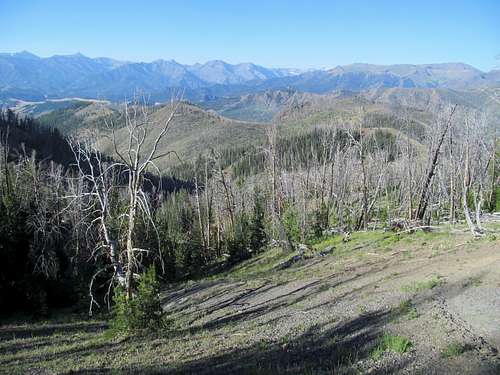
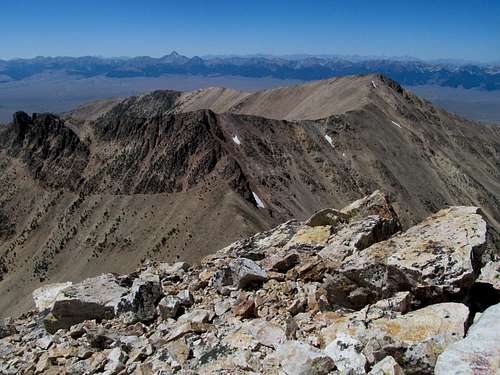
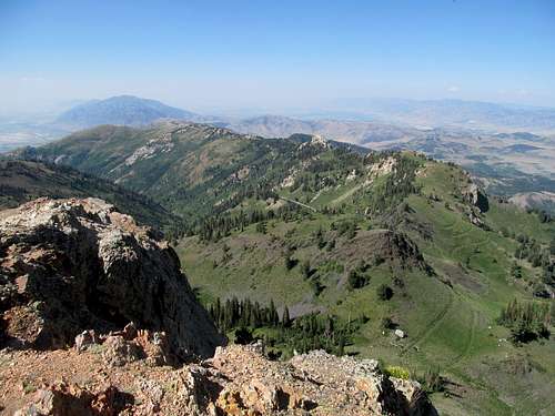
Much of the trail is wooded, but once above treeline the views are priceless the rest of the way to the summit. Nearby the terrifying spectre of Pilot Peak beckoned (or not), and further away the entire breath of the Montana Beartooths stretched behind us, as Sam and I identified Granite, Wood and Castle in the near distance.
It’s still a pretty long stretch gentle tundra (seems to be a theme in the Absarokas) from the views to the summit, and I waded behind as Sam eagerly proceeded to the highpoint well before me.
We enjoyed the views from the Beartooths down to Trout and Dead Indian, with the former having to wait another year at least for the both of us, as well as the mystery peaks to the southwest that were also visible from the Sunlight Basin Road (apparently it’s the Sunlight Peak group, a rare cluster of peaks that neither Sam and I had heard of clustered just outside the Yellowstone).
I had to take a few bathroom breaks on the way down (still chugging plenty of water to soothe my damaged throat) and let Sam go ahead.
I ran down the last mile or so of trail to catch up and felt surprisingly spry; granted, it was downhill so it was tough to judge how recovered I was from my illness funk, but at least it meant I didn’t keep Sam waiting too long at the trailhead.
We waited through tedious mountain construction/one-way stoplights en route to Pryor. The weather was perfect today (aka hot and dry down below the mountains), but by the time we reached the junction for Pryor Sam waved me down and told me he felt more like heading back to Utah. It had been a long week away for him and he had a lot of errands to run before Sunday, so he wanted to get a head start home. To be honest I was a bit relieved because despite the brevity of the hike up Windy I was tired, though it was more the thought of the 30 mile shit dirt road approach to Pryor rather than the supposedly brief hike that I was dreading. We bade adieu and parted ways on a dusty crossroads in Montana upon a residue of plans not carried out to fruition. (Sam would later pick up Avalanche Peak outside of Yellowstone on his way back).
Greg was supposed to already be in Montana, but events interceded. Originally we had thought to possibly meet him on Sunday for a peak in the Dillon area but I had received a text atop Windy from Greg that he couldn’t leave Utah that weekend due to work. We had originally planned for him to drop off my credit card I had mailed to his place in SLC at a small motel/restaurant near Quake Lake, but with this latest I realized that like Sam, I had no choice to go to Salt Lake. As I mapped out the options in my head driving out from Windy I figured that I could manage that detour without too much of a dent in my plans. Willard Peak, a major P4K and the highest peak in the Northern Wasatch, was a major oversight from my three years living in Salt Lake that I could get in a short half day trip Monday. I could get Eighteenmile Peak along the Montana/Idaho border, not a P2K but still significant and aesthetic enough to fall upon my radar, Sunday en route to Salt Lake, and still get up to the Lost Rivers on Tuesday with my only “lost” day still checking off a major to-do peak in Willard. I may have to sacrifice my McGuire repeat with this new equation, but to be honest I had been wavering in my dedication to pursue a repeat anyway no matter how much the last year’s events haunted my nightmares.
With all that in mind, my decision to give up solo’ing Pryor ended up being a blessing in hindsight. I called ahead to book my favorite cheapo motel in Dillon, but without any sort of debit or credit card they told me they could only hold the room until the early evening. Now in possession of a few extra hours I could easily make that deadline whilst stopping at a brewery or two in Bozeman, which I certainly did, enjoying the beers as well as the craft liquors at the distillery next door.
I showered and freshened up in Dillon and embarked towards the Beaverhead Brewing company downtown. The newly furnished taproom was convivial and I was soon talking to a few locals at the bar. One was from Great Falls in town and waiting for a friend of his, supposedly a lethal US Ranger back in the Vietnam days. I had noticed a number of bicyclists carrying huge packs on the way into town, and apparently this was a group of cross country cyclists. I drank, gabbed, and grabbed dinner with the two before stumbling back to my motel ready to sleep off my first true drunken stupor since leaving Massachusetts.
18Mile Freestyle - July 24th, 2016
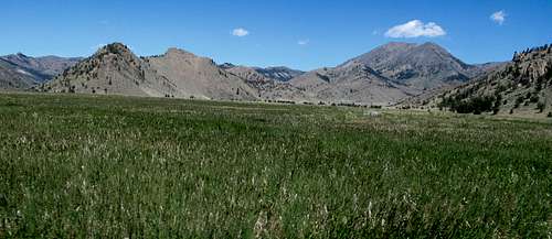
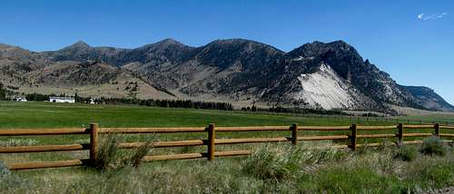
I gave myself a few extra hours to sleep in before setting off into the backcountry of Montana’s backcountry. Despite its prominence, literal and literary seeing its excellent SP page here as well as mention in Cedron’s book despite being only a P1K (also mentions in Lopez and Caffrey guides), everything about Eighteenmile seemed remarkably obscure. The Idaho side sits above the Lemhi Valley and Leadore, a most obscure corner of the a most obscure area of a most obscure state. To the east #18Mile abuts I-15 but is completely shielded from the highway, with the steep Tendoy subrange of the Beaverheads blocking any views to the range crest. The Nicholia Creek approach road traverses these foot-mountains, weaving and cutting through a windy and narrow canyon on a road still remarkably well graded for passenger cars. Once through the mountains you enter a dry secluded offshoot of the Big Hole Valley seemingly fully encircled in every direction by the Beaverheads, with genteel 18Mile revealing itself proudly in its ins rear flanks.
The roads were marked to the Harkness Lakes but I still found some confusion at certain interchanges; closer to the trailhead you encounter a few creek crossings that may present some challenges to a passenger car, before the steep and short 4WD section mentioned in the SP directions.
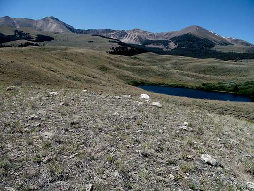
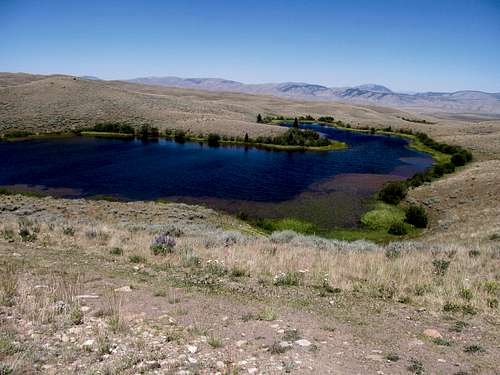
The Harkness Lakes are a wonder, pure blue alpine lakes set in a backdrop more worthy of Kansas than Montana. I left the car and rounded the left side of the first lake, then followed a faint jeep track as it traversed small hills sitting between the lakes, cutting off the road in some places to avoid trivial amounts of elevation gain and loss.
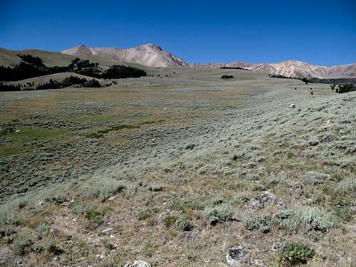
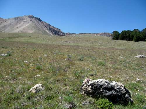
Soon the terrain leveled out and I found a smooth, dry yellow-green gently ascending plane standing between me and Eighteenmile. To my right was a shallow drainage with a dirt road creeping in and making me wonder if I could have saved some mileage via some alternate holy grail of a shortcut.
The only excitement of this stretch was the hopping of a small barbed wire fence. As I dealt with the illusions a featureless plain make upon perceptions of distance I gauged my physical reaction to this mild uphill march. I felt good, but the terrain was easy, so it offered me no grand diagnosis about the state of my state. But the pastoral scenery was surreal, lovely, and I found myself truly enjoying myself for the first time this trip, bathing in the vibes from a still, sunny day.
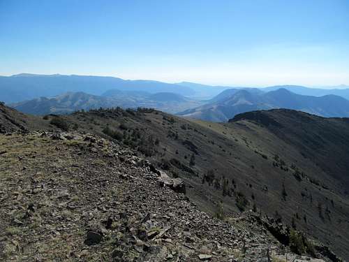
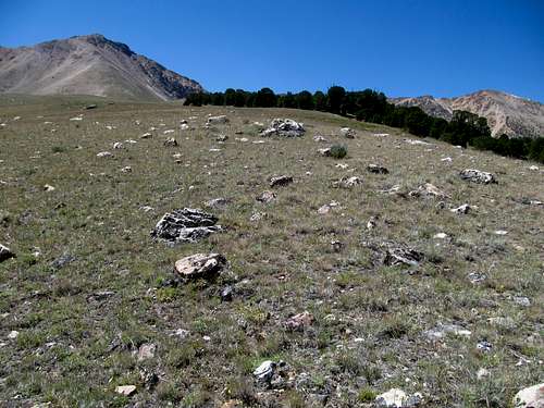
I was impatient to reach the steep part and climb the damn thing though, and the approach seemed to drag a bit near the end. I crested over a small hill to see the landscape narrowing itself to form a sort of half ridge on the right, revealing a steep and wooded drainage bowl between me and Cottonwood Benchmark to the north.
I made it to the steep part and started my upward journey; while I was not 100%, I found myself making it several hundred feet now before needing to rest. There were a few loose steep parts in the middle, and the scree near the top rocky cap of the cap was interspersed with bits and pieces of a climber’s trail.
I reached the alleged class 3 section and, unlike Crazy earlier in the week, enjoyed the scrambling thoroughly. Perhaps it was because it was short, sweet, and safe, but I felt within me tendrils of life grasping the cold black rocks beneath my hands and aimed for some of the more challenging routes between boulders on purpose. A few pitches and rest stops and I followed the climber’s trail again to the summit. I had left it to do the scrambling thing, but I surmise that it continues to the small saddle south of the peak, from which you can approach the summit with less scrambling required.
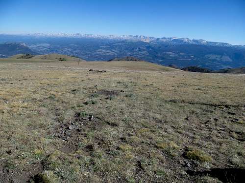
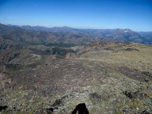
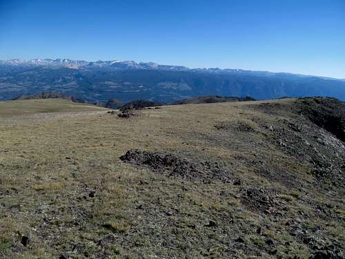
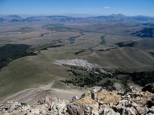
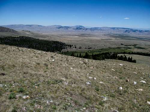
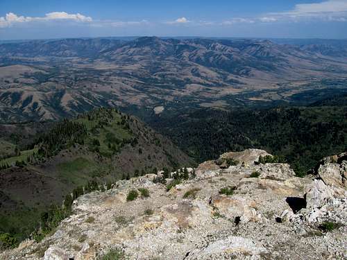
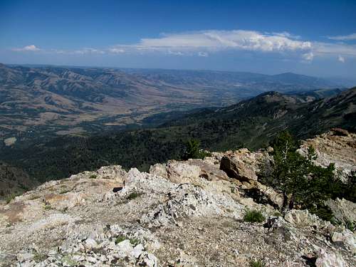
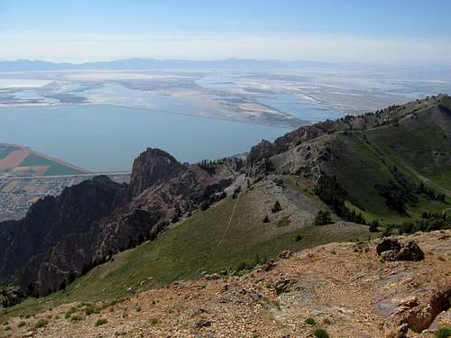
This area was practically home turf for me by now, and I enjoyed the views even more with the knowledge that I had climbed nearly every major summit in view, from Scott Peak massif to the south, to the Homer Young cluster barely in view to the north, to the entire span of the Lemhi’s reaching from the Snake River Plain north towards Salmon and Challis to the north, to the spectre of Borah sticking out behind the Lemhi’s. Climbing in truly familiar territory for the first time in years, I reveled in the newness of the near views of the burnt orange flanks of Jump and Cottonwood Benchmarks, my closest neighbors, as well as a small lake down in the drainage to the northeast.
Looking back I amazed in the lush barrenness of the Montana side of the drainage, the endless waves of prairie between me, Scott Peak, Garfield (which I still needed), and the highway. While I passed by several parties of campers and fishers on Nicholia Road off I-15, looking back I felt like I was standing on a barren, unexplored planet.
With plenty of time to spare for once, I took a few extra minutes to enjoy myself atop the peak. I started down the talus and scree-skied the climbers trail back down the steep ascent ramp.
The gentler parts of the descent provided me ample opportunity to further take in my surroundings as well as look back, gasp, and try to grasp the beauty, dignity, and stature of the peak I just climbed with my camera.
The pure blue pearls of the Harkness Lakes beckoned from the distance, beads of a sapphire oasis amidst the primitive landscape.
I glimpsed specks of human in the distance and encountered a group of backpackers who looked like they were still high schools trudging their way up the hills. I wished them well and prepared my return trip.
I felt like I was time traveling driving down I-15 towards Salt Lake as I had so many times on a Sunday evening in my three years living in Utah: gassing up in Idaho Falls, dreading the hinderlands past Pocatello, studying the ridges of Gunsight Peak looking for a weakness, still glimpsing up at the Wellsvilles and Willard/Ben Lomond massif in awe despite the hundreds of times I’ve cruised by it, cursing the shitty Utah drivers as the roads became crowded upon entering Davis County. Greg, who had to work Saturday, decided to take out his frustrations on a few remote Uinta 13ers, but those mountains, the rugged Blacks Fork approach, and the flinty and flimsy Uinta talus took it right back out on him. It was 6 or 7 PM by the time I talked to him on the phone and he was still above treeline around 12,000 ft. and had maybe 8 or so miles to go, though he was going to try a cross country shortcut through the woods to avoid the dreaded approach. With some extra time to kill I grabbed some drinks with an old buddy and then checked out the Wasatch Brewpub in Sugarhouse before meeting Greg and Kadee when they pulled in around 11 or so. I had my credit card, we caught up and talked mountains for bit and I crashed in their guest bed.
Pioneering Willard - July 25th, 2016
I still needed to get my alignment fixed and figured a day in Salt Lake with some slack in my schedule was the perfect opportunity to do so. While I knew that it was Pioneer Day (observed), I underestimated its reach in Utah and thus had to drive around to several places before I could find a shop that was open who could get ‘er done.
I met Greg for lunch at Habit Burger before cutting my brief sojourn back in Salt Lake short to initiate the second part of my trip…a string of peaks starting at Willard and leading north until I reached Glacier Country. Braving the mid afternoon smog and heat, I felt a (very) slight twinge of regret at leaving the (relative) hustle and bustle of Greater Salt Lake behind.
Opting to take the shorter Willard Basin route meant most of my time would be spent driving and dodging ATV’s along the long and bumpy approach road. And they were out and about given it was a major (one) state holiday but overall proved not to be a huge deal. The biggest obstacle was the SUV stuck in the middle of the road, seemingly for years based on the summit log here, but navigating left around it proved to be actually kind of fun.
Most of the rest of the road sucked but yielded good views as it clung tight to the northeast facing slopes of the long Willard ridge. Having skimmed on the details yet again, I drove all the way up to the parking lot atop Willard/Inspiration Point before realizing that I had gone too far...the road and trail starting near the lake was hundreds of feet below me.
Not that the approach from Inspiration Point was unreasonable, but it required a the loss of several hundred feet before climbing back up to Willard, whereas parking further down would be a more straightforward up and down.
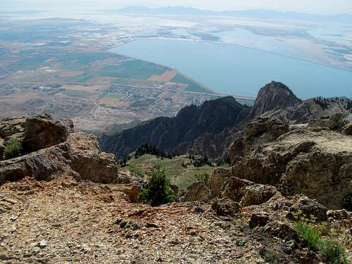
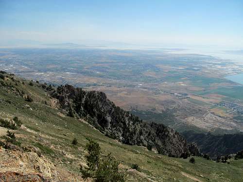
Despite my general disdain for Utah I can’t deny its views, and despite my historical avoidance of Utah during the late summer months back when I was living here I still marveled at the aesthetics of a dry desert peak even in late July. Willard is a very handsome mount and provided me with good views as I hopped down to the saddle. Fortunately the heat was not overbearing at this elevation and not too much on my throat, still scratchy and cause for the occasional severe hacking cough, as I ascended the steep dirt trails to a small saddle below Willard. Seeing the summit so close I got a bit too eager and found myself bushwhacking after I lost the trail after a junction, clinging to desert shrub and branches and ascending easy scramble moves up a series of burnt yellow ledges.
The scrambling was even more fun than the day before, and the summit, with its funky colored rocks carved at the oddest angles bathed in the shadows of the first evening rays of the sunlight was more sublime than I would have imagined.
Despite the detour (and the gas money, and stress, and anger) caused by my sickness and lost wallet (fuck you, former employer who shall remain nameless), I manage to salvage at this this portion (day) of my trip with a highly rewarding summit.
I enjoyed the scrambling down and found the trails leading back to the saddle.
A herd of goats greeted me here, and while the climb back up to Inspiration Point took a bit out of me, the constant views of Willard and the entire damn profile of the Wasatch Front rising up from Ogden its nearby Pleasantvilles made the extra gain worth it.
I would have liked to say I did a good amount of reflecting upon my departure from Utah, but I had exhausted what little nostalgia I had left driving in the previous night. Heading north and somehow spent from a day that did not require much physical exertion, all I could think of was how much of a drive I had left up to the Lost Rivers whilst planning the next foray of my journey into parts familiar and unknown.
Comments
No comments posted yet.