
Comments
No comments posted yet.
|
|
Trip Report |
|---|---|
|
|
48.89220°N / 121.5343°W |
|
|
Jul 3, 2019 |
|
|
Hiking |
|
|
Summer |
Twenty six years had passed since I had last been to the Pacific Northwest. Fear of bad weather ruining my vacation had kept me away. By 2019, I had become ready to give it another shot so I planned a one week mountain hiking trip to northern Washington State. Unfortunately the weather disappointed me in exactly the same way that I expected it to disappoint me. Of the 6 days that I spent in Mt. Baker Snoqualmie National Forest, I got 2 days of perfect sunshine with spectacular views, 2 days of rain when I did not even bother to leave the vacation rental house, and 2 days of drizzle when I spent the energy to climb Hannegan Peak and Excelsior Peak only to be rewarded with dense fog on the summits. The mountains were spectacular alright, that is when I could see them. Maybe I will go back again in another 26 years.
Wednesday July 3, 2019
Trailhead Elevation: 3100 ft
Summit Elevation: 6187 ft
Round Trip Hiking Distance per my GPS: 12.3 miles (probably a little longer than what it really was)
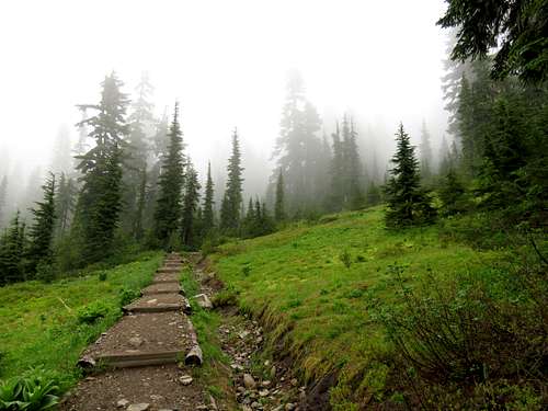
Forecast called for cloudy skies with 20% chance of rain. Left the vacation rental house in Warnick, WA at 4:45 a.m. (sunrise 5:10 a.m.) and drove Route 542 less than 20 miles to the dirt road known as Hannegan Pass Road (NF32). The road had a fairly smooth surface but went into a dense forest of tall pine trees that was rather dark at that hour. After 2.5 miles, I saw a sign that said “Road damage ahead. Limited opportunity to turn around”. That caused some concern but as I drove 5 miles to just a few hundred feet before the end of the road, I reached a spot where the road had been washed away. That was the new parking spot. Many other vehicles had parked there. The people of those vehicles had presumably camped in the mountains. I was the first one at the trailhead on that day and did not see anyone else until much later in the day when I was coming back.
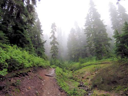
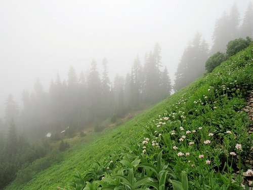
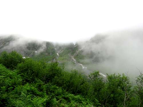
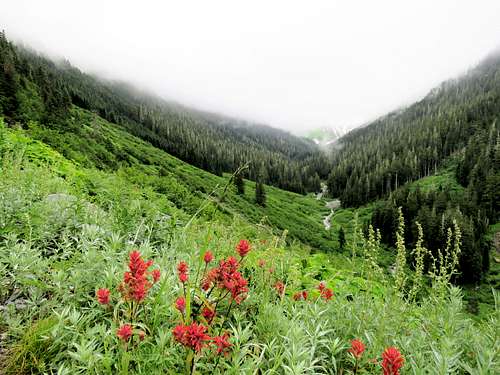
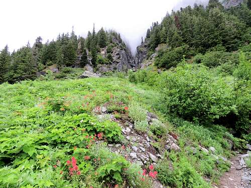
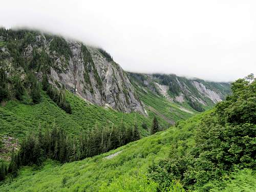
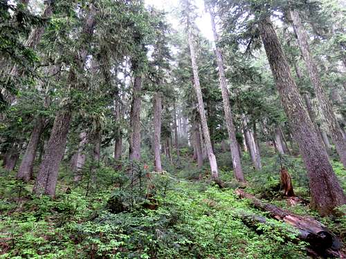
It was cloudy and 44 degrees F. Everything was wet from rain the previous night. Started my hike at 5:40 a.m. The trail followed the bottom of Ruth Creek Valley at some distance from the creek. I was supposed to get great views of the jagged Nooksack Ridge which formed the southwestern wall of the valley but everything was in clouds. The trail went through meadows that had dense growths of grasses and bushes. After a short distance, the bottom of my pants began to get wet from the water on the vegetation. Found a rock where I sat, took off my boots and put on my rain pants. That was a good thing to do. Later I noted water dripping down my rain pants but I did not feel wet or cold.
|
|
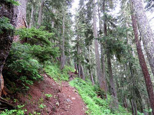
Farther up.
|
|
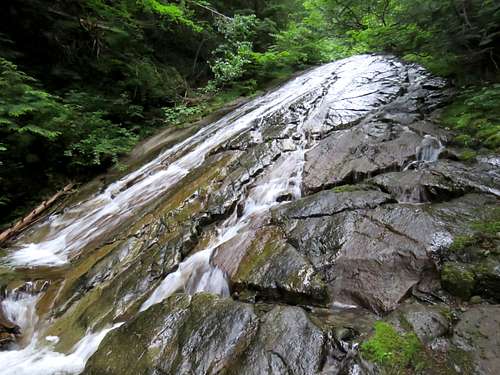
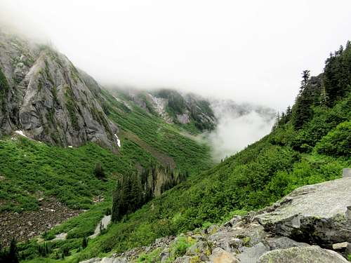
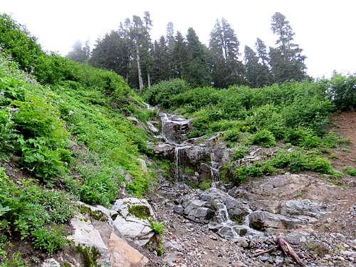
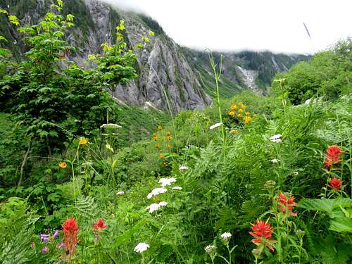
A couple of side streams created waterfalls/cascades that came down the slope I was hiking on.
|
|
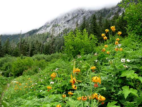
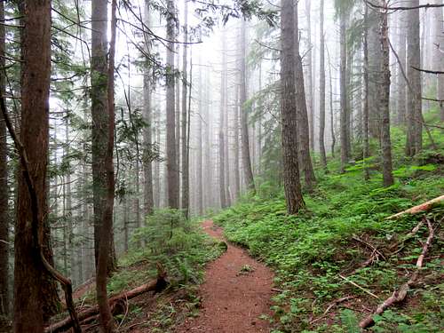
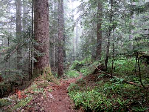
As I gained some elevation, it seemed like the cloud ceiling rose too. That gave me hope that maybe the clouds were going to go away altogether. At one point, I saw my GPS was erroneously putting me on the other side of the valley (poor satellite connection). As I kept going, that problem got automatically fixed. After more than 3.5 miles, I was up to 4500 feet elevation (having climbed 1400 ft). I knew that the real climbing would soon begin. The trail went into a forest, became steep and began climbing toward Hannegan Pass.
|
|
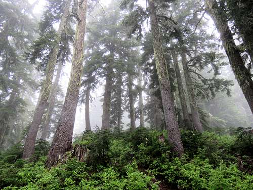
Below Hannegan Pass, I began to go into the clouds.
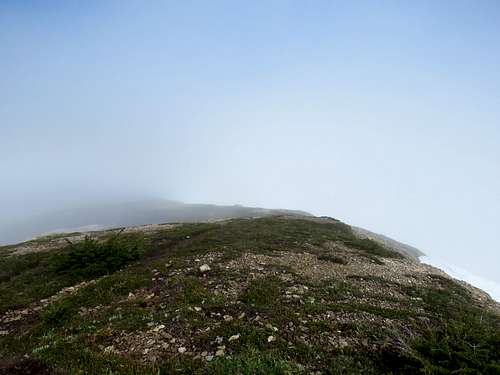
Reached the 5066 ft Hannegan Pass at 8:15 a.m. My GPS showed 5.35 miles. It was supposed to be 5.2 miles to the summit. The earlier problem must have produced inaccurate readings. Got a little bit of drizzle. For a while I wondered if it was worth continuing to the summit. I decided to keep going. Maybe the summit of the mountains rose above the clouds. Wouldn’t that be a cool thing to see? Continued up the trail toward the summit. After a short distance in the forest, The trail went up a steep grassy slope and reached a ridgetop with dwarfed trees and a few patches of snow. I began seeing the disk of the sun through the thinning clouds. Was I really going to get some views from the top?
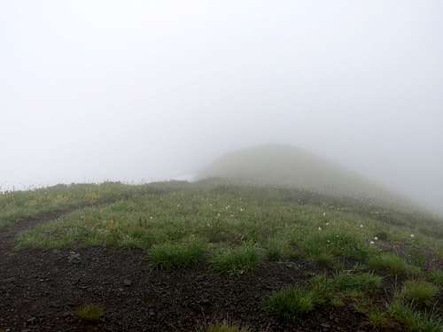
At 9:03 a.m., I reached the 6187 ft summit which was a broad place. I jokingly told myself the only reason I knew I was on the summit was because I was at the end of the line on my GPS screen. A small patch of blue sky opened above me. Sat there and had my lunch. I also called Mary who was at the rental house to test the satellite phone she had got me. I was dying to see the tip of Mt. Shuksan or Baker rising above the clouds. As I kept waiting and no view appeared, I told myself that the mountains were teasing me and they were not going to show me anything. I had left my beautiful and faithful Colorado where I had gone every year to go to Washington instead. In the end I got nothing but a tease. Maybe that was what I deserved.
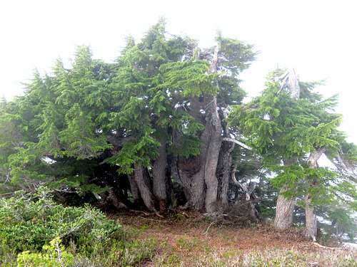
Left the summit at 9:55 a.m. and began to retrace my route back down the mountain. Going down, the slopes in places felt steep. Dwarfed trees.
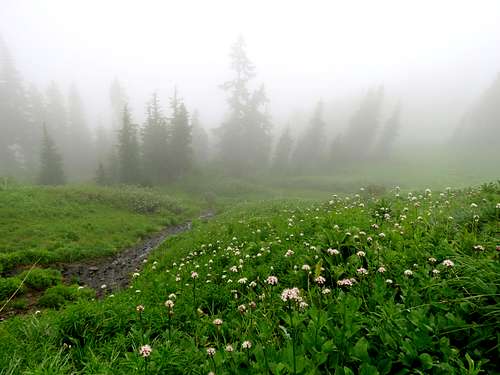
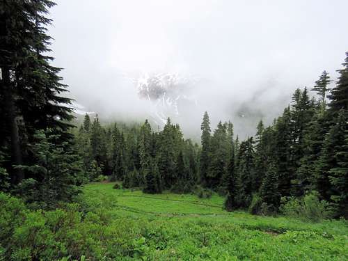
Farther down, fog became dense. Grassy slopes above Hannegan Pass.
Reached Hannegan Pass at 10:40 a.m. I was at that point below the clouds again. Followed the trail back to the car. On my way, I ran into maybe 10 groups of people who were hiking up.
|
|
|
|
Was at the trailhead by 12:50 p.m.
Thursday July 4, 2019
Trailhead Elevation: 1830 ft
Summit Elevation: 5712 ft
Round Trip Hiking Distance: 8.5 miles
Forecast again called for clouds and 20% chance of rain. Left the house at 5 a.m. This time I only had a 10 mile drive on Route 542 to Excelsior Trailhead which was right on the main road. It was cloudy. No one was at trailhead and I did not see any other hikers until I was on my way down. Started my hike at 5:35 a.m.
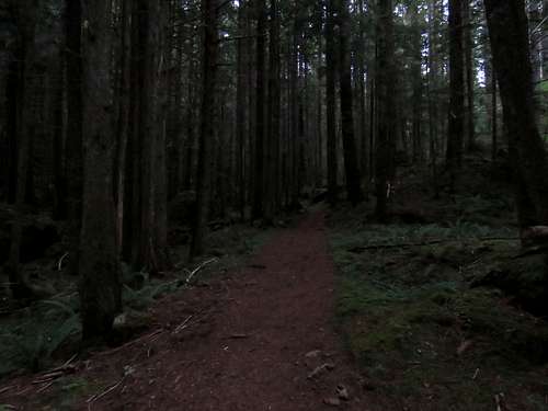
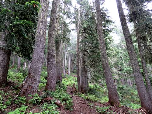
I knew I would be in a pine forest all the way up to 5000 ft elevation so with or without clouds I would have no view for the next 3200 ft up. The trail went into a forest of tall pine trees and began to make one switchback/twist and turn after another going up relentlessly. At that early hour, the forest appeared pretty dark. This added to the sense of adventure.
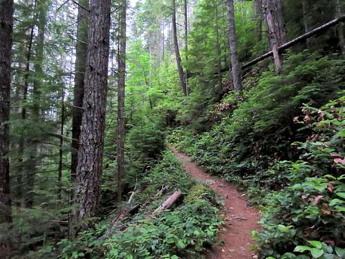
It did slowly begin to become brighter.
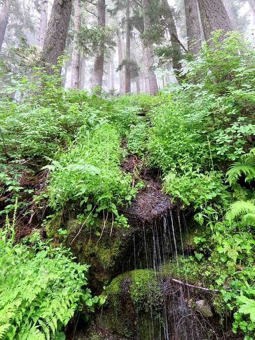
At 2900 ft elevation, the trail went by a steep rocky slope where a stream ran down over the rock creating a waterfall of sorts.
At 7:10 a.m. and 3800 ft elevation, I sat at a switchback and drank some water. It began to drizzle. I was wondering if it was worth going any further but soon decided to continue. Right after that, there was a relatively open area with less trees causing more drizzle to fall on me. The forest soon came back and the drizzle stopped. All day, I could hear wood peckers and my favorite mountain song bird; Hermit Thrush. At 4750 ft, the trees became taller and rather white barked. I though that area was particularly pretty.
|
|
The forest finally ended at 5000 ft. Dense fog appeared and it began to drizzle again.
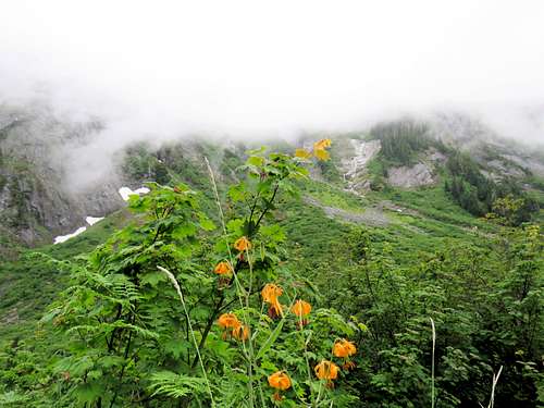
Reached the 5375 ft Excelsior Pass in thick fog. From there it was 0.3 miles and 337 vertical feet to the summit. The trail went over grassy slopes and dwarfed trees getting pretty steep in places. I could see a snow field on the north facing slopes below me but could only see a short distance in the fog. Was on the summit at 8:45 a.m. It was foggy, cool and wet. What on earth was I supposed to do there? Put on my raincoat and had my sandwich then began to retrace my way down at 9:10 a.m.
Back below Excelsior Pass.
Did not want to put pressure on my knees going down all that elevation so I went slow. The hike in the misty forest was itself enjoyable. Saw the first person at around 4600 ft elevation. He seemed to be a speed hiker huffing and puffing going up the slopes fast. Below 3000 ft elevation, I ran into many more people. Reached my car in the parking lot which now had many other vehicles in it at 11:50 a.m.
|
|