Overview
To date, I have reached the summit of 36 U.S. States. I have written trip reports for these and will share photos and trip details on this page. My first state high point was Harney Peak in South Dakota on August 12th, 2001. This hike was gorgeous and fun, and after that I was hooked.
For information on all U.S. State High Points, visit the main Summitpost page on
U.S. Highpoints.
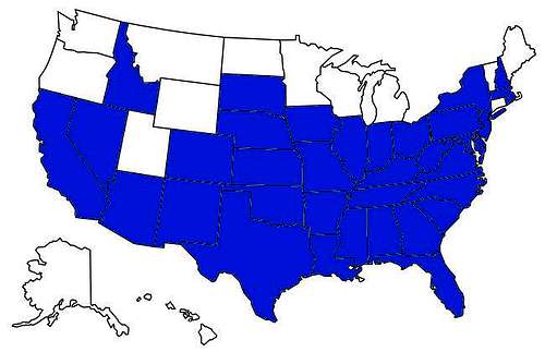
![U.S. Highpoints I have visited as of 8/25/2018]() U.S. highpoints visited as of 8/25/2018
U.S. highpoints visited as of 8/25/2018East
In the East region, I have done 9 highpoints, with Connecticut, Maine, and Vermont remaining. Mount Washington in New Hampshire is certainly the highlight of the East region. It is spectacular for any region with significant alpine tundra and magnificent colors and scenery. New York's Mount Marcy is also quite a gem, and was quite enjoyable despite foggy weather. In fact Mount Marcy is probably the least developed of all the high points I have climbed in the East region. Most others have buildings or towers on top, and are built for tourists. Delaware and Rhode Island are basically flat, and not very scenic. Maryland's high point isn't very developed, in part because it barely stands out from any vantage point, even though it rises nearly 1,000 feet from the road. Still, the East region has its own charm, and I still have two gorgeous mountains still to do (Maine and Vermont) and my home state (Connecticut).
Delaware Trip Report
The least celebrated high point of all is in Delaware. I had a chance to complete it on February 8, 2002. I took my friend from college, Kim, who was heading off to Japan (while I was heading off to Colorado). She made the trip a lot less boring. From central Pennsylvania, I had to take the PA turnpike (76) down to rt. 202. The high point is on a street off of a major road. It is not too exciting, but I realized that you have got to do the small high points as well as the big ones.
Maryland Trip Report
I hiked to the top of Maryland on May 8, 2004. My friend and I did the hike on a day trip from the Washington DC area. I had first attempted the high point on September 15, 2001, but didn't see the sign and turned back at the WV/MD marker. The 2nd time was pretty simple. More details are in the trip report link.
Massachusetts Trip Report
I hiked to the top of Massachusetts on May 29, 2004 on a Memorial Day Weekend trip with a friend. We drove up from Washington DC area. It was a simple hike on a nice trail. More details are in the trip report link.
New Hampshire Trip Report
I hiked to the top of New England the day after Mount Greylock on Memorial Day Weekend 2004; May 30th to be exact. We had to take the Lion's Head route because Tuckerman's Ravine was closed. Once above tree line the winds picked up and visibility was reduced to near zero. But we found the summit. More details are in the trip report link.
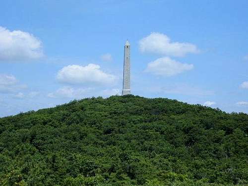
New Jersey Trip Report
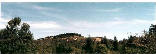
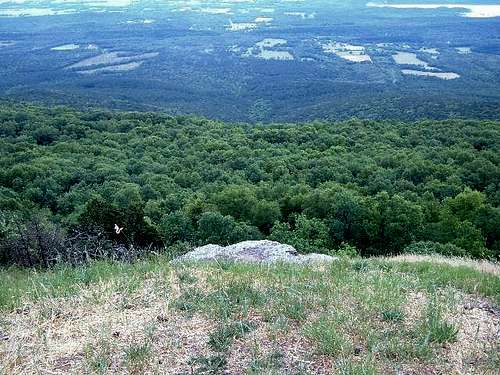
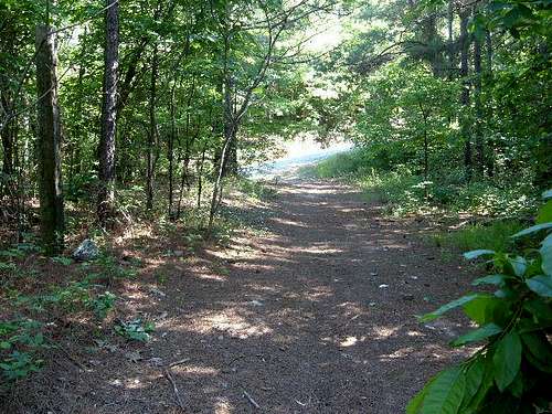
I hiked to the highest point in New Jersey on July 10th, 2004, on the way to Mount Marcy in New York. We parked near the Park headquarters and hiked 1 ½ miles to the summit. We started the hike on Appalachian Trail, which headed towards the mountain for about a mile until we reached an observation tower. A little past the observation tower was the road to the top. The views from the summit were pretty nice.
![Green Forests below the...]() Looking up at the summit.
Looking up at the summit.
I hiked to the top of New York on July 11, 2004. My friend and I hiked 16 miles round trip for what was a long, but rewarding journey. I found the Adirondack Mountains to be a very special place. More details are in the trip report link.
![Along the long trail to...]() Along the Mount Marcy trail
Along the Mount Marcy trail
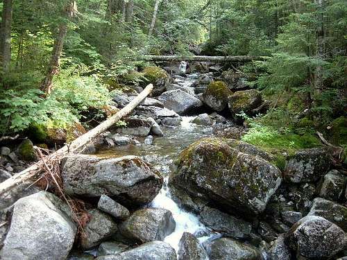
I have actually hiked Mount Davis twice. The first time on September 15, 2001, and the 2nd on August 21, 2005. The 2nd time I was pleased to become more familiar, and even jogged a bit at the top. The mountain roads head up almost to the top of the mountain, which feels more like a park than a mountain summit.
![The Western slope of Mount...]() The Western slope of Mount...
The Western slope of Mount...
When I hiked Jerimoth Hill on May 30th, 2004, it was still only open to the public 5 days a year. Times have changed since, but at the time we rushed down to Rhode Island from Mount Washington in order to make it before it closed. Now I realize that probably wasn’t worth leaving Mount Washington early! However, at least I knocked this high point off my list, and actually the scenery was quite pleasant.
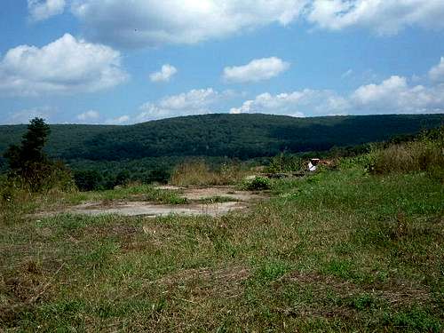
West Virginia Trip Report
On September 15, 2001, just after the 9/11 attacks, I decided to take a trip covering three high points in one day: West Virginia, Maryland, and Pennsylvania. I took 33 West to get to the road to Spruce Knob which takes you up to the top. Driving up Spruce Knob was pretty fun, with steep roads, sharp curves, and scraggy peaks along the way. The view at the top is very nice, and shows the richness and rugged beauty of the area. However, I wish there was a bit longer hiking trail from further below, so at least a person could enjoy a couple miles of scenic hiking to the top.
![View to the summit of Spruce...]() Looking up at the top of Spruce Knob, West Virginia
Looking up at the top of Spruce Knob, West VirginiaSouth
In the South region, I have done all 13 high points. Although some of higher mountains, such as North Carolina, Georgia, and Kentucky can be driven by car to very near the summit, I hiked them via longer routes. The Appalachian Mountains make up six of these high points. Outside the Appalachians, Alabama's highpoint is quite nice, and surprisingly scenic. Texas has the highest of all the South region high points, but it is really located in the Western U.S. Overall, the South region high points are easy to get to, and easy to hike. The most enjoyable from my perspective were Texas, Georgia, and Virginia.
Alabama Trip Report
I hiked to the top of Alabama on January 4, 2002. Happily, we couldn't drive to the top due to ice and got to enjoy a short walk up a hilly road to reach our destination. It was part of a multi-state southern road trip. More details are in the trip report link.
![Cheaha Mountain from the...]() Looking up at the high point of Alabama
Looking up at the high point of Alabama
Mount Magazine is one of the better destinations in the otherwise flatland states. Rolling hills turn into mountains in this region where Mount Magazine rises over 1500 feet from the surrounding valley. The actual summit itself is called Signal Hill, and is in the woods, and was not too exciting. I hiked it on May 23, 2005. I found that the general area is pretty scenic, so I took some time to explore before heading back on the road.
![View down from the handglider...]() Looking down the slopes of Mount Magazine
Looking down the slopes of Mount Magazine
On September 26, 2002 I drove my new car, a Mazda Millennia, through a hurricane on my way from Delray Beach, Florida to Denver, Colorado. I parked near the high point monument and walked up. It wasn't very exciting. More details are in the trip report link.
Georgia Trip Report
I hiked to the top of Georgia on the evening of January 4, 2002. I had hiked to the top of Alabama that morning and then drove through the Appalachians for over 200 miles up to the mountain. There was too much snow to move on, so we parked at the base of the summit road, and hiked three miles up 1,780' of snow. The stars were amazing. More details are in the trip report link.
Kentucky High Point page
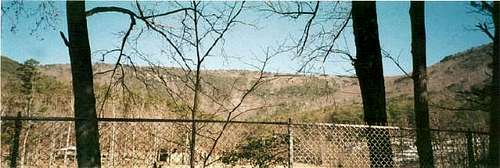
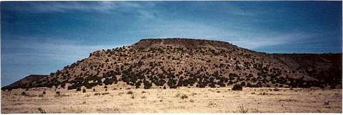
Black Mountain in Kentucky, is a coal mining mountain. It is not a tourist destination, and the road up the mountain is not built for visitors to enjoy its scenery. It was a warm day on January 22, 2002, when I drove my car to the head of the trail which leads to the Black Mountain summit. The trail was too icy to drive, so I hiked about 1.5 miles to the summit. The road to the summit (rt. 160) is a winding mountain road that is fun to drive. It is a far prettier drive than it is a hike. I found the road to the top was directly in between the "Welcome to Virginia" and "Welcome to Kentucky" signs. At the time, there was a look-out tower, however the lower section was missing, so I could not climb up it.
Louisiana Trip Report
I reached the top of Louisiana on September 27, 2002. From I-20, I made my way south and drove down highway 507. A dog barked ferociously as I passed and reached the intersection with the road where the trailhead could be found. I did not know whether to take a right or left. I took a right, and I turned out to be correct. Only a couple hundred yards down the road was a small church I had heard about where the trail started. The summit didn’t have much to see, except for a small toy green alien on top of the rock pile that marked the top. However, it was still a nice walk through the woods.
Mississippi Trip Report
Mississippi was my 30th high point. I completed it on May 23rd, 2005, a week after I finished graduate school. I was returning from the annual wind power conference in Denver; driving back to Arlington, Virginia. I didn’t do another high point until July 2008 (Boundary Peak in Nevada). Woodall Mountain stands out in certain locations along the way to it, because it rises 300 feet above the mostly flat scenery of northern Mississippi. Woodall Mountain is in thick forest, but a trail is blazed to get to the high point. It was a nice drive from nearby Corinth (famous Civil War site) to get there. Highway 72 is a secondary, 4-lane highway that I took, and got me a little more than a mile from the trailhead. Although the trailhead is not marked, it was pretty obvious from the road. The hike was about a mile in length, and steeper than I expected.
![View to the road up to the...]() Heading up the mountain with less than half a mile to go
Heading up the mountain with less than half a mile to go
On August 10, 2003 I hiked to the highest mountain East of the Mississippi River, and the highest mountain in the Appalachians. I was determined to hike it for real. You can drive up very close to the summit. But my friend and I instead took the Mount Mitchell Trail. It was cloudy, but decent enough weather to hike to the top. More details are in the trip report link.
Oklahoma Trip Report
I reached the top of Oklahoma on April 14, 2002. I drove from Denver, Colorado, and found dirt roads that led directly to the main road through the Oklahoma panhandle. This is mesa country. The hike was very pretty and despite the heat I didn't run into any nasty critters. More details are in the trip report link.
![Mesa visible along the Black...]() View along the trail to Black Mesa
View along the trail to Black Mesa
I reached the top of South Carolina on January 5, 2002. We drove up a steep hill as far as we could, got out and hiked the rest of the way up. It was icy. Summit views were somewhat limited at the time. More details are in the trip report link.
Tennessee Trip Report
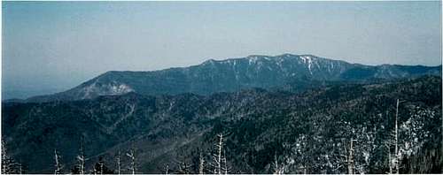
On my trip to Clingman's Dome, I decided to first summit Mount LeConte 6,593’. I had wanted to hike the up the Alum Cave Bluff trail to Mount LeConte, which is the 3rd highest mountain in Tennessee, and 6th highest in the entire Appalachians. The trail is about 11 miles round trip, and involves an elevation gain of 2700 feet. That is quite a bit more than the 330 feet in half a mile it took to get to Clingman’s Dome later the same day.
![LeConte from the summit of...]() Looking at Mount LeConte from the summit of Clingman's Dome
Looking at Mount LeConte from the summit of Clingman's Dome
I hiked the highest point in Texas on Halloween morning in 2002. It was very foggy when I arrived at the trailhead at 5am. I basically hiked the mountain blind, following the trail, with limited visibility. I passed the bridge, which is only about 10 feet across and comes in a downhill section of the mountain. As I continued up the trail, I felt lost, but only because I couldn't see the mountain, so I never knew how high I was, how close to the summit, or what direction was the summit! As I made my way up, I saw a clear view of the top. I had gotten above the clouds, so it appeared as if I was looking out of an airplane window. I hiked the remaining 100 feet up to the top and sat at the summit for about 10 minutes. It was a bit chilly, so I quickly made my way down. It took me about 80 minutes to get to the top.
Virginia Trip Report
On January 21, 2002 I was successful on my second attempt at Mount Rogers. I was living in Virginia at the time. I had tried to find the summit early in January, but I got lost on the AT and ended up on the Wilburn Ridge instead. Frustrated and somewhat lost, I found the AT again and returned to the car. I was determined to go back. This time, I was going to hike to the top of Kentucky during the same trip. This time I knew what I was doing and reached the summit easily. More details are in the trip report link.
Midwest
In the Midwest region, I have done eight high points, with Michigan, Minnesota, North Dakota, and Wisconsin remaining. The Midwest is obviously not the most exciting when it comes to mountains. Several of the high points in this region are little more than a flat plateau. I have nabbed five of these flat high points. The most interesting of these high points is Harney Peak in South Dakota. Situated in the rocky Black Hills, it resembles the Western U.S. far more than the Great Plains. Harney Peak was my first high point, and I enjoyed it so much, it increased my interest in visiting other high points.
Indiana Trip Report
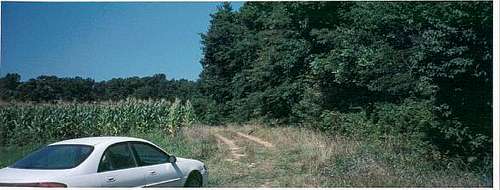
I reached the top of Indiana on August 14, 2001. I had to ask for directions when I got close by, but once I got there, it was pretty straightforward. It's not really a hill, but just a small spot in the woods next to a farm. More details are in the trip report link.
![This is the trailhead on Cart...]() At the trailhead to the top of Indiana
At the trailhead to the top of Indiana
Iowa was my second high point, reached on August 13, 2001. The high point is very decorated. The owners welcome visitors and are proud to hold onto land that is considered a "summit" in the State of Iowa. More details are in the trip report link.
Illinois Trip Report
The highest point in Illinois is only open eight days a year. When I visited on June 5, 2016, it was the first state high point I had completed in nearly 7 years. I was visiting Chicago that weekend and it coincided with the open visit days. So I secured a rental car. The hardest part was getting through Chicago to get in a rental car. Once I got the car, we took a 2 hour 20 minute ride into the farmland. Green rolling hills greeted us as we got closer to the high point. The beauty of this area was far superior than what I had imagined. The hike was easy. Less than 25 minutes. But I was very pleased to reach this high point.
![Walking up the road to the high point of Illinois]() Walking up the road to the high point of Illinois
Walking up the road to the high point of Illinois
I reached the top of Kansas on February 21, 2002. I was moving to the Denver, Colorado area, and I took dirt roads down to the high point. It was pretty windy near the top, and not too exciting. Kansas is one of the more remote high points because it requires driving far from any towns. More details are in the trip report link.
Missouri Trip Report
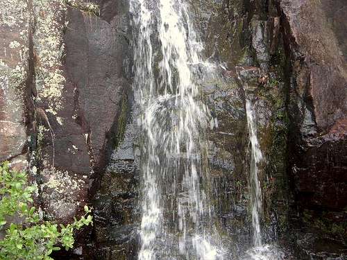
I reached the top of Missouri on May 14, 2005. After driving through the Midwest farmland, Taum Sauk, in Southeastern Missouri was my refuge from the flat landscape. Less than 2 hours from St. Louis, Taum Sauk offers some excellent hiking, with waterfalls (Mina Sauk Falls) and nice views of the Ozark mountains. On my trip, I headed down the Mina Sauk Falls Trail, a nice 3 mile loop to view some waterfalls, about 350 feet below the actual high point. The high point itself was very accessible, with signs on the main road for several miles, leading you to the park. The high point itself was just 1/5th of a mile from where I parked my car. Some of the best views, however, are from the overlook, which was on the right, as I drove to the parking area for the high point.
![Mina Sauk Falls.]() Mina Sauk Falls along the trails on Taum Sauk Mountain
Mina Sauk Falls along the trails on Taum Sauk Mountain
On March 23rd, 2002 I drove 150 miles from Denver to Panorama Point. I drove up I-25 into Wyoming and headed east on I-80 West to exit 401, in Pine Bluff, Wyoming. I went straight off the exit and took a right on Route 30. I followed this road into Nebraska and onto the start of the trail to Panorama Point. Technically I wasn’t supposed to hike 1.3 mile trail because there were supposedly bison along the way. However, I ran the 1.3 miles anyway, and saw that the bison were actually all down the hill at the time. On the way back I hiked a bit in the Pine Bluffs in Wyoming.
Ohio High Point page
Ohio was my 27th highpoint. I reached it on May 13, 2005. I traveled through Ohio on my way to Denver, Colorado for a conference, and decided to take a detour to Bellafontaine to reach the highest point in Ohio. Campbell Hill rises 300 feet from the surrounding area, but has such a large width, that the rise in elevation is not evident from any reasonable vantage point. Campbell Hill is about 40 miles Northwest of Columbus, and pretty easy to find since the high point is visible from the road. I found a parking spot at the Hi-Point Vocational school and walked up the hill, where right below the sign was the summit marker.
South Dakota Trip Report
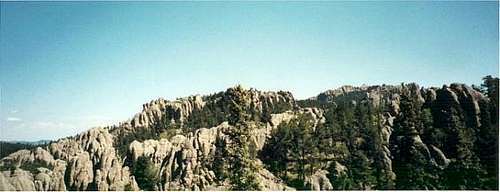
South Dakota was my first high point. It was a good place to start my high point adventures because it is an actual mountain, with a good trail that reaches a rocky vista. The windy mountain roads leading to the trailhead were an exciting reminder that I was reaching a special place. More details are in the trip report link.
![View of the rocky spires from...]() View of the rocky spires from the Harney Peak trail. The summit is in the distance on the right.
View of the rocky spires from the Harney Peak trail. The summit is in the distance on the right. West
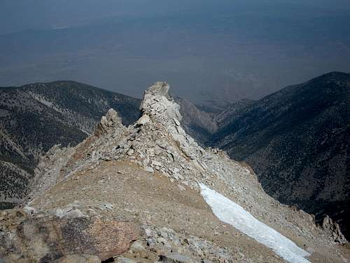
In the West region, I have completed six highpoints (Humphreys Peak, Arizona; Borah Peak, Idaho; Mount Whitney, California; Mount Elbert, Colorado; Boundary Peak, Nevada; and Wheeler Peak, New Mexico). There are 7 highpoints which I have not completed. Certainly, the West offers the most challenging highpoints. I am planning on getting as many of them as I can.
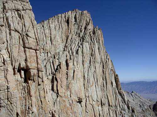
![Spire along the summit ridge to Mount Whitney]() Spire along the Mount Whitney summit ridge
Spire along the Mount Whitney summit ridgeArizona
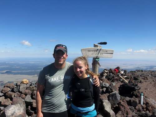
On July 4th, 2016, myself and three friends ventured off to Flagstaff for Humphreys Peak. It was a relatively simple hike. The trail stays in the forest for a long time, and only gets out of it just below 12,000'. We motored up the mountain, and enjoyed some lunch on the summit. The trail was rocky in spots towards the top, but never too challenging.
7
![View towards Humphreys Peak summit]() View towards Humphreys Peak summit
View towards Humphreys Peak summit![On top of Humphreys Peak]() On top of Humphreys Peak
On top of Humphreys PeakCalifornia
Mount Whitney is different than any other high point I have climbed. The sheer distance involved exceeded all my other efforts. In my short hiking career, only Longs Peak in Colorado involved as early a start, and took so long to get up and down. So, I knew Mount Whitney would be a challenge.
Some say Mount Whitney is easy because there is a class 1 hiking trail all the way to the summit. Indeed, that does make reaching the summit less difficult. However, I found Mount Whitney requires considerable endurance. The trail is rockier than I expected. The way down is long and tiring. There are warnings at the trailhead noting "Remember, the summit is only half way!"
On Labor Day 2009, myself and six others got up around 12:15 am at the Dow Villa Hotel in Lone Pine (an excellent place to stay for Whitney hikers). We congregated at the parking lot, with our permits on our packs, and left with three cars a little after 1:00am. It took us half an hour to reach the trailhead. We all got ready, and left the trailhead together a few minutes before 2:00am. We hiked up in the dark, setting a blistering pace, but staying pretty close together. Myself and one other stopped at Mirror Lake briefly, while the rest continued on. We all met again after we had hiked over six miles up to Trail Camp at over 12,000 feet. With about 3 hours of hiking in the bag, we still had another 4.7 miles and just under 2,800 feet to go.
Myself and two others continued on up the switchbacks, while the others rested. The switchbacks weren't that bad really. It was still dark, and the weather was cool. Once we got half way up the switchbacks, we saw the sun begin rise.
![Sunrise on the switchbacks]() Sunrise on the switchbacks
Sunrise on the switchbacks
I was feeling good, but still needed to work on my breathing. I was heaving a little too much, so I began taking deep breaths to fill up my lungs. I hadn't been over 12,000 feet during the summer, so 13,000 feet was getting to me. As I started to move faster than my fellow hikers, I put some music on and pushed up to Trail Crest. I waited there for the two others.
![Trail Crest and the moon]() Trail Crest at Sunrise
Trail Crest at Sunrise
Once we congregated, we stopped and had some food. Then two of us went forward, while the other stayed behind to rest. We descended down to the intersection with the John Muir Trail (JMT) and stopped briefly to talk to some hikers from Cape Cod, Massachusetts that had taken the JMT all the way from Yosemite. We would end up driving them back to Lone Pine at the end of the day. Following the brief respite, I continued up the trail. Phlegm was building in my throat and my head was starting to ache. However, as soon as I saw the summit block in the distance, I knew it was time for a final push. I passed a hiker coming back down who said it was farther than it looked. I noted his warning, and soldiered forward. I had left my cohort behind, and put some music in my ears to keep me motivated and distract from the effects of the altitude.
Finally I got up to the summit block. The trail winded up the slope, and seemed to never end. Finally, I got to a crest on the trail where I could see a little cabin and a bunch of people hanging out. I had made it! I put my arms up and picked up the pace to the true summit. I then collapsed, very tired after 6 hours 45 minutes since I started at the Whitney Portal. My cohort followed 20 minutes later. The rest of my group followed a little more than an hour later. The summit was kind of cold, with some light winds. I spent about an hour up there, eating, drinking and enjoying the view. I signed the summit register.
![Atop Mount Whitney on Labor Day 2009]() Atop Mount Whitney
Atop Mount Whitney
The way down was hard. After all my physical and emotional energy had been spent, I had little left for 6,500 feet down on a sometimes rocky slope. My pack was weighing down my shoulders. I learned only back down at Trail Camp to use the strap around my stomach to ease the burden. As the shoulder pain died down, my feet started to hurt. I felt this big time, particularly in the last five miles. I rested at Mirror Lake with my hiking cohort by my side. I figured she would be ahead of me on the way down, but after a few minutes back on my feet, I decided to take off. I put some music on, and enjoyed the hike for the next 30 minutes or so. However, with about two miles to go, my headache returned, and the music was no longer tenable. The pain was now isolated to my pinky toes which ached each step I took. I gritted my teeth, as two miles that seemed to fly by on the way up, seemed to take forever on the way down. Finally, back at my car, I could barely walk. I struggled into the woods to use the bathroom. My cohort and I drove back down the mountain, picking up our friends from Cape Cod on the way. We drove back to Lone Pine where we arrived a little before 5:00pm. Our fellow hikers got back an hour later. We had dinner at a steakhouse, which I think is called the Totem Cafe. I needed a steak dinner, and the dinner was decent. The rest of the group didn't like their food, nor did they like the poor service. Still, it was what I needed to cap the day. At 9:00pm I went to sleep after being up for almost 21 hours. I woke up at 8:00am the next morning well rested and a little sore. All in all, quite a trip! I don't think I ever want to do it again.
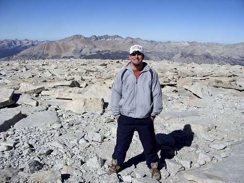
Colorado
![On the summit of Mt. Elbert,...]() On the summit of Mount Elbert
On the summit of Mount Elbert
Colorado Trip Report
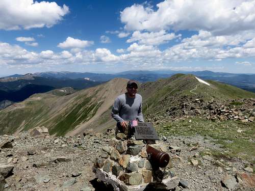
Colorado has the third highest state highpoint in the U.S. Despite its lofty elevation, Mount Elbert is very accessible, and has a straight-forward, simple trail to the summit. I hiked Mount Elbert on June 6, 2002. For such a high mountain, it was surprisingly lacking in snow. It was a very dry year. My trip to the high point was rather uneventful. It took me just over 2 1/2 hours to reach the summit from the trailhead. It is certainly beautiful, however due to its position in the center of the Rocky Mountains, it does not have severe weather comparable to many other state high points in the West. The hike starts at a little over 10,000 feet, so the first hour or so is in the woods. Coming out of the woods, the world opens up, and the views are incredible. Altitude wasn't a big challenge for me on Mount Elbert since I had climbed over 13,000 feet by the time I climbed Elbert. Still, it was my first 14er. More details are in the trip report link.
Idaho
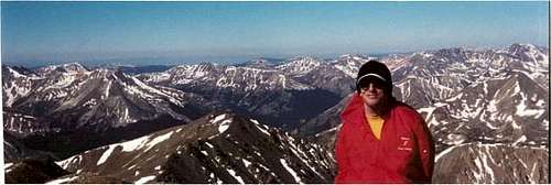
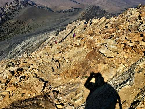
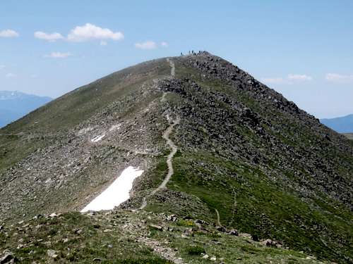
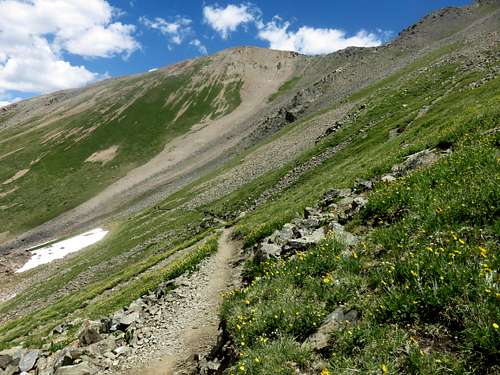
I climbed Borah Peak on August 25, 2018. It was ideal weather, despite some smoke. We started just after 5 in the morning. The hike starts off moderately steep for the first mile. Then, the mountainside is reached, and the trail switchbacks very steeply all the way through the remaining forested area. Once you reach the ridgetop, the trail evens out. However, this is achieved only after hiking up 3,000 feet! Chicken Out Ridge started off not too bad. There are some easy climbing and scrambling moves, with a couple drop offs that look pretty scary. The crux of Chicken Out Ridge is the 20' down climb. It is a tad exposed and isn't terribly simple climbing. However, people help each other out by pointing out the right way. Ultimately, it wasn't too bad. The trail leveled out before the remaining 800'+ push to the summit.
![Descending the final section of the Chicken Out Ridge]() Descending the final section of the Chicken Out Ridge
Descending the final section of the Chicken Out RidgeNevada
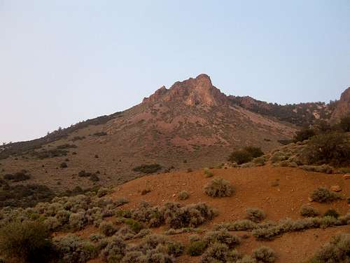
Boundary Peak is short and steep compared with other Western High Points. I climbed it on July 12th, 2008. The fires in California eased overnight, but views to the Sierra Nevada range were limited due to the smoke and haze. After having dinner in Bishop, myself and two hiking partners drove back into Nevada, and took the Queen's Canyon road for about six miles where we camped out at the Queen Mine.
![Rock formation above the trailhead]()
A rock tower above our campsite at the Queen Mine.
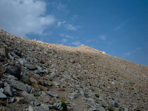
We drove up the next morning to a higher saddle at about 9780 feet. This is where we found the trail sign. We started up the trail, and continued up a steep slope to the first main ridge. We followed this down to the saddle which meets the Trail Canyon route. From here, this is where the really tough part begins. A long a scree slope followed. We huffed and puffed our way up.
![Heading up the shoulder]()
The scree slope up the shoulder of Boundary Peak
At the top of the scree slope, we took the final trail towards the summit. At the top, somebody put a fake lizard, that we all thought was real. After closer inspection, we realized the gag. We tried to hike Montgomery Peak, but the saddle proved very difficult. We made it to the base of Montgomery, and I tried it myself to see if it was feasible. However, it proved futile. There was a difficult class 3 rock formation in the way, and I was just way too tired.
![Rock formation below the summit]()
Looking down at a rock spire below the summit
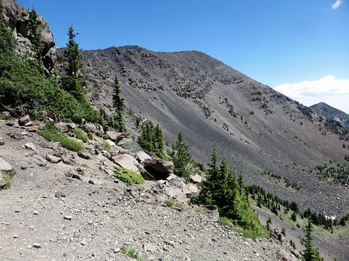
I hiked Wheeler Peak on July 5, 2016. I hiked it one day after Humphreys Peak, this time just with my 69-year old hiking buddy who is as fit as anyone I have ever met at that age. We started at the Bull of the Woods Trailhead, which was much easier to find than I thought. The trail was steep on the way up finally reaching the Bull of the Woods Meadow (just off the trail). I hiked up to Bull of the Woods Mountain, while my hiking partner took a breather.
![View back to Bull of the Woods Mountain en route to Fraser]() View back to Bull of the Woods Mountain en route to Fraser
View back to Bull of the Woods Mountain en route to Fraser
Next, it was Fraser Mountain, which was an easy summit to nab just off the main trail.
![Lake Fork Peak from Fraser Mountain]() Lake Fork Peak from Fraser Mountain
Lake Fork Peak from Fraser Mountain
The trail then descended about 400' from the top of Fraser. We finally got back up towards the alpine country towards Wheeler Peak. A few switchbacks took us up towards the final ridge. Mount Walter was next, immediately adjacent to the trail. Wheeler Peak not far away.
![View back to Fraser on the way to Wheeler Peak]() View back to Fraser on the way to Wheeler Peak
View back to Fraser on the way to Wheeler Peak![View of the final summit block]() View of the final summit block
View of the final summit block![On top of Wheeler Peak]() On top of Wheeler Peak
On top of Wheeler Peak
We descended via the Williams Lake Trail. We took residential ski resort roads back to the car. It was just over 14 miles round trip, and I gained over 4,400'.
![View while descending back down to Williams Lake]() View while descending back down to Williams Lake
View while descending back down to Williams Lake


Comments
Post a Comment