
|
|
Route |
|---|---|
|
|
46.29280°N / 9.04955°E |
|
|
Hiking, Scrambling |
|
|
Spring, Summer |
|
|
One to two days |
|
|
Overview

Summit view towards Lago di Canee

The trail above Alpe Peuret

Pizzo di Claro from Claro (250m)
Pizzo di Claro has 4 main routes to its summit. This Route page is dedicated to the 'Normal Route' which starts at the west-side of the mountain. The starting point is located in the village of Claro. The trail starts at Camping Al censo at an altitude of 250m.
It's an impressive an beautiful route. The path is marked very well by the for Switzerland common, red-white-red stripes. The uppermost part of the route, in which you climb the 'summit pyramid' is marked by blue-white-blue stripes. The lower part of the route is graded T3. The upper part, marked white-blue-white, is graded T4. Some previous hiking experience is therefore advised.
This route is great for the enduranced hiker to do in a single day. For those with not too much hiking experience and/or endurance level it is commonly done in two days, with a sleep-over in the Alpe Peuret-Hut which you pass on your way. (For those interested: The key is hanging at the left side of the main door!, and there are about 12 sleeping places)
From the summit views are really nice, you can see as far as Bernina and Monte Rosa and also the view to the city of Bellinzona alone already makes climbing this mountain worthwhile!
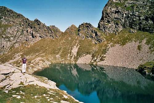 Lago di Canee (2190m) Lago di Canee (2190m) |
Getting There

summit

Pizzo from Claro
Coming from Gotthard (from North), drive down towards Bellinzona and go off at 'Bellinzona-Nord'. From there follow the signs 'Claro' and eventually you will see signs 'Camping Al Censo', where the starting point of this route is located.
Coming from Italy it's the same thing. On the highway (there's only one going through Ticino) go off at Bellinzona-Nord.
Route Description
Descending the West Face; Photo taken from the summit
-> Starting altitude: 250m
-> Summit altitude: 2727m
-> Height difference: almost 2500m
-> Ascend time: +- 8 hours
-> Descend time: +- 5 hours
When arrived at Camping Al Censo, next to the camping a small river is situated: The Censo river. Opposite to the camping a bridge goes over the river. Immediately right from this bridge the trail starts. You will notice the yellow signpost.
The trail is marked red-white-red, immmediately starts a bit steep and to be honest, stays that way until the summit. From the start 'Lago di Canee' is visible on the signs. you have to follow the direction of Lago di Canee along the route. In the first two hours you will pass by two small villages, for as far as I know only temporarily inhabited for holidays purposes. The route goes mainly trough forest at that time.
At about 4 hours from the start you will arrive at the treeline. At this point you will come across the Alpe Peuret-Hut, which is not hosted, but is in very good condition. This is a possible place to spend the night after summiting. From Alpe Peuret (+-1900m) the route continues towards Lago di Canee at 2190m. You will pass old (typical Swiss) stone houses broken down by avalanches in winter.
When you reach Lago di Canee, don't be surprised if you see some local men fishing at the lake. Supposedly the lake is filled with fish (as I was told by these locals). At lago di Canee a blue route sign says: Pizzo di Claro 3 hours. My personal experience is that you can reach the summit in 2 hours from this point.
This final part is about climbing the summit pyramid of the mountain. The route is ,from this point on, less marked and steeper. You have to watch out here for loose and falling stones. Good hiking-shoes are a must! The path goes in a 'zigzag' up to the summit (up the West Face). When you reach the summit the views are really impressive. For as far as I know under the summit cross there is a summit-log, so don't forget to sign it!
For the descent you can make the choice of spending the night at Alpe Peuret or decent down to the village of Claro the same day.
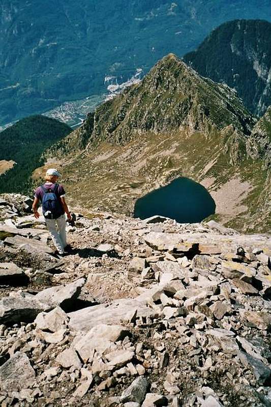
Start of the Descend at the steep summit part, you can see Lago di Canee
Essential Gear
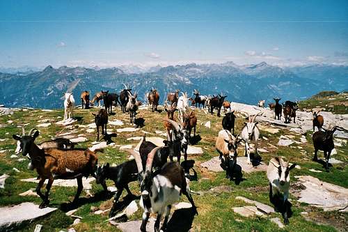 There's a fair chance to mee these guys along the way |  Pizzo di Claro (2727m) from Claro (250m); 2500m lower! |
--> Good Hiking Shoes
--> Warm clothes for the upper part. It can be windy and a bit cold at the summit
--> When spending the night at Alpe Peuret: Bring your own food, there is no host!
External Links
Camping Al Censo: Click hereAlpe Peuret Hut: Click Here