
|
|
Route |
|---|---|
|
|
39.15430°N / 119.88321°W |
|
|
Hike |
|
|
Spring, Summer, Fall, Winter |
|
|
Half a day |
|
|
Class 1 |
|
|
Approach
If you are coming from the Carson City area, come up US 50 to a junction with highway 28 and go north one-half mile from U.S. HWY 50 to the Spooner Lake State Park turnoff on the right side. Drive in, pay your $6 and park. If coming from Incline Village, it is before the US 50 junction. This is a nice area to picnic with tables and rest room facilities so it can be busy on a summer weekend. Lots of bicyclists like to use the North Canyon Trail during the summer and fall, and cross country skiers and snowshoers during the winter.Route Description
From the parking area at Spooner Lake, find the trail that leads north towards North Canyon. If you find yourself at Spooner Lake itself, go back and take the left fork on the trail from the parking area. Continue up the road and stay on the road. There is a modern outhouse facility on the road about half way up the canyon and after about 3 3/4 miles the road tops out at a saddle with a signed road going off to the right. This road is signed "Snow Valley Peak" and heads straight up the hill utilizing a couple of switchbacks. It is another 1.1 miles to the top of the road. Once at the top, a road heads almost 250' in 0.3 miles to the summit. While the peak is covered with antennas and a small building but the views are still spectacular. A register has been reported to be kept near the building. Dennis Poulin stated in his trip report that you'll find it " just south of the building in a group of little trees and brush. There is a summit register in a concrete block at this point." This is also the highest point of Snow Valley Peak.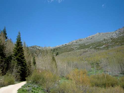
View up the North Canyon
Summary: 10.4 miles round-trip with 2,260 feet elevation gain
 |  |
Essential Gear
Snowshoes or cross country skis in the winter / early springHiking shoes and water in the late spring, summer and fall.
hgrapid - Jun 12, 2016 6:50 pm - Hasn't voted
10 miles round trip?After hiking to Snow Valley Peak-East Peak today and measuring with a GPS and confirming with Google Earth, it appears closer to 5 miles from the parking lot; maybe even 5.3 miles. But at least 10 miles round trip.