
-
 26553 Hits
-
 88.19% Score
-
 26 Votes
|
|
Mountain/Rock |
|---|---|
|
|
35.85410°N / 106.14705°W |
|
|
Santa Fe |
|
|
Hiking |
|
|
Spring, Summer, Fall, Winter |
|
|
6547 ft / 1996 m |
|
|
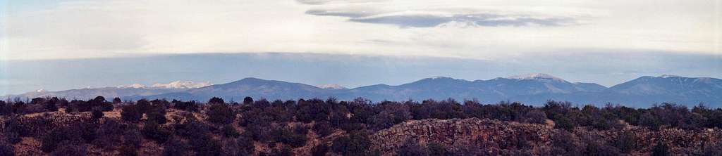
Overview
 Otowi Peak from the south.
 Buckman Mesa cliffs.
Update, Jan. 2013: Plans are underway for substantial improvement and recreational development in the Buckman Crossing area.
Getting There
From the Veterans' Memorial Highway 599, accessible either from I-25 south of Santa Fe or from Hwy. 285 just north of town, exit onto Camino La Tierra (NOT the La Tierra trailheads!) and head west through the Las Campanas subdivision. After approximately miles, take a left off pavement onto OLD Buckman Road. Follow this dirt road about ten miles, passing by the entrance to Diablo Canyon. Just before you reach the Rio Grande, turn right onto the small BLM road signed 26X. Drive a couple hundred yards through the tamarisk and mud puddles and find a place to park. In very muddy conditions, passenger cars may want to park on the main road to avoid 26X. This would not be a good spot to leave a car full of valuables.In dry conditions, any passenger car can drive Buckman Road without trouble. Snow or rain could be problematic. There is flash flood potential along the road in summer monsoon season.
Geology
 Basalt and tuff.
Beginning approximately 13 million years ago, a group of volcanoes became active in this region of New Mexico, and began building up the Jemez Mountains. These volcanoes are part of the Jemez Lineament, a line of young volcanoes bursting from a weakness in the earth's crust. The Jemez Lineament runs from east-central Arizona across the Rio Grande Rift to north-eastern New Mexico, and includes Mount Taylor, the Jemez Range and Capulin Volcano, as well as Otowi Peak. Otowi itself is a cinder cone and a member of the Cerros del Rio group of volcanoes, which were active approximately 2.5 million years ago. These volcanoes form the Caja del Rio Plateau, a knot of low peaks covered in pinon and juniper located southwest of Santa Fe on the east side of the river. The basalts erupted here lie on top of the Santa Fe Group. White Rock Canyon was cut through the Cerros del Rio basalt in the last 2.4 million years, eroding in the process a splendid cross-section of the cinder cone and giving Buckman Mesa its striking profile. Nearby Diablo Canyon is also formed primarily of these basalts.

About 1.4 million years ago, the Jemez experienced a major volcanic explosion, followed by a second approximately 1 million years ago. These eruptions ejected more than 100 cubic miles of material and coated 1,500 square miles in volcanic ash, 1,000 feet deep in places. What remains from this event is the Valles Caldera in the heart of the Jemez Range and the many colorful cliffs of tuff on the slopes of the Pajarito Plateau. Some excellent exposures of these tuff layers are also visible on the cliffs of Buckman Mesa.
References: http://geoinfo.nmt.edu/publications/decisionmakers/2001/dmfg2001_day1.pdf
http://www.cliffdwelling.com/Bandelier/geology.htm
http://www.pajaritoeec.org/3a_nature_guide/rocks_ng.htm
http://www.nmnaturalhistory.org/pdf_files/NMvolcanoes.pdf
http://www2.nature.nps.gov/geology/parks/band/
History
 Espanola Valley
Buckman Mesa is named after Henry Buckman, a lumberman who built a small settlement, a railroad line and a bridge across the river, all of which are gone.
 Pajarito Plateau
Turning the thought to more recent times, one can look back westward towards Los Alamos, the birthplace of the Atomic Age. Within living memory, the Pajarito Plateau was a cliff-walled mountain fastness harboring a top secret laboratory whose mission was to harness sub-atomic physics to create a weapon vastly more powerful than any in history: a surreal thought when one stops taking it for granted. Otowi Bridge, just to the north of Buckman Mesa where Hwy. 502 crosses the river, was once the furthest Manhattan Project scientists were allowed to venture from the lab. Edith Warner, a woman living at the bridge was their main point of contact with the outside world during the war years, a story told in The House at Otowi Bridge. Today from Otowi peaks summit you may hear in the morning or evening the sounds of the daily Los Alamos-Santa Fe commute, as traffic ebbs and flows from America's wealthiest county per capita and highest concentration of PhDs.
This obscure corner of Santa Fe County also showcases the West's perennial water dilemmas. The Buckman Field is actively mined for well water by the City of Santa Fe, with eight wells drilled to 1,000 to 1,400 feet below the surface. Water levels dropped as much as 700 feet between 1973 and 2001. Furthermore, there are plans in the works for a pipeline from the Rio Grande to the growing capitol, to harness not just the unimpressive flows of the Rio, but also water from the increasingly over-allocated Colorado Basin, which will be piped over the Continental Divide by the San Juan-Chama Project.
  |
Seasons
 Fall Colour
 Sandhill Cranes
This area could make for very hot hiking in summer. It might be doable with an early start, however, and the prospect of a swim in the Rio Grande at the finish. The river flows fast here in early summer, with small rapids, and caution is advised. Despite the peak's low elevation, lightning could be a concern during the summer monsoons, and possibly at other times.
Red Tape
None whatsoever to the summit. The boundary of San Ildefonso Pueblo runs just north of Otowi Peak, and this land is off limits. Please respect the Pueblo's wishes and limit you explorations to the south half of Buckman Mesa.Other Attractions
 Diablo Canyon
 White Rock Canyon
 Otowi Peak at Sunset.